
Where Flight Simulation Enthusiasts Gather from Around the World!
AVSIM Library - Search Results

| Category: Flight Simulator 2004 - Scenery | |
| CZFN - Tulita - Northwest Territories, Canada |

|
Images related to this file:
File Description:
Tulita (Fort Norman until 1996) is another in the series of airfields that follow (approximately) the Mackenzie River. At the far northern end of the river and on the eastern side of the delta there is Tuktoyaktuk, then Inuvik, Fort McPherson, Fort Good Hope, Deline, Wrigley, Fort Simpson Island and Fort Simpson, and then Fort Liard at the southern end of the list of those in the Northwest Territories. South of Fort Liard there are Peace River and Dawson Creek, both of which are already posted. Tulita is at the junction of the Mackenzie and Great Bear Rivers, on the east bank of the Mackenzie and the south bank of the Great Bear, around 40 miles southeast of Norman Wells. The town has a population of about 480 folks. The airport is above and to the east of the town, and has 3,000 feet of gravel runway. The scheduled flights are by North Wright and I have also added a Buffalo DC3 and GA. There is a mandatory radio frequency but in this case I have set the "tower" to "unmanned" so you will report position and intentions. There is no fuel available.
| Filename: | CZFN__Tulita__Northwest_Territories_Canada.zip |
| License: | Freeware, limited distribution |
| Added: | 12th July 2014, 08:05:54 |
| Downloads: | 271 |
| Author: | Roger Wensley |
| Size: | 2.66 MB |
| Category: Flight Simulator 2004 - Scenery | |
| Kugluktuk CYCO in Nunavut, Canada |
|
Images related to this file:
File Description:
Kugluktuk is on the coast of northern mainland Canada on the mouth of the Coppermine River. It is around 250 miles west of Cambridge Bay and 200 miles south of Ulukhaktok. Tuktoyaktuk is 450 miles west. Kugluktuk used to be called Coppermine as copper was mined along the banks of the river and used for spear and arrow heads, and this attracted a semi-permanent population. The population now numbers around 1,450. The airfield is inland from the village and the 5,500 feet of 100 feet wide gravel runway is aligned 121T/3301T where T stands for "true" as opposed to magnetic in the Northern Domestic Airspace. Both JETA-1 and 100LL are available, dispensed by a truck as the storage tanks are just off the northern edge of the field. There are flights by First Air and Canadian North and the AI includes a daily flight of each, plus a cargo visit by Buffalo; the closest large city is Yellowknife, 375 miles south. I should have mentioned a long time ago that to see the apron lights working requires you to have the "lights_ss_v2" by Sidney Schwartz installed.
| Filename: | Kugluktuk_CYCO_in_Nunavut_Canada.zip |
| License: | Freeware |
| Added: | 10th November 2012, 04:03:35 |
| Downloads: | 428 |
| Author: | Roger Wensley |
| Size: | 3.04 MB |
| Category: Flight Simulator 2004 - Scenery | |
| Lutselk'e CYLK in the Northwest Territories, Canada |
|
Images related to this file:
File Description:
Lutselk'e is a village on the southern shore of the Great Slave Lake, at the eastern end and about 120 miles east of Yellowknife. The Hudson Bay trading company established a post there in 1925, and the current school opened in 1960. The population is in the region of 330. There is no road access, but the government runs a freight shipping service during the ice-free period of the Summer. The airfield is a mile or so east of the village, with a runway of around 3,500 feet of gravel aligned 08-26 with PAPI at both ends and lit, with lights atop traffic cones. There are scheduled flights from Yellowknife by Air Tindi, included in the AI, as is a once a week freight flight by Buffalo Airways. You will need to have downloaded and installed my runway and taxiway lighting library from recent posts. A note here about my scenery making. There will not be many more to follow this as I am almost at the end of the photos I either took or found for scenery purposes, plus I expect to move on from FS9 at some point during next year.
| Filename: | Lutselke_CYLK_in_the_Northwest_Territories_Canada.zip |
| License: | Freeware, limited distribution |
| Added: | 9th December 2019, 18:04:52 |
| Downloads: | 104 |
| Author: | Roger Wensley |
| Size: | 3.25 MB |
| Category: Flight Simulator 2004 - Scenery | |
| Fort Liard CYJF in the Northwest Territories, Canada |
|
Images related to this file:
File Description:
Fort Liard is the seventh in a series of airfields that follow (approximately) the Mackenzie River. At the far northern end of the river there is Tuktoyaktuk, then Inuvik, Fort McPherson, Fort Good Hope, Deline, Wrigley, and then Fort Simpson Island and Fort Simpson, all posted. Fort Liard is at 708 feet asl and on the east bank of the the Liard River, around 130 miles south of Fort Simpson where the Liard and Mackenzie join, and about 25 miles from the borders with both British Columbia and the Yukon. The town has a population of about 560 folks.
The airport is next to the town, and has almost 3,000 feet of gravel runway. I have no information regarding when it was built but it may be from the WW2 time; the cleared and grassed area is long enough for a runway 0f 6,000 feet. There are no scheduled flights but North Cariboo Air have a base at the airport for local charters to support survey teams etc. and are almost an on-demand-scheduled airline. I have also added a Buffalo DC3 and GA. There is fuel available, but only by prior arrangement with North Cariboo. Right hand circuits for runway 20.
| Filename: | Fort_Liard_CYJF_in_the_Northwest_Territories_Canad.zip |
| License: | Freeware, limited distribution |
| Added: | 11th July 2014, 13:38:49 |
| Downloads: | 301 |
| Author: | Roger Wensley |
| Size: | 10.07 MB |
| Category: Flight Simulator 2004 - Scenery | |
| Rae Lakes CYRA at Gameti in the NW Territories Canada, corrected |
|
Images related to this file:
File Description:
This is a corrected version that rectifies the airfield elevation, which I forgot to include in the first post; 120 downloads and nobody tells me till now? The remainder of this is as first written, apart from the installation instructions: Gameti is a village in the Northwest Territories, around 65 miles north of Whati, which was recently posted. Until 2005 the village, which has a population of around 280, was known as Rae Lakes and the airfield is now renamed Gameti/Rae Lakes as shown in the 2010 version of the Nav Canada Flight Supplement, my standard reference year. Permanent settlement was established there in 1965 There is no all-weather road access and the village is reliant upon the airfield for supplies, along with an ice road in the winter months. The airfield is a mile or so east of the village, with a lit gravel runway of just over 3,000 feet aligned 14-32 and with PAPI at both ends. The airfield is served by Air Tindi from Yellowknife on an almost daily basis, included in the AI here along with some GA and a Friday delivery by a Buffalo DC3 that uses all of the runway. The runway has lake water at each end, ready for the unwary.
| Filename: | Rae_Lakes_CYRA_at_Gameti_in_the_NW_Territories_Can.zip |
| License: | Freeware, limited distribution |
| Added: | 30th November 2020, 18:04:00 |
| Downloads: | 135 |
| Author: | Roger Wensley |
| Size: | 3.9 MB |
| Category: Flight Simulator 2004 - Scenery | |
| Rae Lakes CYRA at Gameti in the Northwest Territories, Canada |
|
Images related to this file:
File Description:
Gameti is a village in the Northwest Territories, around 65 miles north of Whati which was recently posted. Until 2005 the village, which has a population of around 280, was known as Rae Lakes and the airfield is now renamed Gameti/Rae Lakes as shown in the 2010 version of the Nav Canada Flight Supplement, my standard reference year. Permanent settlement was established there in 1965. There is no all-weather road access and the village is reliant upon the airfield for supplies, along with an ice road in the winter months. The airfield is a mile or so east of the village, with a lit gravel runway of just over 3,000 feet aligned 14-32 and with PAPI at both ends. The airfield is served by Air Tindi from Yellowknife on an almost daily basis, included in the AI here along with some GA and a Friday delivery by a Buffalo DC3 that uses all of the runway. The runway has lake water at each end, ready for the unwary. A note here about my scenery making. There will not be many more to follow this as I am almost at the end of the photos I either took or found for scenery purposes, plus I expect to move on from FS9 at some point during next year.
| Filename: | Rae_Lakes_CYRA_at_Gameti_in_the_Northwest_Territor.zip |
| License: | Freeware, limited distribution |
| Added: | 26th December 2019, 19:32:09 |
| Downloads: | 122 |
| Author: | Roger Wensley |
| Size: | 4.81 MB |
| Category: Flight Simulator 2004 - Scenery | |
| Fort Simpson CYFS in the Northwest Territories, Canada |
|
Images related to this file:
File Description:
Fort Simpson is the sixth in a series of airfields that follow (approximately) in a southward direction the Mackenzie River. At the far northern end of the river is Tuktoyaktuk, then Inuvik, Fort McPherson, Fort Good Hope, Deline, Wrigley, and Fort Simpson Island, all posted. Fort Simpson is at 555 feet asl and on the west bank of the the Liard River, close to Fort Simpson Island and where the Liard and the Mackenzie join up. The town of Fort Simpson is on an island, and has a population of 1,250 or so folks. The Hudson Bay trading post was established here in 1822. The new(er) Fort Simpson airport is just over seven miles south of the town, and has 6,000 feet of asphalt runway. It may be from the WW2 time, as it seems there was originally a second runway which has now totally disappeared, There are scheduled flights by First Air and Air Tindi, plus I have added a Buffalo DC3 and GA. There is a mandatory radio frequency which is for both CYFS and CET4 and in this case I have set the "tower" to "manned" so you will report position and obey instructions. There is fuel available. I have added the ferry at the crossing of the Liard River just south of the field.
| Filename: | Fort_Simpson_CYFS_in_the_Northwest_Territories_Can.zip |
| License: | Freeware, limited distribution |
| Added: | 7th July 2014, 22:46:00 |
| Downloads: | 307 |
| Author: | Roger Wensley |
| Size: | 14.18 MB |
| Category: Flight Simulator 2004 - Scenery | |
| Kugaaruk CYBB and DEW Pelly Bay CWPB in Nunavut, Canada |
|
Images related to this file:
File Description:
Kugaaruk is on the coast of northern mainland Canada on the Boothia Peninsula, 60 miles into a deep north-south fjord-like inlet called Pelly Bay. The name was changed from Pelly Bay in 1999, and the population is around 800. Gjoa Haven is 150 miles to the west, and Hall Beach just over 200 miles to the east. Six miles south of the village, and connected by a gravel road, there is a NWS station and what remains of a DEW Auxiliary Site; the DEW site was closed in 1992, a year after the NWS station became operational. There is also a 3,350 feet long gravel runway beside Barrow Lake 2 miles east of the site, Pelly Bay CWPB. Kugaaruk airfield is adjacent to the village and the 5,000 feet of 100 feet wide gravel runway is aligned 049T/229T where T stands for "true" as opposed to magnetic. There are flights by First Air and Canadian North and the AI includes a daily flight of each from Yellowknife via Gjoa Haven (as per real life) plus a cargo visit by Buffalo. Although the runway is long enough to accomodate a 737 it is not licensed for regular scheduled jet flights; the reason for this is that the approach lighting is "inadequate". Included here is a new .bgl for Gjoa Haven which will remove the small hold short line from the gravel; my mistake.
| Filename: | Kugaaruk_CYBB_and_DEW_Pelly_Bay_CWPB_in_Nunavut_Ca.zip |
| License: | Freeware, limited distribution |
| Added: | 25th November 2012, 00:43:07 |
| Downloads: | 427 |
| Author: | Roger Wensley |
| Size: | 6.1 MB |
| Category: Flight Simulator 2004 - Scenery | |
| Tuktoyaktuk CYUB in Northwest Territories, Canada |
|
Images related to this file:
File Description:
Tuktoyaktuk is on the northern coast of Canada, 70 miles north of Inuvik and to the east of the Mackenzie River delta. It has a population of around 900 and because of its natural harbour is a centre for oil exploration activity on the surrounding land and on the Beaufort Sea, with sizeable but now under-used yards dating back to the peak of activity in the late 1970's. On land work is restricted to the winter half of the year, as only the freeze-up makes it possible to move on land with heavy equipment, and during the winter further supples are driven over an ice road from Inuvik up to Tuk. The ice-free summer months are used for floating equipment from Yuk along the coast on barges and then up the rivers to inland sites in preparation for the winter activity. Before the oil there was a DEW line station here, and there is still an automated station on the same site and included here, as are the yards. The airfield is on the coast close to the town and the yards, at 15' ASL. The gravel runway 09/27 is 5,000' feet long and 150' wide; both thresholds are displaced by 200', but of course there are no markings on the gravel. The large apron is on the north side at the centre of the runway and is large enough to accomodate several large planes. Inuvik revised should be installed first, now Tuk, then last of the three Sachs Harbour which has AI for Aklak Airlines flights (operated by Kenn Borek) for all three airfields. There is a separate AI file included here, featuring freight delivery by Buffalo Airways and small planes.
| Filename: | Tuktoyaktuk_CYUB_in_Northwest_Territories_Canada.zip |
| License: | Freeware, limited distribution |
| Added: | 14th May 2012, 17:19:20 |
| Downloads: | 618 |
| Author: | Roger Wensley |
| Size: | 8.99 MB |
| Category: Flight Simulator X - Original Aircraft | |
| B-52J |
|
Images related to this file:
File Description:
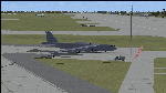
Since it became operational in 1955, the B-52 has been the main long-range heavy bomber of the U.S. Air Force. It first flew on Apr. 15, 1952. Nearly 750 B-52s were built when production ended in Oct. 1963. This "J" model is the future re-engined "h" model 60-0042 of the 917th Wing AFRC based at Barksdale AFB (KBAD). She flies higher, further, and faster than any previous version. The aircraft can cruise at 380 KIAS at 500 ft agl over about 5,000 nm which makes her capable of reaching targets within enemy airspace anywhere on the globe without being detected by radar until it's too late. Her normal high altitude cruise speed has been increased to Mach .88 above FL550E over 9,000 nm without refueling, and her service ceiling has increased to FL570E. The 50,000 lb payload is still nominal, but due to the lighter engines she now has more accomidations for the crew, and does not require refueling very often. She can range much further with less speed (i.e., Mach .85), but there is normally no need for that. This aircraft is designed to fly like the real thing. It is likely one of the best B-52 models available at this time. I have test-flown this aircraft around the globe several times to reassure myself that all is well. You will not have a bouncing effect occur when cruising with 16x speed acceleration and autopilot engaged because all aerodynamics and balance are perfected to a very low margin of error, or no error margin at all. Please be sure to read the INSTRUCT.TXT file for extended details. Original aircraft designer: Mike Stone; Textures by Bill Baldwin; Panel and gauges by Philippe Wallaert; Auto Smoke Effects by Richard Wisman; BR-725 Sound by Ronald Buffalo; Real World aero/engine dynamics, data, lights and effects by: Douglas E. Trapp, FS Flight Dynamics Engineer, Irving, Texas, [email protected], October 2018. The use of this model, and the configuaration of such, is designed for free educational purposes, and protected by the Free Use Act: (https://www.law.cornell.edu/uscode/text/17/107). This model and/or aspects of such cannot be used for monetary purposes!
| Filename: | B52J.zip |
| License: | Freeware |
| Added: | 27th October 2018, 18:57:21 |
| Downloads: | 628 |
| Author: | Douglas E. Trapp |
| Size: | 24.51 MB |
© 2001-2026 AVSIM Online
All Rights Reserved
Privacy Policy |