
Where Flight Simulation Enthusiasts Gather from Around the World!
AVSIM Library - Search Results

| Category: Flight Simulator X - Scenery | |
| Sardinia Photoreal 3/14 - Gallura and Costa Smeralda (Part 1 of 2) |

|
Images related to this file:
File Description:
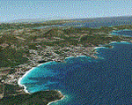
Photoreal coverage of N/E part of Sardinia (Italy), includes Costa Smeralda, Olbia (and LIEO Airport), Arzachena, San Teodoro, Tempio Pausania. Only for FSX. Scenery with water mask. No seasonal and night texture. No autogen.
Credits: Aerial photos summer 2012 courtesy of Microsoft Virtual Earth.
| Filename: | Sardinia_Photoreal_314__Gallura_and_Costa_Smeralda.zip |
| License: | Freeware |
| Added: | 15th June 2013, 07:35:51 |
| Downloads: | 3,974 |
| Author: | Diego PAPARELLA |
| Size: | 438.57 MB |
| Category: Flight Simulator 2002 - Scenery Design | |
| Alaskan Ship Macros |
|
File Description:
Two of Ten Ship Macros (very detailed *api format) created with EOD. A NOAA Research vessel, and the "Sea Train" a 600ft. Train-car freighter. The resource *eod files are available upon request.
Freeware for Scenery Designers.
Make those over water flights more interesting!
| Filename: | Alaskan_Ship_Macros.zip |
| License: | Freeware |
| Added: | 18th November 2002, 23:26:40 |
| Downloads: | 2,178 |
| Author: | Bob Langendorfer |
| Size: | 1.51 MB |
| Category: Flight Simulator 2002 - Scenery | |
| Savana, Anak Airport |
|
File Description:
This small airport is located in Ketchikan Alaska. It has a small 2400X50' dirt runway. There is also a small dock at the other side for water landings. There are small buildings at each location. A small trading post is also located on the island.
| Filename: | Savana_Anak_Airport.zip |
| License: | Freeware |
| Added: | 18th August 2002, 21:04:25 |
| Downloads: | 1,388 |
| Author: | Frank Betts |
| Size: | 1.1 MB |
| Category: Combat Flight Simulator 1 and 2 - Scenery | |
| CF2 Europe |
|
File Description:
CFS2 has no flattening of the coastal areas. This creates mesh problems, as the coastal water will not always be at elevation 0. These BGLs will correct that problem for the European Theatre. Areas include all of Europe, Greenland, Iceland, North Africa, and Western Russia.
| Filename: | CF2_Europe.zip |
| License: | Freeware |
| Added: | 14th August 2002, 00:44:59 |
| Downloads: | 1,672 |
| Author: | Richard Ludowise |
| Size: | 2.52 MB |
| Category: Flight Simulator X - Scenery | |
| Linosa island, Sicily, Italy |
|
File Description:
The photoreal scenery covers the little island of linosa located on the Sicilian Sea. The PhotoReal Scenery has been realized with the new FSX SDK specifications: high resolution (1.19 meter/pixel definition) and blending mask for water. The night texture and autogen are also present.
| Filename: | Linosa_island_Sicily_Italy.zip |
| License: | Freeware |
| Added: | 6th July 2007, 03:07:41 |
| Downloads: | 5,563 |
| Author: | Fulvio Mazzokan |
| Size: | 9.77 MB |
| Category: Flight Simulator 2004 - Scenery | |
| Montana Hops by LBMartin - For helicopter lovers - |
|
File Description:
This scenery contains a lot of spots in the Missoula and Polson (Flathead Lake) area. Things like wood helipad over the water, aerial festival, Rural Fire Service, Fishing camps and Lodges, Fire Towers, S&R base.... Take your time for fly to all the spots...
| Filename: | Montana_Hops_by_LBMartin__For_helicopter_lovers_.zip |
| License: | Freeware |
| Added: | 26th August 2005, 18:01:37 |
| Downloads: | 1,009 |
| Author: | LBMartin |
| Size: | 15.18 MB |
| Category: Flight Simulator X - AFCAD Files | |
| Greek Waterports |
|
File Description:
This is 5 waterports in some places in greece.The only thing you have to do is just pick a float plane when you choose this airports to take off.You start on the water.
It requires the GRcoastlines.ZIP to work.You can find it in AVSIM library
| Filename: | Greek_Waterports.zip |
| License: | Freeware |
| Added: | 22nd February 2008, 09:20:43 |
| Downloads: | 6,875 |
| Author: | Vassilis Kostoulas |
| Size: | 706.92 KB |
| Category: Flight Simulator 2004 - AFCAD Files | |
| Corrected shorelines AFCAD Fix for Washington AI Floatplanes |
|
File Description:
AFCAD Updates to use "Washington AI Floatplanes And Other Goodies" by Lauren Robison, Ron Day and Dexter Thomas with Holger Sandmann's "US North Cascades Mountains and Northwest Washington Coast." Keeps the AI Float-planes in the water. See Read me for more.Requires us_wa_nc.zip and wa_floats_etc.zip
| Filename: | Corrected_shorelines_AFCAD_Fix_for_Washington_AI_F.zip |
| License: | Freeware |
| Added: | 28th October 2008, 17:49:48 |
| Downloads: | 281 |
| Author: | Joe R. Mondano |
| Size: | 8.38 KB |
| Category: Fly! II - TerraScene | |
| Cape Hatteras (Carolinas Project) TerraScene Project Pack |
|
Images related to this file:
File Description:
Re-upload. This TerraScene 2.1 Project pack covers all of global tile 201,154 and the western half of 202,154. Picking up the NC coastline at Atlantic Beach, it continues north through Morehead City, New Bern, Bayboro, Cherry Point and the Pamlico River. To the east, it continues out over Pamlico sound to Cape Lookout, then proceeds north to Cape Hatteras, including Ocracoke, Buxton, and Avon. This pack includes updated Tiger Census (2000) shapefile data, adding new water areas, new highways, and other details. All scenery data files are included: USGS data, shapefiles, and complete custom water masks. Requires TerraScene 2.1 and Fly!II patched to v230 or later.
| Filename: | Cape_Hatteras_Carolinas_Project_TerraScene_Project.zip |
| License: | Freeware |
| Added: | 21st May 2010, 02:35:26 |
| Downloads: | 261 |
| Author: | Randall Rocke |
| Size: | 44.67 MB |
| Category: Fly! II - TerraScene | |
| Spartanburg (Carolinas Project) TerraScene Project Pack |
|
Images related to this file:
File Description:
Re-upload. This TerraScene 2.1 Project pack covers all of global tile 197,154, including Greenville and Spartanburg, SC, adjoining the Johnson City tile on its southern border. It continues south to Anderson, SC and contains a portion of Hartwell Lake to the SW. In the NW, you have Asheville Regional Airport and the city of Asheville, NC tucked within mountainous terrain. This pack includes updated Tiger Census (2000) shapefile data, adding new water areas, new highways, and other details. All scenery data files are included: USGS data, shapefiles, and a complete custom water mask. Requires TerraScene 2.1 and Fly!II patched to v230 or later.
| Filename: | Spartanburg_Carolinas_Project_TerraScene_Project_P.zip |
| License: | Freeware |
| Added: | 21st May 2010, 02:38:26 |
| Downloads: | 169 |
| Author: | Randall Rocke |
| Size: | 73.35 MB |


© 2001-2026 AVSIM Online
All Rights Reserved
Privacy Policy |