
Where Flight Simulation Enthusiasts Gather from Around the World!
AVSIM Library - Search Results

| Category: Flight Simulator X - Scenery | |
| Victoria Inner Harbor Airport (CYWH) |

|
Images related to this file:
File Description:
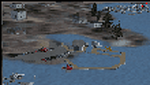
This airport was made using Airport Facilitator X, and Instant Scenery 2. Victoria Inner Harbor Airport is a water airport located in southern Victoria, British Columbia, Canada. The airlines that fly there are Harbor Air, West Coast Air, Kenmore Air, and Whistler Air. This is an airport that flight simulator does not have. I put docks for seaplanes with two seaplanes. I even made it so that you can start off at the dock. I made the small terminal and a parking lot with cars and light poles. I also put the surrounding docks with many boats. There is also a small heliport 0.73 miles away from Victoria Inner Harbor called Shoal Point Heliport. I have made this heliport because it too is another one flight simulator forgot. This was all based on Google Earth and Bing Maps. Please read the read me for instructions on how to install. This is for Flight Simulator X only. By Tyler Lawrence.
| Filename: | Victoria_Inner_Harbor_Airport_CYWH.zip |
| License: | Freeware |
| Added: | 16th January 2012, 23:53:12 |
| Downloads: | 1,489 |
| Author: | Tyler Lawrence |
| Size: | 9.98 MB |
| Category: Flight Simulator 2004 - Scenery | |
| Canouan TVSC in the Grenadines |
|
Images related to this file:
File Description:
Canouan Island is the one of the middle islands in the chain known as St Vincent and the Grenadines, between Mustique and Union Island. Canouan is around 5 miles long and shaped like a hook, with a resident population of 1,200. There has been major touristic development on the island since the early 1990's and the island now has paved roads, electricity, and desalinated water along with a golf course.
The airport is at the southern end of the island and the runway has been extended to 5,875 feet on reclaimed land, making Canouan the jet airport for the Grenadines with flights from North and South America. There are connecting flights to the other islands by SVG and LIAT. The airport apron has been extended to accomodate larger planes and I have shown the airport with this apron work still in progress and during the expansion of the terminal building. The AI has two international flights, on Wednesday and Saturday, and both by American.
| Filename: | Canouan_TVSC_in_the_Grenadines.zip |
| License: | Freeware, limited distribution |
| Added: | 11th June 2013, 22:59:04 |
| Downloads: | 656 |
| Author: | Roger Wensley |
| Size: | 3.6 MB |
| Category: Flight Simulator 2004 - Scenery | |
| Hawk Logging, for Holger Sandmann's scenery |
|
Images related to this file:
File Description:
This is a logging camp, on Admiral Island at the northern end of Chatham Strait in southern Alaska, around 30 miles south of Juneau. It is marked on the chart of the area; if you are chartless then there is a section of the chart included here. This scenery is designed specifically for use in the Tongass Fjord scenery (or Glacier, or Misty? I don't remember now which area it is in!) and probably does not work with just Ultimate Terrain; I haven't tried it. The camp has an identifying code so it will show up on a gps as PELC but there is no interaction with atc as there are no designated water runways; PELC on the GPS just acts as a waypoint. There will be further posts for use with Tongass Fjords, Misty Fjords, and Glacier Bay, and I still find these scenery areas by Holger and his crew the most satisfying in FS9.
| Filename: | Hawk_Logging_for_Holger_Sandmanns_scenery.zip |
| License: | Freeware, limited distribution |
| Added: | 8th November 2014, 22:42:24 |
| Downloads: | 317 |
| Author: | Roger Wensley |
| Size: | 12.37 MB |
| Category: Flight Simulator 2004 - Scenery | |
| Buffalo Narrows CYVT in Saskatchewan, Canada |
|
Images related to this file:
File Description:
Buffalo Narrows is a small town (around 1,400 folks) 130 miles west and a bit north of La Ronge in Saskatchewan, and I discovered that the Buffalo Narrows airfield, wrongly positioned in FS9, had been flooded out by Ultimate Terrain's lake; this is the rescue package. Actually that would be several lakes as the place is surrounded by water including Churchill Lake, Little Peter Pond Lake, and of course Big Peter Pond Lake.
There are two runways, the longest being 5,006' of 100' wide asphalt aligned 11/29, and the other 2,297 and 75' wide, also asphalt. Both runways are lit, and there is JetA and 100LL fuel available. I have placed taxiway lights, but I haven't made proper signage or placed runway lights, or a ton of other things, but it is now landable and with the buildings and fire chemical retarder tanks etc, and there is AI that includes a CL-415. The roads have also been modified to fit.
| Filename: | Buffalo_Narrows_CYVT_in_Saskatchewan_Canada.zip |
| License: | Freeware, limited distribution |
| Added: | 15th July 2012, 19:31:20 |
| Downloads: | 499 |
| Author: | Roger Wensley |
| Size: | 1.8 MB |
| Category: Fly! II - Scenery | |
| Globe Tile D200159 Scenery Pack |
|
File Description:
This upload is a scenery package for globe tile D200159, an area of Pennsylvania that contains Clearfield to the north, State College (roughly center), and Altoona to the southwest. The West Branch of the Susquehanna R. is N., large Raymond Lake is ENE of Altoona, and the Juniata R. is SSE. The uploaded scenery package includes four edited gxx.trn for Fly!2, which flatten most of the bodies of water in globe tile 200159. Border areas were not edited to avoid compatibility problems with bordering globe tiles. Also included are Terrascene 2.1 day and watermask tga files for segments 5,4 and 6,3 plus the corresponding render options file OHPA.trp, which specifies the textures you need to match my segments with those segments you render. For your convenience, I included my Terrascene project file PennSt.tsp. Note: you must use my segment 5,4 for Raymond Lake to be flattened. The globe tile was rendered with options set for subdivideDensity=8 and subdivideTolerance=500.
| Filename: | Globe_Tile_D200159_Scenery_Pack.zip |
| License: | Freeware |
| Added: | 27th October 2002, 01:25:59 |
| Downloads: | 208 |
| Author: | Mark Steinmetz |
| Size: | 18.42 MB |
| Category: Flight Simulator 2002 - Scenery Design | |
| Ground2K for Beginners |
|
File Description:
Newly revised for Ground2K version 4
Ground2K version 4 by Christian Fumey is a very easy to use design tool for Flight Simulator terrain scenery. With it, you can create and modify coasts, roads, rivers, lakes, islands, land and water class, altitude mesh, and textured ground polygons.
This short user guide is meant for beginners, and presents some basic concepts concerning Flight Simulator terrain, and a step-by-step explanation of some of the principal functions of Ground2K.
No technical terms are used here, for ease of comprehension.
An HTML document for universal compatibility.
New sections include:
- expanded coverage of basic concepts and functions;
- common problems and errors with solutions;
- glossary of terms
Very sorry - no support is offered for this guide. For any questions, please consult the AvSim forum dedicated to Flight Simulator scenery design.
| Filename: | Ground2K_for_Beginners.zip |
| License: | Freeware |
| Added: | 24th July 2003, 15:24:13 |
| Downloads: | 5,657 |
| Author: | Luis, Scenery Design Fourm |
| Size: | 1.3 MB |
| Category: Flight Simulator 2004 - Utilities | |
| AirFx - Smoke System Effects Placement Wizard - New Version 1.7.6.5 |
|
File Description: With AirFx you can add any effects to your smokesystem. Ver.1.7.6.5 FEATURES: 7. See readme for update info
1.Pre-made
templates for quick configuration.
2. New effects including: Bomb, Flak, Engine fire, Machine gun, Water dump,
Crop duster, and Chicken cannon. [Chicken cannon only available with Fs2004].
3. Assign effects and placements manually for the greatest control.
4. A templates function is provided to easily organize settings and as an
quick way to get started.
5. Adjacent help screens for comprehensive information at a glance.
6. Aircraft.cfg restoration functions.