
Where Flight Simulation Enthusiasts Gather from Around the World!
AVSIM Library - Search Results

| Category: X-Plane - Scenery | |
| BR MS SBTG - Tres Lagoas Airport v1.0.0 |

|
Images related to this file:
File Description:
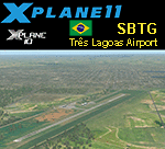
This is an X-Plane 11 and X-Plane 10 scenery package for PlÃnio Alarcom Airport (IATA: TJL, ICAO: SBTG), which is the airport serving Três Lagoas, Brazil. It includes corrected aprons, ramps, gates, taxiways, lighting system, city buildings, ortho-photoscenery for the airfield area, and (XP11 only) airport ground services (like push back). This scenery was tested and is operational (as of December 25, 2017) in "X-Plane 11.1 64 bit", Windows 10 Home. It was also tested and is also operational (as of December 25, 2017) in "X-Plane 10.51 64 bit", Windows 10 Home. Only the default X-Plane 11 libraries, by Laminar Research, are needed. No third party libraries are used.
| Filename: | BR_MS_SBTG__Tres_Lagoas_Airport_v100.zip |
| License: | Freeware |
| Added: | 25th December 2017, 23:26:27 |
| Downloads: | 66 |
| Author: | Rui Mesquita |
| Size: | 7.79 MB |
| Category: Flight Simulator X - AFCAD Files | |
| MHLC - Goloson International Airport - La Ceiba, Honduras |
|
Images related to this file:
File Description:

Goloson International Airport (Spanish: Aeropuerto Internacional Goloson) (IATA: LCE, ICAO: MHLC) is an airport located on the western side of the city of La Ceiba, in the Atlantida Department on the north coast of Honduras. It is also known as La Ceiba Airport (Aeropuerto de La Ceiba) and Hector C. Moncada Air Base (Base Aerea Hector C. Moncada). The Airport serves as the headquarters for Aerolineas Sosa.
Features:
*Expanded parking apron
*Taxiways properly designated and aligned
*Runway markings and lighting corrected
*Parking spots for commercial traffic
*Separate parking area for GA traffic
*Misc airport buildings added
*Airport vehicles and objects throughout the airport
*Fuel service vehicles
*Static aircraft
| Filename: | MHLC__Goloson_International_Airport__La_Ceiba_Hond.zip |
| License: | Freeware |
| Added: | 5th February 2014, 23:07:36 |
| Downloads: | 443 |
| Author: | Jaison Diaz / Endeavour AI |
| Size: | 79.61 KB |
| Category: Fly! II - TerraScene | |
| Brunswick (Carolinas Project) TerraScene Project Pack |
|
File Description:
This is a TerraScene 2.1 Project pack for the area of Brunswick and the southern portion of Savannah, GA, including all of global tile 198,151. Combine this global tile with the Hilton Head tile to prevent the "capitation" of Savannah. Savannah sits directly on the tile borders, so this will give you the whole city. This tile continues the GA coastline to just south of Brunswick and Glynco Jetport. This pack includes updated Tiger Census (2000) shapefile data, adding new water areas, new highways, and other details. All scenery data files are included: USGS data, shapefiles, and a complete custom water mask. Requires TerraScene 2.1 and Fly!II patched to v230 or later.
| Filename: | Brunswick_Carolinas_Project_TerraScene_Project_Pac.zip |
| License: | Freeware |
| Added: | 4th June 2003, 12:19:47 |
| Downloads: | 194 |
| Author: | Randall Rocke |
| Size: | 24.24 MB |
| Category: Flight Simulator 2002 - Original Aircraft | |
| Savannah ICP MXP740 |
|
File Description:
Savannah ICP MXP740 with Rotax912 80Hp emulating engine, belongs to Serres aero club, U/L Aircraft. This Aircraft was copied from the real one, of "Serres Aero club" witch i fly, from a little small airfield in Makedonia with name "Hortero" in the City of Serres. The Savannah, Its success is due to its great dependability and easiness of piloting. Its S.T.O.L. performances make it easy to operate from any airfield. In addition, the Savannah is a very good airplane for cross-country flights during which one can appreciate its great stability. The model of this Fabulous Airplane design it by Massimo Taccoli and panel,sound,texture and air file by me.
| Filename: | Savannah_ICP_MXP740.zip |
| License: | Freeware |
| Added: | 28th June 2002, 21:12:41 |
| Downloads: | 2,073 |
| Author: | Maximos Sevastopoulos |
| Size: | 2.92 MB |
| Category: Flight Simulator 2002 - Aircraft Repaints, Textures and Modifications | |
| Tarom 80s Ilyushin IL-18V |
|
File Description:
Tarom used 14 IL-18 planes in its fleet and they were in service for more than 30 years. This is an IL-18V from the 1970s, registration YR-IMC. After three decades of service, it was preserved near the city of Campina, but it was soon destroyed by hooligans and now the wreck isn't there anymore. I made this repaint as I wanted this great aircraft to fly once again, even if only in FS. The aircraft was made by Pavel Hvatkin in gmax and features full moving parts, opening doors, reflections and night lighting. Repainted by Gergely Kósa. Uses 32-bit textures and includes two texture variations, one with very shiny metallic parts.
| Filename: | Tarom_80s_Ilyushin_IL18V.zip |
| License: | Freeware |
| Added: | 12th January 2003, 18:07:29 |
| Downloads: | 1,193 |
| Author: | Gergely Kosa |
| Size: | 3.42 MB |
| Category: Flight Simulator 2004 - Scenery | |
| Bush Flying Unlimited, Quebec |
|
File Description:
This scenery is located about 55 Nautical miles WNW of Quebec City on a nice lake. It has two gravel runways, a dock for floats, a main lodge and several small cabins. Also there is a barn with an old tractor to keep the grass mowed and the old Dodge Pickup to run errands in. A fuel tank is provided for fuel. There are lots of Gerrish's trees around too. An NDB is provided to help find the place. there is also a water runway with start locations. Runway 15-33 is 2000 feet long and 9-27 is 1800 feet long.
IMPORTANT NOTE!!! Requires Gerrish's Trees Library for FS2000/02/04 - Release 3/ trees_v3.zip... available at AVSIM.COM
| Filename: | Bush_Flying_Unlimited_Quebec.zip |
| License: | Freeware, limited distribution |
| Added: | 17th July 2004, 23:38:21 |
| Downloads: | 4,486 |
| Author: | Brian Gladden, Joe Binka |
| Size: | 3.49 MB |
| Category: Flight Simulator 2004 - Miscellaneous Files | |
| Real World Flight Plans for B767 |
|
File Description:
The two files contain real world B767- 200/300/400 flight plans taken over two 3 day periods, one in August 2003, and the other during March 2004, which originated in, terminated in or passed through UK Airspace. Duplicate routes have been removed from the list, though there may be duplicate city pairs where different routes were flown.
The format of the file is suitable for use by FSBuild and may be included as a Category of flight plans. Alternatively, the route portion may be copied and pasted into the FSBuild route field.
The flight plans from 2003 will need validation as there have been significant changes to airways since they were created.
NOT FOR REAL WORLD NAVIGATION
| Filename: | Real_World_Flight_Plans_for_B767.zip |
| License: | Freeware |
| Added: | 24th March 2005, 14:01:50 |
| Downloads: | 701 |
| Author: | Andrew Piper |
| Size: | 50.83 KB |
| Category: Flight Simulator X - Flight Plans | |
| SkyRoad to the Temple of Kamura-Tok..Episode-1 |
|
File Description:
Dr. Faustin has come to Panama to search the deep jungle of Darien for the temple of Kookoorukoo-Ko where he beleives a million year old map is hidden. The map contains the route to the City of Kamura-Tok somewhere on earth. Here, if his findings are correct, the "Beacon Rock" will be found, this apparatus was according to many legends " left on earth by the gods so that by its emanations, they will find the earth in their next journey". Once in the Jungle camp, the chosen pilot will search for the temple in a tiny AutoGyro for no airplane can land there...Will you be part of the expedition????
| Filename: | SkyRoad_to_the_Temple_of_KamuraTokEpisode1.zip |
| License: | Freeware, limited distribution |
| Added: | 6th July 2007, 19:00:20 |
| Downloads: | 855 |
| Author: | Gera Godoy C |
| Size: | 320.48 KB |
| Category: Flight Simulator 2004 - Scenery | |
| Yuba Co-Oroville Muni |
|
File Description:
FS2004 Scenery - Yuba County Airport (IATA: MYV, ICAO: KMYV) is a public airport located three miles (4.8 km) southeast of Marysville, serving Yuba County, California, USA. The airport has two runways and is mostly used for general aviation. Oroville Municipal Airport (IATA: OVE, ICAO: KOVE) is a public airport located 3 miles (5 km) southwest of the city of Oroville in Butte County, California, USA. Oroville Municipal Airport covers 920 acres and has two runways. This airport is about 23nm NW of Yuba Co. An 18 hole golf course is located right next to the facility for you "Fly-in Golfers". EZ Scenry libraries require, some are included. By John B. Loney, Jr. and Robert Lacy.
| Filename: | Yuba_CoOroville_Muni.zip |
| License: | Freeware, limited distribution |
| Added: | 28th August 2007, 03:37:55 |
| Downloads: | 734 |
| Author: | John B. Loney, Jr. and Robert Lacy |
| Size: | 2.61 MB |
| Category: Flight Simulator 2004 - Aircraft Repaints, Textures and Modifications | |
| Islena Airlines Embraer EMB-110 Bandeirante Pack |
|
Images related to this file:
File Description:

Islena Airlines, was born in La Ceiba in 1981 in the city of La Ceiba in Honduras, operated aircraft such as the Embraer 110, Let410, Shorts 360, F27 and ATR42, covering all major destinations in Honduras and Grand Cayman Island. In the decade of the 90 Islena Airlines becomes part of Grupo Taca and all their corporate image change the colors of the new group. Fleet also was replaced by ATR42 and Shorts360, the Shorts360 were removed from the fleet in 2009 and replaced by ATR42. This package includes 3 variants of the E110 (HR-IAE, HR-IAA and N685AC), AI model author Dee Waldron. Original model find on www.avsim.com. I use painkit by Josh Kubale, thanks for it.
| Filename: | Islena_Airlines_Embraer_EMB110_Bandeirante_Pack.zip |
| License: | Freeware |
| Added: | 4th April 2010, 18:58:44 |
| Downloads: | 188 |
| Author: | Luis A. Flores |
| Size: | 253.07 KB |
© 2001-2026 AVSIM Online
All Rights Reserved
Privacy Policy |