
Where Flight Simulation Enthusiasts Gather from Around the World!
AVSIM Library - Search Results

| Category: Flight Simulator 2004 - Scenery | |
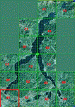
| VAOZ Nashik/Ozar, India |

|
File Description:
Googly scenery for Ozar, a small domestic airport located in Nashik (or
Nasik), 111 miles from Mumbai (Bombay). Nashik is a fast-expanding city in
the Maharashtra state in the Western Ghats located on the western edge of the Deccan
peninsula and is known as the Wine Capital of India or Grape City.
Owing to its close proximity to Mumbai, the airport has not proved popular as
the journey by taxi, bus or rail is not much greater after taking into account
check-in times etc. Air Deccan recently withdrew all flights from Ozar and as
far as I can establish the only airline now serving Ozar is Jagson Airlines,
using Dornier 228 turboprops. There is also a military presence at the east
end of the airport.
Flight Simulator 2004 has only provided a runway at this airport and this scenery
seeks to redress the situation so that you and your "AI" traffic can use the
airport.
The scenery does not purport to be ultra-accurate. Based on high quality
satellite imagery from Google Earth, the layout is proportionally correct but the
added airport features, such as buildings, are built from default Microsoft objects
and add-on libraries so will not look exactly like the real thing.
You are not obliged to download and install any additional scenery libraries,
but to enjoy this scenery in its entirety, you may wish to. It will work fine,
with or without.
| Filename: | VAOZ_NashikOzar_India.zip |
| License: | Freeware |
| Added: | 22nd April 2008, 07:55:32 |
| Downloads: | 737 |
| Author: | John Hinson |
| Size: | 118.11 KB |
| Category: Prepar3D V5 - AI Aircraft | |
| AI Lineas Aereas Azteca Htai Bombardier Learjet 31 XA-OLE |
|
Images related to this file:
File Description:

This is the aircraft of the extinct mexican airline "Lineas Aereas Azteca", the Bombardier Learjet 31 with the registration: XA-OLE. LÃneas Aéreas Azteca was an airline based in Mexico City, Mexico. It operated domestic scheduled services and international services to the USA. Its main base was Mexico City International Airport, with a hub at General Abelardo L. RodrÃguez International Airport, Tijuana. The airline was established on 9 May 2000 and started operations on 1 June 2000, operating domestic services with Boeing 737 aircraft. It started up after TAESA closed down and some of the staff and assets were taken over. The airline's operations were suspended by the government in March 2007 due to safety problems, and in October 2007 the Mexican government permanently revoked its air operator's certificate because the company hadn't solved those problems. On 10 October 2007, the General Civil Aeronautics Directorship (DGAC) of Mexico's Communications and Transport Secretariat permanently revoked LÃneas Aéreas Azteca's air operator's certificate, because the airline did not have a sound financial statement after the previous suspension. The fleet consisted in 6 Boeing 737-300 (XA-AAU, XA-AAV, XA-CAS, XA-TWG, XA-UCL, XA-UCP), 3 Boeing 737-700 (XA-AEP, XA-AEQ, XA-TWF), and 1 Bombardier Learjet 31 (XA-OLE). The models of this traffic are HENRY TOMKIEWICZ AI (HTAI) Bombardier Learjet 31. This is my website: https://el-mundo-de-los-aviones-ai-traffic.jimdosite.com I hope you enjoy it!
| Filename: | AI_Lineas_Aereas_Azteca_Htai_Bombardier_Learjet_31.zip |
| License: | Freeware |
| Added: | 29th May 2023, 21:00:32 |
| Downloads: | 37 |
| Author: | Jesus Gibran Soriano Solleiro |
| Size: | 23.97 MB |
| Category: Flight Simulator 2002 - Scenery | |
| Palisades SRTM Altitude Mesh |
|
File Description:
Ever wanted to fly down the VFR corridor over the Hudson River and gawk at all the skyscrapers in New York City? ... in your dreams! The Department of Fatherland Security has closed it down.
But, we still have Flight Simulator. Unfortunately, the altitude mesh for this area is somewhat lacking in detail.
This Palisades altitude mesh remedies that. Covers the Palisades cliffs, of course (but no Amusement Park, sniff), and also Riverside, Morningside, and Washington Heights, and Fort Tryon. In fact, all 5 Boroughs of New York City are covered, as well as most of central and northern New Jersey (visit beautiful downtown Hoboken!), and the larger part of Long Island. Also Rockland, Westchester, Orange, Putnam counties and more. And even Bear Mountain State Park.
Approximate coverage: N40* to N42* and W73* to W75*.
Made from NASA Shuttle Radar Topography Mission data (3 arc-second resampled to LOD9 - horizontal resolution of 76.4 meters) using SRTM to BGL by Matthew Styles (available in the AvSim library.) Very easy to use - give it a try.
BONUS: includes simple instructions so that anyone can make altitude mesh for their area from SRTM data using SRTM to BGL by Matthew Styles. Sorry, SRTM data only available for the Americas at the moment. The rest of the world coming soon. Check inside for more details.
No support of any kind is offered for this package - very sorry.
| Filename: | Palisades_SRTM_Altitude_Mesh.zip |
| License: | Freeware |
| Added: | 12th June 2003, 16:09:26 |
| Downloads: | 2,165 |
| Author: | Luis, scenery design forum |
| Size: | 3.48 MB |
| Category: Flight Simulator 2004 - Scenery | |
| KSNA, John Wayne-Orange County Airport |
|
Images related to this file:
File Description:

John Wayne Airport (IATA: SNA, ICAO: KSNA, FAA LID: SNA) is an airport in an unincorporated area in Orange County, California, with its mailing address in the city of Santa Ana, which is also the county seat, hence the International Air Transport Association (IATA) airport code. The main entrance to the airport is off of MacArthur Blvd in Irvine, the city that abuts the airport from the north and east. Newport Beach and Costa Mesa form the southern and western boundaries, respectively, together with a small unincorporated area along the Corona del Mar (73) Freeway. Santa Ana lies just north, not actually touching the airport directly. Originally named Orange County Airport, the county Board of Supervisors renamed it in 1979 to honor the actor John Wayne, who resided in neighboring Newport Beach and died that year. It also became the first airport to be named after an entertainer.
The main runway, at 5,701 feet (1,738 m), is one of the shortest of any major airport in the United States, resulting in most passenger aircraft operating from the airport to be no larger than the Boeing 757. However, some larger cargo aircraft, such as the FedEx A310/300, fly from SNA. Some gates are built to handle planes up to the size of a Boeing 767, which can operate with payload/fuel load restrictions. No wide-body passenger aircraft are currently in scheduled service at the airport.
| Filename: | KSNA_John_WayneOrange_County_Airport.zip |
| License: | Freeware, limited distribution |
| Added: | 11th October 2011, 04:03:32 |
| Downloads: | 4,874 |
| Author: | Mateusz Stabryla MK-Studios |
| Size: | 59.73 MB |
| Category: Flight Simulator 2004 - Scenery | |
| VFR of Lario - Como lake, Italy |
|
Images related to this file:
File Description:
This is the first of the expected seventeen sceneries in the "VFR of Lario" project, that will include the full view of the Como Lake, made with photorealistic terrain (multiseason & night) and with 3D GMax realistic objects, including some motions. Further the Como seaplane airport, the project will include some other virtual ones, and all the piers of NLC (Navigation Lake Como). The project will be completed with a related AI seaplane traffic.
The "VFR of Lario" project REQUEST the installation of the scenery "Itcoast2.zip" & the related "ITAC2_P1.zip", both available for free download from different libraries.
Information: Como is the main and beautifull city on the namesake lake (called Lario), placed in the north of Italy, closed to the Helvetic border. It includes the AeroClub Como seaplanes international airport, with his own flight school. Como has the headseat of NLC, the fleet management for connection of forty Lario's piers. This first scenery covers approximately an area of 7.5x6 kmt.
Contents: airport water track with hangar and static seaplanes; breackwater and stadium lake front, war memorial monument, Volta's temple and lighthouse, main Cathedral, Social theater, city old towers and wall, villa Olmo, square Cavour's buildings, NLC main pier and some minor others, Como-Brunate's funicolar connection (animated), lake fountain, Tavernola shipyard, Baradello's castle, Valduce hospital; motor ships (animated), steamer, hydrofoils and other minor boats; several other buildings (GenericBuilding system), trees and lights widespread all over the scenery.
| Filename: | VFR_of_Lario__Como_lake_Italy.zip |
| License: | Freeware |
| Added: | 22nd December 2011, 23:30:47 |
| Downloads: | 3,549 |
| Author: | Aldo Della Vedova, Daniele Lanfranchi, Diego Caligiuri |
| Size: | 25.33 MB |
| Category: Flight Simulator X - AFCAD Files | |
| DAOO - Oran Ahmed Ben Bella International Airport (Es Senia), Algeria |
|
Images related to this file:
File Description:
The main airport of Oran was recently renamed Oran Ahmed Ben Bella International in honor of the nation's founding president. The airport recently underwent EUR 20 million renovations which added the new 07R/25L runway and extended and renamed the existing 07L/25R runway as well as taxiway construction. Renovations were also done to the main parking apron and terminal building. This airport serves as a hub for Air Algeria and Aigle Azur with service to points in Africa, the Middle East and Europe. Several other airlines serve the airport with Air France beginning service from Paris in the Summer of 2013. The city of Oran (population approx. 759,645) is the second largest city in Algeria and an important industrial, educational and cultural center in Alegria.
Features:
*Expanded parking apron
*Parking ramp for cargo (v1.2)
*Taxiways properly desginated (v1.2)
*New runway 07R/25L
*Extension and renaming of runway 07/25 to 07L/25R
*Parking spots for commercial traffic
*Seperate parking areaa for GA traffic
*Misc airport buildings added
*Airport vehicles and objects throughout the airport
*Fuel service vehicles
*Date palms added
*Military area on the north side of the field with a helipad
*Version 1.1 corrects an issue with a misplaced taxi sign as well as a few minor oversights
*Version 1.2 adds correctly labeled taxiway designators (was able to get a hold of recent accurate charts) as well as correct ILS allignment for 25L
| Filename: | DAOO__Oran_Ahmed_Ben_Bella_International_Airport_E.zip |
| License: | Freeware |
| Added: | 13th April 2013, 23:43:00 |
| Downloads: | 1,140 |
| Author: | Jaison Diaz / Endeavour ai |
| Size: | 138.08 KB |
| Category: Flight Simulator X - AI Aircraft | |
| AI Lineas Aereas Azteca Htai Bombardier Learjet 31 XA-OLE |
|
Images related to this file:
File Description:

This is the aircraft of the extinct mexican airline "Lineas Aereas Azteca", the Bombardier Learjet 31 with the registration: XA-OLE. LÃneas Aéreas Azteca was an airline based in Mexico City, Mexico. It operated domestic scheduled services and international services to the USA. Its main base was Mexico City International Airport, with a hub at General Abelardo L. RodrÃguez International Airport, Tijuana. The airline was established on 9 May 2000 and started operations on 1 June 2000, operating domestic services with Boeing 737 aircraft. It started up after TAESA closed down and some of the staff and assets were taken over. The airline's operations were suspended by the government in March 2007 due to safety problems, and in October 2007 the Mexican government permanently revoked its air operator's certificate because the company hadn't solved those problems. On 10 October 2007, the General Civil Aeronautics Directorship (DGAC) of Mexico's Communications and Transport Secretariat permanently revoked LÃneas Aéreas Azteca's air operator's certificate, because the airline did not have a sound financial statement after the previous suspension. The fleet consisted in 6 Boeing 737-300 (XA-AAU, XA-AAV, XA-CAS, XA-TWG, XA-UCL, XA-UCP), 3 Boeing 737-700 (XA-AEP, XA-AEQ, XA-TWF), and 1 Bombardier Learjet 31 (XA-OLE). The models of this traffic are HENRY TOMKIEWICZ AI (HTAI) Bombardier Learjet 31. This is my website: https://el-mundo-de-los-aviones-ai-traffic.jimdosite.com I hope you enjoy it!
| Filename: | AI_Lineas_Aereas_Azteca_Htai_Bombardier_Learjet_31.zip |
| License: | Freeware |
| Added: | 29th May 2023, 21:00:06 |
| Downloads: | 72 |
| Author: | Jesus Gibran Soriano Solleiro |
| Size: | 23.97 MB |
| Category: Flight Simulator X - Scenery | |
| KSNA, John Wayne-Orange County Airport |
|
Images related to this file:
File Description:

John Wayne Airport (IATA: SNA, ICAO: KSNA, FAA LID: SNA) is an airport in an unincorporated area in Orange County, California, with its mailing address in the city of Santa Ana, which is also the county seat, hence the International Air Transport Association (IATA) airport code. The main entrance to the airport is off of MacArthur Blvd in Irvine, the city that abuts the airport from the north and east. Newport Beach and Costa Mesa form the southern and western boundaries, respectively, together with a small unincorporated area along the Corona del Mar (73) Freeway. Santa Ana lies just north, not actually touching the airport directly. Originally named Orange County Airport, the county Board of Supervisors renamed it in 1979 to honor the actor John Wayne, who resided in neighboring Newport Beach and died that year. It also became the first airport to be named after an entertainer.
The main runway, at 5,701 feet (1,738 m), is one of the shortest of any major airport in the United States, resulting in most passenger aircraft operating from the airport to be no larger than the Boeing 757. However, some larger cargo aircraft, such as the FedEx A310/300, fly from SNA. Some gates are built to handle planes up to the size of a Boeing 767, which can operate with payload/fuel load restrictions. No wide-body passenger aircraft are currently in scheduled service at the airport.
| Filename: | KSNA_John_WayneOrange_County_Airport.zip |
| License: | Freeware, limited distribution |
| Added: | 11th October 2011, 08:25:20 |
| Downloads: | 11,002 |
| Author: | Mateusz Stabryla MK-Studios |
| Size: | 66.92 MB |
| Category: Flight Simulator X - Scenery | |
| KFKN - Franklin Municipal / John Beverly Rose Airport - Virginia, USA |
|
File Description:
Also known as Franklin Municipal Airport or John Beverly Rose Field (IATA: FKN, ICAO: KFKN, FAA LID: FKN) is a public airport in Isle of Wight County, Virginia, United States. The airport is owned by the City of Franklin and is located at 32470 John Beverly Rose Drive, two nautical miles (4 km) northeast of the city's central business district.
Added aircraft parkng and custom buildings. Created with Airport Design Editor by ScruffyDuck Software using current FAA documentation and Google Earth measurements, this package offers a replacement for FSX's stock airport. All these enhancements are as close to the real airport as I can get with stock library objects and custom buildings.
| Filename: | KFKN__Franklin_Municipal__John_Beverly_Rose_Airpor.zip |
| License: | Freeware |
| Added: | 10th November 2014, 01:11:40 |
| Downloads: | 302 |
| Author: | Wayne Roberts |
| Size: | 344.67 KB |
| Category: Dovetail Games Flight Sim World - Scenery | |
| LEMR - Aerodromo de La Morgal, Oviedo (Asturias, Spain) version 12 |
|
Images related to this file:
File Description:
With ADE v1.65, I have made a few minor arrangements in my previous FSX-P3Dv4 version of this airfield, and I hope it works in Dovetail Flight Simulator World.
This is a basic scenery for LEMR La Morgal, enhanced in order to make it less sad than the default one, and a few more similar to the Google recent photos. I hope with this file your GA AI Traffic can have place for taking off, landing, refueling and sleeping.
You can use as a Navigation Aid the MW Radio Antenna of Mount Naranco, placed between the airfield and the City of Oviedo, by tuning 729 kHz in yor ADF (Thanks to Francisco Sanchez 'Pacoldfield' for suggesting me this improvement).
| Filename: | LEMR__Aerodromo_de_La_Morgal_Oviedo_Asturias_Spain.zip |
| License: | Freeware |
| Added: | 10th April 2018, 17:56:49 |
| Downloads: | 35 |
| Author: | Felix Fernandez de Castro |
| Size: | 89.53 KB |
© 2001-2026 AVSIM Online
All Rights Reserved
Privacy Policy |