
Where Flight Simulation Enthusiasts Gather from Around the World!
AVSIM Library - Search Results

| Category: Fly! II - TerraModels | |
| EGLC London City Airport And VFR River Thames |

|
File Description:
"I had a lot of fun doing this one. Unable to Terrascene this area because of the "Meridian Line" problem I took it upon myself to Create the River Thames from were Dave Taylors scenery finishes, past EGLC on to the Sea. Adding on my way, buildings, trees and other scenery like Yahts and boats. Also included in the package is some of the towers by Jeff Davis, he made for Fly! I have done a minor repaint of the ships by Biber Salsa, included in this package. Flying down the River Thames from Canary Wharf below 100 ft (tut tut) is great fun in the Bell407, taking about 8 mins. I can see this being the setting for some interesting 'online' races. This put the wonderful program by Allen Kriesman to the test. I didnt think it would cover such a large area, but it did! This whole scenery is Dedicated to Allen Kriesman and his program, Terramodels 2.2"
| Filename: | EGLC_London_City_Airport_And_VFR_River_Thames.zip |
| License: | Freeware, limited distribution |
| Added: | 3rd June 2003, 20:50:18 |
| Downloads: | 405 |
| Author: | Steve Brown YSOMdesign |
| Size: | 482.41 KB |
| Category: Flight Simulator X - Scenery | |
| Mid West Victoria UPDATED. 14 airports. YARA YSWL YMBU YSTA YDOD YWYF YBIR YHPN YKER YSLK YSWH + *NEW* YNHL YHML YWKB |
|
Images related to this file:
File Description:
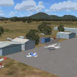
This is an updated version (original Jan 2018). Fixed some ground texture problems plus a lot of added and improved objects and 3 NEW airports. There are 14 airports starting at Ararat and extending up to the Murray at Swan Hill. YARA Ararat YSWL Stawell YMBU Maryborough YSTA Saint Arnaud YDOD Donald YWYF Wycheproof YBIR Birchip YHPN Hopetoun YKER Kerang YSLK Sealake YSWH Swanhill + *NEW* YNHL Nhill YHML Hamilton YWKB Warracknabeal. A lot of airports but not a quicky slap dash effort. It is several hundred hours over many months. Surrounding scenery modified to match real life. Towns, race courses, forests, sewage treatment ponds, obstacles (towers etc) have been added. Included is an AI traffic file that covers all airports that don't already have AI. These files are for Flight Simulator X. Made using Airport Design Editor using some objects borrowed from Robert Budd's excellent Baccus Marsh. RECOMMENDED The scenery is designed to interface with ORBX FTX_AU scenery for Australia (payware). It will work without ORBX but will not interface as well with standard scenery.
| Filename: | Mid_West_Victoria_UPDATED_14_airports_YARA__YSWL__.zip |
| License: | Freeware |
| Added: | 16th May 2019, 18:19:35 |
| Downloads: | 419 |
| Author: | Colin Jeffery |
| Size: | 5.23 MB |
| Category: Flight Simulator X - AFCAD Files | |
| Stoe Creek Farm Airport (7NJ2), NJ |
|
File Description:
Located 01 miles S of Canton, New Jersey, Stoe Creek Farm is a private turf field 1725' in length. The runway is largely clear of obstructions although on approach for Runway 05 you will deal with 20-30' trees a few hundred feet back from the threshold and there are transmission towers along the approach corridor to Runway 23 you should watch out for. The runway does have edge lighting, although the windsock is not lit at night and daytime VFR is still recommended. There are no services for transient craft at this airfield. Since you will be landing on terrain, it is recommended that your mesh complexity is set as high as possible.
Scenery constructed with use of satellite images/streetview/aerial photos - the author has not been there in person.
This scenery is meant to be used in conjunction with MegaScenery Earth New Jersey/Delaware 004. It is not required, but apron use is minimized to allow satellite scenery to show through as much as possible, and objects are placed based on the MSE textures - lack of it may make scenery look out of place.
| Filename: | Stoe_Creek_Farm_Airport_7NJ2_NJ.zip |
| License: | Freeware |
| Added: | 14th February 2011, 18:32:24 |
| Downloads: | 163 |
| Author: | Drew Sikora |
| Size: | 700.91 KB |
| Category: Flight Simulator X - Scenery | |
| Murray river and SE Victoria v2 for ORBX v2. YRIO Robinvale YBRN Balranald YDLQ Deniliquin YLEG Leongatha YYRM Yarram |
|
Images related to this file:
File Description:
'Murray and SE Victoria v2' is made to match ORBX Australia v2 scenery. Use 'Murray + SE Victoria airports' for ORBX v1 or no ORBX. There are 5 airports. 3 airports near the Murray river in Victoria and NSW - YRIO Robinvale, YBRN Balranald, YDLQ Deniliquin. 2 airports in SE Victoria - YLEG Leongatha, YYRM Yarram. ORBX has done these as they have done every airport included with FSX in Australia to a reasonable standard. If I had not already done them for ORBX V1 I would not have bothered. However these are better than ORBX because the surroundings have been modified to match real life. Towns have been added or shifted. Forests cut down or added. Race courses, sewage treatment ponds and other stuff added. Local obstacles (towers etc) added. There are Included are 2 AI traffic files that cover the airports. These files are for Flight Simulator X. Made using Airport Design Editor using some objects borrowed from Robert Budd's excellent Baccus Marsh and 'Static aircrafts' by Jean-Pierre Fillion. REQUIRED The scenery is designed to interface with ORBX FTX_AU V2 scenery for Australia (payware).
| Filename: | Murray_river_and_SE_Victoria_v2_for_ORBX_v2_YRIO_R.zip |
| License: | Freeware |
| Added: | 15th December 2019, 19:06:10 |
| Downloads: | 317 |
| Author: | Colin Jeffery |
| Size: | 10.06 MB |
| Category: Flight Simulator X - AFCAD Files | |
| Thomas Browne Airpark Airport (61NJ), NJ |
|
File Description:
Located 02 miles W of Glassboro, New Jersey, Thomas Browne Airpark Airport is a private turf strip 2000��80 feet. There is no hard-surfaced runway, which means you will be landing on terrain so it is recommended you set your mesh resolution as high as possible. Watch out for trees and buildings alongside and at opposite ends of the runway. Crop fields are planted to the south of the runway and border the runway. You won't crash if you run into them but it certainly won't put you in good favor with the field owners! Take caution to avoid the transmission line towers as they are not lit at night! Neither is the runway, for that matter, so daytime VFR operations only are recommended for this airfield.
Scenery constructed with use of satellite images/streetview/aerial photos - the author has not been there in person.
This scenery is meant to be used in conjunction with MegaScenery Earth New Jersey/Delaware 004. It is not required, but apron use is minimized to allow satellite scenery to show through as much as possible, and objects are placed based on the MSE textures - lack of it may make scenery look out of place.
| Filename: | Thomas_Browne_Airpark_Airport_61NJ_NJ.zip |
| License: | Freeware |
| Added: | 4th February 2011, 02:47:24 |
| Downloads: | 166 |
| Author: | Drew Sikora |
| Size: | 1.41 MB |
| Category: Flight Simulator X - Scenery | |
| Remote Tower Base, Washington State USA |
|
File Description:
Remote Tower Base Operations, Washington State - Airport ID: TOWR (FSX). -
OK, all you Rotorheads - This is a fictional version of a very remote Helicopter landing pad on the Olympic Penn.. You must fly a Helo. I created it for my personal enjoyment and now I am releasing to the public as freeware. I hope you enjoy the "eye-candy". There are multiple radio and fire spotting towers in the area to check out. -
At least it gives you something to travel there for. -
This is an extremely challenging spot to land, especially using real Wx. The landing pad is basically a postage stamp. I created it and have a tough time landing here myself, so have fun with this one. -
You may also go directly to this airport by selecting TOWR as your starting airport. I also added a series of images so you can figure out how to get there from somewhere else. If you have my Wynoochie Lake scenery, its only 6 miles from there. (Just a heads-up) -
Designed with the FS X Sdk Scenery function of the Mission builder, Lee Swordy's AFCAD & the Abacus Scenery shortcut tool. -
This scenery is frame rate friendly.
| Filename: | Remote_Tower_Base_Washington_State_USA.zip |
| License: | Freeware |
| Added: | 3rd May 2007, 21:13:18 |
| Downloads: | 759 |
| Author: | Bob Caparoula |
| Size: | 5.85 MB |
| Category: Flight Simulator X - Scenery | |
| Quebec CYQB |
|
File Description:
All pilots have used or heard the word "Quebec" during their radio communication but not many pilots actually landed at Quebec International airport (CYQB). A great number of Head of States, VIPs, tourists came to Quebec City for summits, special occasions or to visit the city declared a World Heritage Site by UNESCO in 1985. Quebec airport is also hosting a great airshow and this year in June, to celebrate the 400th anniversary of Quebec City, five of the world best aerobatic squadrons will perform simultaneously over Quebec: the British "Red Arrows", the French "La Patrouille de France", the US Navy "Blue Angels", the USAF "Thunderbirds" and the Canadian "Snowbirds". It will be quite a sight.
This very accurate scenery will give you the opportunity to visit CYQB with your simulator. Months of effort were devoted to make this scenery as real as possible. This package includes more that 25 highly detailed hangars and buildings all having night textures, some of them have windows with specular effect. Light poles provide aprons lighting. The adjacent mount Belair have communication towers with strobe lights visible for over 12nm which provides a good visual reference coming into the airport. Exceltech, a maintenance facility has static aircrafts parked in front. A second publication will include the new terminal which is presently under construction.
| Filename: | Quebec_CYQB.zip |
| License: | Freeware |
| Added: | 20th February 2008, 22:13:36 |
| Downloads: | 8,240 |
| Author: | Gilles Boily |
| Size: | 6.21 MB |
| Category: Flight Simulator 2004 - Scenery | |
| VFR of Lario - Como lake, Italy |
|
Images related to this file:
File Description:
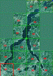
This is the first of the expected seventeen sceneries in the "VFR of Lario" project, that will include the full view of the Como Lake, made with photorealistic terrain (multiseason & night) and with 3D GMax realistic objects, including some motions. Further the Como seaplane airport, the project will include some other virtual ones, and all the piers of NLC (Navigation Lake Como). The project will be completed with a related AI seaplane traffic.
The "VFR of Lario" project REQUEST the installation of the scenery "Itcoast2.zip" & the related "ITAC2_P1.zip", both available for free download from different libraries.
Information: Como is the main and beautifull city on the namesake lake (called Lario), placed in the north of Italy, closed to the Helvetic border. It includes the AeroClub Como seaplanes international airport, with his own flight school. Como has the headseat of NLC, the fleet management for connection of forty Lario's piers. This first scenery covers approximately an area of 7.5x6 kmt.
Contents: airport water track with hangar and static seaplanes; breackwater and stadium lake front, war memorial monument, Volta's temple and lighthouse, main Cathedral, Social theater, city old towers and wall, villa Olmo, square Cavour's buildings, NLC main pier and some minor others, Como-Brunate's funicolar connection (animated), lake fountain, Tavernola shipyard, Baradello's castle, Valduce hospital; motor ships (animated), steamer, hydrofoils and other minor boats; several other buildings (GenericBuilding system), trees and lights widespread all over the scenery.
| Filename: | VFR_of_Lario__Como_lake_Italy.zip |
| License: | Freeware |
| Added: | 22nd December 2011, 23:30:47 |
| Downloads: | 3,551 |
| Author: | Aldo Della Vedova, Daniele Lanfranchi, Diego Caligiuri |
| Size: | 25.33 MB |
| Category: Flight Simulator X - Scenery | |
| Mid West Victoria v2 for ORBX v2. 14 airports. YARA YSWL YMBU YSTA YDOD YWYF YBIR YHPN YKER YSLK YSWH YNHL YHSM YWKB |
|
Images related to this file:
File Description:
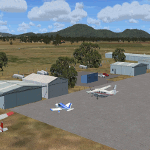
'Mid Western Victoria v2' is made to match ORBX Australia v2 scenery. Use 'Mid West Victoria update' for ORBX v1 or no ORBX. NOTE this is an UPDATE with Horsham replacing Hamilton in the instructions (it is Horsham in the actual scenery). There are 14 airports starting at Ararat and extending up to the Murray at Swan Hill. YARA Ararat YSWL Stawell YMBU Maryborough YSTA Saint Arnaud YDOD Donald YWYF Wycheproof YBIR Birchip YHPN Hopetoun YKER Kerang YSLK Sealake YSWH Swanhill YNHL Nhill YHSM Horsham YWKB Warracknabeal. A lot of airports but this is several hundred hours of effort over many months. ORBX has done these as they have done every airport included with FSX in Australia to a reasonable standard. If I had not already done them for ORBX V1 I would not have bothered. However these are better than ORBX because the surroundings have been modified to match real life. Towns have been added or shifted. Forests cut down or added. Race courses, sewage treatment ponds and other stuff added. Local obstacles (towers etc) added. There are 6 custom terminal buildings accurate to real life. Included is an AI traffic file that covers airports that dont already have AI. These files are for Flight Simulator X. Made using Airport Design Editor using some objects borrowed from Robert Budd's excellent Baccus Marsh and 'Static aircrafts' by Jean-Pierre Fillion. REQUIRED The scenery is designed to interface with ORBX FTX_AU V2 scenery for Australia (payware).
| Filename: | Mid_West_Victoria_v2_for_ORBX_v2_14_airports_YARA_.zip |
| License: | Freeware |
| Added: | 2nd May 2020, 23:11:14 |
| Downloads: | 258 |
| Author: | Colin Jeffery |
| Size: | 10.49 MB |
| Category: Flight Simulator 2004 - AFCAD Files | |
| The U.S. Virgin Islands (TISX/TIST) |
|
File Description:
Accurate rendition of the TIST and TISX airports. Includes accuarate gate numbering and locations for all airlines serving the airport as well as for general aviation aircraft. This is my continuing series of doing airports that have been neglected by both MS and the community. Hopefully this will enhance flying into this airport for those of you that frequent it. Unfortuantely there aren't many reference materials in terms of gate assignments or locations or numbering on the internet. I've flown in and out of this airport several times so most of this is from memory and a few shots I managed to find on airliners.net and jetphotos.net. It may not be 100% correct but it's pretty close and defientely a major improvement over the default scenery, which by the way...MS decided to place two large cell phone or radio towers right on the tarmac in front of the terminal, brilliant idea! If anyone out there knows of a way to remove them please e-mail me. Having said that, it's a beautiful island and a fun airport to fly into and out of. The St. Croix airport is also pretty much done from memory and a few photos since there isn't much reference material for gates, in this instance there aren't airline assignments to the gates since this is a smaller airport and the airlines pretty much are assigned random gates since there are only about a handful of gates. Again, though, definetely an improvement over the default. Now if only someone would do some landclass for the Virgin Islands ;-) Hope this enhances your flying into the sunny Caribbean!
| Filename: | The_US_Virgin_Islands_TISXTIST.zip |
| License: | Freeware |
| Added: | 30th June 2004, 04:52:33 |
| Downloads: | 2,702 |
| Author: | Jason Diaz |
| Size: | 136.53 KB |


© 2001-2026 AVSIM Online
All Rights Reserved
Privacy Policy |