
Where Flight Simulation Enthusiasts Gather from Around the World!
AVSIM Library - Search Results

| Category: Flight Simulator X - AFCAD Files | |
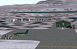
| PADU - Unalaska Airport, Alaska |

|
File Description:
The airport is sometimes referred to as Dutch Harbor Airport. In 2002, the State of Alaska renamed it Tom Madsen Airport in honor of Charles Thomas Madsen Sr., a bush pilot who was killed in an airplane accident that year. However, the Federal Aviation Administration still refers to it as Unalaska Airport.
Moved aprons, added additional parking and buildings. Adjusted and added taxiway lights. Changes are based on 2012 construction plans.
| Filename: | PADU__Unalaska_Airport_Alaska.zip |
| License: | Freeware |
| Added: | 3rd January 2013, 01:53:15 |
| Downloads: | 873 |
| Author: | Wayne Roberts |
| Size: | 136.52 KB |
| Category: Flight Simulator 2004 - Scenery | |
| PAIW Wales, Alaska, USA |
|
Images related to this file:
File Description:
Googly scenery for Wales - a small domestic airport on the western coast of Alaska that is poorly provided for in Flight Simulator 2004. These scenery files add taxiways, aprons, buildings and other airport features, so that you and your "AI" traffic can land, taxi, park and take off in a realistic manner.
Wales is a small village with a population of just over 150 people, so the facilities at this 4000 foot gravel airstrip are fairly limited. The airport is allocated the ICAO code PAIW, although Microsoft has ignored this in Flight Simulator and uses the IATA ticket code IWK. Wales is served by light aircraft from airlines such as Bering Air, Cape Smythe Air, Frontier Flying Service, and Hageland Aviation Services. You might find it a convenient stopping-off point for a quick trip across to Russia - this is about as close as you can get and a nip across the Bering Strait will find you there in no time.
The scenery does not purport to be ultra-accurate. Based on high-detail satellite imagery from Google Earth, the layout is proportionally correct but the added airport features, such as buildings, are built from default Microsoft objects and add-on libraries so will not look like the real thing.
You are not obliged to download and install any additional scenery libraries, but to enjoy this scenery in its entirety, you may wish to. It will work fine, with or without.
[File re-uploaded at request of AVSIM]
| Filename: | PAIW_Wales_Alaska_USA.zip |
| License: | Freeware |
| Added: | 26th June 2010, 13:51:45 |
| Downloads: | 1,266 |
| Author: | John Hinson |
| Size: | 76.81 KB |
| Category: Flight Simulator X - AFCAD Files | |
| PAMC - McGrath Airport - Alaska |
|
Images related to this file:
File Description:
McGrath Airport covers an area of 641 acres (259 ha) at an elevation of 343 feet (105 m) above mean sea level. It has two asphalt paved runways: 16/34 measuring 5,936 x 100 ft (1,809 x 30 m) and 23/05 measuring 2,000 x 60 ft.
Changes were made based on 2012 construction plans. Runway 23/05 was added along with taxiway "C" and parking aprons.
| Filename: | PAMC__McGrath_Airport__Alaska.zip |
| License: | Freeware |
| Added: | 16th August 2013, 06:54:41 |
| Downloads: | 300 |
| Author: | Wayne Roberts |
| Size: | 9.23 KB |
| Category: Flight Simulator 2004 - Scenery | |
| PADL - Dillingham - Alaska, USA |
|
Images related to this file:
File Description:
Dillingham is a town with a population of around 2,300 at the southeast corner of the Bering Sea in Bristol Bay, 70 miles west of King Salmon. The town's economical well being is based on the commercial price of salmon and the numerous surrounding sport fishing lodges. FS9 shows the town as way more extensive than it is; the landclass textures correct this. The airport is a mile west of the town and has a single runway 6,400 feet long and orientated 01-19. There are scheduled passenger flights by Alaska Air (numerous in summer and non-existant in winter) and PenAir (year around) plus cargo flights by Everts and Northern Air Transport, and local scheduled flights by Grant Air; the AI includes these, plus GA. The GA gravel apron is behind the main apron and across a road, which is unusual. The parking on the asphalt apron is marked; in actuality there are no markings but landing at a field in FS9 that doesn't have a control tower leaves one wondering where to go; the six spots at the far northern end are unused by AI and free for visitors.
| Filename: | PADL__Dillingham__Alaska_USA.zip |
| License: | Freeware, limited distribution |
| Added: | 14th May 2015, 17:35:29 |
| Downloads: | 393 |
| Author: | Roger Wensley |
| Size: | 10.39 MB |
| Category: Flight Simulator 2004 - Scenery | |
| Koyukuk KYU in Alaska |
|
Images related to this file:
File Description:
Koyukuk is a small village on the northern bank of the Yukon River, around 5 miles east of where the river turns from north-south to east-west, east being upstream towards the distant Fairbanks. The mouth of the Koyukuk River that joins the Yukon is just to the east of the village. The population is now under 100 and living from fishing and the land. During the late 1800's the local population lived off the land and also by the spin off from gold mining in the same way as the nearby Nulato, but when in the early 1900's gold mining activities moved to Nome and Fairbanks local prosperity plunged. In fact, the village only became a permanently inhabited establishment in 1939, when a school was built. The airfield is close by and has a gravel runway aligned 6-24 and 4,000 feet long with PAPI on the approach to 6. There is also a shorter and parallel grass runway that is only used in the winter snows by light planes that are on skis and without wheels. Apart from the airfield itself, and it's buildings, this scenery modifies the local land class, adds village buildings while reducing the village size to reality, and creates a new airfield background. Koyukuk is served by Wright Air from Fairbanks in the east and this is included in the AI provided with the post of Nulato. A note here about my scenery making. This is post number 509 and there will not be many more to follow this as I am almost at the end of the photos I either took or found for scenery purposes. There is a limit to what can be located online and I have already been making use of the little there is; eg Unalakleet. So, if you are near an airport (preferably Canadian or Alaskan) and have a camera..... Let me know.
| Filename: | Koyukuk_KYU_in_Alaska.zip |
| License: | Freeware, limited distribution |
| Added: | 30th August 2019, 18:23:12 |
| Downloads: | 124 |
| Author: | Roger Wensley |
| Size: | 3.26 MB |
| Category: Flight Simulator 2004 - Scenery | |
| Loney's Alaska Vol. 4 |
|
Images related to this file:
File Description:
FS2004 Scenery-Loney's Alaska vol4. This download comprises of 5 more Alaskan airports enhanced using EZ Scenery. The airports include Wales (IWK), Tin City LRRS (PATC), Teller (K54), Buck Creek (AK98) and Brevig Mission (KTS). Includes AI traffic through Traffic Tools with modified AFCAD files. EZ Scenery libraries required. By John B. Loney, Jr.
| Filename: | Loneys_Alaska_Vol_4.zip |
| License: | Freeware, limited distribution |
| Added: | 3rd June 2010, 00:44:50 |
| Downloads: | 1,492 |
| Author: | John B. Loney, Jr. |
| Size: | 644.09 KB |
| Category: Flight Simulator 2004 - Scenery | |
| Loney's Alaska Vol 2 |
|
File Description:
FS2004 Scenery-Loney's Alaska vol2. This download comprises of 6 more Alaskan airports enhanced using Rwy12 and EZ Scenery. The airports include Johnstone Point (2AK5), Boswell Bay (AK97), Cordova Muni (CKU), Thompson Pass (K55), Sheep Mountain (PASP) and Skelton (PAZK). There are some challenging approaches once again. Includes AI traffic through Traffic Tools with modified AFCAD files and dynamic scenery with Lago's FSE. Rwy12 and EZ Scenery libraries required.
| Filename: | Loneys_Alaska_Vol_2.zip |
| License: | Freeware |
| Added: | 1st April 2006, 22:47:31 |
| Downloads: | 1,824 |
| Author: | John B. Loney, Jr. |
| Size: | 1.12 MB |
| Category: Flight Simulator X - Scenery | |
| PAKI - Kipnuk Airport, Alaska |
|
File Description:
Changes are based on 2011 construction plans.Added taxiway and apron for runway 17/35.PAPI system Runway End Identifier Lights) were added along with custom models.
| Filename: | PAKI__Kipnuk_Airport_Alaska.zip |
| License: | Freeware |
| Added: | 16th April 2013, 08:04:02 |
| Downloads: | 808 |
| Author: | Wayne Roberts |
| Size: | 447.5 KB |
| Category: Flight Simulator X - Scenery | |
| Alaska Navaid Update 2011 |
|
Images related to this file:
File Description:
The default Flight Simulator database of VOR/NDB's is fast becoming out of date, Making
VOR navigation using current IFR en-route charts impractical to impossible. When flying along
charted airways, this discrepancy can cause you to become far off course. This update solves
that problem by re calibrating all navigation aids in Alaska based on information submitted to
the FAA January 13, 2011. This allows you to accurately navigate using any navaid in Alaska
while using current IFR en-route charts. This update includes magnetic variation data, and
navaid position. All data was compiled from the ground up. http://akfsnavaid.zzl.org
| Filename: | Alaska_Navaid_Update_2011.zip |
| License: | Check within download |
| Added: | 29th March 2011, 00:56:19 |
| Downloads: | 1,107 |
| Author: | Wilson Malone |
| Size: | 499.91 KB |
| Category: Flight Simulator 2004 - AFCAD Files | |
| PAYA Yakutat, Alaska, USA |
|
File Description:
Googlyafcad A&F Data for Yakutat, based on Google Earth satellite data.
Unfortunately, Microsoft have only limited facilities at this airport in Flight
Simulator 2004 with no provision for commercial traffic and this file will allow
you and your "AI" traffic to land, taxi, park and take off in a realistic manner.
Yakutat airport sees regular flights by Boeing 737 jets of Alaska Airlines, along
with smaller-sized traffic by local operators such as Arctic Circle Air Service
| Filename: | PAYA_Yakutat_Alaska_USA.zip |
| License: | Freeware |
| Added: | 5th August 2008, 08:29:27 |
| Downloads: | 526 |
| Author: | John Hinson |
| Size: | 63.18 KB |
© 2001-2026 AVSIM Online
All Rights Reserved
Privacy Policy |