
Where Flight Simulation Enthusiasts Gather from Around the World!
AVSIM Library - Search Results

| Category: Flight Simulator X - Utilities | |
| FS Earth 5.2 for Google Earth and FSX |

|
Images related to this file:
File Description:
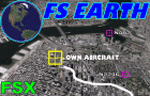
This program acts as a link between Flight Simulator X and Google Earth, letting to follow a flight in real time, over the satellite images generated by Google Earth. Flights can be saved, and many options are available for fine tuning the performance, as well as the map's style (zoom, tilt, orientation). Works on a single computer running FSX and Google Earth all together or, for best experience, can be used on two networked computers running respectively FSX (master) and Google Earth (slave). AI and Multiplayer traffic is also displayed in Google Earth, with course prediction and other information. Requires Flight Simulator X and Google Earth. The program running in trial mode works only around Anchorage, Alaska, (PANC / ANC) for a maximum of five minutes per flight session. Version 5.2 has new aircraft icons & labels and improves the compatibility with Windows Vista. A version for FS2004 is available also.
| Filename: | FS_Earth_52_for_Google_Earth_and_FSX.zip |
| License: | Shareware, time limited |
| Added: | 3rd May 2010, 07:38:23 |
| Downloads: | 2,701 |
| Author: | Luciano Napolitano |
| Size: | 3.46 MB |
| Category: Flight Simulator X - Utilities | |
| FS Earth 4.2 for Google Earth |
|
File Description:
This program acts as an interface between Flight Simulator X and Google Earth, letting to follow a flight in real time, over the satellite images generated by Google Earth. Flights can be saved, and many options are available for fine tuning the performance, as well as the map's style (zoom, tilt, orientation). Works on a single computer running FSX and Google Earth all together or, for best experience, can be used on two networked computers running respectively FSX (master) and Google Earth (slave). AI and Multiplayer traffic is also displayed in Google Earth, with course prediction and other information. Requires Flight Simulator X and Google Earth. The program running in trial mode works only around Anchorage, Alaska, (PANC / ANC) for a maximum of five minutes per flight session. Version 4.2 has improved compatibility with Windows Vista and minor bug fixes. A version for FS2004 is available also. By Luciano Napolitano.
| Filename: | FS_Earth_42_for_Google_Earth.zip |
| License: | Shareware, time limited |
| Added: | 9th March 2007, 13:39:05 |
| Downloads: | 2,213 |
| Author: | Luciano Napolitano |
| Size: | 2.44 MB |
| Category: Flight Simulator 2004 - Scenery | |
| Point Ellis cannery V1, for Holger Sandmann's Tongass Fjord scenery |
|
Images related to this file:
File Description:
This is a revised version of Point Ellis cannery, originally posted in 2007. It is unsurprisingly just east of Point Ellis, on the east side of the southern end of Chatham Strait in southern Alaska. It is marked on the chart of the area, and if you are chartless then there is a piece of the chart here. This scenery is designed specifically for use in the Tongass Fjord scenery, and probably doesn't work with just Ultimate Terrain. The cannery has an identifying code so it will show up on a gps as "PECA". There is no interaction with atc as there are no designated water runways, so the "PECA" on the gps just acts as a waypoint. There will be further posts for use with Tongass Fjords, Misty Fjords, and Glacier Bay, and I still find these scenery areas by Holger and his crew the most satisfying in FS9.
| Filename: | Point_Ellis_cannery_V1_for_Holger_Sandmanns_Tongas.zip |
| License: | Freeware, limited distribution |
| Added: | 6th November 2014, 21:55:48 |
| Downloads: | 237 |
| Author: | Roger Wensley |
| Size: | 3.86 MB |
| Category: Flight Simulator 2004 - Scenery | |
| Vancouver Island and Inner Passage float bases in BC, Canada |
|
File Description:
This is a series of float bases to the east of the northern part of Vancouver Island. They are all zipped together because: first, they are all in the same geographical area and if you like one you may like them all; second it means I only write one set of notes; and third I only upload once. I was looking to fill in the gap between what Holger Sandmann and his cohorts have done with Alaska, and Vancouver and Vancouver Island to the south, and there are these 16 float bases in a stretch of 180 miles between the northern part of Vancouver Island and the mainland coast. And if you leave out the relatively isolated Rivers Inlet to the north then they are all within a 140 mile stretch. Some are on the east coast of Vancouver Island, but most are on islands between the mainland and the island.
| Filename: | Vancouver_Island_and_Inner_Passage_float_bases_in_.zip |
| License: | Freeware |
| Added: | 3rd August 2008, 06:03:09 |
| Downloads: | 1,871 |
| Author: | Roger Wensley & Jim Turner |
| Size: | 6.85 MB |
| Category: Flight Simulator 2004 - AI Flight Plans | |
| Air Manas (Pegasus Asia) - Summer 2016 |
|
Images related to this file:
File Description:

Summer 2016 flightplans for Air Manas (Pegasus Asia).
| Filename: | Air_Manas_Pegasus_Asia__Summer_2016.zip |
| License: | Freeware, limited distribution |
| Added: | 16th September 2016, 12:45:09 |
| Downloads: | 431 |
| Author: | Jeroen Eekhof |
| Size: | 695.26 KB |
| Category: Prepar3D V1-4 - Aircraft Repaints, Textures and Modifications | |
| Stobart Air AT72 EI-GPP |
|
Images related to this file:
File Description:

Stobart Air AT72 EI-GPP. Requires Carenado AT72.
| Filename: | Stobart_Air_AT72_EIGPP.zip |
| License: | Freeware, limited distribution |
| Added: | 16th February 2020, 16:50:19 |
| Downloads: | 99 |
| Author: | Jake Wright |
| Size: | 40.54 MB |
| Category: Prepar3D V1-4 - Aircraft Repaints, Textures and Modifications | |
| Gulf Air Boeiong 787-9 |
|
Images related to this file:
File Description:
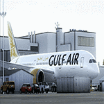
Gulf Air 787-9 RR New Logo Update
| Filename: | Gulf_Air_Boeiong_7879.zip |
| License: | Freeware |
| Added: | 12th April 2018, 23:38:43 |
| Downloads: | 154 |
| Author: | Mohamed Abdelhamid Mohamed |
| Size: | 23.52 MB |
| Category: Prepar3D V1-4 - Aircraft Repaints, Textures and Modifications | |
| Monster Energy Tornado GR1 |
|
File Description:
Fictional repaint ' MONSTER ENERGY ' Tornado Gr4 air display
| Filename: | Monster_Energy_Tornado_GR1.zip |
| License: | Freeware |
| Added: | 18th May 2017, 14:39:35 |
| Downloads: | 61 |
| Author: | Lee Fitzwater |
| Size: | 15.81 MB |
| Category: Flight Simulator 2004 - AI Flight Plans | |
| Bulgaria Air Winter 2013-2014 |
|
File Description:
Bulgaria Air flight plans for winter 2013-2014
| Filename: | Bulgaria_Air_Winter_20132014.zip |
| License: | Freeware, limited distribution |
| Added: | 3rd February 2014, 11:18:03 |
| Downloads: | 268 |
| Author: | Denis Galand |
| Size: | 3.5 KB |
| Category: Flight Simulator 2004 - AI Flight Plans | |
| Air Service Liege (ASL) - Summer 14 |
|
Images related to this file:
File Description:

Fictional Summer 2014 FP's for Air Service Liege.
| Filename: | Air_Service_Liege_ASL__Summer_14.zip |
| License: | Freeware |
| Added: | 5th July 2014, 16:28:08 |
| Downloads: | 341 |
| Author: | Fynn Gaertner |
| Size: | 7.22 KB |
© 2001-2026 AVSIM Online
All Rights Reserved
Privacy Policy |