
Where Flight Simulation Enthusiasts Gather from Around the World!
AVSIM Library - Search Results

| Category: X-Plane - Scenery | |
| BR MG SBZM - Zona da Mata Airport v1.0.0 |

|
Images related to this file:
File Description:
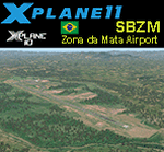
This is an X-Plane 11 and X-Plane 10 scenery package for Presidente Itamar Franco Airport (IATA: IZA, ICAO: SBZM), formerly and still commonly called Zona da Mata Regional Airport, which is an airport serving Juiz de Fora, MG - Brazil, as well as the region of Zona da Mata, in Minas Gerais. It includes corrected aprons, ramps, gates, taxiways, lighting system, city buildings, ortho-photoscenery for the airfield area, and (XP11 only) airport ground services (like push back). This scenery was tested and is operational (as of December 15, 2017) in "X-Plane 11.1 64 bit", Windows 10 Home. It was also tested and is also operational (as of December 15, 2017) in "X-Plane 10.51 64 bit", Windows 10 Home. Only the default X-Plane 11 libraries, by Laminar Research, are needed. No third party libraries are used.
| Filename: | BR_MG_SBZM__Zona_da_Mata_Airport_v100.zip |
| License: | Freeware |
| Added: | 15th December 2017, 18:07:44 |
| Downloads: | 59 |
| Author: | Rui Mesquita |
| Size: | 11 MB |
| Category: X-Plane - Scenery | |
| BR SC SBJA - Jaguaruna Regional Airport v1.0.0 |
|
Images related to this file:
File Description:
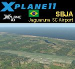
This is an X-Plane 11 and X-Plane 10 scenery package for Humberto Ghizzo Bortoluzzi Regional Airport (IATA: JJG, ICAO: SBJA), also known as Jaguaruna Regional Airport, which is the airport serving the cities of Jaguaruna, Tubarão and Criciúma, and the southern region of Santa Catarina, Brazil. It includes corrected aprons, ramps, gates, taxiways, lighting system, city buildings, ortho-photoscenery for the airfield area, and (XP11 only) airport ground services (like push back). This scenery was tested and is operational (as of December 27, 2017) in "X-Plane 11.11 64 bit", Windows 10 Home. It was also tested and is also operational (as of December 27, 2017) in "X-Plane 10.51 64 bit", Windows 10 Home. Only the default X-Plane 11 libraries, by Laminar Research, are needed. No third party libraries are used.
| Filename: | BR_SC_SBJA__Jaguaruna_Regional_Airport_v100.zip |
| License: | Freeware |
| Added: | 28th December 2017, 18:28:25 |
| Downloads: | 63 |
| Author: | Rui Mesquita |
| Size: | 11.41 MB |
| Category: Flight Simulator X - Scenery Design | |
| SLLP El Alto Intl. Airport LA PAZ Bolivia FSX |
|
File Description:
¿Do you want to know what is like to take off and land in a high altitude airport?
SLLP LA PAZ Airport is waiting you!
We added some fictional buildings to this airport; was built with fsx elements (acceleration pack) so no more textures will be needed
than the lights and the radar whose credits have been indicated inside the delivery.
The city environment, taxiways, terminal, the hangar yards and scrap yards have been improved,
the approach points have been controlled according to the air navigation charts, adding D5.5 PAZ for SID.
It has two cargo parking, gates, jetways, and ramps for smaller aircraft etc.
It has a fixed and transported fuel service, as well as mobile jetways by default, pushback service,
and an environment suitable for the large area of this large Latin American airport. Aero charts included.
Enjoy it!
| Filename: | SLLP_El_Alto_Intl_Airport_LA_PAZ_Bolivia_FSX.zip |
| License: | Freeware |
| Added: | 6th December 2020, 23:50:55 |
| Downloads: | 1,851 |
| Author: | Cristóbal Laje Ros |
| Size: | 28.88 MB |
| Category: Flight Simulator X - Scenery | |
| Charlotte/Douglas Intl - KCLT - North Carolina, USA |
|
Images related to this file:
File Description:
This is a reasonably accurate and up-to-date version of Charlotte/Douglas Intl airport with two optional files made only for FSX users, do not use in P3D: There is one version with the Crosswind runway 5/23 activated where all 4 runways will be used for takeoff/landing and one version as the default airport runway operation: I have given this airport a complete makeover, assigned parking as per their website where possible with extra parking, the new northern extension for concourse A now included, taxiways and taxi signs updated to the latest charts, ILS approaches also updated to the latest charts where possible, extra fuel trucks, support vehicle roads rebuilt and many other scenery improvements and objects added, airport views are from the roof of the control tower (when in tower view) please view the readme before installation
| Filename: | CharlotteDouglas_Intl__KCLT___North_Carolina_USA.zip |
| License: | Freeware, limited distribution |
| Added: | 20th May 2020, 17:31:50 |
| Downloads: | 43,535 |
| Author: | Ray Smith |
| Size: | 5.38 MB |
| Category: Flight Simulator 2004 - Scenery | |
| FTTN Am-Timan, Chad |
|
File Description:
Googly scenery for Am-Timan (ICAO: FTTN, ICAO: ANC), also known as Am
Timan, Am Timane, Am Timmane, Umm Timman - take your pick! It is a small
airport serving a small city of the same name in South-Eastern Chad,
almost exactly centred in the continent of Africa.
The airport was upgraded in 1971 by the French Foreign Legion to allow
military transport craft to land, but it still retains a sand/dirt
strip. The airport is served today by a couple of flights a week using
Fokker Fellowship jets of Toumai Air Tchad.
The entire area is very dry and sandy but for some reason it is depicted
in Flight Simulator as green and lush. Microsoft have only provided a runway
at this airport and this scenery seeks to redress the situation so that you
and your "AI" traffic can use the airport realistically.
The scenery does not purport to be ultra-accurate. Based on high quality
satellite imagery from Google Earth, the layout is proportionally correct but the
added airport features, such as buildings, are built from default Microsoft objects
and add-on libraries so will not look exactly like the real thing.
You are not obliged to download and install any additional scenery libraries,
but to enjoy this scenery in its entirety, you may wish to. It will work fine,
with or without.
| Filename: | FTTN_AmTiman_Chad.zip |
| License: | Freeware |
| Added: | 24th December 2008, 13:31:36 |
| Downloads: | 883 |
| Author: | John Hinson |
| Size: | 83.66 KB |
| Category: Flight Simulator 2004 - Scenery | |
| Coffs Harbour (YSCH), NSW, Australia |
|
File Description:
Coffs Harbour Regional Airport (YSCH) FS2004
********************************************
Coffs Harbour airport, located roughly halfway between Sydney and Brisbane on the East coast of Australia, is owned and operated by Coffs Harbour Council. They took over the airport in the early nineties and after a massive expansion plan including widening the runway to handle jets up to a Boeing 767 and building a new terminal at a cost of $4 million dollars. This terminal was opened in November 2000 and should handle the expanding traffic for the next 10 years. At present over 200,000 passengers pass through the terminal.
The scenery re-creates the entire airport for FS2004 including the new terminal, old terminal, all of the ga hangars, flying school, airport tower and many more structures. All modelling was carried out using textures from photographs taken on site to ensure an authentic result. In addition the harbour at Coffs Harbour has been modelled as well as Mutton Bird Island that was missing completely in the default. To conserve frame rates the harbour has not been fully detailed but is accurate in placement and looks realistic on an approach to runway 21.
AFCAD file and traffic tools file is included to populate the airport with additional AI traffic. Also contains three sample flights, which can be selected from the flight simulator select flight menu.
| Filename: | Coffs_Harbour_YSCH_NSW_Australia.zip |
| License: | Freeware |
| Added: | 2nd July 2004, 20:08:19 |
| Downloads: | 5,000 |
| Author: | John Ross |
| Size: | 8.17 MB |
| Category: Flight Simulator 2004 - Scenery Design | |
| WBGT/WBTM Long Banga, Tanjung Manis, Malaysia |
|
Images related to this file:
File Description:
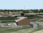
Googly scenery for WBGT Long Banga, Tanjung Manis (sometimes also referred to
under the ICAO code WBTM) - a small domestic airport in Malaysia that it seems
Microsoft forgot to provide in in Flight Simulator 2004. These scenery
files create the airport and add taxiways, aprons, buildings and other airport
features, so that you and your "AI" traffic can land, taxi, park and take off in
a realistic manner. Also added is the missing TMS non-directional beacon at
this airport (on frequency 264.0).
The airport serves the township of Sarikei, capital of the Sarekei district in
the Sarekei Division (are you following this?) of Sarawak in Eastern Malaysia.
Flights are provided by MASwings, a subsidiary of Malaysian Airlines, with De
Havilland Twin Otter aircraft calling here a few times per week.
The scenery does not purport to be ultra-accurate. Based on high-detail satellite
imagery from Google Earth, the layout is proportionally correct but the added
airport features, such as buildings, are built from default Microsoft objects
and add-on libraries so will not look exactly like the real thing.
You are not obliged to download and install any additional scenery libraries,
but to enjoy this scenery in its entirety, you may wish to. It will work fine,
with or without.
[File re-uploaded at request of AVSIM]
| Filename: | WBGTWBTM_Long_Banga_Tanjung_Manis_Malaysia.zip |
| License: | Freeware |
| Added: | 23rd May 2010, 01:23:38 |
| Downloads: | 964 |
| Author: | John Hinson |
| Size: | 51.04 KB |
| Category: Flight Simulator 2004 - Aircraft Repaints, Textures and Modifications | |
| Air France Airbus A320-214 (F-HEPE) |
|
Images related to this file:
File Description:

Air France, is the French flag carrier headquartered in Tremblay-en-France, (north of Paris). It is a subsidiary of the Air France-KLM Group and a founding member of the SkyTeam global airline alliance. As of 2013 Air France serves 35 destinations in France and operates worldwide scheduled passenger and cargo services to 164 destinations in 93 countries. The airline's global hub is at Paris Charles de Gaulle Airport, with Paris Orly Airport, Lyon-Saint Exupery Airport, Marseille Provence Airport, Toulouse Blagnac Airport, and Nice Cote d'Azur Airport serving as secondary hubs.
Air France livery is painted on Project Airbus's Airbus A320-214 model (included). The textures are saved in 32bit format for quality graphics. Textures are also characterized by HD (High Definition). Its features are idle-reverser animation, animated pack vents and pressurisation outflow valve, detailed textures, accurate paint, dynamic shine & effects, dynamic flexing wings that respond to turbulence, fully independent suspension, trim animation, gear steering, accurate flight dynamics, spoiler animation, reflective cockpit windows, improved wingflex code with input from several new parameters including ground spoilers, fuel load, and angle of attack, transparent navigation light lenses and many more. Visit my facebook page "Aviation Art Paintings by Giacomo Tomasini" for news, updates and previews on my future repaint projects: https://www.facebook.com/AviationArtPaintings . Thanks for downloading & Happy flying.
| Filename: | Air_France_Airbus_A320214_FHEPE.zip |
| License: | Freeware |
| Added: | 18th July 2013, 23:55:07 |
| Downloads: | 1,783 |
| Author: | Giacomo Tomasini |
| Size: | 18.57 MB |
| Category: Flight Simulator X - Scenery | |
| Polish Airports VOL. 2 X DEMO |
|
Images related to this file:
File Description:
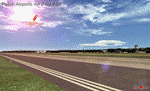
POLISH AIRPORTS VOL. 2 X DEMO is a package of detailed sceneries of EPSC Szczecin, EPLL Lodz and EPZG Zielona Gora airports in Poland, fully compatible with FSX, P3Dv1, P3Dv2 (till v2.1).
This product is a fully functional DEMO version of the commercial payware product. It features same airports layout as in the full version but with limited 3D objects and low resolution textures. Using this free demo ensures no problems with online (VATSIM, IVAO, multiplayer etc.) flying in case some users use the payware scenery and some don't.
Szczecin-Goleniow "Solidarnosc" (SZZ/EPSC) is the main domestic and international airport serving the city of Szczecin in Poland. Lodz Wladyslaw Reymont (LCJ/EPLL), formerly known as Lodz-Lublinek Airport, is a regional airport in central Poland. Zielona Gora-Babimost (IEG/EPZG) is a regional post-military airport located within the greater Zielona Gora agglomeration and is the 11th busiest airport in Poland.
The product is equipped with an automatic installer, which means that the scenery will be automatically added to the Flight Simulator Scenery Library. Please uninstall all previous versions of this airport you may have installed before. Please make also sure that no duplicate AFCAD files are installed.
Enjoy your virtual flying with Drzewiecki Design!
| Filename: | Polish_Airports_VOL_2_X_DEMO.zip |
| License: | Commercial demo |
| Added: | 2nd September 2015, 22:20:07 |
| Downloads: | 676 |
| Author: | Drzewiecki Design |
| Size: | 17.1 MB |
| Category: X-Plane - Scenery | |
| EPGO - Goraszka 2007 for X-Plane 8 |
|
Images related to this file:
File Description:

EPGO GORASZKA 2007 SCENERY FOR X-PLANE 8
----- ABOUT THE AIRPORT -----
EPGO Goraszka airport is located 12nm (20km) south-east of Warsaw downtown and Warsaw Frederic Chopin International Airport. It was built in 1994 and belongs to General Aviation company, which offers aero-taxi flights, air transport and special flights (air photo, patrol) and airport services. The airport has a 800m-long runway and a lightened helipad, which can be used by helicopters up to 5700kg weight. General Aviation's fleet includes Antonov AN-2, PZL-104 Wilga 80, Bell 407 and 427. Since 1996 the International Air Picnic Goraszka is organized every year by "Polish Eagles" Foundation created on initiative of Zbigniew Niemczycki.
----- SCENERY FEATURES -----
This airstrip has never been included in any of X-plane series default airports list and this is the first, detailed scenery of EPGO. Main features of the scenery are:
-Ground photo texture for the surrounding area - perfect for VFR approaches (four seasons + night textures)
-Airport ground high resolution textures - feel the grass when taxiing (four seasons + night textures)
-Highly detailed 3D objects, all photo textured - we made over 300 photos to have them all realistically textured
-Detailed autogen for the whole area - almost every building and every tree
-Tower view - feel like an air traffic controller
| Filename: | EPGO__Goraszka_2007_for_XPlane_8.zip |
| License: | Freeware, limited distribution |
| Added: | 27th October 2015, 15:16:51 |
| Downloads: | 25 |
| Author: | Drzewiecki Design |
| Size: | 50.53 MB |


© 2001-2026 AVSIM Online
All Rights Reserved
Privacy Policy |