
Where Flight Simulation Enthusiasts Gather from Around the World!
AVSIM Library - Search Results

| Category: Flight Simulator 2004 - Scenery | |
| Goodspeed Airport (42B) - East Haddam, Connecticut |

|
Images related to this file:
File Description:

Goodspeed is a privately owned airfield in East Haddam, Connecticut that operates as a public access general aviation facility. The runway is a short 2120 feet and is carefully placed in a shoreline meadow of the Connecticut river. Surrounded by the dense forests and community, the airport is a tight approach, further hampered by the presence of the East Haddam Bridge, which sits under the runway 14 approach. The airport has limited parking facilities for transient aircraft, and it is not common for visiting aircraft to park in the grass in front of the "terminal". Hanger facilities are provided as well. Nearby is the famous Goodspeed Opera House, established back in the 19th century, the house still has operas other performances regularly.
Features:
-High Resolution Ground textures around airport;
-Accurate models of all airport buildings;
-Detailed taxiways and runways;
-Super HD grass and pavement;
-Custom aerial imagery for area, including autogen;
-Full seasonal textures (Spring, Summer, Fall, Winter);
-Various "Easter Eggs";
-Deer (at dusk);
-Christmas Lights (During the Holiday Season);
-Night Textures;
-Runway Lights, obstruction lights;
-And much more!
Created by Dustin Mosher www.dmosher.info
| Filename: | Goodspeed_Airport_42B__East_Haddam_Connecticut.zip |
| License: | Freeware, limited distribution |
| Added: | 4th March 2010, 13:34:02 |
| Downloads: | 685 |
| Author: | Dustin Mosher |
| Size: | 62.8 MB |
| Category: Flight Simulator X - AFCAD Files | |
| B J Farms Airport (NJ06), NJ |
|
File Description:
Located 03 miles E of Shiloh, New Jersey, B J Farms Airport is an undefined grass strip 1500' in length. Because it is not a visible strip, this scenery removes the default grass runway that is located there. If you are looking to visit this area, JY17 is less than 1 mile away. (http://www.mseairports.com/index.php?page_id=781)
Scenery constructed with use of satellite images/streetview/aerial photos - the author has not been there in person.
This scenery is meant to be used in conjunction with MegaScenery Earth New Jersey/Delaware 004. It is not required, but apron use is minimized to allow satellite scenery to show through as much as possible, and objects are placed based on the MSE textures - lack of it may make scenery look out of place.
| Filename: | B_J_Farms_Airport_NJ06_NJ.zip |
| License: | Freeware |
| Added: | 14th June 2011, 02:15:45 |
| Downloads: | 163 |
| Author: | Drew Sikora |
| Size: | 179.16 KB |
| Category: Flight Simulator X - AFCAD Files | |
| Wide Sky Airpark Airport (JY31), NJ |
|
File Description:
Located 03 miles NW of Bridgeton, New Jersey on 23 acres of land, Wide Sky Airpark Airport is a private turf field 2550' in length. There is no fuel available, but there is tiedown space by the main hangar in the middle of the field to the west. You can start in the parking spot there if you have a plane with 40' or less wingspan (collision with static aircraft is disabled so you can put a bigger plane there if you wish with no trouble). The windsock is not lit at night and is located atop the south end of then main hangar's roof. The field is hedged in to the east with bushes but they do not cause aircraft collisions. The runway is lit for night VFR operations. There is no hard surfaced runway so set your terrain mesh settings as high as possible to enjoy rolling around on bare bumpy terrain.
Scenery constructed with use of satellite images/streetview/aerial photos - the author has not been there in person.
This scenery is meant to be used in conjunction with MegaScenery Earth New Jersey/Delaware 004. It is not required, but apron use is minimized to allow satellite scenery to show through as much as possible, and objects are placed based on the MSE textures - lack of it may make scenery look out of place.
| Filename: | Wide_Sky_Airpark_Airport_JY31_NJ.zip |
| License: | Freeware |
| Added: | 10th May 2011, 13:40:36 |
| Downloads: | 157 |
| Author: | Drew Sikora |
| Size: | 1.27 MB |
| Category: Flight Simulator X - AFCAD Files | |
| Woodcrest Farms Airstrip Airport (JY17), NJ |
|
File Description:
Located 02 miles NE of Shiloh, New Jersey, Woodcrest Farms Airstrip Airport is a private turf field 2303' in length. There are no services offered for transient aircraft and the field is not lit, so daytime VFR operations only are recommended. There is no hard-surfaced runway so make sure your terrain mesh is set as high as possible. You can start on the runway or parked next to the hangar east of the field
Scenery constructed with use of satellite images/streetview/aerial photos - the author has not been there in person.
This scenery is meant to be used in conjunction with MegaScenery Earth New Jersey/Delaware 004. It is not required, but apron use is minimized to allow satellite scenery to show through as much as possible, and objects are placed based on the MSE textures - lack of it may make scenery look out of place.
| Filename: | Woodcrest_Farms_Airstrip_Airport_JY17_NJ.zip |
| License: | Freeware |
| Added: | 11th May 2011, 03:29:54 |
| Downloads: | 170 |
| Author: | Drew Sikora |
| Size: | 443.09 KB |
| Category: Flight Simulator X - Scenery | |
| NL2000 v4.01 EHTW Active Enschede Airport |
|
Images related to this file:
File Description:
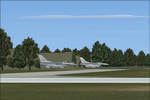
This is the NL2000 v4.01 EHTW Active Enschede Airport Twente 'with active Air Base' package for the NL2000 scenery version 4.
You need the NL2000 v4.0.20 installer to install this package.
The Netherlands 2000 v4 Scenery is a modular free FSX scenery covering the Netherlands.
Visit our website for other available packages.
By The Netherlands 2000 Scenery Design Team (www.nl-2000.com).
| Filename: | NL2000_v401_EHTW_Active_Enschede_Airport.zip |
| License: | Freeware |
| Added: | 14th May 2011, 17:21:39 |
| Downloads: | 1,108 |
| Author: | The Netherlands 2000 scenery design team |
| Size: | 59.2 MB |
| Category: Flight Simulator X - Scenery | |
| NL2000 v4.01 EHVB closed Valkenburg Airport |
|
Images related to this file:
File Description:
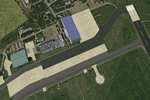
This is the NL2000 v4.01 EHVB closed Valkenburg Airport package for the NL2000 scenery version 4.
You need the NL2000 v4.0.20 installer to install this package.
The Netherlands 2000 v4 Scenery is a modular free FSX scenery covering the Netherlands.
Visit our website for other available packages.
By The Netherlands 2000 Scenery Design Team (www.nl-2000.com).
| Filename: | NL2000_v401_EHVB_closed_Valkenburg_Airport.zip |
| License: | Freeware |
| Added: | 14th May 2011, 17:22:06 |
| Downloads: | 882 |
| Author: | The Netherlands 2000 scenery design team |
| Size: | 126.45 MB |
| Category: Flight Simulator X - AFCAD Files | |
| High Meadow Farms Airport (9NJ8), NJ |
|
File Description:
Located 02 miles SW of Hope, New Jersey on 88 acres of land, High Meadow Farms Airport is a private turf strip 1850' in length. Take notice that the traffic pattern for Runway 13 is Right while the pattern for Runway 31 is Left. There is no hard surface runway so have your terrain mesh set as high as possible. There is tie down space available next to the paved area by the other parked aircraft however there are no official services offered for transient aircraft. This is a great airport to depart from to see some nice hilly terrain in northern NJ, it is just a few miles from the Delaware River Water Gap.
Scenery constructed with use of satellite images/streetview/aerial photos - the author has not been there in person.
This scenery is meant to be used in conjunction with MegaScenery Earth New York 007. It is not required, but apron use is minimized to allow satellite scenery to show through as much as possible, and objects are placed based on the MSE textures - lack of it may make scenery look out of place.
| Filename: | High_Meadow_Farms_Airport_9NJ8_NJ.zip |
| License: | Freeware |
| Added: | 7th April 2011, 00:16:49 |
| Downloads: | 200 |
| Author: | Drew Sikora |
| Size: | 641 KB |
| Category: Civil Flight Simulators - Looking Glass Flight Unlimited 3 | |
| Grant County International outer terrain airport |
|
Images related to this file:
File Description:
Tower-controlled outer terrain airport for FU3. Grant County International MWH lies in the outer terrain east of the Seattle region. It's in the Columbia River Basin, a few miles from Ephrata and at the north end of Moses Lake. Full comms, AI, ambient sounds, airport buildings, paved taxiways et c. as usual. Works best with a full installation of FU3's Seattle and outer terrain with FU2's Sanfran region. For best effect use also various 3d object libraries all available in the Avsim Library as otherwise this airport will lack a lot of 3d objects.
| Filename: | Grant_County_International_outer_terrain_airport.zip |
| License: | Freeware |
| Added: | 8th April 2011, 10:04:29 |
| Downloads: | 85 |
| Author: | Dave Morgan |
| Size: | 29.31 MB |
| Category: Flight Simulator X - AFCAD Files | |
| Trenton-Robbinsville Airport (N87), NJ v1.1 |
|
File Description:
Located 01 miles E of Robbinsville, New Jersey on 139 acres of land, Trenton-Robbinsville Airport is a public asphalt strip 4275' in length. Airport improvements over stock include non-precision runway markings added, PAPI lights placed accurately and glide slopes adjusted, segment circle rendered and all parking locations placed. If a parking spot is labeled RAMP_GA it is occupied or blocked by a static scenery object and should not be selected by the user. (All static scenery by parking locations has collision disabled). All tiedown locations are RAMP_GA_SMALL that can accommodate planes with wingspans up to 40 feet. There is hangar parking, noted by a DOCK_GA parking identifier, that can handle aircraft with wingspans up to 60 feet. Fuel is available by stopping next to the fuel tank in the middle of the tarmac area. Windsock (wind tee within seg circle) is out of service indefinitely. Scenery constructed with use of satellite images/streetview/aerial photos - the author has not been there in person. This scenery is meant to be used in conjunction with MegaScenery Earth New Jersey/Delaware 002. It is not required, but apron use is minimized to allow satellite scenery to show through as much as possible, and objects are placed based on the MSE textures - lack of it may make scenery look out of place.
| Filename: | TrentonRobbinsville_Airport_N87_NJ_v11.zip |
| License: | Freeware |
| Added: | 17th July 2011, 02:18:52 |
| Downloads: | 208 |
| Author: | Drew Sikora |
| Size: | 965.92 KB |
| Category: Flight Simulator X - AFCAD Files | |
| Peaslees Airstrip Airport (NJ25), New Jersey |
|
File Description:
Located 01 miles SW of Clarksboro, New Jersey on 8 acres of land, Peaslees Airstrip is a private turf field 2207' in length. The hard surface runway has been removed to allow for landings on terrain, so have your terrain mesh set as high as possible. The surrounding area of rural farmland and houses has been filled in to provide an encompassing ground environment with as few breaks to the horizon as possible. There are no services at this airport - if you arrive there is room past the hangar to park and tie down although no tie downs are available in real life, thus you can only start from this airport on the runway. The windsock is located approximately midfield of the runway, as in real life. A second hangar has been constructed nearby the current one, but MSE textures do not reflect this and it was not included. This airport is not lit and daytime VFR operations only are recommended.
Scenery constructed with use of satellite images/streetview/aerial photos - the author has not been there in person.
This scenery is meant to be used in conjunction with MegaScenery Earth New Jersey/Delaware 004. It is not required, but apron use is minimized to allow satellite scenery to show through as much as possible, and objects are placed based on the MSE textures - lack of it may make scenery look out of place.
| Filename: | Peaslees_Airstrip_Airport_NJ25_New_Jersey.zip |
| License: | Freeware |
| Added: | 20th August 2011, 19:56:22 |
| Downloads: | 160 |
| Author: | Drew Sikora |
| Size: | 1 MB |


© 2001-2026 AVSIM Online
All Rights Reserved
Privacy Policy |