
Where Flight Simulation Enthusiasts Gather from Around the World!
AVSIM Library - Search Results

| Category: Flight Simulator 2004 - Scenery | |
| UUEE Moscow Sheremetyevo 2015 DEMO |

|
Images related to this file:
File Description:
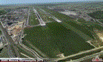
UUEE MOSCOW SHEREMETYEVO 2015 DEMO is a scenery of UUEE Sheremetyevo airport in Moscow, Russia, fully compatible with FS2004.
This product is a fully functional DEMO version of the commercial payware product. Most objects are modelled as in the full version but covered with low resolution textures. Using this free demo ensures no problems with online (VATSIM, IVAO, multiplayer etc.) flying in case some users use the payware scenery and some don't.
Moscow is the capital city and the most populous federal subject of Russia. The city is a major political, economic, cultural and scientific center in Russia and in Eastern Europe. Sheremetyevo International Airport (SVO/UUEE) is an international airport located in Khimki, Moscow Oblast. It is a hub for passenger operations of the Russian international airline Aeroflot, and is one of the three major airports that serve Moscow, along with Domodedovo International Airport and Vnukovo International Airport
The product is equipped with an automatic installer, which means that the scenery will be automatically added to the Flight Simulator Scenery Library. Please uninstall all previous versions of this airport you may have installed before. Please make also sure that no duplicated AFCAD files are installed.
Enjoy your virtual flying with Drzewiecki Design!
| Filename: | UUEE_Moscow_Sheremetyevo_2015_DEMO.zip |
| License: | Commercial demo |
| Added: | 4th April 2016, 21:52:46 |
| Downloads: | 851 |
| Author: | Drzewiecki Design |
| Size: | 13.68 MB |
| Category: Flight Simulator X - Scenery | |
| KMSN - Madison Wisconsin Dane County Airport - Wisconsin, USA |
|
Images related to this file:
File Description:
Madison Wisconsin Dane County Regional Airport for FSX. Several improvements have been made to the default airport. The default terminal buildings have been replaced with buildings created in FSDS; aircraft gates have been correctly coded using Airport Design Editor 1.67.5684; a new airport vehicle network has been built; extra fuel trucks have been added throughout the airport; the tower view has been changed to display from the roof of the control tower; a static FedEX truck in two different color schemes has been placed in the cargo area; a missing taxiway has been added, and all taxiway designators are correctly placed and named; there is the option to open all three runways to AI traffic; the 115th Fighter Wing of the Wisconsin Air National Guard is represented, and the parking spaces for the military AI aircraft there are coded to work with the MAIW GLANG1 flight plans; optionally, a set of GA flight plans made using AI flight Planner using all FSX default aircraft is included to liven up the GA area; another option included is to display moving road traffic outside the airport; and Jim Dhaenen's excellent ramp lights are also included. Please read the README FIRST.txt and installation.txt files to insure proper installation of all files.
| Filename: | KMSN__Madison_Wisconsin_Dane_County_Airport__Wisco.zip |
| License: | Freeware, limited distribution |
| Added: | 10th April 2016, 19:55:42 |
| Downloads: | 1,288 |
| Author: | Patrick Finch |
| Size: | 2.1 MB |
| Category: Flight Simulator 2004 - Scenery | |
| WIKD/WIOD Tanjung Pandan/Buluh Tumbang/H.A.S. Hanandjoeddin, Indonesia |
|
File Description:
Googly scenery for WIKD/WIOD Tanjung Pandan/Buluh Tumbang/H.A.S. Hanandjoeddin,
Indonesia, based on Google Earth satellite data. It is a small domestic airport
serving the island of Belitung, located about 17 miles from the main town of the
island - Tandjungpandan. The island produces mainly tin and pepper but there are
some beaches that are generating tourist traffic too.
Flight Simulator 2004 has made no provision for any traffic at this airport and
this scenery seeks to redress the situation. The airport sees daily scheduled
traffic operated by Batavia Air and Sriwijaya Air.
The scenery does not purport to be ultra-accurate. Based on poor quality
satellite imagery from Google Earth, the layout is proportionally correct but the
added airport features, such as buildings, are built from default Microsoft objects
and add-on libraries so will not look exactly like the real thing.
You are not obliged to download and install any additional scenery libraries,
but to enjoy this scenery in its entirety, you may wish to. It will work fine,
with or without.
The ICAO code for this airport has recently changed from WIKD to WIOD. The included
files allow you to either retain the old code or optionally change the airport to
use the new one.
| Filename: | WIKDWIOD_Tanjung_PandanBuluh_TumbangHAS_Hanandjoed.zip |
| License: | Freeware |
| Added: | 22nd February 2008, 09:19:27 |
| Downloads: | 1,775 |
| Author: | John Hinson |
| Size: | 64.96 KB |
| Category: Flight Simulator X - Scenery | |
| SBSN - Santarem, Brazil Photo Real |
|
File Description:
The International Airport of Santarem - Maestro Wilson Fonseca ( IATA : STS , ICAO : SBSN ) is the airport serving the city of Santarem and region . Its name is a tribute to the great poet , musician and composer Santareno , Wilson Dias da Fonseca . Currently , it is the fifth busiest airport in the northern region of Brazil . Has great important role in strengthening the bonds of Brazil with the world , due to its geographical location, between Belem and Manaus and is an alternative for international flights . It is located 15 km away from the city center and has easy access by Highway Fernando Guilhon . In its surroundings , a special landscape ornamentation shows markedly the gateway to the region , known as " The Pearl of the Tapajos ." It opened in March 1977 under the administration of the Air Force Command 31 and transferred to the administration Infraero on March 31, 1980.
The airport is currently undergoing reform and the first step is already completed , which is the construction of a new building to house the airport administration . The reform provides for doubling the airport arrivals hall , doubling the departure lounge , increase parking capacity and the overall revitalization of the electrical system and cooling . For all the changes should be needed about £ 2.700.000,00.2
| Filename: | SBSN__Santarem_Brazil__Photo_Real.zip |
| License: | Freeware |
| Added: | 5th February 2014, 09:45:35 |
| Downloads: | 2,638 |
| Author: | Alexandre Lima |
| Size: | 20.16 MB |
| Category: Flight Simulator X - AFCAD Files | |
| CYQQ - CFB Comox, British Columbia, Canada. |
|
File Description:
Canadian Forces Base Comox (IATA: YQQ, ICAO: CYQQ), commonly referred to as CFB Comox, is a Canadian Forces Base located 2.5 NM (4.6 km; 2.9 mi) north northeast of Comox, British Columbia. It is primarily operated as an air force base by Canadian Forces Air Command and is one of two bases in the country using the CP-140 Aurora anti-submarine/maritime patrol and surveillance aircraft. Its primary lodger unit is 19 Wing.
CFB Comox's airfield is also used by civilian aircraft, with civilian operations at the base referring to the facility as Comox Airport. The airport is classified as an airport of entry by NAV CANADA and is staffed by the Canada Border Services Agency. CBSA officers at this airport currently can handle general aviation aircraft only, with no more than 15 passengers.
| Filename: | CYQQ__CFB_Comox_British_Columbia_Canada.zip |
| License: | Freeware |
| Added: | 5th November 2009, 02:16:02 |
| Downloads: | 603 |
| Author: | Robert Catherall |
| Size: | 1.22 MB |
| Category: Flight Simulator X - Missions | |
| The Most Dangerous Airports: Kai Tak |
|
File Description:
I have created the next in, The Most Dangerous Airport Mission Series: namely Kai Tak. The missions are a historical nature, both for the airport and the aircraft. The flight is a fictional charter British Airways flight. The Kai Tak airport was rated as the one of the most dangerous airports, due to it's approach, it has a 45° right bank just, before landing on runway 13. The airport was famous for it's approach through, flying through the high raising buildings of Hong Kong, with regular crosswinds, which have created numerous problems for many a pilot. So I decided to put these two together in a mission to be enjoyed as a challenge.
I have created the following 4 options: FSX - Day - Stormy weather;
FSX - Night - Stormy weather;
Online - Day - weather;
Online - Night - weather.
| Filename: | The_Most_Dangerous_Airports_Kai_Tak.zip |
| License: | Freeware |
| Added: | 12th February 2010, 10:26:54 |
| Downloads: | 3,396 |
| Author: | Robbie Albers |
| Size: | 17.96 MB |
| Category: Flight Simulator 2004 - Scenery | |
| DGSI Kumasi, Ghana |
|
Images related to this file:
File Description:
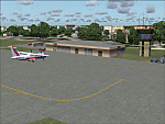
Googly scenery for Kumasi - a small domestic airport in Ghana for which no facilities
are provided in Flight Simulator 2004. These scenery files add taxiways, aprons,
buildings and other airport features, so that you and your "AI" traffic can land,
taxi, park and take off in a realistic manner.
The airport serves the city of Kumasi (capital of the Ashanti region) and sees
regular flights using turboprop airliners operated by Accra based operators
Antrak Air and Citylink.
The scenery does not purport to be ultra-accurate. Based on high-detail satellite
imagery from Google Earth, the layout is proportionally correct but the added
airport features, such as buildings, are built from default Microsoft objects
and add-on libraries so will not look like the real thing.
[File re-uploaded at request of AVSIM]
| Filename: | DGSI_Kumasi_Ghana.zip |
| License: | Freeware |
| Added: | 23rd May 2010, 01:25:23 |
| Downloads: | 1,420 |
| Author: | John Hinson |
| Size: | 80.3 KB |
| Category: Flight Simulator X - Scenery | |
| Lesvos-Chios |
|
Images related to this file:
File Description:
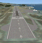
AS REAL AS IT GETS.
This is a detailed photorealistic scenery of the islands of Lesvos, Chios, Oinouses and Psara.
Default FSX airports of Mytilini (LGMT), Polychnitos (LG0D) and Chios (LGHI) were completely redone, positioned to their exact location, and many buildings and objects were added in the airport compounds.
New LGMT and LG0D altitude change files.(Read the .txt file for installation instructions).
New aprons, taxi signs and plenty of aircraft parking.
New models for Chios airport terminal building (not original), airport terminal building signs, roadway-runway crossing gates and crossing signs for Polychnitos airport all with night textures.
The scenery contains plenty of autogen objects, buildings, vegetation and road traffic near the airports.
I have also included 3 aircraft traffic files and 1 helicopter traffic file.
| Filename: | LesvosChios.zip |
| License: | Freeware |
| Added: | 18th September 2011, 23:58:49 |
| Downloads: | 2,478 |
| Author: | Angelo Tassoglou |
| Size: | 141.62 MB |
| Category: Flight Simulator 2004 - Scenery | |
| Doha International Airport (OTBD) - (AIRAC update May 2012) |
|
Images related to this file:
File Description:
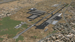
This is a very simple rendition of Doha airport as of May 2012 with default and library objects. It updates my previous version of this scenery with recent changes implemented as of AIRAC1205:
- Runway designator changed to 15/33
- New aprons and parking stands
- Many other features and fixes
All taxiways, aprons, parkings are perfectly accurate according to airport charts and personal experience. Buildings and airport objects are placed according to real life but are not themselves a real depiction. I have used default objects as well as library objects found on the Internet. If anyone downloading this airport has knowledge on how to create custom buildings and objects to improve the scenery, please let me know, I'll be happy to share photos of the real thing for you.
| Filename: | Doha_International_Airport_OTBD__AIRAC_update_May_.zip |
| License: | Freeware, limited distribution |
| Added: | 12th May 2012, 23:09:38 |
| Downloads: | 5,288 |
| Author: | Frederic Revol |
| Size: | 6.79 MB |
| Category: Flight Simulator X - Scenery | |
| KLVK - Livermore Municipal Airport - California, USA |
|
Images related to this file:
File Description:
FSX Scenery - Livermore Municipal Airport (IATA: LVK, ICAO: KLVK) is in Livermore, California, USA, east of San Francisco Bay. The airport is three miles northwest of the downtown area. Near the 650-acre airport are the Water Reclamation Plant and the Las Positas Golf Course. There are two parallel asphalt runways. The main lighted runway is 5,250 ft long and the second runway, unlighted, built in 1985, is 2,700 ft long is used mainly for training. Besides the 2,400 sq ft Terminal building, built in 1969, there are nearly 400 aircraft storage hangar units as well as a corporate-style hangar building containing 20,000 sq ft of space along with an aircraft storage shelter. About 600 aircraft are based on Livermore Airport. For your flying pleasure by John B. Loney, Jr.
| Filename: | KLVK__Livermore_Municipal_Airport____California_US.zip |
| License: | Freeware, limited distribution |
| Added: | 17th July 2015, 17:12:03 |
| Downloads: | 366 |
| Author: | John B. Loney, Jr. |
| Size: | 10.81 MB |


© 2001-2026 AVSIM Online
All Rights Reserved
Privacy Policy |