
Where Flight Simulation Enthusiasts Gather from Around the World!
AVSIM Library - Search Results

| Category: Flight Simulator X - AFCAD Files | |
| Strawberry Fields Airport (89NJ), NJ |

|
File Description:
Located 02 miles N of Mays Landing, New Jersey on 220 acres of land, Strawberry Fields Airport is a private turf/sand strip. SkyVector lists the runway as 2200' long, but as measured during development it is closer to 3000'. In addition to Runways 14 and 32, there is a second runway that is not listed in the airport directory and presumed closed. However if you need it in an emergency the numbers are 03 and 21 (no starts are available for these runways). This airport is not lit and is best used only during daytime VFR conditions. The windsock can be found at the intersection of the two runways and is also not lit. You will be landing on bare terrain so have your mesh complexity slider set as high as possible for best effect.
Scenery constructed with use of satellite images/streetview/aerial photos - the author has not been there in person.
This scenery is meant to be used in conjunction with MegaScenery Earth New Jersey/Delaware 003. It is not required, but apron use is minimized to allow satellite scenery to show through as much as possible, and objects are placed based on the MSE textures - lack of it may make scenery look out of place.
| Filename: | Strawberry_Fields_Airport_89NJ_NJ.zip |
| License: | Freeware |
| Added: | 17th February 2011, 07:55:52 |
| Downloads: | 204 |
| Author: | Drew Sikora |
| Size: | 1.75 MB |
| Category: Flight Simulator 2004 - Scenery | |
| KHRL Valley INTL airport FIX |
|
Images related to this file:
File Description:

This file will fix the problem with KHRL_FS9.
A issue with the taxiways and AI aircraft not showing up has been repaired with this file. Follow the READ ME instructions inside.
This file is for KHRL_FS9.zip
| Filename: | KHRL_Valley_INTL_airport_FIX.zip |
| License: | Freeware |
| Added: | 20th February 2011, 20:57:57 |
| Downloads: | 436 |
| Author: | Rob Touchtone |
| Size: | 30.99 KB |
| Category: Flight Simulator X - Scenery | |
| JY43 Hill Top Airport NJ |
|
Images related to this file:
File Description:
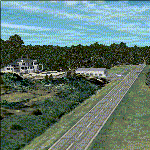
I was flying around the FSX world looking for a real world sloping airstrip just begging to be modeled with a touchdown tire squealing, smoking rubber - that kind of hardened surface sloping runway after I finally figured out how to persuade the FSX SDK to compile one. The Airfield Candidate shall have high density LiDAR elevation and high resolution Orthoimagery data available for public download. I was flying a Beechcraft Baron 58 over Wanaque Reservoir in Northeast NJ of all places when I happened upon a photo scenery runway on a sloping hill top without the usual FSX flattened airport plateau effect and FSX textured runway. They have missed this one ! Hello JY43. - Wally-Bob
| Filename: | JY43_Hill_Top_Airport_NJ.zip |
| License: | Freeware, limited distribution |
| Added: | 9th March 2011, 23:20:14 |
| Downloads: | 1,074 |
| Author: | Walter Roberts |
| Size: | 67.74 MB |
| Category: Flight Simulator 2004 - Sounds | |
| Zweibrucken (EDRZ) airport call sign |
|
File Description:
Here is the long time missed call sign for the german airport Zweibrucken (EDRZ). PLEASE READ THE readme.txt VERY CAREFULLY!
| Filename: | Zweibrucken_EDRZ_airport_call_sign.zip |
| License: | Freeware |
| Added: | 19th March 2011, 23:50:22 |
| Downloads: | 243 |
| Author: | Hans-Juergen Merkel |
| Size: | 2.03 KB |
| Category: Flight Simulator X - AFCAD Files | |
| Southern Cross Airport (C01), NJ |
|
File Description:
Located 03 miles SW of Williamstown, New Jersey on 18 acres of land, Southern Cross is a public turf airstrip with an ample 2400' runway. The runway is hard surfaced in order to allow for AI traffic to use this airport, however the end user must enable flights to arrive/depart from this airfield within their AI traffic program in order for AI to appear here. Tie down space is available north of Runway 09 and fuel is available at the tank next to the hangar. This airport is not lit at night so daytime VFR operations only are recommended. In addition to trees at the ends of both runways, power lines are strung up across there too.
Scenery constructed with use of satellite images/streetview/aerial photos - the author has not been there in person.
This scenery is meant to be used in conjunction with MegaScenery Earth New Jersey/Delaware 004. It is not required, but apron use is minimized to allow satellite scenery to show through as much as possible, and objects are placed based on the MSE textures - lack of it may make scenery look out of place.
| Filename: | Southern_Cross_Airport_C01_NJ.zip |
| License: | Freeware |
| Added: | 25th March 2011, 16:38:00 |
| Downloads: | 192 |
| Author: | Drew Sikora |
| Size: | 630.77 KB |
| Category: Flight Simulator X - AFCAD Files | |
| PHHN - Hana Airport - Maui Hawaii |
|
File Description:
Hana Airport - Island of Maui in Hawaii. README!!! Relocate position according to Google Earth - Additional parking spot, terminal, firehouse and hangar.
| Filename: | PHHN__Hana_Airport__Maui_Hawaii.zip |
| License: | Freeware |
| Added: | 30th March 2011, 01:13:42 |
| Downloads: | 516 |
| Author: | Gilbert Bowers |
| Size: | 3.79 KB |
| Category: Flight Simulator X - AFCAD Files | |
| Halka Nurseries Airport (9NJ6), NJ |
|
File Description:
Located 02 miles W of Fairton, New Jersey on 150 acres of land, Halka Nurseries Airport is a private turf strip 2400' in length. The airspace has been analyzed and deemed suitable for aircraft up to a light twin. Take caution on the Runway 18 approach as power lines are strung up along the street opposite the runway. There is no hard surfaced runway so have your terrain mesh set as high as possible to experience bumpy terrain. There is no windsock, so be sure to know your weather before arriving or departing - the winds in this area are predominantly out of the west and this runway is north/south. Trees and bushes are close to some areas of the runway and can pose a danger in high crosswinds. There are no services for transient aircraft.
Scenery constructed with use of satellite images/streetview/aerial photos - the author has not been there in person.
This scenery is meant to be used in conjunction with MegaScenery Earth New Jersey/Delaware 005. It is not required, but apron use is minimized to allow satellite scenery to show through as much as possible, and objects are placed based on the MSE textures - lack of it may make scenery look out of place.
| Filename: | Halka_Nurseries_Airport_9NJ6_NJ.zip |
| License: | Freeware |
| Added: | 6th April 2011, 03:27:56 |
| Downloads: | 207 |
| Author: | Drew Sikora |
| Size: | 829.12 KB |
| Category: Flight Simulator X - AFCAD Files | |
| Essex County Airport (KCDW), NJ |
|
File Description:
Located 02 miles N of Caldwell, New Jersey on 275 acres of land, Essex County Airport is a public airport with two asphalt runways, the longest of which is 4552'. Major changes include Runway 9/27 updated to the current 10/28; Runway 4/22 markings are custom made to match the real world, with threshold stripes on Runway 22 only; the beacon has been relocated to its real world location atop the control tower. Additionally, 221 parking locations have been accurately placed around the airport, broken up into 6 sections. See the included airport diagram that labels the various parking areas. 89 of these parking spaces are labeled RAMP_GA and these spaces are occupied by static aircraft. Collision with all static aircraft is disabled but still, if you do not want to start occupying the same space as another airplane, do not choose parking spots labeled RAMP_GA. Instead, all user aircraft should choose either RAMP_GA_SMALL (for wingspans up to 40') or RAMP_GA_MEDIUM (for wingspans up to 60' and only available in East Parking). Also, only 86 of these parking spaces are available for AI aircraft to spawn in. There are hangars available to transient aircraft: the two in South and Southeast parking are able to accommodate small craft with wingspans up to 40'; the one in Northeast parking is able to accommodate larger aircraft with wingspans up to 54'. Helicopters can start either on Taxiway P (South helipad), Taxiway N (North helipad) or in front of the main terminal (East helipad). Fuel is available in both the East and South parking areas by stopping anywhere on the concrete next to the fuel tank/pump. Take note that the runway patterns are both Left and Right and the pattern altitude varies for aircraft type. There are known issues with the AI for this airport, see the ReadMe for more details.
Scenery constructed with use of satellite images/streetview/aerial photos - the author has not been there in person.
This scenery is meant to be used in conjunction with MegaScenery Earth New York 005. It is not required, but apron use is minimized to allow satellite scenery to show through as much as possible, and objects are placed based on the MSE textures - lack of it may make scenery look out of place.
| Filename: | Essex_County_Airport_KCDW_NJ.zip |
| License: | Freeware |
| Added: | 14th April 2011, 01:50:13 |
| Downloads: | 416 |
| Author: | Drew Sikora |
| Size: | 2.4 MB |
| Category: Flight Simulator X - AFCAD Files | |
| KLAX Los Angeles International Airport |
|
File Description:
All Gates In Use;
2 A380 Gates;
New Taxiways Included;
New Airlines Included;
All Runways In Use.
| Filename: | KLAX_Los_Angeles_International_Airport.zip |
| License: | Freeware |
| Added: | 16th April 2011, 11:58:31 |
| Downloads: | 1,231 |
| Author: | Cesar Robles |
| Size: | 51.22 KB |
| Category: Flight Simulator X - AFCAD Files | |
| Var-Sky Airport (JY08), NJ |
|
File Description:
Located 02 miles E of Woodstown, New Jersey on 38 acres of land, Var-Sky Airport is a private turf strip 1165' in length and a slightly challenging approach with trees closely bordering the sides of both runway ends. This airport has lighting on the runway however there is no beacon and the windsock (located atop the hangar) is not lit. There are no services offered for transient aircraft. There is no hard surfaced runway so having your terrain mesh settings as high as possible is recommended.
Scenery constructed with use of satellite images/streetview/aerial photos - the author has not been there in person.
This scenery is meant to be used in conjunction with MegaScenery Earth New Jersey/Delaware 004. It is not required, but apron use is minimized to allow satellite scenery to show through as much as possible, and objects are placed based on the MSE textures - lack of it may make scenery look out of place.
| Filename: | VarSky_Airport_JY08_NJ.zip |
| License: | Freeware |
| Added: | 19th April 2011, 06:21:50 |
| Downloads: | 195 |
| Author: | Drew Sikora |
| Size: | 361.96 KB |


© 2001-2026 AVSIM Online
All Rights Reserved
Privacy Policy |