
Where Flight Simulation Enthusiasts Gather from Around the World!
AVSIM Library - Search Results

| Category: Flight Simulator 2004 - Scenery | |
| Branson Airport KBBG--New Airport, Scenery, and Flight Plans |

|
Images related to this file:
File Description:

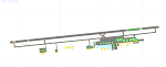
This project adds a new Branson Airport KBBG (Missouri) to FS 2004, which opened in May 2009, and is a privately developed commercial airport. The construction of the airport, which involved the flattening of several Ozark Mountains, is claimed to be the largest earthmoving project in Missouri history. As a result, the airport actually sits on a manmade plateau, surrounded by rolling hills. The airport uses the ICAO identifier BBG, however, the airlines use the IATA code BKG. The airport is served by AirTran, Frontier, and ExpressJet (Branson AirExpress), and is located in hilly terrain. Aircraft equipped with a terrain avoidance warning system may experience system activation on final approach. AFCAD created using Airport Design Editor 9 v1.47.07, and the hilltops were cleared and flattened and roads were added using SBuilder 2.05 revision 06. The terminal and hangar were added and modified from within Airport Design Editor 9. This airport is based on my more detailed FSX version, Branson_Airport_Project.zip.
| Filename: | Branson_Airport_KBBGNew_Airport_Scenery_and_Flight.zip |
| License: | Freeware |
| Added: | 16th August 2010, 20:50:16 |
| Downloads: | 1,731 |
| Author: | Carlyle Sharpe |
| Size: | 3.23 MB |
| Category: Flight Simulator X - Scenery | |
| 2B3 Parlin Field, Newport, New Hampshire Airport |
|
Images related to this file:
File Description:
This airport was originally released as part of an FSX airport scenery package containing 21 airports, located in New Hampshire and Vermont. The link to the original 21 New Hampshire & Vermont Airport package is shown below. This file is not required, but allows you to download 21 related airports.
The 2B3 Parlin Field airport in the original 21 airport package was missing a required scenery file which corrects the airport altitude (from 784 ft. to 794 ft.) due to the mis-location of the stock FSX airport. This download provides all three of the required .bgl scenery files.
related download:
http://library.avsim.net/search.php?SearchTerm=new+hampshire+%26+Vermont+airports&CatID=root&Go=Search
This FSX scenery package contains the 2B3 Parlin Field airport in Newport, New Hampshire. This airport is intended to be used with FSX and the free addon - TileProxy. TileProxy provides real-time photorealistic satellite imagery in place of the stock auto generated FSX scenery or any other scenery package.
| Filename: | 2B3_Parlin_Field_Newport_New_Hampshire_Airport.zip |
| License: | Freeware |
| Added: | 2nd December 2013, 05:36:38 |
| Downloads: | 531 |
| Author: | John Greenwood |
| Size: | 631.59 KB |
| Category: Flight Simulator X - AFCAD Files | |
| CYQG - Windsor International Airport - Windsor, Ontario, Canada v1.1 |
|
Images related to this file:
File Description:

This airport update was made with the latest version of ADE (Airport Design Editor) and made for FSX as a replacement for the stock (default) airport. I've made several changes to the airport which are listed below. All these enchancements are as close to the real airport as I can get with stock library objects. I've used satellite images, terminal photos and maps throughout the whole process so building locations are as accurate as possible. Happy landings in the beautiful Canada!
Features:
Expanded parking apron, Main terminal building with parking for commercial aircraft,
Seperate parking aprons for GA traffic, Hangars and other airport buildings added,
Airport vehicles and objects throughout the airport, Airport fire station with fire truck,
De-icing vehicle/runway plow, Static fuel station with fuel vehicles
Newly expanded taxiway for runway 7/25 (v.1.1), New hangar and taxiway near runway 30 threshold (v1.1)
| Filename: | CYQG__Windsor_International_Airport__Windsor_Ontar.zip |
| License: | Freeware |
| Added: | 31st July 2012, 11:21:35 |
| Downloads: | 717 |
| Author: | Jaison Diaz / Endeavour AI |
| Size: | 105.69 KB |
| Category: Flight Simulator X - AFCAD Files | |
| FGBT - Bata Airport - Bata, Equatorial Guinea |
|
File Description:
Bata Airport (IATA: BSG, ICAO: FGBT) is the second largest airport in Equatorial Guinea, after Malabo Airport, and is the only other paved runway. The airport is located some way north of Bata and a short way south of Utonde, it has a
2.3 km runway that operates only during the daytime and in good light. The state carrier and four other private companies make up the majority of Bata's industry, transporting passengers from Bioko's international airport or the two
800m strips on Annobon or Mongomo. The airport is large enough to accommodate a Boeing 737. Bata served 15,000 passengers in 2001. In July 2002, all staff at the airport were arrested for allowing the leader of the Popular Union, an o
pposition party, to board a flight to the Gabon. The tower frequency is 118.800 MHz (VHF).
Airport elevation and two runways were corrected also the aprons and buildinds. Airport charts cortesy of vatcaf.flyvatsimafrica.org
This work is dedicated to West Wind Airlines.
| Filename: | FGBT__Bata_Airport__Bata_Equatorial_Guinea.zip |
| License: | Freeware |
| Added: | 19th May 2013, 17:22:05 |
| Downloads: | 765 |
| Author: | Anwar Gonzalez |
| Size: | 677.55 KB |
| Category: Flight Simulator X - AFCAD Files | |
| TISX - Henry E. Rohlsen Airport / Christiansted, St. Croix, US Virgin Islands |
|
Images related to this file:
File Description:
TISX - Henry E. Rohlsen Airport / Christiansted, St. Croix, USVI
This airport update was made with the latest version of ADE (Airport Design Editor) and made for FSX as a replacement for the stock (default) airport. I've made several changes to the airport which are listed below. All these enchancements are as close to the real airport as I can get with stock library objects. I've used satellite images, terminal photos and maps throughout the whole process so building locations are as accurate as possible. Happy landings in the serene United States Virgin Islands!
Features:
Expanded parking apron, Main terminal building with parking area for commercial traffic
Seperate parking area for GA traffic, Misc airport buildings added
Airport vehicles and objects throughout the airport, Fuel tanks and vehicles
Coconut trees, Expanded runway as per latest charts
Expanded taxiways as per latest charts, Military cargo area
Commercial cargo area
| Filename: | TISX__Henry_E_Rohlsen_Airport__Christiansted_St_Cr.zip |
| License: | Freeware |
| Added: | 23rd October 2012, 18:37:47 |
| Downloads: | 785 |
| Author: | Jaison Diaz / Endeavour AI |
| Size: | 109.69 KB |
| Category: Prepar3D V5 - Scenery | |
| VOBL_P3Dv5 |
|
File Description:
Kempegowda International Airport (IATA: BLR, ICAO: VOBL) is an international airport serving Bangalore, the capital of the Indian state of Karnataka, in the Southern part of India. Spread over 4,000 acres (1,600 ha), it is located about 30 kilometres (19 mi) north of the city near the suburb of Devanahalli. It is owned and operated by Bengaluru International Airport Limited (BIAL), a public–private consortium. The airport opened in May 2008 as an alternative to increased congestion at HAL Airport, the original primary commercial airport serving the city. It is named after Kempe Gowda I, the founder of Bangalore. Kempegowda International Airport became Karnataka's first fully solar powered airport developed by CleanMax Solar.[5][6]
Kempegowda Airport is the third-busiest airport by passenger traffic in the country, behind the airports in Delhi and Mumbai, and is the 29th busiest airport in Asia. It handled around 33.30 million passengers in the calendar year 2018 with 658 aircraft movements a day. The cargo handled by the airport continues to increase steadily, with the airport handling about 386,849 tonnes (426,428 short tons) of cargo between April 2018 and March 2019.[7]
The airport consists of two runways and a passenger terminal, which handles both domestic and international operations. The second runway, constructed by Larsen & Toubro, was commissioned on 6 December 2019.[8][9] A second terminal is in the early stages of construction. Also, there is a cargo village and three cargo terminals. The airport serves as a hub for AirAsia India, Alliance Air, and IndiGo and is a focus city for Air India and SpiceJet.
Note: All terminal buildings credit goes to thomlinden. It's freeware scenery.
| Filename: | VOBL_P3Dv5.zip |
| License: | Freeware |
| Added: | 28th October 2020, 22:42:22 |
| Downloads: | 189 |
| Author: | Abhishek Banerjee |
| Size: | 20.83 MB |
| Category: Prepar3D V5 - Scenery | |
| VOBL_P3Dv5 |
|
File Description:
Kempegowda International Airport (IATA: BLR, ICAO: VOBL) is an international airport serving Bangalore, the capital of the Indian state of Karnataka, in the Southern part of India. Spread over 4,000 acres (1,600 ha), it is located about 30 kilometres (19 mi) north of the city near the suburb of Devanahalli. It is owned and operated by Bengaluru International Airport Limited (BIAL), a public–private consortium. The airport opened in May 2008 as an alternative to increased congestion at HAL Airport, the original primary commercial airport serving the city. It is named after Kempe Gowda I, the founder of Bangalore. Kempegowda International Airport became Karnataka's first fully solar powered airport developed by CleanMax Solar.[5][6] Kempegowda Airport is the third-busiest airport by passenger traffic in the country, behind the airports in Delhi and Mumbai, and is the 29th busiest airport in Asia. It handled around 33.30 million passengers in the calendar year 2018 with 658 aircraft movements a day. The cargo handled by the airport continues to increase steadily, with the airport handling about 386,849 tonnes (426,428 short tons) of cargo between April 2018 and March 2019.[7] The airport consists of two runways and a passenger terminal, which handles both domestic and international operations. The second runway, constructed by Larsen & Toubro, was commissioned on 6 December 2019.[8][9] A second terminal is in the early stages of construction. Also, there is a cargo village and three cargo terminals. The airport serves as a hub for AirAsia India, Alliance Air, and IndiGo and is a focus city for Air India and SpiceJet. Note: All terminal buildings credit goes to thomlinden. It's freeware scenery.
| Filename: | VOBL_P3Dv5.zip |
| License: | Freeware |
| Added: | 31st October 2020, 19:00:11 |
| Downloads: | 852 |
| Author: | Abhishek Banerjee |
| Size: | 16.84 MB |
| Category: Flight Simulator 2004 - AFCAD Files | |
| NAHA Gates |
|
File Description:
NAHA Airport Gates
| Filename: | NAHA_Gates.zip |
| License: | Freeware |
| Added: | 31st October 2003, 00:47:30 |
| Downloads: | 830 |
| Author: | Hiroaki kubota |
| Size: | 116.26 KB |
| Category: Flight Simulator 2002 - AFCAD Files | |
| VCBI Afcad , Colombo, Sri Lanka |
|
File Description:
Colombo International Airport.
| Filename: | VCBI__Afcad__Colombo_Sri_Lanka.zip |
| License: | Freeware |
| Added: | 21st November 2002, 20:42:25 |
| Downloads: | 412 |
| Author: | Rajeevan |
| Size: | 2.89 KB |
| Category: Flight Simulator 2004 - AI Flight Plans | |
| MASkargo - Winter 2013-14 |
|
Images related to this file:
File Description:

Include Optimize speed version,Season:Winter 2013/14,Callsign:MALAYSIAN,ICAO:MAS,IATA:MH,Weekly flights:98,Hubs:Kuala Lumpur International Airport (KUL),Penang International Airport (PEN).
| Filename: | MASkargo__Winter_201314.zip |
| License: | Freeware, limited distribution |
| Added: | 17th November 2013, 18:45:16 |
| Downloads: | 272 |
| Author: | Michael 'Pushen' Babitskiy,UTT |
| Size: | 209.86 KB |
© 2001-2026 AVSIM Online
All Rights Reserved
Privacy Policy |