
Where Flight Simulation Enthusiasts Gather from Around the World!
AVSIM Library - Search Results

| Category: Flight Simulator X - Scenery | |
| CSK8 - King George Airpark |

|
File Description:
Welcome to King George Airpark!
King George Airpark is home of Ultralight aviation fan. It is located in Surrey,BC, only few miles south of YVR. FSX did not take care very much of this airpark, wrong rwy position and trees all other the field, Ouch!.I replaced both airstrips accordingly with the visual ground reference of the River and Rwy07, bare in mind 50Ft obstacle procedure in effect for Rwy 07 and Rwy 33. Thanks FSX :(
VFR only when visiting CSK8. Parking spots available. Watch out for traffic on the ground, no much space to taxi freely though.
Hope you'll enjoy your stop in awesome King George Airpark! :)
| Filename: | CSK8__King_George_Airpark.zip |
| License: | Freeware |
| Added: | 4th April 2009, 08:28:26 |
| Downloads: | 669 |
| Author: | Daniel Louvet |
| Size: | 1.02 MB |
| Category: Flight Simulator X - Scenery | |
| Copalis State Airport, WA (S16) |
|
Images related to this file:
File Description:
Copalis State Airport in Grays Harbor County, Washington is listed in Popular Mechanics' 18 strangest airports in the world. It is a public airport consisting of beach sand available as a runway at low tide and has no other facilities. The airport "runway" occurs in the wrong location in FSX with UT-USA, and this package corrects that as well as adding some scenery. Look out for seagulls when landing and taking off. The dolphin playing offshore are as hard to spot as they are in real life. A campsite fire helps you locate the landing area, and two small GA parking spaces are available for AI traffic.
| Filename: | Copalis_State_Airport_WA_S16.zip |
| License: | Freeware |
| Added: | 2nd March 2010, 19:11:40 |
| Downloads: | 921 |
| Author: | Art Poole |
| Size: | 118.52 KB |
| Category: Flight Simulator 2004 - AFCAD Files | |
| AFCAD for FMEE (Saint Denis Gillot) and FMEP (Saint Pierre Pierrefonds) - La Reunion (France VFR scenery) |
|
Images related to this file:
File Description:
New AFCADs for the Reunion airports: FMEE (Saint Denis Gillot) and FMEP (Saint Pierre Pierrefonds) for wonderful "La Reunion" payware by FranceVFR. Might be default scenery compatible as well. Not tested in FSX.
The major changes are introduced to FMEP, including correct runway length (2100m) and width (45m), PAPI lights on both runway sides, added new apron B and taxiway B. Now you can land with your Airbus A3xx or Boeing 737 (these types land at FMEP in the real world).
The changes introduced to FMEE include some minor corrections to parking positions and added runway's asphalt edge.
Modifications are based on the Google Earth and AIP France.
| Filename: | AFCAD_for_FMEE_Saint_Denis_Gillot_and_FMEP_Saint_P.zip |
| License: | Freeware |
| Added: | 18th February 2010, 17:00:54 |
| Downloads: | 1,166 |
| Author: | Gregory Zapart |
| Size: | 15.7 KB |
| Category: Flight Simulator 2004 - Scenery Design | |
| Gate Markings SS V2+ scenery objects library |
|
Images related to this file:
File Description:
Lines painted on the tarmac at the gate to assist the pilot and ground crew in parking that jet. You'll see these at pretty much any large airport. Made in a variety of styles and colors, and based on photos of the real thing. Can be scaled up or down to fit pretty much any size jetliner. V2+ adds specific compatibility with RWY12, ADE9X, and Sbuilder 2.05. If you have already installed the previous version of this library and are NOT using one of these programs to place scenery objects, you do not need to download and install V2+. Installing V2+ should not affect any scenery made using objects from V2.
| Filename: | Gate_Markings_SS_V2_scenery_objects_library.zip |
| License: | Freeware |
| Added: | 24th January 2010, 11:13:32 |
| Downloads: | 2,129 |
| Author: | Sidney Schwartz |
| Size: | 1.36 MB |
| Category: Flight Simulator X - AFCAD Files | |
| Lhasa Gonggar (ZULS) Update 1.2 - Tibet, China |
|
Images related to this file:
File Description:
This update to the ZULS airport I created using the freeware Airport Design Editor X (v1.47.07), it includes:
-an extended vehicle taxi network that surrounds the perimeter of the airport
-extended jetways, resized parkings radius and taxipaths
-additional and touch up on some airport objects' appearance and/or position, including a rotating tower beacon at night
with FSX object libraries. Some objects (lightposts and car parking lots) from the Acceleration pack are added for more realism, but may not be visible for the FSX RTM users.
This scenery is designed based on photos taken from Google Maps and other sites about the Lhasa Gonggar Airport.
| Filename: | Lhasa_Gonggar_ZULS_Update_12__Tibet_China.zip |
| License: | Freeware |
| Added: | 5th August 2010, 20:44:02 |
| Downloads: | 944 |
| Author: | Harry Sung |
| Size: | 424.7 KB |
| Category: Flight Simulator X - AFCAD Files | |
| Trinca Airport (13N), NJ |
|
File Description:
Located 03 miles SW of Andover, New Jersey on 12 acres of land, Trinca Airport is a small turf field publicly owned by Green Township. Parking is available on the turf patch around the hangars. Field is unlit, hence the airport is closed Sunset to sunrise.
Scenery constructed with use of Google Maps images, the author has not been there in person.
This scenery is meant to be used in conjunction with MegaScenery Earth New York 007. It is not required, but apron use is minimized to allow satellite scenery to show through as much as possible - lack of it may make scenery look out of place.
| Filename: | Trinca_Airport_13N_NJ.zip |
| License: | Freeware |
| Added: | 4th October 2010, 02:02:00 |
| Downloads: | 238 |
| Author: | Drew Sikora |
| Size: | 902.17 KB |
| Category: Flight Simulator 2004 - Scenery | |
| Los Cabos SJD / MMSD |
|
Images related to this file:
File Description:

This is a complete remake of the Los Cabos Int'l Airport in Cabo San Lucas/ San Jose Del Cabo. All terminal buildings have been replaced and repositioned to be more accurate. All parking is accurate per the SJD website and other online sources. There is a
fictional parallel taxiway to the south end of the runway which is under construction in real life. There has been significant enhancement to the beach resort area along the coastline which makes the approach a little more realistic. Also included in this download is a must-have landclass file by Alfredo Hernandez that adds much needed civilization to the area.
| Filename: | Los_Cabos_SJD__MMSD.zip |
| License: | Freeware |
| Added: | 5th September 2010, 11:11:41 |
| Downloads: | 1,631 |
| Author: | William Morgan, FRFStudio.net |
| Size: | 9.75 MB |
| Category: Flight Simulator 2004 - AFCAD Files | |
| KSEAv0112 |
|
Images related to this file:
File Description:

KSEAv0112 zip contains 3 bgl's (1 afcad, 1 for building placement and 1 for the missing waypoints/default GPS approaches). This redo contains the proper location of Runway 16R/34L, many taxi sign corrections, relocation of terminal parking spaces, straight taxiways and missing waypoints for the default GPS including all runway approaches. All missing RNAV waypoints have been added for all arrival and departures for use in the MS9 flight planner. I used Google Earth for measurements, the current airport diagram, and info from the KSEA website for current gate assignments. Created with AFX and IS for FS9 ONLY to replace the default AP or my KSEAv1109. Have Fun, Joe
| Filename: | KSEAv0112.zip |
| License: | Freeware |
| Added: | 4th January 2012, 17:15:56 |
| Downloads: | 1,153 |
| Author: | Joe Bourgeois |
| Size: | 23.52 KB |
| Category: Flight Simulator X - Scenery | |
| Metropolitan Oakland International Airport, Oakland (CA), Photo Real Scenery (KOAK) |
|
Images related to this file:
File Description:
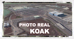
This Photo Real scenery is a complete rebuild for the FSX Default KOAK airport using the latest version of ADE, SBuilderX scenery design tool, & Google SketchUp. This scenery includes completely rebuilt terminal buildings, FedEx Hub buildings, realistic Google Earth buildings, and Photo Real ground textures that gives the airport a more realistic feeling. I constructed this scenery using all FSX textures and imported Google Earth Buildings via Google SketchUp. I have also added new commercial buildings next to the RWY 11 approach, parking lot lamps, terminal gate assignments, and several other nice scenery enhancements. The runways and airport aprons are aligned to match Google & Yahoo satellite imagery.
| Filename: | Metropolitan_Oakland_International_Airport_Oakland.zip |
| License: | Freeware |
| Added: | 23rd June 2012, 04:27:02 |
| Downloads: | 6,840 |
| Author: | Glenn Johnson |
| Size: | 53.71 MB |
| Category: Flight Simulator X - Scenery | |
| Crooked & Acklins Islands (MYCI-MYAP) - The Bahamas |
|
Images related to this file:
File Description:
These islands are sparsely populated, but FSX with UTX-TAC has Crooked Island containing cities with high-rise buildings instead of settlements. This has been adjusted somewhat in this scenery. Bahamasair has flights twice weekly to these islands with the landing at MYCI being one of the more challenging due to rising terrain at the east end of the short and narrow runway. Parking has been provided to accommodate those AI flights in this package. The scenery includes custom scenery objects, placement of library objects and landclass changes. Scenery is based on Google Earth, Bing Maps and photos taken locally, and it is optimized for use with UTX-TAC.
| Filename: | Crooked__Acklins_Islands_MYCIMYAP__The_Bahamas.zip |
| License: | Freeware |
| Added: | 27th September 2013, 20:39:10 |
| Downloads: | 1,157 |
| Author: | Art Poole |
| Size: | 4.4 MB |


© 2001-2026 AVSIM Online
All Rights Reserved
Privacy Policy |