
Where Flight Simulation Enthusiasts Gather from Around the World!
AVSIM Library - Search Results

| Category: Flight Simulator X - Aircraft Repaints, Textures and Modifications | |
| Air Antilles ATR42 package |

|
File Description:
Repaint for the payware Virtualcol ATR seires. Includes Air Antilles ATR42 Fleet of 3 500s and 1 600. Air Antilles is a airline based in the Caribbean
| Filename: | Air_Antilles_ATR42_package.zip |
| License: | Freeware |
| Added: | 22nd June 2019, 04:13:26 |
| Downloads: | 353 |
| Author: | Andre Noreiga |
| Size: | 12 MB |
| Category: Flight Simulator 2004 - AI Aircraft | |
| Angolan Air Force Embraer EMB-120 |
|
File Description:
Angolan Air Force Embraer EMB-120 repaint for your AI traffic. Includes 'representative' flight plans for all three EMB-120 currently operated by the Angolan Air Force.
| Filename: | Angolan_Air_Force_Embraer_EMB120.zip |
| License: | Freeware |
| Added: | 31st March 2009, 21:03:37 |
| Downloads: | 457 |
| Author: | Paul W. Irving |
| Size: | 150.29 KB |
| Category: Flight Simulator 2004 - AFCAD Files | |
| Calgary International Airport, Calgary, Alberta, Canada (CYYC/YYC) CanUK - Scenery (Fix for FSNav and FSCommander) |
|
File Description:
This AFCAD2 file will correctly display taxiways and parking areas for CYYC by CanUk
| Filename: | Calgary_International_Airport_Calgary_Alberta_Cana.zip |
| License: | Freeware |
| Added: | 11th April 2007, 12:20:41 |
| Downloads: | 1,659 |
| Author: | CanUk Scenery Adam Bentley and David Madge |
| Size: | 11.8 KB |
| Category: Flight Simulator 2004 - Scenery | |
| Frozen rivers and lakes for winter ski operations along the Canada/USA border and Alaska |
|
Images related to this file:
File Description:
This "freezes" lakes and rivers in a wide strip along both sides of the Canadian and US border and part of Alaska (and is reversible with a tick in the FS9 library) and can be landed on with skis or wheels for winter operations. The area covered is from east of Quebec City to west of Calgary and Edmonton, with an extension north to cover Hudson Bay, so from from 70 west to 100 west and 40 north to 56 north (65 north in the Hudson Bay area). This includes large parts of Quebec, Ontario, Manitoba, Saskatchewan, Alberta, Michigan, Wisconsin, and Minnesota, and most of North Dakota and Montana, and the Alaska north shore and around Anchorage.
This is really for use with Ultimate Terrain, though it will work without it. But as UT is what gets all the lakes and rivers there and in the right place it would be a shame not to be using UT.
| Filename: | Frozen_rivers_and_lakes_for__winter_ski_operations.zip |
| License: | Freeware, limited distribution |
| Added: | 18th February 2010, 14:33:41 |
| Downloads: | 628 |
| Author: | Roger Wensley |
| Size: | 424.36 KB |
| Category: Flight Simulator 2004 - AI Aircraft | |
| Cirrus Airlines De Havilland Canada DHC-8-300 Dash 8 'D-BIER' 50 Jahre Saarland |
|
File Description:
Repaint of the PAI Dahs8-300. Paint of the Cirrus Airlines Special Livery "50 Jahre Saarland" D-BIER. Use with the PAI-models available on Projektai.com. For more informations about the actual flightplan and other repaints for the flightplan, please visit http://worldoftraffic.de.ki/
| Filename: | Cirrus_Airlines_De_Havilland_Canada_DHC8300_Dash_8.zip |
| License: | Freeware |
| Added: | 12th June 2007, 22:36:07 |
| Downloads: | 578 |
| Author: | Martin Schumacher |
| Size: | 242.09 KB |
| Category: Flight Simulator X - Scenery | |
| Victoria, Canada including US Southern Gulf Islands and San Juan Islands - Part 1 of 2 |
|
Images related to this file:
File Description:
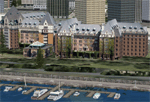
FSX-only version of Victoria, Canada area scenery including the Southern Gulf Islands and the San Juan Islands of the US. Includes automated installer and configurator by Scot Fraser.
Features:
-accurate shorelines, lakes and streams;
-landclass;
-FSX multi-LOD mesh with 10m maximum resolution;
-complete road network with moving traffic;
-railroads;
-utility corridors;
-marinas and ferry terminals;
-many static boats, including a custom model of the Canada Coast Guard ship Sir Wilfred Laurier;
-detailed models of major buildings and the Ogden Point Terminal;
-many bridges;
-nearly 300 marine lights; and corrected antennae locations.
Facilities include Don Grovestine's famous CYYJ (Victoria International Airport); 12 other Canadian land-based airports: Butler Field, Duncan (CAM3), Gaines, Hastings, Hudson Island, James Island, Thomas, Village Bay, Raven Field (CML2), Saltspring, Sidney Island, Whiskey Point; 20 US airports Blakely (38WA), Burden (61WA), Center Island (79WA), Clam Harbor (WA35), Crane Island, Decatur Shores (WN07), Decatur-Jones (WA18), Waldronaire (90WA), Orcas Island (KORS), Friday Harbour (KFHR), Lopez Island (S31), Pile Point, Roche Harbor (WA09), Shaw Island, Stuart Island Airpark (7WA5), Stuart Island West (2WA3), Wilding (6WA5), Windsock (4WA4); 12 floatplane facilities: Bedwell (CAB3), Fisherman's Bay (WA81), Friday Harbor (W33), Ganges (CAX6), Maple Bay, Mayne (CAW7), Port Washington (CAP8), Roche Harbor (W39), Rosario (W49), Shawnigan Lake (CAV8), Victoria Harbour (CYWH), Victoria International (CAP5) and Westsound, Orcas (WA83) - many with AI traffic; 9 heliports: Ganges (CAL7), Mayne (CBF5), Camel Point (CBF7), Jubilee (CBK8), Victoria General (CBW7) Madrona Bay (CBW9), Shoal Point (CBZ7), Mount Belcher (CMBH).
AI models include the DHC-2 floatplane in local liveries, a cruise ship model (by Mitsuya Hamaguchi) and two repaints, pilot boat, and small boats (by Larry Silsbee).
Ultimate Terrain X compatible (not required). Users of Vancouver+ for FSX will also get additional cruise ship traffic and additional floatplane and helicopter traffic. Full documentation. By Don Grovestine, Jon Patch and Holger Sandmann. Many other contributors: see documentation. Part 1 of 2 - you also need file vicenh7b.zip
| Filename: | Victoria_Canada_including_US_Southern_Gulf_Islands.zip |
| License: | Check within download |
| Added: | 29th January 2010, 21:23:17 |
| Downloads: | 23,161 |
| Author: | Don Grovestine, Jon Patch and Holger Sandmann |
| Size: | 56.8 MB |
| Category: Flight Simulator X - Scenery | |
| Victoria, Canada including US Southern Gulf Islands and San Juan Islands - Part 2 of 2 |
|
Images related to this file:
File Description:
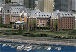
FSX-only version of Victoria, Canada area scenery including the Southern Gulf Islands and the San Juan Islands of the US. Includes automated installer and configurator by Scot Fraser.
Features:
-accurate shorelines, lakes and streams;
-landclass;
-FSX multi-LOD mesh with 10m maximum resolution;
-complete road network with moving traffic;
-railroads;
-utility corridors;
-marinas and ferry terminals;
-many static boats, including a custom model of the Canada Coast Guard ship Sir Wilfred Laurier;
-detailed models of major buildings and the Ogden Point Terminal;
-many bridges;
-nearly 300 marine lights; and corrected antennae locations.
Facilities include Don Grovestine's famous CYYJ (Victoria International Airport); 12 other Canadian land-based airports: Butler Field, Duncan (CAM3), Gaines, Hastings, Hudson Island, James Island, Thomas, Village Bay, Raven Field (CML2), Saltspring, Sidney Island, Whiskey Point; 20 US airports Blakely (38WA), Burden (61WA), Center Island (79WA), Clam Harbor (WA35), Crane Island, Decatur Shores (WN07), Decatur-Jones (WA18), Waldronaire (90WA), Orcas Island (KORS), Friday Harbour (KFHR), Lopez Island (S31), Pile Point, Roche Harbor (WA09), Shaw Island, Stuart Island Airpark (7WA5), Stuart Island West (2WA3), Wilding (6WA5), Windsock (4WA4); 12 floatplane facilities: Bedwell (CAB3), Fisherman's Bay (WA81), Friday Harbor (W33), Ganges (CAX6), Maple Bay, Mayne (CAW7), Port Washington (CAP8), Roche Harbor (W39), Rosario (W49), Shawnigan Lake (CAV8), Victoria Harbour (CYWH), Victoria International (CAP5) and Westsound, Orcas (WA83) - many with AI traffic; 9 heliports: Ganges (CAL7), Mayne (CBF5), Camel Point (CBF7), Jubilee (CBK8), Victoria General (CBW7) Madrona Bay (CBW9), Shoal Point (CBZ7), Mount Belcher (CMBH).
AI models include the DHC-2 floatplane in local liveries, a cruise ship model (by Mitsuya Hamaguchi) and two repaints, pilot boat, and small boats (by Larry Silsbee).
Ultimate Terrain X compatible (not required). Users of Vancouver+ for FSX will also get additional cruise ship traffic and additional floatplane and helicopter traffic. Full documentation. By Don Grovestine, Jon Patch and Holger Sandmann. Many other contributors: see documentation. Part 2 of 2 - you also need file vicenh7a.zip
| Filename: | Victoria_Canada_including_US_Southern_Gulf_Islands.zip |
| License: | Check within download |
| Added: | 29th January 2010, 21:21:49 |
| Downloads: | 23,164 |
| Author: | Don Grovestine, Jon Patch and Holger Sandmann |
| Size: | 59.08 MB |
| Category: Flight Simulator 2004 - Original Aircraft | |
| Australian Customs Service De Havilland Canada DHC-8-200 Dash 8 / 8Q (All New Design) |
|
File Description:
FS2004 PAD Dehavilland Dash8-Q202. A modified twin turboprop regional airliner. Australian Customs Service,
operated by Surveillance Australia. An all new FSDS2.24 design with 2D panel, Dynamic VC, and Custom Sound. In addition, a custom TCAS (Traffic Collision Avoidance System), a complete Ground Handling module with push back and taxi speed control and the latest version GPWS (Ground Proximity Warning System) is included. The visual model features an opening airstair with detailed cabin interior, operating lift dump and roll control spoilers, passenger wing and cabin views, and high definition reflective textures. A comprehensive set of html documents (Check List & Ref List) are included for in-flight information. A separate Panel_Docs folder accompanies this release with panel and systems help files and pilot's notes and more.
| Filename: | Australian_Customs_Service_De_Havilland_Canada_DHC.zip |
| License: | Freeware, limited distribution |
| Added: | 19th May 2005, 04:56:53 |
| Downloads: | 7,996 |
| Author: | Jean-Pierre Brisard, Barry Blaisdell, Bob May - Premier Aircraft Design |
| Size: | 21.48 MB |
| Category: Flight Simulator 2004 - Scenery | |
| Clinton Point CWCP, Horton River CWHR & Keats Point CWKP; DEW sites in Northwest Territories, Canada |
|
Images related to this file:
File Description:
These are three DEW line sites in northern mainland Canada, to the east of Tuktoyaktuk.
Clinton Point is almost 300 miles east of Tuktoyaktuk and on the Northwest Territories and Nunavut border. It is the site of a closed DEW station (closed in 1993) and all the buildings have been removed, unlike many other sites where buildings are still almost complete. The roads and the gravel runway down by the beach are still there.
Horton River is 150 miles east of Tuktoyaktuk, up on higher land above the cliffs at around 500 feet ASL. The NWS (North Warning System) replaced the I site which was there previously and which ceased operations in 1963. The NWS is serviced by helicopter from a barge 400 yards away on the beach.
Keats Point is 270 miles east of Tuktoyaktuk, 7 miles from the coast but significantly close to a lake, which was probably used for float plane delivery in the summer (or ski plane delivery in the winter) of NWS station elements during construction.
| Filename: | Clinton_Point_CWCP_Horton_River_CWHR__Keats_Point_.zip |
| License: | Freeware, limited distribution |
| Added: | 17th July 2012, 18:57:08 |
| Downloads: | 282 |
| Author: | Roger Wensley |
| Size: | 2.07 MB |
| Category: Flight Simulator X - Aircraft Repaints, Textures and Modifications | |
| Southwest Airlines California One V2 Boeing 737-700WL |
|
Images related to this file:
File Description:

PMDG Boeing 737-700WL NGX Southwest Airlines California One repaint. In real life it is a -300WL, but I have converted it to a -700WL. Bump Maps are provided by Chris Hicks. I have also included the panel options. You need the PMDG 737NGX Base-pack and Add-on pack to use.
This is the Version 2 of my first paint. If you downloaded my first one please download this one and delete the first one with the Livery Manager ten install this one. The differences is the whole paint has been re-download and this one is a lot better. It has a VC number now, bump maps that are made my Chris Hicks, and the whole bear has been repainted by hand and all the other lines redone on the paint. I hope you enjoy this.
| Filename: | Southwest_Airlines_California_One_V2_Boeing_737700WL.zip |
| License: | Freeware |
| Added: | 31st January 2013, 02:28:17 |
| Downloads: | 2,005 |
| Author: | Ian Besemer |
| Size: | 28.28 MB |


© 2001-2026 AVSIM Online
All Rights Reserved
Privacy Policy |