
Where Flight Simulation Enthusiasts Gather from Around the World!
AVSIM Library - Search Results

| Category: Flight Simulator 2004 - Scenery | |
| Alexandria CNS4 field near Ottawa, Ontario, Canada |

|
Images related to this file:
File Description:
This was the thirteenth of a projected 16 airfields in the Ottawa area originally posted in 2006; this version has specifically modeled buildings. Alexandria is just a mile east of the town of the same name, 50 miles east of Ottawa International and 16 miles north of Cornwall. It has one grass runway which is 2,020' long and 100' wide and which parallels the road. There are two hangers and a two storey clubhouse, and fuel. And in the summer look out for the gliders doing right hand circuits and the parachutists on vertical finals.
| Filename: | Alexandria_CNS4_field_near_Ottawa_Ontario_Canada.zip |
| License: | Freeware, limited distribution |
| Added: | 16th February 2010, 01:41:39 |
| Downloads: | 441 |
| Author: | Roger Wensley |
| Size: | 1.33 MB |
| Category: Flight Simulator 2004 - Scenery | |
| CNU8 - Toronto - Markham Airport (2008), Ontario, Canada |
|
Images related to this file:
File Description:
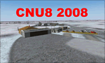
CNU8 - Toronto - Markham Airport (2008) - Markham v1. The airport is owned and operated by Markham Airport Inc., and is not part of the Greater Toronto Airport Authority.
The airport consists of a single 2,000 foot runway for small and private aircraft only (with night flying capabilities). The Royal Canadian Air Cadets Gliding Program uses the north side or the runway 09/27 for glider operations in the spring and fall months, and use a northern traffic pattern. This airport may disappear with the establishment of a planned Pickering Airport or re-location of Toronto/Buttonville Municipal Airport.
(This is a re-upload of the scenery to replace the original that was lost in the AVSIM hack. No changes have been made)
| Filename: | CNU8__Toronto__Markham_Airport_2008_Ontario_Canada.zip |
| License: | Freeware, limited distribution |
| Added: | 16th May 2010, 10:06:40 |
| Downloads: | 1,590 |
| Author: | Keith Murphy |
| Size: | 5.24 MB |
| Category: Flight Simulator X - Scenery | |
| CYOW Ottawa, Canada SUMMER 2010 RELEASE UPDATE |
|
File Description:
This release corrects almost all issues brought to my attention in the first release of May 2nd 2010.
You will still find a few unpainted models and such, but the airport is now fully funtional for AI.
Xwind runways were not added. Anyone wishing a copy of a Xwind version, let me know, it is currently being developed.
This is it for the summer, look forward to an update and a few more airports in the Ottawa area in the fall.
Thanks everyone and enjoy!
| Filename: | CYOW__Ottawa_Canada__SUMMER_2010_RELEASE_UPDATE.zip |
| License: | Freeware |
| Added: | 7th May 2010, 10:46:25 |
| Downloads: | 8,333 |
| Author: | John De Young |
| Size: | 82.69 MB |
| Category: Flight Simulator 2004 - Original Aircraft | |
| de Havilland of Canada C-7A Caribou |
|
Images related to this file:
File Description:
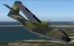
The de Havilland Canada DHC-4 Caribou (known in the U.S. military as CV-2 and C-7 Caribou) is a Canadian-designed and produced specialized cargo aircraft with short takeoff and landing (STOL) capability. The Caribou was first flown in 1958 and although mainly retired from military operations, is still in use in small numbers as a rugged "bush" aircraft.
| Filename: | de_Havilland_of_Canada_C7A_Caribou.zip |
| License: | Freeware |
| Added: | 31st July 2010, 22:35:08 |
| Downloads: | 1,686 |
| Author: | Peter Mercy / Mike Stone |
| Size: | 21.11 MB |
| Category: Flight Simulator 2004 - Scenery | |
| Aklavik CYKD in the Northwest Territories, Canada |
|
Images related to this file:
File Description:
Aklavik is a town of 650 or so inhabitants at N68 W135, which means 120 miles inside the Arctic Circle and on the West Channel of the Mackenzie River delta. It is 40 miles west of Inuvik and around 60 miles from where the Mackenzie meets the Beaufort Sea. There is only one airline serving the town on a regular basis and that is North Wright, which is headquartered in Norman Wells and also has a base in Inuvik. Aklavik village does not feature in FS9, so the first thing to do was to add it; not all the smaller streets are in place but it is the right shape and with around the right number of houses. The only building with (partly) correct textures is the school near the airfield. I couldn't begin to model 150+ houses, so think of it as a hand-made auto-generated village. I had to move the airfield over beside the river, so there is a DELETE file and a GRASS file, as well as an AFCAD for AI (the AI will follow later) and a scenery file.
| Filename: | Aklavik_CYKD_in_the_Northwest_Territories_Canada.zip |
| License: | Freeware, limited distribution |
| Added: | 10th October 2010, 03:02:19 |
| Downloads: | 630 |
| Author: | Roger Wensley |
| Size: | 1.91 MB |
| Category: Flight Simulator 2004 - Scenery | |
| Sanikiluaq CYSK in Hudson Bay, Nunavut, Canada |
|
Images related to this file:
File Description:
Sanikiluaq is a village 740 or so inhabitants at N56 30, W79, which means in the southern part of Hudson Bay, close to James Bay. The village is at the north end of Flaherty Island, which is the largest of the Belcher Islands. You might fly there from La Grande Riviere in Quebec (200 miles SSE) or maybe from Moosonee in Ontario at the bottom of James Bay (350 miles SSW). Sanikiluaq village does not feature in FS9, so the first thing to do was to add it; it is the right shape and with around the right number of houses on the right streets but as I wasn't going to model 100+ individual houses just think of it as a hand-made auto-generated village. I also had to move the airfield over beside the river, so there is a DELETE file and a GRASS file and a ROADS file, as well as an AFCAD for AI and a scenery file. And AI for a visiting Air Inuit plane.
| Filename: | Sanikiluaq_CYSK_in_Hudson_Bay_Nunavut_Canada.zip |
| License: | Freeware, limited distribution |
| Added: | 11th October 2010, 23:15:41 |
| Downloads: | 516 |
| Author: | Roger Wensley |
| Size: | 2.21 MB |
| Category: Flight Simulator 2004 - Scenery | |
| Waskaganish CYKQ in James Bay, Quebec, Canada |
|
Images related to this file:
File Description:
Waskagansh is a village with 2,500 or so inhabitants at N51 28 W78 45 on the southeast shore of James Bay. It was founded in 1668 as Fort Charles (later it became Fort Rupert) and was the first Hudson's Bay Company trading post in the James Bay area. The village's current name means Little House in the Cree language. The village does not feature in FS9 but is included in this scenery with approximately the right shape; just think of it as a hand-made auto-generated village.
I also had to add the roads (the file called "waskROADS"), delete the stock airfield background ("WaskDELETE"), and add a new background ("WaskGRASS") plus of course there is the usual scenery file and the AFCAD and AI. There is also a note in here on what to do about a possible texture problem for the village that I have discussed with two downloaders and solved. I hope.
| Filename: | Waskaganish_CYKQ_in_James_Bay_Quebec_Canada.zip |
| License: | Freeware, limited distribution |
| Added: | 21st October 2010, 23:32:16 |
| Downloads: | 541 |
| Author: | Roger Wensley |
| Size: | 1.38 MB |
| Category: Flight Simulator 2004 - Scenery | |
| Puvirnituq CYPX in Hudson Bay, Quebec, Canada |
|
Images related to this file:
File Description:
Puvirnituq is a village of 1,300 or so inhabitants at N60 W77 on the east shore of Hudson Bay. It's name means "Putrid" in Inuit, and there are two different stories about how it got the name. The village does not feature in FS9, but is included in this scenery with approximately the right shape (the coast, even with UT, is not exactly right) so just think of it as a hand-made auto-generated village which gives the airfield a reason for being there. The runway is a very generous 6,300 feet of gravel 148 feet wide, which should be enough for almost anything. I also had to add the roads, delete the stock airfield background and add a new background, plus of course there is the scenery file and the AFCAD and AI.
| Filename: | Puvirnituq_CYPX_in_Hudson_Bay_Quebec_Canada.zip |
| License: | Freeware, limited distribution |
| Added: | 30th October 2010, 13:34:30 |
| Downloads: | 375 |
| Author: | Roger Wensley |
| Size: | 1.72 MB |
| Category: Flight Simulator 2004 - Scenery | |
| Ivujivik CYIK in Hudson Bay, Quebec, Canada |
|
Images related to this file:
File Description:
Ivujivik is a village of 350 or so inhabitants at N62 25 W78 on the northeastern corner of Hudson Bay. The village does not feature in FS9 but is included in this scenery with approximately the right shape (the coast, even with UT, is not exactly right) so just think of it as a hand-made auto-generated village which gives the airfield a reason. The runway is 3,500 feet of gravel 100 feet wide, which should be enough. I also added the roads, deleted the stock airfield background and added a new background, plus of course there is the scenery file and the AFCAD and AI. You may note that the terminal has the elevation written on the sign as 126', while on the winter photo it is written on the older & bigger sign as 130'. I thought this is because satellite radar has fixed the elevations of all airfields more accurately than before, as Rockcliffe too has gone from 192' to 188'; the alternative explanation is that global warming has raised sea level by 4'. Wow! That's a thought. I presume the new sign was made smaller as a cost saving.
| Filename: | Ivujivik_CYIK_in_Hudson_Bay_Quebec_Canada.zip |
| License: | Freeware, limited distribution |
| Added: | 31st October 2010, 07:41:20 |
| Downloads: | 458 |
| Author: | Roger Wensley |
| Size: | 2.07 MB |
| Category: Flight Simulator 2004 - Scenery | |
| Salluit CYZG in Hudson Strait, Quebec, Canada |
|
Images related to this file:
File Description:
Salluit is a village of 1,250 or so inhabitants at N 62 W 75 40 on the shore of Sugluk Inlet, which is off Hudson Strait. It's name means "Skinny Ones" in Inuit, and refers to a time when there was not enough to eat, which is a rather scary reminder of just how fragile Inuit survival used to be. The village does not feature in FS9 but is included in this scenery with approximately the right shape and with the roads that lead to the airfield and what I presume are quarries for building materials and roads. The airfield runway is 3,510 feet of gravel 100 feet wide and is some 740 feet higher than the village on the shoreline. I added the roads, the quarries, a new airfield background, plus of course there is the scenery file and the AFCAD and AI.
| Filename: | Salluit_CYZG_in_Hudson_Strait_Quebec_Canada.zip |
| License: | Freeware, limited distribution |
| Added: | 2nd November 2010, 01:18:55 |
| Downloads: | 373 |
| Author: | Roger Wensley |
| Size: | 1.96 MB |


© 2001-2026 AVSIM Online
All Rights Reserved
Privacy Policy |