
Where Flight Simulation Enthusiasts Gather from Around the World!
AVSIM Library - Search Results

| Category: Flight Simulator 2004 - Scenery | |
| Pontiac Airpark CPC7 in Quebec Canada |

|
Images related to this file:
File Description:
Pontiac Airpark is in Quebec on the north bank of the Ottawa River, some 20 miles northwest of Ottawa in Canada. It is a new airfield and in fact is still under construction, though the east-west runway has been in use since late last year. This east-west runway is 3,400 feet long and gravel, though it will later be lighted, and then asphalted. The second runway will be just under 2,000 feet and unlighted gravel, and at its southern end there are docks for float planes. The float base is already in use; CPC7 is the ICAO code for the float base. There are lots for sale, and the idea is to build your house right on the airfield so there is no driving necessary between house and plane, thus leaving more time for what is important. There will be updates as things progress.
| Filename: | Pontiac_Airpark_CPC7_in_Quebec_Canada.zip |
| License: | Freeware, limited distribution |
| Added: | 1st May 2010, 00:33:40 |
| Downloads: | 339 |
| Author: | Roger Wensley |
| Size: | 7.06 MB |
| Category: Flight Simulator X - Panels | |
| De Havilland Canada DHC-8 300 |
|
Images related to this file:
File Description:
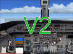
Re-upload. Updated 2D panel for FS-X and now fully working in FS2004. About 40 modifications and some new gauges
| Filename: | De_Havilland_Canada_DHC8_300.zip |
| License: | Freeware, limited distribution |
| Added: | 8th June 2010, 02:43:18 |
| Downloads: | 2,835 |
| Author: | Pierre Fasseaux |
| Size: | 2.12 MB |
| Category: Flight Simulator 2004 - Scenery | |
| Factory Field CF40 in Quebec Canada |
|
Images related to this file:
File Description:
Factory Field (my name for it) is in Quebec on highway 321 a few miles north of St Andre Avellin, and 40 miles ENE of Ottawa. The runway is 3,500 feet long and asphalt and went out of regular use in the early 1990's when the airfield was closed. It was sold in 1995 to a company (ELP) that has built up a factory for manufacturing and fitting snow ploughs and other pneumatically operated equipment to trucks, and who now use the runway for testing their snow ploughs. In between times, as it is not marked closed with an "X", it is also occasionally used by customers who fly in, usually to get the drivers there to take delivery of completed trucks. The surface is good and there are no obstructions but also no markings, though with 3,500 feet of 100 feet wide asphalt there is plenty of space and it doesn't much matter.
| Filename: | Factory_Field_CF40_in_Quebec_Canada.zip |
| License: | Freeware, limited distribution |
| Added: | 13th May 2010, 22:11:41 |
| Downloads: | 347 |
| Author: | Roger Wensley |
| Size: | 1.27 MB |
| Category: Flight Simulator 2004 - Aircraft Repaints, Textures and Modifications | |
| De Havilland Canada DHC-2 Beaver |
|
Images related to this file:
File Description:
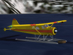
By request.
The repaint is based on the color scheme of aircraft N101SY.
Texture files only. The original Beaver model by Aerosoft (http://www.aerosoft-shop.com/) is required. Thanks to the Aerosoft crew for allowing me to upload this repaint and for making the aircraft in the first place.
| Filename: | De_Havilland_Canada_DHC2_Beaver.zip |
| License: | Freeware, limited distribution |
| Added: | 15th May 2010, 22:35:29 |
| Downloads: | 681 |
| Author: | Nathan Havercroft / Aerosoft |
| Size: | 1.61 MB |
| Category: Flight Simulator 2004 - Scenery | |
| Hope Field near Ottawa Ontario, Canada |
|
Images related to this file:
File Description:
The field is newly included in the Canada Flight Supplement. Unusually for a grass field the runway has the numbers marked out in white; given that this is a private airfield that does not invite unexpected guests and has only one plane based there, and presuming that the owner can remember his own runway headings, it is unlikely that these will still be there in a year's time. There is no hangar as yet. To the west is highway 416 and to the east is the Rideau River, both of which run north-south. Lke Rockcliffe (which is to the north) the airfield is right on the edge of the Ottawa control zone, so you should already be below 1,500 feet ASL when approaching from the south and talking to Ottawa tower when arriving from the north. The runway is 07/25 and 2,800 feet long, which should be enough for almost anybody, and the field is at 315 feet ASL. Manotick is a mile to the north east on the Rideau River and the Rideau Valley Airpark CPL3 is six miles south in the bend of the Rideau where it turns west.
| Filename: | Hope_Field_near_Ottawa_Ontario_Canada.zip |
| License: | Freeware, limited distribution |
| Added: | 10th July 2010, 19:34:51 |
| Downloads: | 200 |
| Author: | Roger Wensley |
| Size: | 3.15 MB |
| Category: Flight Simulator 2004 - Scenery | |
| Hall Beach CYUX in Nunavut, Canada |
|
Images related to this file:
File Description:
Hall Beach is on the Melville Peninsula, part of the mainland of Canada, south and west of Baffin Island. It is around 40 miles south of Igloolik and 50 miles west of Rowley, both of them my previous posts. The airfield was built to support the construction and operation of a main DEW line radar station and to support the rest of the associated chain. Because of the employment opportunities this brought, a village developed nearby. The airfield continues in regular use and the runway, though still gravel, is 5,400' long and 150' wide and lighted; the alignment is 124T and 304T as this is in northern domestic airspace and bearings are given as 'true" and not "magnetic". There are scenery folders for the village, roads, grass, etc, and AI for two airlines with regular service to Hall Beach.
| Filename: | Hall_Beach_CYUX_in_Nunavut_Canada.zip |
| License: | Freeware, limited distribution |
| Added: | 22nd November 2011, 14:33:08 |
| Downloads: | 456 |
| Author: | Roger Wensley |
| Size: | 3.83 MB |
| Category: Flight Simulator 2004 - Scenery | |
| Baker Lake CYBK in Nunavut, Canada |
|
Images related to this file:
File Description:
Baker Lake is the only Nunavut community that is not next to the sea. It is, as you might have guessed, on the shore of Baker Lake and 160 miles west and a bit north of Rankin Inlet on the shore of Hudson Bay (a recent post by Sid and Pete). The Hudson Bay Company opened a trading post there in 1916 and the town slowly developed, though as recently as 1946 the population was still only 32. These days the airfield is the support field for several nearby mines and there are now nearly 1,800 folks in Baker Lake using the stores, schools, churches, hospital, etc. The runway is almost 4,200' of 100' wide gravel and lighted; the alignment is 162T and 342T as this is in northern domestic airspace and bearings are given as 'true" and not "magnetic". Both JETA and 100LL fuel is available. The town is to the northeast of the airfield and is made up of a landclass without autogeneration, as this would mean a bunch of trees that would be, to say the least, unrealistic.
| Filename: | Baker_Lake_CYBK_in_Nunavut_Canada.zip |
| License: | Freeware, limited distribution |
| Added: | 23rd November 2011, 09:21:56 |
| Downloads: | 515 |
| Author: | Roger Wensley |
| Size: | 2.45 MB |
| Category: Flight Simulator 2004 - Scenery | |
| St Jovite CSZ3 in Quebec Canada |
|
Images related to this file:
File Description:
St Jovite is a grass strip in Quebec near the town of St Jovite and the Mont Tremblant tourist area. This updated version has specifically modeled buildings etc. The unlighted runway is 3,300 feet long, aligned 02/20, and there is now fuel available, so that's a change for the better. However, there is also a landing fee and charges for overnight parking, though the fee is waived if you buy fuel. Based upon my experience of St Jovite there is no AI required for added realism; you will be the only plane visiting and that will be totally realistic. There must be a busy time, but I have never seen it. The aerial picture shows St Jovite from the south, with Lac Ouimet and Mont Tremblant beyond.
| Filename: | St_Jovite_CSZ3_in_Quebec_Canada.zip |
| License: | Freeware, limited distribution |
| Added: | 25th November 2011, 17:29:25 |
| Downloads: | 306 |
| Author: | Roger Wensley |
| Size: | 2.5 MB |
| Category: Flight Simulator 2004 - Scenery | |
| Coral Harbour CYZS in Nunavut, Canada |
|
Images related to this file:
File Description:
Coral Harbour is on Southampton Island, which partly blocks the northern end of Hudson Bay and is around the size of Switzerland. The village has a population of just under 800 people and is some 200 miles from Cape Dorset, Ivujivik, and Repulse Bay, and 230 miles from Chesterfield Inlet to the southwest. Cape Dorset and Ivujivik have already been posted and Chesterfield Inlet will be posted later this month. The airfield is inland from the village and the 5,000 feet of gravel runway is aligned 155T/335T where T stands for "true" as opposed to magnetic in the Northern Domestic Airspace. JETA-1 fuel is officially available, and in practice so is 100LL, though the latter will be in drums. The visiting AI airlines are First Air and Calm Air.
| Filename: | Coral_Harbour_CYZS_in_Nunavut_Canada.zip |
| License: | Freeware, limited distribution |
| Added: | 29th November 2011, 00:43:08 |
| Downloads: | 369 |
| Author: | Roger Wensley |
| Size: | 3.83 MB |
| Category: Flight Simulator 2004 - Scenery | |
| Cape Dyer CWFD in Nunavut, Canada |
|
Images related to this file:
File Description:
Cape Dyer is on the southeast corner of Baffin Island, around 120 miles east of Pangnirtung at approximately N66 45 W61 30. There is a fine view north up the Davis Strait between Baffin Island and Greenland, and this is the whole reason for the airfield's existance as it was built to support the construction and operation of a DEW line radar station, which has now been updated to a North Warning System site. There are two camps; the upper camp is on the east side of the Cape and is where the radars are located, linked by a gravel road to the lower camp, which is on the west and more sheltered side of the Cape on the clifs above Sunneshine Fjord. The runway is 5,000' of 150' wide gravel, and it is lighted and at 1,320' feet ASL. Cape Dyer is now listed as abandoned in the Canada Flight Supplement. It is, however, still there and presumably is still used for access to the North Warning System equipment, which is automated and generally unmanned. The buildings were modeled for this scenery and include a hanagar large enough to accommodate a C-130. Ultimate Terrain is not required as it does not cover northern Canada.
| Filename: | Cape_Dyer_CWFD_in_Nunavut_Canada.zip |
| License: | Freeware, limited distribution |
| Added: | 21st June 2011, 19:30:07 |
| Downloads: | 488 |
| Author: | Roger Wensley |
| Size: | 1.9 MB |


© 2001-2026 AVSIM Online
All Rights Reserved
Privacy Policy |