
Where Flight Simulation Enthusiasts Gather from Around the World!
AVSIM Library - Search Results

| Category: Prepar3D V1-4 - Scenery | |
| EPKK KRAKOW BALICE X V2 DEMO |

|
Images related to this file:
File Description:
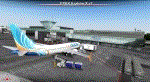
EPKK KRAKOW BALICE X V2 DEMO features the scenery of EPKK Krakow Balice airport and Krakow City, Poland, fully compatible with FSX, FSX:SE, FSW, P3Dv1-v4.
It's a fully functional DEMO version of the commercial payware product. It features same airport layout as in the full version but with limited 3D objects and low resolution textures. Using this free demo ensures no problems with online (VATSIM, IVAO, multiplayer etc.) flying in case some users use the payware scenery and some don't.
John Paul II International Airport Krakow-Balice (KRK / EPKK) is an international airport located near Krakow, in the village of Balice, 11 km (6.8 mi) west of the city centre, in southern Poland. The airport has one concrete runway, number 07/25, 2550x60m.
It's equipped with an automatic installer, which means that the scenery will be automatically added to the Flight Simulator Scenery Library.
Please uninstall all previous versions of this airport you may have installed before. Please make also sure that no duplicated AFCAD files are installed.
Enjoy your virtual flying with Drzewiecki Design!
| Filename: | EPKK_KRAKOW_BALICE_X_V2_DEMO.zip |
| License: | Freeware, limited distribution |
| Added: | 22nd November 2018, 00:56:01 |
| Downloads: | 521 |
| Author: | Drzewiecki Design |
| Size: | 12.67 MB |
| Category: Flight Simulator X - AFCAD Files | |
| Warren Grove Range Airport (NJ24), New Jersey |
|
File Description:
Located 03 miles SW of Burlington County, New Jersey, Warren Grove Range is a private concrete airfield 1800' in length. It is owned by the Department of Defense and exists in a restricted flight area. The bare sand of this area has washed out the satellite images tremendously from over-exposure thanks to reflected sunlight - you can't even make out the runway (which FSX places incorrectly over a mile away). Due to lack of ground definition and primary use as a military facility, this airport has not been developed by MSEAirports and the concrete runway has been removed.
Scenery constructed with use of satellite images/streetview/aerial photos - the author has not been there in person.
This scenery is meant to be used in conjunction with MegaScenery Earth New Jersey/Delaware 003. It is not required, but apron use is minimized to allow satellite scenery to show through as much as possible, and objects are placed based on the MSE textures - lack of it may make scenery look out of place.
| Filename: | Warren_Grove_Range_Airport_NJ24_New_Jersey.zip |
| License: | Freeware |
| Added: | 20th August 2011, 19:58:05 |
| Downloads: | 174 |
| Author: | Drew Sikora |
| Size: | 153.47 KB |
| Category: Flight Simulator X - AFCAD Files | |
| Fla-Net Airport (0NJ5), NJ |
|
File Description:
This another weird airport entry in the FSX database. The real 0NJ5 is the Meadowlands Sports Complex Heliport #2, and this just shows up as a random turf strip up near Netcong/Flanders in northern NJ. I could not find any specific information regarding the airport online, and while it does appear to once harbour the room and terrain for a grass strip, it's largely overgrown, even in the current MegaScenery Earth textures. So I've removed the strip entirely. There is still a start at the northwest end of where the strip used to be if you want to travel there, but that's it.
Scenery constructed with use of satellite images/streetview, the author has not been there in person.
This scenery is meant to be used in conjunction with MegaScenery Earth New York 005. It is not required, but apron use is minimized to allow satellite scenery to show through as much as possible, and objects are placed based on the MSE textures - lack of it may make scenery look out of place.
| Filename: | FlaNet_Airport_0NJ5_NJ.zip |
| License: | Freeware |
| Added: | 21st October 2010, 23:23:44 |
| Downloads: | 188 |
| Author: | Drew Sikora |
| Size: | 199.2 KB |
| Category: Flight Simulator X - AFCAD Files | |
| Woodbine Municipal Airport (1N4), NJ |
|
File Description:
Located 02 miles SE of Woodbine, New Jersey on 700 acres of land, Woodbine Municipal Airport serves small to large GA craft as well as gliders and ultralights. Tie downs are the only option for transient aircraft. The main parking area of the airport is located in the center tarmac area near the fuel station. The parking spots can accomodate aircraft with wingspans up to 50 feet. Anything larger should park off the side of the taxiway. Fuel is available by stopping near the fuel tank. It should be noted that this airport's real ICAO is KOBI.
Scenery constructed with use of satellite images/streetview, the author has not been there in person.
This scenery is meant to be used in conjunction with MegaScenery Earth New Jersey/Delaware 005. It is not required, but apron use is minimized to allow satellite scenery to show through as much as possible, and objects are placed based on the MSE textures - lack of it may make scenery look out of place.
| Filename: | Woodbine_Municipal_Airport_1N4_NJ.zip |
| License: | Freeware |
| Added: | 22nd October 2010, 06:03:35 |
| Downloads: | 202 |
| Author: | Drew Sikora |
| Size: | 352.7 KB |
| Category: Flight Simulator X - AFCAD Files | |
| Central Jersey Regional Airport (47N), NJ |
|
File Description:
Located 01 miles S of Manville, New Jersey on 119 acres of land, Central Jersey Regional Airport is a public asphalt strip. Hangars and tiedowns are offered for transient craft. The open hangar at the north of the airport is available for parking - it can be a bit of a tight fit taxiing in so I have disabled collision with the two planes nearby. You can also select the DOCK parking space to start inside the hangar. Fuel is available on the north tarmac by the fuel truck in front of the hangar, and on the south tarmac by the fuel tank. Trees are summertime ONLY.
Scenery constructed with use of satellite images/streetview, the author has not been there in person.
This scenery is meant to be used in conjunction with MegaScenery Earth New Jersey/Delaware 001. It is not required, but apron use is minimized to allow satellite scenery to show through as much as possible, and objects are placed based on the MSE textures - lack of it may make scenery look out of place.
| Filename: | Central_Jersey_Regional_Airport_47N_NJ.zip |
| License: | Freeware |
| Added: | 25th November 2010, 14:15:25 |
| Downloads: | 295 |
| Author: | Drew Sikora |
| Size: | 1.92 MB |
| Category: Flight Simulator 2004 - AFCAD Files | |
| EGNM AFCAD v2.5 |
|
Images related to this file:
File Description: Can be used with the following on AVSIM:

Peter Slater's FS9 AFCAD for EGNM (2009 v2.5). This is the AFCAD (updated and tweaked) for:
Default Scenery Users (Default FS2004 Scenery)
EGNM Extreme Freeware Scenery Package v1.0 (Package by Peter Slater - found here on AVSIM)
UK2000 Part 7 (which includes EGNM) by Gary Summons
British Airports Vol.6 (which includes EGNM) by Justflight
BA and UK2000 AFCAD updated only but the v1 for the others are included. Please make sure you read the readme.txt before installing. You have the choice to configure which runway is used if not both (i.e. 14, 32 or both). By Peter Slater, uploaded by Gareth Abbott. Those who downloaded v2 please re-download this version. Visit his web site for his other projects at www.fsprojects.co.nr or search 'peter slater' here on AVSIM.
| Filename: | EGNM_AFCAD_v25.zip |
| License: | Freeware |
| Added: | 12th January 2012, 19:39:10 |
| Downloads: | 905 |
| Author: | Peter Slater, Gareth Abbott |
| Size: | 1.34 MB |
| Category: Flight Simulator 2004 - Scenery | |
| VFR of Lario, Area B1 - Como lake, Italy |
|
Images related to this file:
File Description:

This is the second scenery of the "VFR of Lario" project that follows the previous LagoComo_A1, made with photorealistic terrain (multiseason & night) and with some 3D GMax realistic objects. With this scenery there are also enclosed the great realistic meshes that cover all the Como lake area.
Information: Como's lake (called Lario), is placed in the north of Italy, closed to the Helvetic border. This second scenery covers approximately an area of 7.5x6 kmt, from Bosco di Falmoira/Rondago (NW) to Nesso (NE), and from Balerna/Chiasso (SW) to monte Bolletto (SE), and includes some details of the towns around the lake as Cernobbio (pier, Villa Erba and Convention Center, Villa d'Este, Akzo Nobel buildings), Moltrasio (pier), Carate Urio (pier), Laglio (villa Oleandra), Brienno (buildings and pier), Nesso (pier), Careno (pier), Faggeto Lario (pier), Torno (building and Pier), Blevio (pier).
Contents: several piers and small docks, motor ships and boats, an animated hydrofoil; some other buildings (GenericBuilding system) and trees widespread all over the scenery. Review of Brunate's funicolar and Castel Baradello, due to updated meshes.
| Filename: | VFR_of_Lario_Area_B1__Como_lake_Italy.zip |
| License: | Freeware |
| Added: | 26th January 2012, 15:23:57 |
| Downloads: | 1,948 |
| Author: | Della Vedova Aldo, Daniele Lanfranchi, Diego Caligiuri, Gian Mario Verga |
| Size: | 36.15 MB |
| Category: Flight Simulator X - AFCAD Files | |
| Coombs Airport (7NJ7), NJ |
|
File Description:
Located 04 miles NE of Elmer, New Jersey, Coombs Airport is a private turf field 2000' in length wilth clear 20:1 approach and departure at each end of the runway. You'll find some surrounding buildings but they are all located several hundred yards from the runway. This is a good strip to keep in mind for emergencies if you're in the area. You will be landing on terrain so having your mesh complexity set as high as possible is recommended. This airport is not lit at night, daytime VFR operations only are suggested. There are no transient services offered.
Scenery constructed with use of satellite images/streetview/aerial photos - the author has not been there in person.
This scenery is meant to be used in conjunction with MegaScenery Earth New Jersey/Delaware 004. It is not required, but apron use is minimized to allow satellite scenery to show through as much as possible, and objects are placed based on the MSE textures - lack of it may make scenery look out of place.
| Filename: | Coombs_Airport_7NJ7_NJ.zip |
| License: | Freeware |
| Added: | 16th February 2011, 00:03:55 |
| Downloads: | 191 |
| Author: | Drew Sikora |
| Size: | 756.22 KB |
| Category: Flight Simulator X - AFCAD Files | |
| Rainbow's End Airport (JY39), NJ |
|
File Description:
Located 07 miles S of Salem, New Jersey on 20 acres of land, Rainbow's End Airport is a private turf strip 2200' in length. There are no services for transient aircraft and the airport is not lit at night, so daytime VFR operations only are recommended. If you have an aircraft with 40' or less of wingspan you can start at one of the parking spaces east or west of the runway by the hangars. Otherwise it is suggested you start on the runway. There is no hard surfaced runway so set your terrain mesh as high as possible.
Scenery constructed with use of satellite images/streetview/aerial photos - the author has not been there in person.
This scenery is meant to be used in conjunction with MegaScenery Earth New Jersey/Delaware 005 & New Jersey/Delaware 004. It is not required, but apron use is minimized to allow satellite scenery to show through as much as possible, and objects are placed based on the MSE textures - lack of it may make scenery look out of place.
| Filename: | Rainbows_End_Airport_JY39_NJ.zip |
| License: | Freeware |
| Added: | 12th May 2011, 00:58:29 |
| Downloads: | 173 |
| Author: | Drew Sikora |
| Size: | 626.46 KB |
| Category: Flight Simulator X - Scenery | |
| Bornholm Island X DEMO |
|
Images related to this file:
File Description:
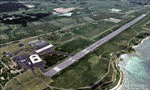
BORNHOLM ISLAND X DEMO features an extremely detailed scenery of Bornholm Island with EKRN Ronne airport in Denmark, fully compatible with both FSX and P3Dv1.
It's a fully functional DEMO version of the commercial payware product. It features same airport layout as in the full version but with limited 3D objects and low resolution textures. Using this free demo ensures no problems with online (VATSIM, IVAO, multiplayer etc.) flying in case some users use the payware scenery and some don't.
Bornholm is an island located in the Baltic Sea 37 km south of Sweden and the north of Poland. Bornholm Airport (RNN / EKRN) is a Danish airport located 2.7 nautical miles (5 km) southeast of Ronne.
This product is equipped with an automatic installer, which means that the scenery will be automatically added to the Flight Simulator Scenery Library.
Please uninstall all previous versions of this airport you may have installed before. Please make also sure that no duplicated AFCAD files are installed. Enjoy your virtual flying with Drzewiecki Design!
| Filename: | Bornholm_Island_X_DEMO.zip |
| License: | Commercial demo |
| Added: | 2nd September 2015, 21:47:52 |
| Downloads: | 1,787 |
| Author: | Drzewiecki Design |
| Size: | 15.39 MB |


© 2001-2026 AVSIM Online
All Rights Reserved
Privacy Policy |