
Where Flight Simulation Enthusiasts Gather from Around the World!
AVSIM Library - Search Results

| Category: Flight Simulator 2002 - Scenery | |
| Working TACAN Beacons in the Netherlands (For Default or NL2000 Scenery) |

|
File Description:
In real-life TACAN beacons require a TACAN receiver to receive the course (OBS) information of the beacon. With a civil VOR/DME receiver you only receive the distance (DME) from the beacon. The problem in FS is that there are no dedicated TACAN gauges, so it's not possible to perform TACAN approaches. These approaches require course information of the beacon. To overcome this problem this scenery modifies the TACAN beacons in the Netherlands so you can fully use them with civil receivers. So are able to fly TACAN approaches.
By Marcel Ritzema (Dutch FlyMil Group)
| Filename: | Working_TACAN_Beacons_in_the_Netherlands_For_Defau.zip |
| License: | Freeware, limited distribution |
| Added: | 21st April 2003, 12:32:18 |
| Downloads: | 643 |
| Author: | Marcel Ritzema |
| Size: | 15.7 KB |
| Category: Flight Simulator 2004 - AFCAD Files | |
| Corrado Gex, Aosta, Italy (LIMW/AOT) - Only for photoreal scenery use |
|
File Description:
A very simple AFCAD file to make compatible the LIMW airport with my photoreal scenery: Valle d'Aosta part 1 and 2. Search on AVSIM library "valle aosta" for more info.
| Filename: | Corrado_Gex_Aosta_Italy_LIMWAOT__Only_for_photorea.zip |
| License: | Freeware |
| Added: | 16th April 2007, 03:22:20 |
| Downloads: | 3,876 |
| Author: | Fulvio Mazzokan |
| Size: | 2.51 KB |
| Category: Flight Simulator 2004 - Scenery Design | |
| Visual Index and XML Code - Library objects for naval scenery design |
|
File Description:
A document - created with freeware "Open Office.org 1.1.4", that presents
pictures and XML code ( which you can copy and paste ) for the reuse of
various objects ( piers, marina, rig, port crane lighthouse and icebergs ) available
in the Microsoft "objects library" - included in FS 2004 - in your own scenery designs.
| Filename: | Visual_Index_and_XML_Code__Library_objects_for_nav.zip |
| License: | Freeware |
| Added: | 24th July 2005, 18:06:18 |
| Downloads: | 863 |
| Author: | Marc Renaud |
| Size: | 978.43 KB |
| Category: Civil Flight Simulators - Looking Glass Flight Unlimited 3 | |
| BGL2E Convert Static Scenery Models of MSFS to FU3 Version 1.8 |
|
File Description:
To convert static scenery models of MSFS to FU3 you need just the .bgl files of the scenery and BGLAnalyzer.exe to deassemble the file to .sca or .txt - then just load it with bgl2e.exe select the object you want and convert it to E-format. From there with the FU3 modeltools and mipmap utilities from Robert it's simple to finish the textured object. Use as texture the MSFS texture converted to GIF of not more than 256x256, if larger just resize to 256x256. This new version 1.8 will support colored poly, editing of material name, numbers, coordinates, excluding of labeled parts and polygons, excluding Objects then saving the edited version to an archive. More complex objects can be converted now see pictures bgl2e15.jpg / bgl2e17.jpg
| Filename: | BGL2E_Convert_Static_Scenery_Models_of_MSFS_to_FU3.zip |
| License: | Freeware, limited distribution |
| Added: | 1st September 2005, 12:38:25 |
| Downloads: | 255 |
| Author: | Andre Meystre |
| Size: | 675.64 KB |
| Category: Flight Simulator 2004 - Scenery Design | |
| LOM Images for ez-helicopters_and_pads Collection, an EZ Scenery Object Library |
|
File Description:
This archive contains an image import file containing thumbnails - or Image Files for use with Library Object Manager (LOM)- Version 1.0+ Program to Manage FS9 Library Objects and Create Scenery by ScruffyDuck Software, Jon Masterson. This is an image collection of 2 static helicopters and 9 other helicopter pads - Requires LOM (available on this site) and EZ Scenery Library ez-helicopters_and_pads.zip also available on this site. Also included is a set of higher resolution screenshots to upgrade those images imported into LOM. Higher resolution screenshots are suitable for printing an index or contact sheet of images. By Bryan Wallis.
| Filename: | LOM_Images_for_ezhelicopters_and_pads_Collection_a.zip |
| License: | Freeware |
| Added: | 2nd June 2006, 03:11:25 |
| Downloads: | 1,197 |
| Author: | Bryan Wallis |
| Size: | 507.95 KB |
| Category: Flight Simulator 2004 - AFCAD Files | |
| Tel Aviv LLBG & LLSD free & MAIW IDF scenery merge AFCADs v1.0 |
|
File Description:
This is a two AFCAD pack that allows you to enjoy both two great freeware airport sceneries, Ben Gurion (LLBG) by David Rosenfeld and Sde Dov (LLSD) by Nir Behar, available for Tel Aviv, Israel AND Military AI Works (MAIW) IDF package. See readme file for details.
| Filename: | Tel_Aviv_LLBG__LLSD_free__MAIW_IDF_scenery_merge_A.zip |
| License: | Freeware |
| Added: | 25th January 2008, 14:37:51 |
| Downloads: | 2,552 |
| Author: | Rysiek Winawer |
| Size: | 24.42 KB |
| Category: Flight Simulator 2004 - Scenery | |
| Canyonlands National Park South, Monticello (U43), Utah, Photo-Scenery (FSX too) |
|
Images related to this file:
File Description:
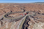
This scenery covers the southern part of Canyonlands National Park (Needles District) in Utah. The colorful layers of sand- and limestone that you can see today built over hundreds of millions years by advancing and retreating oceans as well as rivers that deposited huge amounts of sediment. About 15 million years ago these layers began to rise due to a colliding movement of plates in the earth's crust, forming what is today called the Colorado Plateau. As the land rose higher, erosion accelerated, resulting in countless canyons, mesas and buttes. The uplifting land caused the rivers to carve in even faster, resulting in the deep canyons of the Colorado and Green Rivers. The needles and fins in the Needles District have yet another story: First uplifts and later slides created a system of perpendicular cracks. Then he resulting crosshatched pattern of "joints" widened by erosion until only thin fins and needles of rock remained. The scenery extends my Arches National Park scenery to the south and brings you another 3.500 sq km in 4.7m/pix quality. To explore the scenery depart from Monticello (U43) and head north. YourDonation@Work: Dedicated to Nels, David and Michael. Thanks!
| Filename: | Canyonlands_National_Park_South_Monticello_U43_Uta.zip |
| License: | Freeware, limited distribution |
| Added: | 30th December 2009, 21:44:56 |
| Downloads: | 1,528 |
| Author: | Gottfried Razek - blueskyscenery.com |
| Size: | 95.76 MB |
| Category: Flight Simulator 2004 - Scenery | |
| Canyonlands National Park, The Maze-North, Utah, Photo-Scenery (FSX too) |
|
Images related to this file:
File Description:
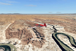
This is a re-upload of a package that was corrupted during the crash of the AVSIM library. The Maze is the wildest and least accessible district of Canyonlands National Park. It is a perplexing jumble of canyons that has been described as a '30 sq miles puzzle in sandstone'. The Maze covers the area west of the Green River and north of the Colorado River. Getting to most locations requires multiple hours of 4WD road driving. Hiking trails usually require multi day backpack trips.
Too strenous? Let's go flying! Checking out the area from an eagles perspective is certainly a stunning experience. The colors are awesome and the landforms are of breathtaking beauty. The scenery extends my Arches National Park scenery to the west and brings you another 3.500 sq km in 4.7m/pix quality. YourDonation@Work: Dedicated to Frans, Francois and James. Thanks!
| Filename: | Canyonlands_National_Park_The_MazeNorth_Utah_Photo.zip |
| License: | Freeware, limited distribution |
| Added: | 31st December 2009, 11:01:39 |
| Downloads: | 2,373 |
| Author: | Gottfried Razek - blueskyscenery.com |
| Size: | 92.88 MB |
| Category: Flight Simulator 2004 - Scenery | |
| Canyonlands National Park, The Maze-South, Utah, Photo-Scenery (FSX too) |
|
Images related to this file:
File Description:
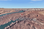
This is a re-upload of a package that was corrupted during the crash of the AVSIM library. This is the fourth package of the Arches/Canyonlands area. It covers the area southwest and including the confluence of the Colorado and Green Rivers. From there you can fly down Cataract Canyon which is famed for its premium whitewater rafting oportunities. Or explore the Maze (the area west of the Green and north of the Colorado River) with it's labyrinth of canyons and colorful sandstone formations. The scenery extends west to Hite (UT03) on Lake Powell. Brings the total Southern Utah coverage to 14.000 sq km in 4.7m/pix quality. YourDonation@Work: Dedicated to Patrick, Hideyuki and Art. Thanks!
| Filename: | Canyonlands_National_Park_The_MazeSouth_Utah_Photo.zip |
| License: | Freeware, limited distribution |
| Added: | 31st December 2009, 22:33:46 |
| Downloads: | 2,085 |
| Author: | Gottfried Razek - blueskyscenery.com |
| Size: | 95.67 MB |
| Category: Flight Simulator 2004 - Scenery | |
| Page (KPGA), Lake Powell West, Utah/Arizona, Photo-Scenery (FS9 & FSX) |
|
Images related to this file:
File Description:
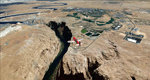
This scenery covers the western part of Lake Powell, the city of Page (KPGA), the Vermillion Cliffs, Glenn Canyon just south of Glenn Canyon Dam, the northern part of Marble Canyon, Paria Canyon, Cockscomb, etc, etc. Spectacular! To explore the scenery depart from Page Municipal Airport (KPGA). High resolution versions of this scenery for FS9 and FSX (much sharper, but larger and multiple downloads) are available at www.blueskyscenery.com/CNY_South3West3.html . The screenies are taken from the high-res versions, so expect this version to be slightly more blurry. YourDonation@Work: Dedicated to William, Veit and Michele.
| Filename: | Page_KPGA_Lake_Powell_West_UtahArizona_PhotoScener.zip |
| License: | Freeware, limited distribution |
| Added: | 3rd March 2010, 21:26:32 |
| Downloads: | 1,821 |
| Author: | Gottfried Razek - blueskyscenery.com |
| Size: | 92.41 MB |


© 2001-2026 AVSIM Online
All Rights Reserved
Privacy Policy |