
Where Flight Simulation Enthusiasts Gather from Around the World!
AVSIM Library - Search Results

| Category: Flight Simulator 2004 - Original Aircraft | |
| Savoia Marchetti S.79CS "Sparviero/Corsa-Transatlantico" |

|
Images related to this file:
File Description:

Civilian "CS" (Competizione Sportiva=Sporting Race) versions of the known medium and torpedo bomber Savoia-Marchetti S.79 "Sparviero", deployed by Regia Aeronautica, or Italian Royal Air Force, were successfully flown (w/civil marks) in the "Istres-Damascus-Paris (Lindberg Cup)" 1937 air race, where they ranked the first three places of the final scoreboard. The also "civilian" "T" (Transatlantic) version of the very same S.79 performed exceptionally in the 1938 Atlantic crossing Roma-Dakar-Rio de Janeiro and in a 1939 experimental test meant to verify the feasibility of an airline passengers and mail line between Italy and South America for the civilian airlines (Ala Littoria S.A.- Linee Aeree Atlantiche, later called L.A.T.I./Linee Aeree Transcontinentali Italiane) over the routes of Southern Atlantic Ocean.
3 new different GMax models, covering 3 different versions of the civilian S.79 described above and featuring the standard animated parts, such as all flight controls, props pitch and leading-edge slats. Ten (10) different liveries depicting all the S.79CS team which flew the 1937 Istres-Damascus-Paris Race, the 1938 Roma-Rio de Janeiro Expedition and 1939 Transatlantic Test flight. This plane was originally developed for FS9, but an FSX version is also available in another separated release. VC only. GMax Models and Skins by Manuele Villa & Italianwings.Installation instructions included. By Manuele Villa/MVG3D, April 2016.
| Filename: | Savoia_Marchetti_S79CS_SparvieroCorsaTransatlantic.zip |
| License: | Freeware |
| Added: | 22nd April 2016, 22:22:42 |
| Downloads: | 330 |
| Author: | Manuele Villa |
| Size: | 54.25 MB |
| Category: Flight Simulator X - Scenery | |
| Deshi Sceneries - Deshi Dhaka (VGHS/VGZR) Shahjalal/Zia International Airport, Dhaka, Bangladesh |
|
Images related to this file:
File Description:

This is the first and only full freeware scenery released for VGHS/VGZR Dhaka, Bangladesh. This has been a work in progress since 2012, and in 2016 we decided to make it public beta for the Bangladeshi Flight Sim Community. The team wasn't able to work further on this and the project was taken over by another developer who worked alongside our team. After years of hard work, we finally were able to collaborate with Final Approach Design Simulations, and released the full and final version of this scenery for P3D V4-5, in the simMarket as payware. While the FSX version was untouched and not upgraded further, we wanted to publish it online as a freeware scenery and NO MORE A BETA TEST. We hereby have uploaded the scenery, and according to our EULA, we are HEREBY changing the clause that states it is only to be used by Bangladeshi and that it is a limited release. We HEREBY declare it a full release for FSX, and we are allowing all nationalities to use our software. We hope you enjoy this free release and if you are a P3D V4-5 user, go check out our final product in the simMarket under the title "HAZRAT SHAHJALAL DHAKA VGHS DAC P3D4-5" by "Final Approach Design Simulations".
| Filename: | Deshi_Sceneries__Deshi_Dhaka_VGHSVGZR_ShahjalalZia.zip |
| License: | Freeware, limited distribution |
| Added: | 17th July 2022, 15:33:37 |
| Downloads: | 771 |
| Author: | Shafat Hasan, Karib Ahmed, Melus Haque, Imran Uddin |
| Size: | 41.24 MB |
| Category: Flight Simulator 2004 - Scenery | |
| Denver (KDEN), Colorado, Photo-Scenery |
|
Images related to this file:
File Description:
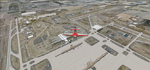
Denver (KDEN), Colorado, Photo-Scenery for FS9 & FSX.
This package covers Denver, the capital of Colorado which is also nicknamed Mile-High City because its elevation is one mile (5.280 ft). The sixth RW (16R/34L) of Denver Int'l. Airport (KDEN) is the longest commercial RW in the US with a length of 16.000ft. This allows fully loaded B747's to take off in Denvers mile-high altitude during hot summer days, when density altitudes can approach 9.000(!) ft.
KDEN is a major hub for United Airlines and the headquarters for Frontier Airlines. The airports distinctive white tent-like fabric roof is designed to be reminiscent of the snow-covered peaks of the Rocky Mountains which you can see on approach or departure.
Other important airports covered by this region are Centennial Airport (KAPA), Buckley AFB (KBKF) and Rocky Mountain Metropolitan Airport (KBJC). Extends my Mt.Evans/Georgetown package to the east and provides another 3.500 sq km in 4.7m/pix quality.
High resolution versions for FS9 and FSX (much sharper, but larger and multiple downloads) are available at www.blueskyscenery.com/GNB_SouthEast.html
. The screenies are taken from the high-res versions, so expect this version to be slightly more blurry. YourDonation@Work: Dedicated to Mark and Charles. Thanks!
| Filename: | Denver_KDEN_Colorado_PhotoScenery.zip |
| License: | Freeware, limited distribution |
| Added: | 31st October 2009, 11:24:39 |
| Downloads: | 7,292 |
| Author: | Gottfried Razek, blueskyscenery.com |
| Size: | 95.21 MB |
| Category: Flight Simulator 2004 - Scenery | |
| Union Island TVSU in the Grenadines, eastern Caribbean Version 1.1 |
|
Images related to this file:
File Description:
This is a self-contained version 1.1 that modifies the terrain flattens around the airport. I found that suddenly, and for no apparent reason, the Lesser Antilles mesh and my flattens were at war and creating hills within the airport boundary. If you are not having problems then you do not need this.
Union Island is in the southern tail of the chain of islands known as St Vincent and the Grenadines, between Canouan and Carriacou. Union is another small island, 3.5 miles long and at its widest 1.5 miles wide; the resident population is around 3,000, mostly in the two towns Clifton and Ashton. The airport is at the eastern end of the island, and has been extended into the sea on landfill. The runway is now around 2,480 feet long, aligned 08 (and with the southeast trade winds it is unlikely that you will find yourself using 26) and with a displaced threshold of 530 feet due to the hill to the west. The terminal is adjacent to a rather small apron; there is parking on the grass north of the taxiway. There are connecting flights by SVG to Barbados and the other islands and these are reflected in the AI. The airport has no lighting, and flights are obliged to land and depart in daylight hours only, outside of which the airport is closed.
| Filename: | Union_Island_TVSU_in_the_Grenadines_eastern_Caribb.zip |
| License: | Freeware, limited distribution |
| Added: | 16th June 2013, 18:46:33 |
| Downloads: | 532 |
| Author: | Roger Wensley |
| Size: | 2.02 MB |
| Category: Flight Simulator 2004 - Scenery | |
| Airstrips of Central Germany |
|
Images related to this file:
File Description:
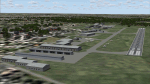
Another selection in my Airstrips of Western Europe project, herewith 80+ small airfields in central Germany, each enhanced with taxiways, parking spaces, buildings etc. and aprons as appropriate, to further facilitate the generation of lightweight AI traffic in the area, without overloading the more major airfields.
Again, there's no photo-realism here, just a selection of basic 'generic' buildings, more or less accurately sized and placed to reflect the airfield layout as seen on on-line satellite imagery and aerial photography. These buildings have minimal effect on frame-rates, so are ideal for this kind of job. The airfields are aligned as well as possible with the roads etc. in UT Europe and the Genesis Europe mesh, but should mostly be fine in a default installation or other configuration.
As before, the files for each airfield can be easily identified by the ICAO code, even if the airfield names vary slightly, so you can pick and choose and mix and match to suit any sceneries you already have, should you so wish. There is no requirement for any other download. Each airfield will exist as a stand-alone entity should you only want a few of them.
Please read the rest of this "blurb" in the included text file. There may be some details of note or interest.
| Filename: | Airstrips_of_Central_Germany.zip |
| License: | Freeware |
| Added: | 26th February 2025, 19:22:06 |
| Downloads: | 118 |
| Author: | Chris Eve |
| Size: | 1.14 MB |
| Category: Flight Simulator X - Scenery | |
| RAF Hooton Park - Cheshire, England |
|
File Description:
RAF Hooton Park, on the Wirral Peninsula, Cheshire, was a Royal Air Force station originally built for the Royal Flying Corps in 1917 as a training aerodrome for pilots in World War I. During the early/mid-1930s, it was one of the two airfields (with Liverpool Speke) handling scheduled services for the Merseyside region. Hooton Park was home to No. 610 (County of Chester) Squadron and, post World War II, to No. 611 (West Lancashire) and No. 663 (AOP) Squadron.
The airfield closed in 1957 after the disbandment of the Royal Auxiliary Air Force, but the three pairs of Belfast Truss hangars erected in 1917 survived the closure. The site was bought by Vauxhall Motors, who built their Vauxhall Ellesmere Port plant there, which today produces the Vauxhall Astra. A small remaining section of the airfield site is now owned and managed by The Hooton Park Trust. The hangars are also home to The Griffin Trust and an aircraft preservation society named The Aeroplane Collection. Another part of the old airfield, including a length of the old paved runway, perimeter track and the apron used to park Meteor jet fighters, remains in the ownership of The Naylor Trust. A Second World War B1 hangar is also on this site.
Third party add-on's will be required see the readme.txt for details.
| Filename: | RAF_Hooton_Park___Cheshire_England.zip |
| License: | Freeware |
| Added: | 13th December 2015, 12:12:02 |
| Downloads: | 196 |
| Author: | Terry Boissel |
| Size: | 1.47 MB |
| Category: Flight Simulator 2004 - Scenery | |
| Z19O - Hamat Airbase - Batroun, Lebanon |
|
Images related to this file:
File Description:
Hamat is a village near the coast of Lebanon, around 25 miles north of Beirut. The airport runway was built during the civil war to the west of Hamat in the late 1970's, between Hamat and another village called Wuajh Al Hajar. The intention was have an alternative to Beirut airport, which could be (and often was) closed by shell fire from any or all of the sides involved in the civil war, or by bombing by those who were not directly part of the civil war but occasionally joined in. It has been used for drag racing, occasional freefall parachuting (this may continue) and is now an army base with mostly helicopter use. The runway is around 5,600 feet of asphalt, 90 feet wide and aligned 02/20. There is no lighting. The apron is set well back from the runway and has hangars at each end; one set is four hangars long, and at the other end of the apron there are three hangars. There are also the remains of some radar to the west of the apron, bombed (in 1982?). The runway has been repositioned and the surrounding landclass modified to reduce one village to it's approximate actual size and to create a second village which was missing entirely. An intrusive road has been deleted, and the airfield grass area also modified.
| Filename: | Z19O__Hamat_Airbase__Batroun_Lebanon.zip |
| License: | Freeware, limited distribution |
| Added: | 23rd May 2015, 10:03:10 |
| Downloads: | 226 |
| Author: | Roger Wensley |
| Size: | 8.53 MB |
| Category: Flight Simulator 2004 - Helicopters | |
| AIR LLOYD ( Germany ) MBB BO 105 CBS5 D-HBWH |
|
File Description:
This Zip-file includes a repaint of the D-HBWH, witch is courently flying for Air-LLOYD (Deutsche Helicopter Flugservice GmbH)
The helicopter is a MBB BO105CBS-5 [c/n S-929, Baujahr 1997] with short rotorhead.
The Helicopter is Used for detecting leaks in gas lines in Germany. For this operation there are several build in sensors of the ADLARES system (gas detecting by laser measurement )mounted on the Helicopter
Within this Repaint you get an new Airfile with more realistic Flight-Dynamics.
The Repaint based on the BO 105 by Güther Krämer and should work with FS2004 and FS2002
If you havent any BO 105 from Güther Krämer you can download a BO 105- Pack with Sound, Panel and a lot of other Repaints at www.va-luftrettung.de or from Günther Krämers the Website (www.gkflusi.de)
| Filename: | AIR_LLOYD__Germany__MBB_BO_105_CBS5__DHBWH.zip |
| License: | Freeware |
| Added: | 26th June 2006, 19:09:21 |
| Downloads: | 1,573 |
| Author: | Joerg Hammes |
| Size: | 1.69 MB |
| Category: Flight Simulator 2004 - Scenery | |
| Pascua Island,South America,V1,Soaring |
|
File Description:
FS2002/2004 Pascua Island,South America,V1,Soaring Scenery
This file came about because I wanted some thermals lifts to navigations glider´s flights over Pascua Island,Chile Region,South America.It is first file of five steps files thermals pack to flight from Pascua to Santiago.
Installation:
FS2004 - Paste Scenery file inside Microsoft Games folder overwriting older Scenery file.
FS2002 - Paste Scenery file inside FS2002´s overwriting existing Scenery Folder,AND AFTER you MUST ACTIVATE tHERMALS fiLE as below steps patH:
1.Start FS2002
2.Mouse - Right click - ativate upper tool bar
3.Choose World
4.Choose Scenery Library
5.Choose Add area
6.Choose Scenery
7.choose Thermals
8.Choose Add area
9.Choose OK
10.Restart FS2002
It is Freeware.
Good flights end better Landings.
Volta Redonda,Brazil,05/25/2006
Design: Francisco Vargas.
E-mail: [email protected]
| Filename: | Pascua_IslandSouth_AmericaV1Soaring.zip |
| License: | Freeware |
| Added: | 16th July 2006, 04:38:37 |
| Downloads: | 367 |
| Author: | Francisco Augusto Vargas Carneiro |
| Size: | 2.08 MB |
| Category: Flight Simulator 2004 - Scenery | |
| Pascua Island,South America,V1,Soaring |
|
File Description:
FS2002/2004 Pascua Island,South America,V1,Soaring Scenery
This file came about because I wanted some thermals lifts to navigations glider´s flights over Pascua Island,Chile Region,South America.It is first file of five steps files thermals pack to flight from Pascua to Santiago.
Installation:
FS2004 - Paste Scenery file inside Microsoft Games folder overwriting older Scenery file.
FS2002 - Paste Scenery file inside FS2002´s overwriting existing Scenery Folder,AND AFTER you MUST ACTIVATE tHERMALS fiLE as below steps patH:
1.Start FS2002
2.Mouse - Right click - ativate upper tool bar
3.Choose World
4.Choose Scenery Library
5.Choose Add area
6.Choose Scenery
7.choose Thermals
8.Choose Add area
9.Choose OK
10.Restart FS2002
It is Freeware.
Good flights end better Landings.
Volta Redonda,Brazil,05/25/2006
Design: Francisco Vargas.
E-mail: [email protected]
| Filename: | Pascua_IslandSouth_AmericaV1Soaring.zip |
| License: | Freeware |
| Added: | 16th July 2006, 04:38:53 |
| Downloads: | 401 |
| Author: | Francisco Augusto Vargas Carneiro |
| Size: | 2.46 MB |


© 2001-2026 AVSIM Online
All Rights Reserved
Privacy Policy |