
Where Flight Simulation Enthusiasts Gather from Around the World!
AVSIM Library - Search Results

| Category: Flight Simulator 2004 - Scenery | |
| Kimmirut CYLC on Baffin Island in Nunavut, Canada |

|
Images related to this file:
File Description:
Kimmirut is a village of some 400 folks at the southern end of the southwest-facing coast of Baffin Island, 75 miles southwest of Iqaluit. It is on the northern side of the Hudson Strait between Baffin Island and Quebec, opposite Kangiqsujuaq on the Quebec shore. The airfield is served by two flights per week, one on Monday and another on Friday, only half fueled to be able to use the 1,899' of gravel 75' wide runway. The terminal building is small and there is a garage building for airport maintenance vehicles (snow clearing). There are some nearby buildings that I have included. The village is "represented" (not "modeled") with approximately the right shape and road layout. Take enough fuel so that you can leave again, as fuel is no longer for sale here. The Cape Dyer bgls are to make a small correction, it is explained in the text. I will not be posting new sceneries in the future and this is the last one for Avsim; it completes Baffin Island.
| Filename: | Kimmirut_CYLC_on_Baffin_Island_in_Nunavut_Canada.zip |
| License: | Freeware, limited distribution |
| Added: | 25th July 2011, 17:36:57 |
| Downloads: | 534 |
| Author: | Roger Wensley |
| Size: | 2.53 MB |
| Category: Flight Simulator 2004 - Scenery | |
| Union Island TVSU in the Grenadines |
|
Images related to this file:
File Description:
Union Island is in the southern tail of the chain of islands known as St Vincent and the Grenadines, between Canouan and Carriacou. Union is another small island, 3.5 miles long and at its widest 1.5 miles wide; the resident population is around 3,000, mostly in the two towns Clifton and Ashton.
The airport is at the eastern end of the island, and has been extended into the sea on landfill. The runway is now around 2,480 feet long, aligned 08 (and with the southeast trade winds it is unlikely that you will find yourself using 26) and with a displaced threshold of 530 feet due to the hill to the west. The terminal is adjacent to a rather small apron; there is parking on the grass north of the taxiway. There are connecting flights by SVG to Barbados and the other islands and these are reflected in the AI. The airport has no lighting, and flights are obliged to land and depart in daylight hours only, outside of which the airport is closed.
| Filename: | Union_Island_TVSU_in_the_Grenadines.zip |
| License: | Freeware, limited distribution |
| Added: | 11th June 2013, 23:26:50 |
| Downloads: | 435 |
| Author: | Roger Wensley |
| Size: | 2.02 MB |
| Category: Prepar3D V1-4 - Scenery | |
| The island of Capraia N43.3.2 E9.50.13 and City |
|
File Description:
The island of Capraia N43.3.2 E9.50.13 is located in the Corsica Channel (arm of the sea on the border between the Ligurian Sea and the Tyrrhenian Sea), and is an island of volcanic origin, the third largest in the Tuscan Archipelago. It has high and rocky coasts with no beaches (sometimes in the Cala della Mortola there is a small sandy beach [5]) and a small lake basin (called Stagnone or Laghetto [6]) in the most mountainous area, with peaks along a central chain Anticamente called Aigylion Greeks and then Capraria from the Romans, the name derives from the presence of wild goats on the island, but according to another hypothesis the toponym derives from a Mediterranean theme * karpa with the meaning of «rock». It was certainly an Etruscan landing place like the other Tyrrhenian islands in the 7th century, becoming a pirate base when it was occupied by the Romans.Important VFR point for approaching fron Nord airport Isola d'Elba.
Within the downloaded package you will find readme files for scenery installation. Good fly VFR. Pasquale Marrulli.
| Filename: | The_island_of_Capraia_N4332_E95013_and_City.zip |
| License: | Freeware |
| Added: | 2nd January 2018, 17:31:32 |
| Downloads: | 154 |
| Author: | Pasquale Marrulli |
| Size: | 2.8 KB |
| Category: Flight Simulator 2004 - Aircraft Repaints, Textures and Modifications | |
| Dutch Navy Lockheed PV-2 Harpoon |
|
Images related to this file:
File Description:
Featured is Royal Netherlands Navy 19-10, ex-US Navy BuNo 37260, Lockheed c/n 15-1226. VSQ320 at Valkenburg operated 18 PV-2s under MDAP (Mutual Defense Assistance Program) from September 1951 till December 1953, when they were replaced by Lockheed P2V-5 Neptunes. The Harpoons were not only used for maritime reconnaissance during their short career in Dutch service. Search and rescue was another main task, and particularly in February 1953 during the tidal flooding of the Southwest of the Netherlands they played a vital role in the rescue and supply operations (food for people and live stock, empty sandbags, etc.). 19-10 served from 29 September 1951 till 16 November 1953 with VSQ320 and then till June 1954 with VSQ8 (Search and Rescue). Like her 17 sister ships she then moved to the Portuguese Navy. You will require Milton Shupe and Team's FS2004 or FSX Lockheed PV-2 Harpoon (harpfs9v13.zip resp. harpfsxv13.zip). Repaint by Maarten Brouwer.
For FS2004 and FSX.
| Filename: | Dutch_Navy_Lockheed_PV2_Harpoon.zip |
| License: | Freeware, limited distribution |
| Added: | 19th September 2015, 21:22:16 |
| Downloads: | 191 |
| Author: | Maarten Brouwer |
| Size: | 15.4 MB |
| Category: Flight Simulator X - Scenery | |
| RAF Dalton |
|
File Description:
RAF Dalton was named after a local village although it was closer to RAF Topcliffe who it was intended to be the
satellite for.
RAF Dalton was home to No. 102 Squadron beginning in November 1941. No. 102 Squadron returned to Topcliffe in June
1942 and for a time Dalton hosted No. 1652 Heavy Conversion Unit (HCU) flying Halifaxes. The airfield was improved in
1942 and in early 1943 was allocated to No. 6 Group Royal Canadian Air Force (RCAF). Canadian squadrons stationed
here at one time or another included No. 428 Squadron, No. 424 Squadron, No. 420 Squadron, and No. 1666 Heavy
Conversion Unit (which moved to RAF Wombleton in October 1943). The station also housed no. 1691 Bomber Gunnery Flight
(BGF) RCAF and its successor, No. 1695 Bomber Defence Training Flight (BDTF) RCAF, the last RCAF unit to serve at this
station.
In November 1944, control passed from No. 6 Group to the new No. 7 (Training) Group. By August 1945 all units at
Dalton were disbanded or transferred and the Station closed in 1946.
Source:Wikipedia
| Filename: | RAF_Dalton.zip |
| License: | Freeware |
| Added: | 26th February 2017, 07:30:47 |
| Downloads: | 80 |
| Author: | Terry Boissel |
| Size: | 1.57 MB |
| Category: Flight Simulator X - Scenery | |
| FSX Portland International Airport KPDX |
|
Images related to this file:
File Description:
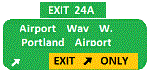
Welcome to Portland International Airport for FSX!
The City of Roses is in the process of revamping KPDX. Many of us have spent time on Concourse A
waiting for our Horizon flight. Many have utilized the ground level walkways on Concourse E to
get to their United Express flight. Both are things of the past.
KPDX is now a primary Alaska Airlines hub. This summer British Airways will start service to London
Heathrow.
The runways have been adjusted to their current length. The taxiways have been corrected (this is
particularly important at the juncture of 10L and 21 which used to overlap). A copy of the current
airport diagram is included.
All the buildings (with the exception of the tower) are custom. Airport vehicles use
the proper vehicle paths and do not use taxiways.To achieve this I had to add a vehicle path that crosses
10R and another that crosses 03.
Three scenery complexity levels are used (normal,dense, and very dense). More eye candy appears with each
increase.
| Filename: | FSX_Portland_International_Airport__KPDX.zip |
| License: | Freeware, limited distribution |
| Added: | 15th January 2020, 05:01:47 |
| Downloads: | 1,790 |
| Author: | Brett Delana |
| Size: | 12.18 MB |
| Category: Flight Simulator 2004 - Scenery | |
| Grande Cache CEQ5 in Alberta, Canada |
|
Images related to this file:
File Description:
Grande Cache is at 4,117 feet above sea level, just under 90 miles south of Grande Prairie and 220 miles west of Edmonton. It is among the eastern foothills of the Rockies. The town was established to accommodate employees of a coal mine and their families in the early 1970's. There was a financial roller coaster ride for the coalmine during the next few years and despite the opening of a wood chip plant and a federal prison the town was eventually downgraded to a hamlet by a vote in 2018, as it was essentially bankrupt and had a population of less than 4,500. The airport, some 10 miles east of the town, had two aprons, one for GA and scheduled flights and another, the eastern one, for fire fighting planes. I say "had" as it was closed in January 2017. However, the fire fighting area appears to have been maintained (tanks repainted, for instance) and is presumably able to support operations if required. The date for this scenery is 2009.
| Filename: | Grande_Cache_CEQ5_in_Alberta_Canada.zip |
| License: | Freeware, limited distribution |
| Added: | 29th September 2021, 03:59:20 |
| Downloads: | 89 |
| Author: | Roger Wensley |
| Size: | 7.49 MB |
| Category: Flight Simulator X - Scenery | |
| EGVL - RAF Little Rissington - Gloucestershire, England |
|
File Description:
RAF Little Rissington (ICAO: EGVL) is an RAF aerodrome and former RAF station in Gloucestershire, England. It was once home to the Central Flying School, the Vintage Pair and the Red Arrows.
Built during the 1930s, the station was opened in 1938 and closed in 1994. The married-quarters and main technical site were sold in 1996 (the former becoming the village of Upper Rissington), but the aerodrome has been retained by the Ministry of Defence and remains active along with the southern technical sites, under the operational control of HQ No.2 Flying Training School at RAF Syerston.
It is now home to 637 Volunteer Gliding Squadron as the primary military unit, who provide elementary flying training for Combined Cadet Force and Air Training Corps cadets. The airfield is also used by the forces as a relief landing ground, training area and parachute dropping area. In previous years, the Royal Air Force estate has been used as a film set, including The Avengers, part of the ice chase in Die Another Day, and the Thunderbirds film. Souce: Wikipedia
| Filename: | EGVL__RAF_Little_Rissington__Gloucestershire_England.zip |
| License: | Freeware |
| Added: | 23rd November 2015, 14:41:23 |
| Downloads: | 466 |
| Author: | Terry Boissel |
| Size: | 19.74 KB |
| Category: X-Plane - Original Aircraft | |
| GlassWing: the Visible Biplane (Xp v7.62) |
|
File Description:
Welcome to GlassWing, the most detailed aircraft yet made for X-Plane. It represents a new generation of Xp planes: aircraft modeled mostly outside of PlaneMaker.
GlassWing is a four place, all metal sport biplane made for mountain flying. It offers superb climb rates, very short field capabilities and a high service ceiling. With its transparent skin, every major aircraft component is visible: spars, ribs, hinges and more. Right down to the spark plugs. It is a good visual tool for any flight school. It also shows the relationship between power and trim.
GlassWing can haul almost 700 pounds into remote regions, for scenic and challenging flights. With its 300 horsepower V8 engine, it climbs like a homesick angel and can turn on a dime. Comes with Greg Hofer's Garmin AVD 55 GPS plug in (PC only) for easy navigation. GlassWing is an excellent barnstormer, ribbon cutter, hangar and Tower buzzer.
Join Doug and Allison with their husky dog Sitka, on a weekend camping flight into the hills. Try some real flying: in the mountains, not over them. Land where no one has landed before. A good system with 128 VRAM is recommended for smooth flights. Fly the GlassWing today ! VISIT THE SCREENSHOT GALLERY AT: http://www.x-plane.org/home/xplanechris/GlassWing/Gallery/GlassWingGallery.html
| Filename: | GlassWing_the_Visible_Biplane_Xp_v762.zip |
| License: | Freeware |
| Added: | 8th January 2005, 05:45:33 |
| Downloads: | 387 |
| Author: | Christopher Coggon |
| Size: | 2.63 MB |
| Category: Flight Simulator 2004 - Aircraft Repaints, Textures and Modifications | |
| Lucky Partners Boeing B-17G |
|
File Description:
This is a repaint (textures only) for the Donationware B-17G Late from FighterTown Design Group. You can get it here for a great price!! www.donationware.net
Thank you FDG for providing this great plane!!
Special thanks go to Jarink, who is a repainter in IL-2/PF. Jarink was kind enough to send me his layered photoshop files of the Noseart that I used for these repaints. I also used his repaints as a guide for my repaints.
This texture represents "Lucky Partners" from the 710th Bomb Squadron, 447th Bomb Group. Lucky Partners had been known to have been a part of the 447th, based on a few photographs taken at Rattlesden during the spring of 1945. Yet the actual identify of the aircraft remained in question. The nose panel now preserved in Kingman had been cut below the location of the factory-painted serial number, and the existing photos showed that the name "Lucky Partners" had been painted over the last three (and most significant) digits of that serial number.
It was originally named Little Herbie by the Hoffman crew, but did not bear any name or nose art until much later, when its name changed to Lucky Partners.
| Filename: | Lucky_Partners_Boeing_B17G.zip |
| License: | Freeware |
| Added: | 31st August 2006, 14:02:03 |
| Downloads: | 114 |
| Author: | Brian Hill/Fightertown Design Group |
| Size: | 4.42 MB |


© 2001-2026 AVSIM Online
All Rights Reserved
Privacy Policy |