
Where Flight Simulation Enthusiasts Gather from Around the World!
AVSIM Library - Search Results

| Category: Flight Simulator 2004 - Aircraft Repaints, Textures and Modifications | |
| Eurowings "Europa Park" Airbus A320-214 (D-ABDQ) |

|
Images related to this file:
File Description:

This is a repaint of the excellent Project Airbus A320-214, in Eurowings "Europa Park" livery, D-ABDQ. Model included. The textures are saved in 32 bit format for quality graphics. Shine effect. Night textures by Adam Hamada. Contains accurate model with details such as: opening passenger and cargo doors, animated pack inlets and outflow valves, all operable control surfaces, detailed flap tracks and slat rails, hydraulics modelled on spoilers, landing gear doors and many more. For updates visit the website of Project Airbus: www.pafs.wf
| Filename: | Eurowings_Europa_Park_Airbus_A320214_DABDQ.zip |
| License: | Freeware |
| Added: | 9th April 2017, 07:30:38 |
| Downloads: | 577 |
| Author: | Stefan Bree, Project Airbus |
| Size: | 14.17 MB |
| Category: Flight Simulator 2004 - Aircraft Repaints, Textures and Modifications | |
| Austrian Airlines Airbus A320-214 |
|
Images related to this file:
File Description:

The Project Airbus A320 painted in the latest Austrian Airlines colours. Includes, custom alpha to make fuselage shine, custom shadow, realistic tail, many accurate renditions of the real world 'OE-LBN.' Exterior textures in high quality 32bit. Please note this: since Project Airbus did NOT include custom mapping for the upper area above the cockpit windows, the two registration letters there will not be included. Compatible with FSX and FS9. Textures only, base pack must be downloaded separated from "www.pafs.wf". Visit "www.gearlesspaints.weebly.com" for more paints.
| Filename: | Austrian_Airlines_Airbus_A320214.zip |
| License: | Freeware, limited distribution |
| Added: | 18th June 2012, 19:35:33 |
| Downloads: | 1,925 |
| Author: | Matt Wang, Project Airbus |
| Size: | 7.99 MB |
| Category: Flight Simulator X - Scenery | |
| ENHV - Honningsvag-Valan - Honningsvag, Norway |
|
Images related to this file:
File Description:
ENHV is the most northern airport in Europe (self-promotion of the airport). It it situated on a promontory 46 feet above the sea a few miles southeast of the Nordkap.
This scenery is not a stand-alone-scenery. It is an update of the Airports of Norway (AoN) where ENHV is already included. So AoN has to be installed first to see the buildings and the objects on this airport.
In addition the Nordkap is included with the rock, the museum and the viewing point.
AON you can download here:
http://www.flightsimnorway.com/addons/default.php?funct=dl&pack=aon
Also recommended is to install are the corresponding Photo sceneries AoN Phatopack 1 + 2:
http://www.flightsimnorway.com/addons/default.php?funct=dl&pack=aon
There are some errors corrected In ENHV that occur in the AoN:
1. The altitude is adjusted to the correct height of 46 feet.
2. The sea is where it should be.
3. The land classes are partially adjusted.
4. The town of Honningsvag is involved.
5. The Northern Cape is included, but can be installed separately.
| Filename: | ENHV__HonningsvagValan__Honningsvag_Norway.zip |
| License: | Freeware |
| Added: | 19th October 2015, 18:54:47 |
| Downloads: | 1,927 |
| Author: | Wolfgang Allers |
| Size: | 131.64 MB |
| Category: Flight Simulator 2004 - Aircraft Repaints, Textures and Modifications | |
| Strathair Douglas DC-3 |
|
File Description:
Strathair was formed in 1962 based at Strathallen Castle, Scotland. In May 1966 a DC-3 G-APPO was acquired with the intention of operating scheduled services. It was based at Edinburgh but did little flying apart from crew training and an ocasional charter flight. By October of that year it had moved on to new owners. In April 1967, another DC-3 G-AOGZ was purchased and this was considerably more active than the previous one. It was kept busy on passenger and feight charter flights and also operated scheduled services on behalf of British United out of Blackpool. 1967 saw the aircraft move to Aberdeen where it was used on oil-rig support flights on behalf of B.E.A. to Sumburgh and Teesside. The DC-3 continued operating this kind of work until March 1969 when it was sold. This repaint is of G-AOGZ. Requires default Douglas DC-3.
| Filename: | Strathair_Douglas_DC3.zip |
| License: | Freeware |
| Added: | 15th April 2007, 00:04:59 |
| Downloads: | 282 |
| Author: | John Payne |
| Size: | 1.65 MB |
| Category: Flight Simulator 2004 - Scenery | |
| Tillsonburg CNQ4 in Ontario Canada REPLACEMENT |
|
File Description:
This is a replacement (though complete in itself) for my original Tillsonburg post with the corrected office building included. Tillsonburg is a small town in southwest Ontario, mid way between Toronto, Buffalo, and Detroit. The airfield is some four miles north of the town. It was originally built by the RCAF as an emergency grass field to support flying training in WW2. It now has two grass runways, each 2,400 feet long, and another 4,000 feet long that is asphalt. There is a company that carries out painting and ulholstery work, a flight school, and of course the Canadian Harvard Aircraft Association, which is a volunteer organisation that does what the title suggests and takes care of Harvards, I think six of them plus a Tiger Moth, and something else. And when I was there two years ago and in the winter there was a licensed AME just starting up.
| Filename: | Tillsonburg_CNQ4_in_Ontario_Canada_REPLACEMENT.zip |
| License: | Freeware |
| Added: | 12th November 2008, 14:48:26 |
| Downloads: | 665 |
| Author: | Roger Wensley & Jim Turner |
| Size: | 1.43 MB |
| Category: Flight Simulator 2004 - Scenery | |
| Canyonlands National Park, The Maze-North, Utah, Photo-Scenery (FSX too) |
|
Images related to this file:
File Description:
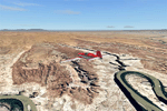
This is a re-upload of a package that was corrupted during the crash of the AVSIM library. The Maze is the wildest and least accessible district of Canyonlands National Park. It is a perplexing jumble of canyons that has been described as a '30 sq miles puzzle in sandstone'. The Maze covers the area west of the Green River and north of the Colorado River. Getting to most locations requires multiple hours of 4WD road driving. Hiking trails usually require multi day backpack trips.
Too strenous? Let's go flying! Checking out the area from an eagles perspective is certainly a stunning experience. The colors are awesome and the landforms are of breathtaking beauty. The scenery extends my Arches National Park scenery to the west and brings you another 3.500 sq km in 4.7m/pix quality. YourDonation@Work: Dedicated to Frans, Francois and James. Thanks!
| Filename: | Canyonlands_National_Park_The_MazeNorth_Utah_Photo.zip |
| License: | Freeware, limited distribution |
| Added: | 31st December 2009, 11:01:39 |
| Downloads: | 2,373 |
| Author: | Gottfried Razek - blueskyscenery.com |
| Size: | 92.88 MB |
| Category: Flight Simulator 2004 - Scenery | |
| Lake Powell East / Natural Bridges National Monument, Utah, Photo-Scenery |
|
Images related to this file:
File Description:
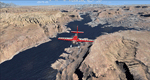
Lake Powell East / Natural Bridges National Monument, Utah, Photo-Scenery (FS9 & FSX)
This scenery covers the eastern part of Lake Powell from just south of Hite (UT03) and goes down south along White Canyon, Natural Bridges National Monument and the Grand Gulch Primitive Area all the way to the San Juan River. It extends my Canyonlands sceneries to the south and brings you another 3.500 sq km of wonderful southern Utah in 4.7m/pix quality. To explore the scenery depart from Cal Black Memorial Apt. (U96) and head east. High resolution versions of this scenery for FS9 and FSX (much sharper, but larger and multiple downloads) are available at www.blueskyscenery.com/CNY_South2West.html. The screenies are taken from the high-res versions, so expect this version to be slightly more blurry. YourDonation@Work: Dedicated to Guy, Ruben and EDB.
| Filename: | Lake_Powell_East__Natural_Bridges_National_Monumen.zip |
| License: | Freeware, limited distribution |
| Added: | 4th January 2010, 19:19:43 |
| Downloads: | 1,873 |
| Author: | Gottfried Razek, blueskyscenery.com |
| Size: | 95.26 MB |
| Category: Flight Simulator 2004 - Scenery | |
| Snowden Farm CF39, in Ontario Canada |
|
Images related to this file:
File Description:
Another airfield close to Highway 11, further south towards Lake Simcoe. Snowden Farm is a bit over five miles south of Huntsville and east of of highway 11. The grass runway 12/30 is just over 2,000 feel long and sandwiched between Penfold Lake to the north, and on the south side a large pond with a creek that connects to the much larger Mary Lake to the east. There is a hangar and a shed at the eastern end of the runway. There is one airfield scenery file, and two landclass files to provide the grassed area and the large pond and creek. I presume that the pond was just a little too small to register with Ultimate Terrain. The scenery might work without Ultimate Terrain but I haven't tested it, and for sure without it Penfold Lake and probably Mary Lake won't appear.
| Filename: | Snowden_Farm_CF39_in_Ontario_Canada.zip |
| License: | Freeware, limited distribution |
| Added: | 5th February 2010, 03:51:07 |
| Downloads: | 298 |
| Author: | Roger Wensley |
| Size: | 837.43 KB |
| Category: Flight Simulator 2004 - Aircraft Repaints, Textures and Modifications | |
| China Southern, Embraer ERJ-145 (B-3060), v2 |
|
Images related to this file:
File Description:

I originally released this aircraft here on January 26th 2007. I recently received some valuable input from He Lingyuan, a fellow simmer from the great land of China. This input lead to a correction on the Chinese lettering on the right side of the fuselage. Thank you He Lingyuan. So, I took this opportunity to correct another problem with this aircraft repaint; the Rolls Royce engine logos. They were missing from the original repaint. They are now present. So, with these changes consider this re-release as a version 2.
Repainted textures are 32-bit with no mipmaps. As before, this is a full install; Dreamwings Design ERJ-145 model and air files included. Uses default panel and sounds, but see README file for panel and sound suggestions.
NOTE: This is a re-upload due to the AVSIM site compromise.
| Filename: | China_Southern_Embraer_ERJ145_B3060_v2.zip |
| License: | Freeware, limited distribution |
| Added: | 29th May 2010, 09:15:16 |
| Downloads: | 560 |
| Author: | Dreamwings Design, Jeffrey S. Bryner |
| Size: | 3.13 MB |
| Category: Flight Simulator 2004 - Scenery | |
| Inuvik CYXT in the Northwest Territories, Canada |
|
Images related to this file:
File Description:
Inuvik is a town of 3,500 or so inhabitants at N68 18 W133 29, which puts it 120 miles inside the Arctic Circle on the east side of the Mackenzie River delta and around 90 miles from where the Mackenzie meets the Beaufort Sea. There is a Canadian Forces base at the eastern end of the field, with shelters for six F18 fighters; the base in one form or another has been there for a while and is the reason for the generous length of asphalt runway.
Inuvik was established in the early 1960's as a replacement regional center for Aklavik which is 40 miles to the west across the delta and which flooded on a regular and inconvenient basis. This probably works without Ultimate Terrain but I haven't tested it. I also haven't tested it in FSX but I was told it works there too.
| Filename: | Inuvik_CYXT_in_the_Northwest_Territories_Canada.zip |
| License: | Freeware, limited distribution |
| Added: | 6th October 2010, 13:22:04 |
| Downloads: | 943 |
| Author: | Roger Wensley |
| Size: | 4.12 MB |


© 2001-2026 AVSIM Online
All Rights Reserved
Privacy Policy |