
Where Flight Simulation Enthusiasts Gather from Around the World!
AVSIM Library - Search Results

| Category: Flight Simulator X - Scenery | |
| LEMG-X-JVX |

|
Images related to this file:
File Description:

LEMG, Malaga, Spain.
Hello Flightsim friends.
This is an reworked ADE [Scruffy Duck] scenery of LEMG, Malaga Airport, Spain, for FSX
It was annoying to find that almost everything was wrong at LEMG in FSX.
Runway numbers, Exits, Entrances to the Apron etc.
I've tried to get all the runways, turn offs and runway signs in their correct positions.
The Runways are now: 13 and 31 instead of 14 and 32
-crows next to entrance D13 at the NW end of the runway 13 and south of the airport almost halfways.-Seagulls next to the shore line.-Fishingships, a Cruiseliner and a freighter at sea.-Oil tanks near Apron entrance D2 [extremely dense setting]- Some military objects on the MIL part of the airport plus extra buildings.-Somewhere in the mountains there should be Eagles I know they are there but heck, I didn't yet see them my self :-) The MAR approach should lead you past them though]
AVSIM upload only
| Filename: | LEMGXJVX.zip |
| License: | Freeware, limited distribution |
| Added: | 1st April 2010, 02:21:00 |
| Downloads: | 1,726 |
| Author: | Joost Visser |
| Size: | 435.24 KB |
| Category: Prepar3D V1-4 - Aircraft Repaints, Textures and Modifications | |
| Air Austral 1998 AI Package |
|
File Description:
Air Austral had yet to venture into longhaul flying in 1998, with 2 737-300s and a 737-500 flying to neighboring islands and venturing a bit into Western and Southern Africa. As the Comoros and Mayotte didn't have flag carriers, Air Austral and Air Madagascar connected destinations to these islands beyond RUN. Note that the YVA airport has since closed and the HAH airport further north is used now. These plans use the old airport and a scenery will eventually be created. Today, the airline has grown many times it's size in 1998 and now flies 777-300ERs and 787s across the globe.
Repaints for the FAIB 737-300 and 737-500 by APG and Alex\Funk included. Flightplans by Chasen Richardson. Part of the 1998 Flight Simulator Project. Follow us on Facebook at facebook.com/flightsim98 and on instagram as @bayviationsim. For more Retro AI, check out the forums at: http://retroai.proboards.com/
| Filename: | Air_Austral_1998_AI_Package.zip |
| License: | Freeware, limited distribution |
| Added: | 28th December 2019, 19:53:40 |
| Downloads: | 158 |
| Author: | Antoine Calleja, Alex\Funk,Chasen Richardson\Bayviation |
| Size: | 1.16 MB |
| Category: Flight Simulator 2004 - Scenery | |
| Wake Island (PWAK) |
|
Images related to this file:
File Description:

FS2004 photo scenery and AI package for Wake Island (PWAK) in the Pacific. Seemingly drifting in a strategic yet isolated position Wake Island-an atoll really-was one of the loneliest outposts of the United States. Originally a gas station for Pan Am's 'Clipper' flying boats, Wake was also a strategic air base during the Second World War. This continued with the Cold War as Wake became a centerpiece of the Pacific Radar Net against the Soviets.
With the thawing of Eastern Europe and the advent of more efficient jet aircraft Wake slowly drifted back to the quiet backwater it is again today, home to a handful of civilian caretakers and local wildlife. This scenery attempt to recapture Wake in the early 1980's when it still performed a semi-regular duty as gas station and pit stop. (This is a reload of the scenery due to the Hack attack - no changes to previous package)
| Filename: | Wake_Island_PWAK.zip |
| License: | Freeware, limited distribution |
| Added: | 15th May 2010, 08:57:58 |
| Downloads: | 4,933 |
| Author: | John Stinstrom |
| Size: | 4.75 MB |
| Category: Flight Simulator 2004 - Aircraft Repaints, Textures and Modifications | |
| Lightmaps Boeing 747 Pax ** Updated Textures ** |
|
File Description:
CLS Boeing 747 Revised Lightmap Package; utilizing the payware CLS model set. I neglected some of the lightmaps for all of the 747 repaints I have been cranking out lately, so here is my pennance. Included are full fuselage/tail lightmaps for the 747-100, -200B, -200BM/Combi, -300, and -300M/Combi. Additionally, in each folder, I have included optional lightmaps to enable a tail logo light; and for the -100/-200 models, an optional port side upper deck door window. I have only done two freighters to date, and I made custom lightmaps from scratch for those; so no freighters are included here. I have a whole gob of freighters planned, but haven't seen any two with identical window configurations yet, so all will have custom lightmaps. This lightmap update covers any CLS 747 pax repaint I have done prior to this release; and all subsequent repaints will have the updated lightmaps already included. Repaints by Michael Pearson.
| Filename: | Lightmaps_Boeing_747_Pax__Updated_Textures_.zip |
| License: | Freeware |
| Added: | 14th July 2016, 09:24:05 |
| Downloads: | 273 |
| Author: | Michael Pearson & Trell Brown |
| Size: | 1.18 MB |
| Category: Flight Simulator 2004 - Scenery | |
| "Himalayan Peaks" LOD10 Mesh, Volume 3 - Namcha Barwa |
|
File Description:
Highly detailed terrain mesh of the Namcha Barwa area, N29°-31° E94°-96°. The files in this package are based on Shuttle Radar (SRTM) Version 2 data but with many of the void areas, especially the most significant sections, filled with elevation data generated from topographic maps by Jonathan de Ferranti. While Jonathan's work is unrelated to flight simulation he kindly gave me permission to compile his data for use in FS. The result is a wonderful improvement in detail and accuracy over any existing mesh file, freeware or commercial, based on SRTM or DTED data alone. Due to the large area of the Himalayas I've compiled the source data as two separate series: the "Himalayan Peaks" series covers prominent mountains and ranges in higher detail and locally overrides any existing LOD9 terrain mesh. In addition, a LOD9 "base mesh" series covering the entire Himalayas will be available for those who do not yet have an add-on terrain mesh of these beautiful mountains.
| Filename: | Himalayan_Peaks_LOD10_Mesh_Volume_3__Namcha_Barwa.zip |
| License: | Freeware, limited distribution |
| Added: | 18th February 2006, 23:15:17 |
| Downloads: | 12,186 |
| Author: | Holger Sandmann and Jonathan de Ferranti |
| Size: | 15.09 MB |
| Category: Flight Simulator 2004 - Scenery | |
| "Himalayan Peaks" LOD10 Mesh, Volume 4 - Annapurna |
|
Images related to this file:
File Description:

Highly detailed terrain mesh of the Annapurna area, N28-30 E83-85. The files in this package are based on Shuttle Radar (SRTM) Version 2 data but with many of the void areas, especially the most significant sections, filled with elevation data generated from topographic maps by Jonathan de Ferranti. While Jonathan's work is unrelated to flight simulation he kindly gave me permission to compile his data for use in FS. The result is a wonderful improvement in detail and accuracy over any existing mesh file, freeware or commercial, based on SRTM or DTED data alone.
Due to the large area of the Himalayas I've compiled the source data as two separate series: the "Himalayan Peaks" series covers prominent mountains and ranges in higher detail and locally overrides any existing LOD9 terrain mesh. In addition, a LOD9 "base mesh" series covering the entire Himalayas will be available for those who do not yet have an add-on terrain mesh of these beautiful mountains.
| Filename: | Himalayan_Peaks_LOD10_Mesh_Volume_4__Annapurna.zip |
| License: | Freeware, limited distribution |
| Added: | 29th May 2010, 08:59:29 |
| Downloads: | 10,461 |
| Author: | Holger Sandmann, Jonathan de Ferranti |
| Size: | 15.07 MB |
| Category: Flight Simulator 2004 - Scenery | |
| "Himalayan Peaks" LOD10 Mesh, Volume 5 - Garhwal |
|
File Description:
Highly detailed terrain mesh of the Garhwal area, N30°-32° E78°-81°. The files in this package are based on Shuttle Radar (SRTM) Version 2 data but with many of the void areas, especially the most significant sections, filled with elevation data generated from topographic maps by Jonathan de Ferranti. While Jonathan's work is unrelated to flight simulation he kindly gave me permission to compile his data for use in FS. The result is a wonderful improvement in detail and accuracy over any existing mesh file, freeware or commercial, based on SRTM or DTED data alone. Due to the large area of the Himalayas I've compiled the source data as two separate series: the "Himalayan Peaks" series covers prominent mountains and ranges in higher detail and locally overrides any existing LOD9 terrain mesh. In addition, a LOD9 "base mesh" series covering the entire Himalayas will be available for those who do not yet have an add-on terrain mesh of these beautiful mountains.
| Filename: | Himalayan_Peaks_LOD10_Mesh_Volume_5__Garhwal.zip |
| License: | Freeware, limited distribution |
| Added: | 18th February 2006, 23:16:47 |
| Downloads: | 10,132 |
| Author: | Holger Sandmann and Jonathan de Ferranti |
| Size: | 27.72 MB |
| Category: Flight Simulator 2004 - Scenery | |
| Himalayan Peaks LOD10 Mesh, Volume 1 - Mt. Everest and Kula Kangri |
|
File Description:
Highly detailed terrain mesh of the Mt. Everest and Kula Kangri areas, N26°-29° E85°-92°. The files in this package are based on Shuttle Radar (SRTM) Version 2 data but with many of the void areas, especially the most significant sections, filled with elevation data generated from topographic maps by Jonathan de Ferranti. While Jonathan's work is unrelated to flight simulation he kindly gave me permission to compile his data for use in FS. The result is a wonderful improvement in detail and accuracy over any existing mesh file, freeware or commercial, based on SRTM or DTED data alone. Due to the large area of the Himalayas I've compiled the source data as two separate series: the "Himalayan Peaks" series covers prominent mountains and ranges in higher detail and locally overrides any existing LOD9 terrain mesh. In addition, a LOD9 "base mesh" series covering the entire Himalayas will be available for those who do not yet have an add-on terrain mesh of these beautiful mountains.
| Filename: | Himalayan_Peaks_LOD10_Mesh_Volume_1__Mt_Everest_an.zip |
| License: | Freeware, limited distribution |
| Added: | 9th February 2006, 22:13:00 |
| Downloads: | 37,043 |
| Author: | Holger Sandmann and Jonathan de Ferranti |
| Size: | 52.01 MB |
| Category: Flight Simulator 2004 - Scenery | |
| "Himalayan Peaks" LOD10 Mesh, Volume 7 - K2 and Karakoram |
|
Images related to this file:
File Description:

Highly detailed terrain mesh of the Karakoram area, N35-37 E73-77. The files in this package are based on Shuttle Radar (SRTM) Version 2 data but with many of the void areas, especially the most significant sections, filled with elevation data generated from topographic maps by Jonathan de Ferranti. While Jonathan's work is unrelated to flight simulation he kindly gave me permission to compile his data for use in FS. The result is a wonderful improvement in detail and accuracy over any existing mesh file, freeware or commercial, based on SRTM or DTED data alone.
Due to the large area of the Himalayas I've compiled the source data as two separate series: the "Himalayan Peaks" series covers prominent mountains and ranges in higher detail and locally overrides any existing LOD9 terrain mesh. In addition, a LOD9 "base mesh" series covering the entire Himalayas will be available for those who do not yet have an add-on terrain mesh of these beautiful mountains.
| Filename: | Himalayan_Peaks_LOD10_Mesh_Volume_7__K2_and_Karako.zip |
| License: | Freeware, limited distribution |
| Added: | 30th May 2010, 09:56:27 |
| Downloads: | 9,475 |
| Author: | Holger Sandmann, Jonathan de Ferranti |
| Size: | 38.58 MB |
| Category: Flight Simulator 2004 - Scenery | |
| "Himalayan Peaks" LOD10 Mesh, Volume 6 - Jammu and Kashmir |
|
Images related to this file:
File Description:
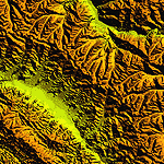
Highly detailed terrain mesh of the Jammu and Kashmir areas, N31-36 E76-78. The files in this package are based on Shuttle Radar (SRTM) Version 2 data but with many of the void areas, especially the most significant sections, filled with elevation data generated from topographic maps by Jonathan de Ferranti. While Jonathan's work is unrelated to flight simulation he kindly gave me permission to compile his data for use in FS. The result is a wonderful improvement in detail and accuracy over any existing mesh file, freeware or commercial, based on SRTM or DTED data alone.
Due to the large area of the Himalayas I've compiled the source data as two separate series: the "Himalayan Peaks" series covers prominent mountains and ranges in higher detail and locally overrides any existing LOD9 terrain mesh. In addition, a LOD9 "base mesh" series covering the entire Himalayas will be available for those who do not yet have an add-on terrain mesh of these beautiful mountains.
| Filename: | Himalayan_Peaks_LOD10_Mesh_Volume_6__Jammu_and_Kas.zip |
| License: | Freeware, limited distribution |
| Added: | 29th May 2010, 08:55:43 |
| Downloads: | 9,664 |
| Author: | Holger Sandmann, Jonathan de Ferranti |
| Size: | 52.19 MB |


© 2001-2026 AVSIM Online
All Rights Reserved
Privacy Policy |