
Where Flight Simulation Enthusiasts Gather from Around the World!
AVSIM Library - Search Results

| Category: Flight Simulator X - Aircraft Repaints, Textures and Modifications | |
| FSX Project Airbus Cebu Pacific Airbus A320-214 RP-C4156 and RP-C4160 Liveries |

|
File Description:
I remade the textures from my month old "let's fly every Juan" Liveries. The following is what I changed and added:
-Added reflections (lowered the opacity)
-Changed the colors to be more accurate
-Changed the allignments of the texts
-Changed the placement of the registration under the left wing from the center to the left side
In order to use these textures, you have to download the Project Airbus A32x Family with FD-FMC v2.0. It could be found in AVSIM Library. File name of the plane: pa_a32x_family_fd-fmc_2.0_377637.zip
The following is registrations that is included in this file:
RP-C4156 ("let's fly every Juan" Livery)
RP-C4160 ("let's fly every Juan" Livery)
RP-C4156 (Albino Livery)
RP-C4160 (Albino Livery)
readme, fltsim txt files is included here
FILE NAME: CEBU PACIFIC LET'S FLY EVERY JUAN PA320-200 IMPROVED.zip
| Filename: | FSX_Project_Airbus_Cebu_Pacific_Airbus_A320214_RPC.zip |
| License: | Freeware |
| Added: | 2nd November 2023, 10:52:54 |
| Downloads: | 56 |
| Author: | Rye Kristian Bunao |
| Size: | 23.74 MB |
| Category: Flight Simulator 2004 - Original Aircraft | |
| Yakolev 52 |
|
Images related to this file:
File Description:

Re-upload following Avsim hack. Quoting from Wikipedia: "The Yakovlev Yak-52 is a Soviet primary trainer aircraft. It first flew in 1976 and is still being produced in Romania, by Aerostar, they gained manufacturing rights under agreement within COMECON socialist trade organisation now defunct. The Yak-52 was designed originally as an aerobatic trainer for students in the Soviet DOSAAF training organisation. That organisation trained both civilian sport pilots and military pilots.
Since the early 1990s and the fall of the Soviet Union, many Yak 52s have been exported to the west. Of the approximately 1,800 produced to date, most now fly in the United States, United Kingdom, New Zealand, Australia and other western countries.
A descendant of the single-seat competition aerobatic Yakovlev Yak-50, the all-metal Yak-52 is powered by a 360 hp, 9-cylinder radial engine, the Vedeneyev M14P. The aircraft has inverted fuel and oil systems permitting inverted flight for as long as two minutes. The engine drives a two-bladed counter-clockwise rotating, constant-speed, wood and fiberglass laminate propeller.
The tricycle landing gear is fully retractable, but it remains partially-exposed in the retracted position, affording both a useful level of drag in down manoeuvres and a measure of protection should the plane be forced to land "wheels up." Curiously the main wheels retract forward into the slipstream."
It has has been constructed using Gmax v1.2. The aircraft is constructed with as few polygons as possible and with a single texture file to ensure the absolute minimum impact on your framerates. The model has six LODs.
As usual, I have made three different textures for the aircraft. These are accurate textures which also includes the actual registration number of the aircraft as this seems to be what many desire to have.
It is designed specifically to enhance the AI aircraft population and to use with the marvellous GA-Traffic programme by Markus Brunner . It is also very flyable as a normal aircraft.
| Filename: | Yakolev_52.zip |
| License: | Freeware, limited distribution |
| Added: | 31st August 2010, 23:45:54 |
| Downloads: | 3,128 |
| Author: | Mike Cronin |
| Size: | 304.03 KB |
| Category: Flight Simulator 2004 - Scenery | |
| Airports Northern Coast Alaska (PALU, PPIZ, PAWI, AK03) |
|
Images related to this file:
File Description:
The town of Barrow is in the far north of Alaska, and these are coastal villages or radar installations to the west of Barrow, and there will be additions. Cape Lisburne is a gravel runway right next to the coast with radar gear and accomodation buildings close by, and what was called "Top Camp" at the end of a long and steep road to the top of a nearby hill, or mountain. The runway is lit, as are most of them in this area of long dark winter nights. Barrow is 270 miles to the northeast. Point Lay PPIZ used to have a radar installation as well as a village, but the old buildings have now been removed and the gravel runway 05-23 has been lengthened to 5,000 feet to serve the village throughout the year. The population is around 270, living mostly traditionally and with an annual beluga whale hunt. Barrow is 180 miles to the northeast.
Wainwright PAWI, some 80 miles southwest of Barrow and on the coast, has a population of around 570. The PAWI runway is just under 5,000 feet long and like PPIZ is aligned 05-23, lit, and with PAPI on each end. The original runway of some 2,000 feet is still visible next to the apron. Three miles to the southeast there is a third runway, at AK03, serving the Wainwright DEW station. It was decided in 2007 to close the station and to remove the buildings both there and at Point Lay because of subsidence, but everything at Wainwright was still in place in 2009 and beyond. The villages have been "sketched" as opposed to replicated exactly. The texture folder includes the missing car textures for Barrow PABR, and the AI is modified PABR to include passenger flights by Ravn and cargo flights by Northern Air Cargo, plus limited GA. There are no flattened grassed areas at these airfields; they are runways and taxiways and aprons on a bed of gravel on permafrost.
| Filename: | Airports_Northern_Coast_Alaska_PALU_PPIZ_PAWI_AK03.zip |
| License: | Freeware, limited distribution |
| Added: | 16th June 2016, 15:59:24 |
| Downloads: | 360 |
| Author: | Roger Wensley |
| Size: | 10.84 MB |
| Category: Flight Simulator 2004 - Scenery | |
| 8AK7 - Bullen Point - Alaska North Slope 7 |
|
Images related to this file:
File Description:
The town of Barrow is in the far north of Alaska, and these are coastal villages or radar installations to the west, south, and now east of Barrow. There will be further additions. Bullen Point is a DEW station Air Force base 240 miles east of Barrow and 75 miles east of Oliktok. The runway is just under 4,000 feet of gravel and aligned 05-23; this is approximately at right angles to the default FS9 alignment and how that came about is something I doubt Bill Gates could explain. Most of the DEW buildings have now been removed (including the large hangar, which is unusual) but as I had a layout I made the whole site as it was originally, way back in the days when the north slope was still a wilderness. The AI is one day a C-130, on another a Cessna, and on a third a DC3. When I started this North Slope series it was my intention to create the full monty and make all the oil and gas installations and Deadhorse airport etc. I have come to realise that the oil side is impossible to make. There is so much of it and each bit is as time consuming as Heathrow while the actual airfields are more like Rockcliffe CYRO, so a lot of effort for what is just background to an adjoining airfield. But at the same time, if I make the new airstrips it is impossible NOT to make the oil installations as they are the dominating feature. So no new airstrips, and this is going to be just the 1960's or 1970's, when the oil business was only exploratory and the airfields were for villages or DEW stations, and Harmon Helmerick had his dirt strip on the Colville River estuary and was guiding hunters and fishermen and had just started to help out Sinclair Oil with oil exploration in 1966. Read his book. Download my previous post of his field.
| Filename: | 8AK7__Bullen_Point__Alaska_North_Slope_7.zip |
| License: | Freeware, limited distribution |
| Added: | 15th July 2016, 17:46:54 |
| Downloads: | 278 |
| Author: | Roger Wensley |
| Size: | 2.5 MB |
| Category: Flight Simulator 2004 - Scenery | |
| Monument Valley UT25 and Oljato 05UT in Utah USA |
|
Images related to this file:
File Description:
Monument Valley is an impressive sight in south Utah but not, unfortunately, in FS9. Unless you invest in a detailed terrain mesh there are no stacks of rocks reaching for the sky and the lasting overall impression is just of a desert. But I had already downloaded the land textures so I ended up making the Monument Valley UT25 airfield and the nearby Oljato 05UT, which has no buildings of any sort. Maybe I was bored. There is a lodge close to the field with dozens of cabins, but I had insufficient information so this is for the airfield only. The 4,000 feet of new tarmac is aligned 16-34 and is single ended with a large chunk of rock at the southern end; 16 is only used for landing and 34 is only for take off. The runway is not lit. Do not be surprised when you ask to select a runway for take off and FS9 only gives you 16 as a choice, even though you know this is the wrong one. When you accept it FS9 will quickly switch it to 34; apart from a possible sense of humour I have no idea why it does this. Nothing much to say about Oljato. What do you need? You actually don't need Ultimate Terrain as there are other land textures used here, so you will definitely need to have downloaded and installed the land textures "cny_south3west_2010 lr" and "cny_south3west2_2010 lr" by Gottfried Razek, as these land textures showed the runways in the correct positions. Look in the scenery library here or at the other place. A note here about my scenery making. There will not be many more to follow this (unless you count 4 as many) as I am almost at the end of the photos I either took or found for scenery purposes, plus I expect to move on from FS9 at some point during next year.
| Filename: | Monument_Valley_UT25_and_Oljato_05UT_in_Utah_USA.zip |
| License: | Freeware, limited distribution |
| Added: | 22nd January 2020, 20:13:54 |
| Downloads: | 218 |
| Author: | Roger Wensley |
| Size: | 2.91 MB |
| Category: Flight Simulator X - Scenery | |
| RAF Church Fenton |
|
File Description:
RAF Church Fenton (ICAO: EGXG) was an Royal Air Force station in North Yorkshire, near the village of Church Fenton.
Plans for a new airfield adjacent to the village of Church Fenton were announced in June 1935, it was subject to protest from the local population particularly concerning the waste of valuable farming land and was close to an existing airfield not far away at Sherburn. Despite the protests construction started in early 1936 on the site, which was a mixture of private and West Riding County Council-owned farm land.
On 1 April 1937, the station was declared open and on 19 April the first station commander Wing Commander W.E. Swann assumed command. Within two months No. 71 Squadron RAF had arrived with their Gloster Gladiators.
Second World War
Opened in 1937, the station saw the peak of its activity during the years of the Second World War, when it served within the defence network of fighter bases of the RAF providing protection for the Leeds, Bradford, Sheffield and Humberside industrial regions.
During September 1940, it became home to the first RAF "Eagle squadron" of American volunteers being No. 71 Squadron RAF. The airfield was also home to both the first all-Canadian and all-Polish squadrons, with No. 242 Squadron RAF for the Canadians and No. 306 Squadron RAF for the Polish.
As technologies evolved, the first night fighter Operational Training Unit (54 OTU) was formed at Church Fenton in 1940 and stayed until 1942. Some of the squadrons stationed there flew the famous de Havilland Mosquito.
Source and more information can be found at
:- http://military.wikia.com/wiki/RAF_Church_Fenton
| Filename: | RAF_Church_Fenton.zip |
| License: | Freeware |
| Added: | 9th June 2017, 19:06:49 |
| Downloads: | 179 |
| Author: | Terry Boissel |
| Size: | 13.72 MB |
| Category: Flight Simulator 2004 - Aircraft Repaints, Textures and Modifications | |
| Scottish Airlines Douglas DC-3 Dakota |
|
File Description:
Scottish Airlines was formed in 1946 as the airline division of Prestwick based Scottish Aviation. The airline operated scheduled services within the UK along with charter work on a world wide basis. The backbone of their fleet in the immediate post war years was a dozen or so Douglas C47 Dakotas with long haul work being carried out by 5 Consolidated Liberator II & III transports. By 1958, the fleet was reduced to just one C47B (G-AMPP), this aircraft maintained the summer Prestwick to Isle of Man service and earned revenue during the winter with whatever charter work could be found. Due to her varied work routines and her pronounceable registration letters she was affectionately known by the airline staff as "G-AMPP the Tramp".
These are textures for MAAM Douglas DC-3 package available from Mid Atlantic Air Museum Simulations (MAAM-SIM) Scottish Airlines textures by Jaap de Baare. Based on repaint templates by Mark Beaumont and original textures by Jan Visser.
| Filename: | Scottish_Airlines_Douglas_DC3_Dakota.zip |
| License: | Freeware |
| Added: | 30th December 2006, 20:08:29 |
| Downloads: | 940 |
| Author: | Jaap de Baare / MAAM-SIM |
| Size: | 864.74 KB |
| Category: Flight Simulator 2004 - Sounds | |
| ATC Voices - Airline Call Signs set 19 |
|
File Description:
A collection of 19 new or improved airline callsigns, for use with
Flight Simulator 2004 and FS2002. Installation requires the
EditVoicepack software
(see http://bevelstone.xs4all.nl/FlightSimulator/EditVoicepack) by Lars
Møllebjerg which is also available free download from the usual Flight
Simulator download sites such as Avsim.
The callsigns included here represent a range of airlines around the
world for which flightplans and/or aircraft are available. They are:
AIRBRASIL: Air Brasil (Brazil),
AIRLIMITED: Airwaves Airlink (Zambia),
AWAL: Bahrain Air (Bahrain),
BATMAN: G5 Executive (Switzerland),
CARIBBEAN AIRLINES: Caribbean Airlines (Trinidad & Tobago),
CHONG QING: Chong Qing Airlines (China),
CITYLINK: CTK Network Aviation (Ghana),
COSTERA: Aerolitoral (Mexico),
EUROMANX: Euromanx (United Kingdom),
FLAGSHIP: Pinnacle Airlines (United States of America),
GABON AIRLINES: Gabon Airlines (Gabon),
ICE: Skytraders (Australia),
ORBEST: Orbest (Portugal),
ORIONIX: Orion-X (Russian Federation),
OSH AVIA: Osh Avia (Kyrgyzstan),
SKY CHALLENGER: Challenge Aero (Ukraine),
SWIFT TANGO: Five Forty Aviation - Fly540 (Kenya),
TURKISH AIRFORCE: Turkish Air Force (Turkey), and
VALUAIR: Valuair (Singapore).
| Filename: | ATC_Voices__Airline_Call_Signs_set_19.zip |
| License: | Freeware |
| Added: | 16th February 2008, 09:42:46 |
| Downloads: | 5,887 |
| Author: | John Hinson |
| Size: | 14.5 KB |
| Category: Flight Simulator X - Scenery | |
| GPS Enabled Acceleration Carrier |
|
File Description:
This carrier is for FSX Acceleration owners and allows the user to start from the deck in FSX, by using the supplied airport code EG51. The carrier is the Acceleration model and includes full use of the cat launch and arrestor cable. Their are two models supplied, a static and a moving version. The static version allows the use of GPS approach from any airport in the world, and start from the deck all day. The moving version allows the same features before 7am GMT and after arrival at the destination port at Lands End (10:15am GMT). The user could use the FSX menu to get on board the deck area of this carrier prior to 7am GMT and then sail with it. The Lands End destination allows full use of GPS facilities whilst the carrier is in that port too, EG53 is the airport code. This is from 10:15 to 14:00 GMT before it starts the return journey.
| Filename: | GPS_Enabled_Acceleration_Carrier.zip |
| License: | Freeware, limited distribution |
| Added: | 23rd February 2008, 14:45:52 |
| Downloads: | 1,818 |
| Author: | Steve Brooks |
| Size: | 103.01 KB |
| Category: Flight Simulator 2004 - Scenery | |
| OPGD Gwadar International, Pakistan |
|
Images related to this file:
File Description:
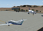
Googly scenery for OPGD Gwadar International, Pakistan. In Flight Simulator
2004 only general aviation parking is provided at this so-called international airport but in the real world it is served two or three times a day by Airbii of Airblue and ATRs of Pakistan International Airways. These scenery files improve or add
aprons, taxiways, buildings and other airport features to Flight Simulator's limited
representation and allow "AI" traffic to land, taxi, park and take off in a realistic
manner.
The scenery does not purport to be ultra-accurate. Based on high-detail satellite
imagery from Google Earth, the layout is proportionally correct but the added
airport features, such as buildings, are built from default Microsoft objects
and add-on libraries so will not look like the real thing.
You are not obliged to download and install any additional scenery libraries,
but to enjoy this scenery in its entirety, you may wish to. It will work fine,
with or without.
[File re-uploaded at request of AVSIM]
| Filename: | OPGD_Gwadar_International_Pakistan.zip |
| License: | Freeware |
| Added: | 23rd May 2010, 01:26:15 |
| Downloads: | 1,065 |
| Author: | John Hinson |
| Size: | 58.09 KB |


© 2001-2026 AVSIM Online
All Rights Reserved
Privacy Policy |