
Where Flight Simulation Enthusiasts Gather from Around the World!
AVSIM Library - Search Results

| Category: Flight Simulator X - Utilities | |
| FS Remote version 1.0 |

|
File Description:
Email: [email protected]
Name: Hans Elzer
Current version 1.0
Version 1.0 contains various little bug fixes plus Fuel management in the Engines dialog
FS-Remote a utility for remotely controlling FSX
The Zip file contains:
* Readme text file
* .NET 2.0 FS-Remote executable
* Configuration file for FS-Remote
* Document file in MSWord format
What you need to run FS-Remote:
* .NET 2.0 or 3.0 installed on the computer where you want to run FS-Remote
* FSUIPC4 (registered) on the computer where you run FSX
* WideClient (FSUIPC4 FSWide remote) if you want to run FS-Remote on a remote computer
It does what the title says FS-Remote controls FSX remotely through FSUIPC.
Just take a look at the (word) document that is contained in the zip file and look at some screen shots.
It can view and control the following items in FSX through FSUIPC:
* Aircraft - Control aircraft switches like Lights, Doors, Pushback, De-Ice and Jetway plus call fuel truck
* Auto Pilot - Control auto pilot switches plus reset altimeter and heading indicator instruments
* Radio - Control radio stack switches and push buttons plus view navigation status information
* Attitude - View attitude information and warnings plus convert and view various items in feet, meter, knots, mph and km/p
* Engines - Control engines auto start and stop plus fuel management
* Weather - not implemented jet (next version)
* Environment - View the local date, time and position environment information
* Date Time - Control and view the flight simulator date and time
* Message - View and send messages to flight simulator message bar
* FPS - View real-time flight simulator frames per second FPS rate
* About - View version information about FS-Remote, FSUIPC4 and FSX
Hope that you like it.
| Filename: | FS_Remote_version_10.zip |
| License: | Freeware |
| Added: | 9th September 2007, 15:26:14 |
| Downloads: | 1,439 |
| Author: | Hans Elzer |
| Size: | 353.2 KB |
| Category: Flight Simulator 2002 - Scenery | |
| EGGP Liverpool John Lennon Airport V3.1 |
|
File Description:
This new version has come about as a result of over a month sitting in front of Paint Shop Pro! All the textures have been redone including the night textures (If anyone knows how to light up AI aircraft then I'd love to hear from them!).
Many new macros have been created and hence the airport now has a lot more buildings! The railway bridge has been finished and I've also created my own version of the road bridge.
I've switched tree creation to GroundMaker as this was less frame rate hugging and allowed what I consider to be a more realistic representation of the wooded areas around the airport.
The scenery is aligned to the Visual Flight / Getmapping VFR Scenery published by Just Flight and has been specifically designed to complement the add-on. You do not however need the VFR scenery to use these files!
This scenery forms part of the "UK2002 Scenery Project" co-ordinated by John Woodside - http://fsaviation.net/. Thanks also go to John and to Peter Leadbeater for the information they have supplied to me regarding the airport
| Filename: | EGGP_Liverpool_John_Lennon_Airport_V31.zip |
| License: | Freeware |
| Added: | 22nd March 2003, 02:36:29 |
| Downloads: | 2,824 |
| Author: | Paul Derbyshire |
| Size: | 3.67 MB |
| Category: FlightGear - Base Distribution | |
| Air NewZeland Boeing747-400 |
|
File Description:
Hey , here is the AIR NEWZELAND plane file , just download it and try it in FGFS , see what have been changed with the new paints .
Every guys here can do this job ig you have SGIformat Plug-in for PhotoShop installed , you will easily import , edit and export .rgb file format in P.S. , the .rgb filr format ( PBimage ) are used in all the textures in FGSF , so the 747`s too .
In doing this paint , i have used a REAL PHOTO based , it means all the parts from new 747 in all from one REAL PHOTO liverly , it dosn`t a draw image but pretty REAL textures , Using a little Photoshop skills to added them together to be a paint , High detail , High quaritty , High liverly and pretty Real .
I think you`ll love it , Thanks .
Thanks guys , i have already known how to operating in FGFS , and just for fun , i have already do the re-paint for 747 too , there is AIR NEWZELAND `s paint job , the LORD of the RINGS color designs .
| Filename: | Air_NewZeland_Boeing747400.zip |
| License: | Freeware |
| Added: | 26th October 2004, 04:55:05 |
| Downloads: | 450 |
| Author: | DennyChan |
| Size: | 4.31 MB |
| Category: Flight Simulator 2004 - Scenery Design | |
| Tropical Trees Scenery Macros |
|
File Description:
This file is for use by scenery designers only. It is a collection of around fifty different tropical trees for use in your scenery. All of the trees are created in API format using R8 textures for low impact. They are all single plane trees which turn to face the aircraft giving a nice full look from whatever angle you view them. Most have been created using Scott Armstrong's textures from his recently uploaded file tropicaltextures.zip available at Avsim. There are also a few of the trees I have been using, which were made from textures by John de Langristin. This is a complete library, and should have exactly what you are looking for to do tropical scenery. Many of the trees appear 3 dimensional due to the excellent photo real textures. Most of the trees are Coconut Palms in various positions and shapes, but there are also other trees, bananas, shrubs, and large texture walls for background use.
There are also five various night lit trees included.
| Filename: | Tropical_Trees_Scenery_Macros.zip |
| License: | Freeware |
| Added: | 12th October 2004, 15:23:33 |
| Downloads: | 1,790 |
| Author: | Bill Melichar |
| Size: | 2.05 MB |
| Category: Flight Simulator X - Scenery | |
| Scappoose Industrial Airpark |
|
Images related to this file:
File Description:
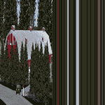
Presenting KSPB Scappoose, Oregon Industrial Airpark, for FSX only. This is a nice area on the way from Portland, OR to St. Helens,OR around the Sauvie Island area.
ICAO is KSPB as mentioned above. VOWDME is 114.00 60nm range, ILS is 111.10 at 27 nm range.
This includes photo real file at high res for clarity. I made the red barn from pictures I found. One picture is included for comparison. This includes the mailbox and flower arrangement adjacent to it just for fun. Included are a few houses in the barn area and fencing which I did the best I could with what I have at the time.
Default vehicles and planes are added, but not too many so as not to cause frame rates issues. Included are a 55 Ford truck I made and one called fordtruck2 which is not as good as the '55 ford is, but I got in a rush...but it worked well. Enjoy. contact info is in the readme file. Bob
| Filename: | Scappoose_Industrial_Airpark.zip |
| License: | Freeware |
| Added: | 1st August 2012, 13:12:51 |
| Downloads: | 517 |
| Author: | Robert Lacy |
| Size: | 60.24 MB |
| Category: Navigation and ATC - Navigation | |
| LSZS - Samedan visual approach chart v3 |
|
Images related to this file:
File Description:
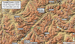
Custom made visual approach chart and pilot's briefing for Engadin (St. Moritz) Samedan LSZS airport in Switzerland, Europe's highest elevation airport (5,600 ft.) situated in the Swiss Alps. This airport is a day VFR operations only and has no instrument approach due to extreme terrain around it. A demanding visual descent into a canyon, in between steep rising terrain, is required to make the visual approaches for both runways with a steep 4.4* degrees final approach portion guided by the PAPI's. Still, executive jets up to Boeing 737(BBJ) size approach the airport often in the winter peak season VFR with these procedures. It is designed as per real operators' pilot briefing for Samedan. Real airport's full pilot briefing document also included. The real airport's excellent briefing (included) intentionally does not contain the maneuvers needed for the approach of jets through the mountains but only reporting points for all and maneuvers for light aircraft only. This gap is what this chart covers. Version 2 chart included better graphics and refined visual procedure for jets and version 3 now includes real pilot's briefing guide.
| Filename: | LSZS__Samedan_visual_approach_chart_v3.zip |
| License: | Freeware, limited distribution |
| Added: | 20th March 2015, 23:35:11 |
| Downloads: | 2,026 |
| Author: | Kyprianos Biris |
| Size: | 7.1 MB |
| Category: Flight Simulator 2002 - Flight Plans | |
| 34RTWest |
|
File Description:
An FS2002 GPS flight Plan. The 34th in a series of Round the World flight plans for the FS2002 default scenery. Depart Guwahati runway 02, India and arrive 1 hour 04 minutes later at Paro (VQPR) runway 33, Bhutan. A quiet and gentle flight, at least for the first 14 minutes then on entering a deep valley to start a pass storming climb into the snow capped mountains the mood of the flight changes. A session of dodging through gaps in the peaks concludes with a ‘Dive Bomber” VFR finals into a airport surrounded by very high ground and with its runway in a deep pit in a valley bottom, brings the session to an end. Pilots who have so far enjoyed the brand of fun and nonsense I call flight planning, will not be disappointed with this flight. The flight briefing (Word and text) is for a B737-400, it contains climb, cruise, top of descent and fuel loading details, waypoint timings and destination details.
| Filename: | 34RTWest.zip |
| License: | Freeware |
| Added: | 7th July 2002, 19:09:58 |
| Downloads: | 1,055 |
| Author: | The Ancient Brit |
| Size: | 37.4 KB |
| Category: Flight Simulator X - Aircraft Repaints, Textures and Modifications | |
| All Nippon Airways - ANA Boeing 747-400 |
|
File Description:
UPLOAD did "FSX All Nippon Airways Boeing 747-400" on August 19, 2007. But, it was modified because the coating of the detailed part couldn't be done beautifully. Let ANA Airplane of "All Nippon Airways" soar with both "British Airways" and "Northwest Airlines", "Aloha airlines", "Hawaiian airlines" in the sky of the world. It is made in AI Airplane as well. A ANA Airplane appears on KLAX, KONT, EGLL, EGKK,PHNL. It asks for aviation traffic by more than 40%.
| Filename: | All_Nippon_Airways__ANA_Boeing_747400.zip |
| License: | Freeware |
| Added: | 23rd August 2007, 07:56:09 |
| Downloads: | 1,362 |
| Author: | Ichro Yamamoto |
| Size: | 1.71 MB |
| Category: Flight Simulator 2004 - Scenery | |
| YAYE |
|
File Description:
YAYE is an exisiting airport(FS & real world) in Australia's northern territory. This is enhanced per request by a friend, Rico, in the Netherlands. YAYE now hasVOR, NDB, ILS, hotel with parking lot and cars, sattilite dish, radio antenna, hot air ballons, gas station, tour buses arriving,people here and there. It has 2 moving radar dishes, enhanced terminal with jetways at the gates,AI ready, sheep/duck ranch, 5 heliports. Abacus library, and abw files, ex-scenery, and ryw12 library files needed.
| Filename: | YAYE.zip |
| License: | Freeware |
| Added: | 5th June 2006, 04:49:45 |
| Downloads: | 605 |
| Author: | Robert Lacy |
| Size: | 27.59 KB |
| Category: Flight Simulator 2004 - Utilities | |
| METAR/TAF DECODER - English version |
|
File Description:
METAR/TAF DECODER is a script which replaces the default keyboard shortcuts page of the FS 2004 kneeboard and provides real world METAR and TAF information inside Flight Simulator. The script connects to the main METAR/TAF web application which can be found at http://metar.hvaip.net
- METAR/TAF reports for all airports decoded in plain english/greek
- Runway information including suggestion for active runway based on surface winds
- Crosswind component calculation for landing/take off
| Filename: | METARTAF_DECODER__English_version.zip |
| License: | Freeware |
| Added: | 10th May 2007, 13:00:44 |
| Downloads: | 2,246 |
| Author: | Yorgos Hantzopoulos |
| Size: | 64.48 KB |


© 2001-2026 AVSIM Online
All Rights Reserved
Privacy Policy |