
Where Flight Simulation Enthusiasts Gather from Around the World!
AVSIM Library - Search Results

| Category: Flight Simulator X - Missions | |
| MSF6 |

|
Images related to this file:
File Description:
All the MSF missions consist of several episodes. The present mission here is the episode n°6. It is obvious that the next episode will be the logical result of this present adventure, and so on for the following episodes.
The story of this episode n°6 begins at the airport of BUKOBA and ends at the airport of ENTEBBE, with very bad weather conditions.
The briefing of departure is voluntarily very short, you will find no indication for the realization of the episode, simply the description of the context there of departure. All the indications to realize the episode will be given to you by sound files. In other words, it will be necessary to you to be very attentive to the diverse dialogues, in French, sorry, which you will hear. I will try to create an English version later.
ALL EPISODES OF MSF ARE A TRIBUTE TO THE WOMEN AND MEN OF THE MEDICAL WORLD.
| Filename: | MSF6.zip |
| License: | Freeware |
| Added: | 27th May 2021, 21:32:14 |
| Downloads: | 76 |
| Author: | Alain BOUTIE |
| Size: | 9.39 MB |
| Category: Flight Simulator 2004 - Miscellaneous Files | |
| Active ILS - EHAM (Amsterdam - Schiphol Airport) |
|
File Description:
As most know initiating the ILS at certain airports for AI Traffic is not a function at this time when using AFCAD2. If you add a new ILS runway to an airport such as EHAM (Schiphol 18R/36L) only the user aircraft can use this runway when visibility falls below 3 miles. ATC will no longer use this runway for AI Traffic because FS9 sees it as a visual runway. This will cause ATC to vector all your AI Traffic back to (01L/19R old numbers) 18C/36C (new numbers) which is also a Terminal departure runway. This bgl file adds all NAVAIDS for making 18R/36L a Precision Instrument Runway. All AI Aircraft will now continue to use 18R when Airport weather conditions are less than 3 miles. Read the text file for all the enhancements added to EHAM *** 3rd Party Scenery Designers Special ILS bgl and FS2004 Default Scenery AFCAD included ***
| Filename: | Active_ILS__EHAM_Amsterdam__Schiphol_Airport.zip |
| License: | Freeware, limited distribution |
| Added: | 6th October 2004, 18:16:17 |
| Downloads: | 5,583 |
| Author: | Jim Vile |
| Size: | 43.27 KB |
| Category: Flight Simulator 2004 - Scenery Design | |
| Land Classification Visual Reference |
|
File Description:
Welcome to the visual reference for Land Classifications used with MSFS 2002 and 2004. This reference is not tested with MS Flight Simulator X, but I guess it could be very helpful there too.
You are able to see how a specific Land Classification Value will look in MSFS without building a .bgl file first. You can even compare different Values right away to make an easy decision of which one to use.
Since this reference is a PDF file, you don't need any other tool, but a PDF reader or editor of your choice.
The amount of the visual references is very complete, at least as far as the documentation of the SDK for Terrain Modeling is complete.
All the screenshots are taken at Ibiza, Spain at the exact same location, angle of view, season, date and time with identical weather conditions. This way it is easy to compare the different Land Classifications and get an idea of how they really look.
| Filename: | Land_Classification_Visual_Reference.zip |
| License: | Freeware |
| Added: | 23rd October 2006, 22:28:34 |
| Downloads: | 1,397 |
| Author: | Gerhard Scheuerecker |
| Size: | 18.2 MB |
| Category: Flight Simulator 2004 - Miscellaneous Files | |
| Go To any Airport Version 3 |
|
File Description:
Go To Any Airport Version 3.- Now 3 Airports Included.
Always wanted to return to your favourite local Airport from anywhere in the world? simply - with no fuss? Look no Further.
Start at your Designated Airport, [in this case London Gatwick or Innsbruck or Dublin in a 737], then Goto any Airport! - via the FS9 World menu and return to the Original Designated Airport - every time! - By Just turning the GPS/nav switch to GPS and Flight Director and autothrottle on whilst still on the ground.Click on the Autopilot and Nav Hold switch once above 1000ft - thats it !! . Set Weather and Altitude as required and Speed in autopilot and away you go. Use the FS9 ATC as You Travel, call into designated Airport when close and receive the curent ATIS and Runway approach in use.
HAVE FUN.
(This is different to the great circle direct routes that you can programme into the very good FS9 GPS - each and every time you start from a new airport).
| Filename: | Go_To_any_Airport_Version_3.zip |
| License: | Freeware |
| Added: | 7th March 2004, 17:42:32 |
| Downloads: | 433 |
| Author: | Alan Trussell |
| Size: | 26.95 KB |
| Category: Flight Simulator 2004 - Miscellaneous Files | |
| GoTo Any Airport |
|
File Description:
GoTo Any Airport.
Inclued here Heathrow and London Luton. Always wanted to return to your favourite local Airport from anywhere in the world? simply - with no fuss? Look no Further.
Start at these Designated Airports,then Goto any Airport! - via the FS9 World menu and return to the Original Airport - every time! - By Just turning the GPS/nav switch to GPS and Flight Director and autothrottle on whilst still on the ground.Click on the Autopilot, IAS, ALT and Nav Hold switches once above 1000ft - thats it !! . Set Weather and Altitude as required and Speed in autopilot and away you go. Use the FS9 ATC as You Travel, call into Airport when close and receive the curent ATIS and Runway approach in use.
The added circuit flights are on Autopilot and allow you to observe the airport befor landing.They make good moving screen savers - but make sure you have plenty of fuel!compatible with UK2000 Airports & VFR scenery for UK.
| Filename: | GoTo_Any_Airport.zip |
| License: | Freeware |
| Added: | 19th June 2004, 07:12:30 |
| Downloads: | 690 |
| Author: | Alan Trussell |
| Size: | 38.37 KB |
| Category: Flight Simulator 2004 - Scenery | |
| Misty Moorings DynaScene Scenario - 08/18/2005 |
|
File Description:
DynaScene scenario based scenery file for Misty Moorings members and other interested parties. (Misty Fjords Scenery from www.fsaddon.com required). Provides background text, photos, and scenery for a temporary scenario. Story as follows: NEWS FLASH! 08/18/2005 - BUSH PILOT GROUNDED PENDING INVESTIGATION - KETCHIKAN (APX) - The alaska wilderness is no stranger to strange tales. At least that's how it appears in the case of a local bush pilot, Randy Morgan, who had quite a large one to tell.
At 6 PM on the evening of the 16th, Randy and one passenger took off in a Cessna 182RG from Maloney's Tavern on his way back to Ketchikan. "The weather was good and I had no idea what was about to happen" said Randy Morgan. "We had planned our flight to pass over Raptor's Roost and Punchbowl Lake before heading into Ketchikan when I saw it." (full text in download) - Makes use of Rwy12 libraries by Seev Kahn and Glen Gordon (included in download).
| Filename: | Misty_Moorings_DynaScene_Scenario__08182005.zip |
| License: | Freeware |
| Added: | 22nd August 2005, 01:04:19 |
| Downloads: | 968 |
| Author: | Glen Gordon (Professor Khaos) |
| Size: | 4.76 MB |
| Category: Flight Simulator X - Missions | |
| The Most Dangerous Airports: Lukla V2 |
|
Images related to this file:
File Description:
Approach to Lukla V2 (Totally New Mission)
You are a very experienced pilot flying the Twin Otter for Yeti Airlines on an imaginary flight to and from Lukla. Take-off from Biratnagar airport VNVT climb to at least 13500 ft to WP1 Turn to Lukla. From WP1 carefully descent to 10000 ft (there should be cloud to make it more difficult, if you have some sort of weather add-on running) to WP2 Approach to VNLK, after passing through the gate turn sharp right and land at Lukla airport, remember that the runway has an incline of several degrees. Turn around and take-off again, stay on the runway and rotate just before the end of the runway. Follow the valley back to the south until you are able to track the VOR 112.30 at roughly 276�°, till you reach Kathmandu Intl Airport and land. Yes, it sounds easy, butâ�¦ find out for yourself.
| Filename: | The_Most_Dangerous_Airports_Lukla_V2.zip |
| License: | Freeware |
| Added: | 9th June 2010, 02:40:12 |
| Downloads: | 1,679 |
| Author: | Robbie Albers |
| Size: | 2.17 MB |
| Category: Flight Simulator X - Utilities | |
| SimLauncherX v5.9 |
|
Images related to this file:
File Description:
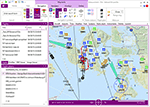
SimLauncherX (or SLX for short) can be used as a launcher application for both FSX:ME, FSX:SE and Prepar3D (v1, v2 and v3). Flights/scenarios can be loaded when launching the simulator or when the simulator is already running. New flights can be created by selecting one of the installed aircraft, selecting the start location (runway or parking position), selecting the type of weather and the time of day. You can also display and create flight plans and attach them to a flight as requested or active flight plan. Version 5.9 adds a flight computer, AI browser, interactive (spoken) checklists, PMDG 737/777 CDUs, approach charts, fleet management and many other improvements. SimLauncherX is a more modern version of my previous SimLauncher application with a lot of additional functionality:
- interactive map.
- display, create and modify flight plans.
- show .kml/.kmz files on the map.
- radio stack.
- instruments panel.
- scenery.cfg editor.
- dll/exe.xml editor.
- process monitor.
Works with FSX:ME, FSX:SE and P3D v1, v2 and v3.
| Filename: | SimLauncherX_v59.zip |
| License: | Freeware, limited distribution |
| Added: | 1st April 2017, 08:18:19 |
| Downloads: | 15,779 |
| Author: | Maarten Boelens |
| Size: | 52.64 MB |
| Category: Flight Simulator 2004 - Scenery | |
| SKMZ 2011 |
|
File Description:
La Nubia Airport (IATA: MZL, ICAO: SKMZ) is located in Manizales, Colombia, 8 km[1] southeast of the city's downtown. Due to its short runway and limited ramp space, the only aircraft which can use the airport are turbopropeller
aircraft such as the Fokker 50, ATR 42 and the Dash 8 models. The main problem of La Nubia airport is weather. Sometimes shut down to fog, rain or winds, it is difficult for airlines to offer a reliable schedule for the passengers
wishing to visit Manizales and Caldas, and combined with its limited hours of operation (just daylight), this fact has been an obstacle for the region's development.
This file is the airport with the runway and taxi ways resized, airport buildings; the airport charts required to navigate in and out of this airport can be found at www.aerocivil.gov.co/ under Informacion Aeronautica click AIP;
on AIP click Aerodromos then click at SKMZ.
| Filename: | SKMZ_2011.zip |
| License: | Freeware |
| Added: | 24th August 2011, 00:02:46 |
| Downloads: | 555 |
| Author: | Anwar Gonzalez |
| Size: | 4.21 KB |
| Category: Flight Simulator 2004 - Scenery | |
| Ocean Stations Scenery |
|
File Description:
I've produced this scenery to provide all of the Ocean Stations I know about in the 1950's and 1960's. There is a ship on station (painted in the colors of the USA, UK, France, Norway, and Japan), an NDB to give you a bearing to the ship, a way to contact the ship using voice (you can get your position relative to the ship this way), and a DME for distances further than the limited 30 NM FS ATC gives you (normal communications would reach about 100 NM). You can also get a weather report, and if you are a seaplane you can be cleared to land. If you are a landplane, I guess this would constitute permission to ditch...
I want to give a big thank you to Mitsuya Hamaguchi (hama) for graciously supplying the ship used in this scenery.
This version uses AI ships and is NOT COMPATIBLE with multiplayer - use OceanStationsMP.zip instead
| Filename: | Ocean_Stations_Scenery.zip |
| License: | Freeware, limited distribution |
| Added: | 6th May 2008, 03:51:41 |
| Downloads: | 3,569 |
| Author: | Tom Gibson |
| Size: | 1.02 MB |


© 2001-2026 AVSIM Online
All Rights Reserved
Privacy Policy |