
Where Flight Simulation Enthusiasts Gather from Around the World!
AVSIM Library - Search Results

| Category: Navigation and ATC - Navigation | |
| Los Angeles ARTCC charts from AIRAC 0505 - Volume 3 of 5 |

|
File Description:
This collection of US Terminal Procedures has been assembled to provide a complete set of charts for flight simulation use within the Los Angeles ARTCC region, on behalf of VATSIM's Los Angeles ARTCC (ZLA), whose website can be found at http://www.laartcc.org
**THIS IS VOLUME 3 OF 5** Charts are in Adobe PDF format.
Volume 3 = ZLA_AIRAC0505_CA_OUTLYING.ZIP
Features procedure charts for all appropriate California airports outside the combined Southern California Terminal Radar Approach Control facility "SoCAL", but under the limited ATC responsibility of the Los Angeles Center facility, and includes amongst others:
KSBA - Santa Barbara Airport (Class C)
KPSP - Palm Springs Airport (TRSA)
KBFL - Bakersfield Meadows Field (Class D)
KCMA - Camarillo Airport (Class D)
KOXR - Oxnard Airport (Class D)
KSMX - Santa Maria Public / Hancock Field (Class D)
KSBP - San Luis County Regional (Class D)
KMHV - Mohave Airport (Class D)
KVCV - Victorville Airport (Class D)
KTRM - Jacqueline Cochran Regional Airport
L35 - Big Bear Airport
16 other California outlying fields in LA Center airspace.
| Filename: | Los_Angeles_ARTCC_charts_from_AIRAC_0505____Volume.zip |
| License: | Freeware |
| Added: | 15th May 2005, 18:05:53 |
| Downloads: | 498 |
| Author: | Mark Coldwell |
| Size: | 27.18 MB |
| Category: Flight Simulator 2004 - Gauges | |
| Delco Carousel IV-A Boeing 727 v2.51 |
|
File Description:
This download provides a dual INS mockup for all your Dreamfleet 727 v2 cockpits PLUS a TCAS and Transponder set that is fully compatible for online flying!
- all gauges are located where they would be in reality, that is on the overhead and next to the wx radar on the forward pedestal - as well in the virtual cockpit!
- package includes the excellent freeware IVSI embedded TCAS & Transponder by I.L. Hetherington in ALL non-EFIS variants, both 2D and virtual cockpit!
- package includes ilhtcaschange.gau by Jose Oliveira
- it is now possible to add gauges to the forward pedestal panel even in the virtual cockpit - FMS, GPS, you name it
This is version 2.51 includes
- a complete dual INS setup INCLUDING the new cardreader function to load and save INS Data (Waypoints)
- now compatible with the latest Simufly version 1.5 INS gauges
NOTE: the INS gauges are NOT included and need to be downloaded.
| Filename: | Delco_Carousel_IVA_Boeing_727_v251.zip |
| License: | Freeware |
| Added: | 9th July 2007, 13:40:39 |
| Downloads: | 4,134 |
| Author: | Nick Schreger (MeatWater) |
| Size: | 1.21 MB |
| Category: Flight Simulator 2004 - Scenery | |
| Himalayan Peaks LOD10 Mesh, Volume 1 - Mt. Everest and Kula Kangri |
|
File Description:
Highly detailed terrain mesh of the Mt. Everest and Kula Kangri areas, N26°-29° E85°-92°. The files in this package are based on Shuttle Radar (SRTM) Version 2 data but with many of the void areas, especially the most significant sections, filled with elevation data generated from topographic maps by Jonathan de Ferranti. While Jonathan's work is unrelated to flight simulation he kindly gave me permission to compile his data for use in FS. The result is a wonderful improvement in detail and accuracy over any existing mesh file, freeware or commercial, based on SRTM or DTED data alone. Due to the large area of the Himalayas I've compiled the source data as two separate series: the "Himalayan Peaks" series covers prominent mountains and ranges in higher detail and locally overrides any existing LOD9 terrain mesh. In addition, a LOD9 "base mesh" series covering the entire Himalayas will be available for those who do not yet have an add-on terrain mesh of these beautiful mountains.
| Filename: | Himalayan_Peaks_LOD10_Mesh_Volume_1__Mt_Everest_an.zip |
| License: | Freeware, limited distribution |
| Added: | 9th February 2006, 22:13:00 |
| Downloads: | 37,042 |
| Author: | Holger Sandmann and Jonathan de Ferranti |
| Size: | 52.01 MB |
| Category: Flight Simulator 2004 - Scenery | |
| High-resolution 76-m (LOD9) Terrain Mesh and Scenery Enhancements for the Southern Canadian Rockies |
|
File Description:
Not simply an add-on mesh, these files include many scenery enhancements for the southern Rockies of British Columbia and Alberta. Coverage extends from Cranbrook to Calgary, and Hinton to Edmonton (N48.9-53.4 W112.3-116.3). The mesh source data are 3-arcsec (~90-m) Shuttle Radar (SRTM) files, compiled at LOD9 (76-m) resolution. All lake elevations (!) have been adjusted to eliminate the problems with the default lake data and to better fit the new terrain mesh. In addition, the Transcanada Highway/Icefields Parkway corridor in Banff National Park, from Canmore to the Hwy 11 junction, has been completely re-made, with dozens of alpine lakes (including Lake Louise, Moraine Lake, and Lake O'Hara), accurate transportation network, and landclass/waterclass updates based on satellite imagery. Due to significant changes in FS2004 to vector layering and autogen features, the special scenery enhancements cannot be used with FS2002. However, terrain mesh, lake corrections and landclass replacements will work well in FS2002.
| Filename: | Highresolution_76m_LOD9_Terrain_Mesh_and_Scenery_E.zip |
| License: | Freeware, limited distribution |
| Added: | 29th October 2003, 03:01:22 |
| Downloads: | 15,465 |
| Author: | Holger Sandmann |
| Size: | 21.81 MB |
| Category: Flight Simulator 2004 - Scenery | |
| "Himalayan Peaks" LOD10 Mesh, Volume 3 - Namcha Barwa |
|
File Description:
Highly detailed terrain mesh of the Namcha Barwa area, N29°-31° E94°-96°. The files in this package are based on Shuttle Radar (SRTM) Version 2 data but with many of the void areas, especially the most significant sections, filled with elevation data generated from topographic maps by Jonathan de Ferranti. While Jonathan's work is unrelated to flight simulation he kindly gave me permission to compile his data for use in FS. The result is a wonderful improvement in detail and accuracy over any existing mesh file, freeware or commercial, based on SRTM or DTED data alone. Due to the large area of the Himalayas I've compiled the source data as two separate series: the "Himalayan Peaks" series covers prominent mountains and ranges in higher detail and locally overrides any existing LOD9 terrain mesh. In addition, a LOD9 "base mesh" series covering the entire Himalayas will be available for those who do not yet have an add-on terrain mesh of these beautiful mountains.
| Filename: | Himalayan_Peaks_LOD10_Mesh_Volume_3__Namcha_Barwa.zip |
| License: | Freeware, limited distribution |
| Added: | 18th February 2006, 23:15:17 |
| Downloads: | 12,185 |
| Author: | Holger Sandmann and Jonathan de Ferranti |
| Size: | 15.09 MB |
| Category: Flight Simulator 2004 - Scenery | |
| "Himalayan Peaks" LOD10 Mesh, Volume 4 - Annapurna |
|
Images related to this file:
File Description:

Highly detailed terrain mesh of the Annapurna area, N28-30 E83-85. The files in this package are based on Shuttle Radar (SRTM) Version 2 data but with many of the void areas, especially the most significant sections, filled with elevation data generated from topographic maps by Jonathan de Ferranti. While Jonathan's work is unrelated to flight simulation he kindly gave me permission to compile his data for use in FS. The result is a wonderful improvement in detail and accuracy over any existing mesh file, freeware or commercial, based on SRTM or DTED data alone.
Due to the large area of the Himalayas I've compiled the source data as two separate series: the "Himalayan Peaks" series covers prominent mountains and ranges in higher detail and locally overrides any existing LOD9 terrain mesh. In addition, a LOD9 "base mesh" series covering the entire Himalayas will be available for those who do not yet have an add-on terrain mesh of these beautiful mountains.
| Filename: | Himalayan_Peaks_LOD10_Mesh_Volume_4__Annapurna.zip |
| License: | Freeware, limited distribution |
| Added: | 29th May 2010, 08:59:29 |
| Downloads: | 10,460 |
| Author: | Holger Sandmann, Jonathan de Ferranti |
| Size: | 15.07 MB |
| Category: Flight Simulator 2004 - Scenery | |
| "Himalayan Peaks" LOD10 Mesh, Volume 5 - Garhwal |
|
File Description:
Highly detailed terrain mesh of the Garhwal area, N30°-32° E78°-81°. The files in this package are based on Shuttle Radar (SRTM) Version 2 data but with many of the void areas, especially the most significant sections, filled with elevation data generated from topographic maps by Jonathan de Ferranti. While Jonathan's work is unrelated to flight simulation he kindly gave me permission to compile his data for use in FS. The result is a wonderful improvement in detail and accuracy over any existing mesh file, freeware or commercial, based on SRTM or DTED data alone. Due to the large area of the Himalayas I've compiled the source data as two separate series: the "Himalayan Peaks" series covers prominent mountains and ranges in higher detail and locally overrides any existing LOD9 terrain mesh. In addition, a LOD9 "base mesh" series covering the entire Himalayas will be available for those who do not yet have an add-on terrain mesh of these beautiful mountains.
| Filename: | Himalayan_Peaks_LOD10_Mesh_Volume_5__Garhwal.zip |
| License: | Freeware, limited distribution |
| Added: | 18th February 2006, 23:16:47 |
| Downloads: | 10,131 |
| Author: | Holger Sandmann and Jonathan de Ferranti |
| Size: | 27.72 MB |
| Category: Flight Simulator 2004 - Scenery | |
| "Himalayan Peaks" LOD10 Mesh, Volume 6 - Jammu and Kashmir |
|
Images related to this file:
File Description:
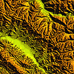
Highly detailed terrain mesh of the Jammu and Kashmir areas, N31-36 E76-78. The files in this package are based on Shuttle Radar (SRTM) Version 2 data but with many of the void areas, especially the most significant sections, filled with elevation data generated from topographic maps by Jonathan de Ferranti. While Jonathan's work is unrelated to flight simulation he kindly gave me permission to compile his data for use in FS. The result is a wonderful improvement in detail and accuracy over any existing mesh file, freeware or commercial, based on SRTM or DTED data alone.
Due to the large area of the Himalayas I've compiled the source data as two separate series: the "Himalayan Peaks" series covers prominent mountains and ranges in higher detail and locally overrides any existing LOD9 terrain mesh. In addition, a LOD9 "base mesh" series covering the entire Himalayas will be available for those who do not yet have an add-on terrain mesh of these beautiful mountains.
| Filename: | Himalayan_Peaks_LOD10_Mesh_Volume_6__Jammu_and_Kas.zip |
| License: | Freeware, limited distribution |
| Added: | 29th May 2010, 08:55:43 |
| Downloads: | 9,663 |
| Author: | Holger Sandmann, Jonathan de Ferranti |
| Size: | 52.19 MB |
| Category: Flight Simulator 2004 - Scenery | |
| "Himalayan Peaks" LOD10 Mesh, Volume 7 - K2 and Karakoram |
|
Images related to this file:
File Description:

Highly detailed terrain mesh of the Karakoram area, N35-37 E73-77. The files in this package are based on Shuttle Radar (SRTM) Version 2 data but with many of the void areas, especially the most significant sections, filled with elevation data generated from topographic maps by Jonathan de Ferranti. While Jonathan's work is unrelated to flight simulation he kindly gave me permission to compile his data for use in FS. The result is a wonderful improvement in detail and accuracy over any existing mesh file, freeware or commercial, based on SRTM or DTED data alone.
Due to the large area of the Himalayas I've compiled the source data as two separate series: the "Himalayan Peaks" series covers prominent mountains and ranges in higher detail and locally overrides any existing LOD9 terrain mesh. In addition, a LOD9 "base mesh" series covering the entire Himalayas will be available for those who do not yet have an add-on terrain mesh of these beautiful mountains.
| Filename: | Himalayan_Peaks_LOD10_Mesh_Volume_7__K2_and_Karako.zip |
| License: | Freeware, limited distribution |
| Added: | 30th May 2010, 09:56:27 |
| Downloads: | 9,474 |
| Author: | Holger Sandmann, Jonathan de Ferranti |
| Size: | 38.58 MB |
| Category: Flight Simulator 2004 - Aircraft Repaints, Textures and Modifications | |
| Caicos International Limited Douglas DC-4 |
|
Images related to this file:
File Description:

Textures for Jens B. Kristensen's excellent Douglas DC-4/C-54, repainted by Manfred Meyer.
This are textures only, You need to download and install DC4_V30.ZIP by J. B. Kristensen, use the cargo model with no radar nose!
These textures depict N529D (c/n 10748) of Caicos International Limited.
The aircraft was delivered in june 1945 as 42-72643 to the USAAF. After conversion to DC-4 in 1946 she went to China and flew for CNAC and CAT as XT-T-07 and XT-102. 1949 the plane came into US register as N4890V and served with several companies like Trans Ocean, Southwest, Riddle and Flying Tiger. 1960 she goes to Paraguayan Air Service as ZP-CBP and later in 1968 to SAM Colombia as HK-529. Bought by Florida Aircraft Leasing in 1970 and leased 1973 to 1975 to Caicos International Limited.
After then flew for Anglers Club and Southern Aero Trades, after all it believed destroyed in Colombia 1979.
| Filename: | Caicos_International_Limited_Douglas_DC4.zip |
| License: | Freeware |
| Added: | 16th November 2014, 21:00:43 |
| Downloads: | 120 |
| Author: | Manfred Meyer |
| Size: | 2.6 MB |


© 2001-2026 AVSIM Online
All Rights Reserved
Privacy Policy |