
Where Flight Simulation Enthusiasts Gather from Around the World!
AVSIM Library - Search Results

| Category: Flight Simulator X - Scenery | |
| EDTC Bruchsal |

|
Images related to this file:
File Description:
The airfield Bruchsal (ICAO: EDTC) is a special landing place in the city Bruchsal.
In addition to the use of the resident Luftsportverein Bruchsal, the place is also approved as a factory airfield of the company DG Flugzeugbau.
It has a grass runway: 12/30 - 500 by 30 metres (about 1,640 by 98 ft).
The scenery was created with a satellite picture of the airport, to match up all buildings, aprons, surroundings and so on, representing the most current state of EDTC as for the data that was available for the time the scenery got
created.
It contains ground textures for Summer and Winter (Spring/Fall use the Summer texture); autogen and default scenery objects of FSX plus a modified AFCAD file.
| Filename: | EDTC_Bruchsal.zip |
| License: | Freeware, limited distribution |
| Added: | 18th June 2018, 16:46:11 |
| Downloads: | 315 |
| Author: | Peregrine Simulations |
| Size: | 27.5 MB |
| Category: Prepar3D V1-4 - Scenery | |
| Fortezza di Hohenwerfen Austria |
|
File Description:
Do you remember the film "Where the eagles dare" well I created the scenery of the fortress of Hohenwerfen (N47.28.96 E13.11.32) where the film was set, a marvel for those who love VFR flight. Located in Haute Savoie near the airport of Salzburg Austria. This scenario was built with Instant scenery and also reproduces the effects of the nocturnal city.
INSTALLATION
The installation is very simple and consists of a single file.bgl you need to paste in the folder addonscenery (FSX or Prepar3D ver.3 / 4) and specifically in the scenery subfolder.
When you start your mortgage will be loaded automatically the scenario. Not liable for any conflicts with other scenary. I do not have trussed Thanks
Author email Pasquale Marrulli [email protected]
| Filename: | Fortezza_di_Hohenwerfen_Austria.zip |
| License: | Freeware |
| Added: | 10th February 2020, 20:25:29 |
| Downloads: | 258 |
| Author: | Pasquale Marrulli |
| Size: | 1.08 KB |
| Category: Flight Simulator 2002 - AFCAD Files | |
| Belg7000 |
|
File Description:
Scenery "Belg7000 V1.6" (1-Mai-2003) - Upgrade to FS2002 (Belgium 2003).
Airport : New EBSG-StGhislain - EBCV-Chièvres V1.1 - EBTY-Maubray - Cerfontaine(lake Eau d'Heure) and EBFS "by Early Bird".
The Belgium scenery where you can fly in "VFR" over 7000 Square Km area.
scenery : Mouscron-(Kortrijk)-Tournai-StGhislain-Mons-Lalouvière-Charleroi-Namur-Andenne-Huy-Liège-Verviers/Visé.
Beaumont-Chimay-Couvin-Cerfontaine "Eau d'Heure-artificial/barrier-lake", virelles-lake, Florennes-Dinant-Mettet-StGérard.
Nivelles-Genappe-Braine-l'Alleud-Tubize, Enghien-Ath-Chièvres-Renaix and more... Condé/Escaut-Quiévrechain (France).
Abbey : Maredsous, Floreffe, Bonne Espérance.
"Meuse valley", "Sambre valley", "Vesdre valley", and "Ourthe/Amblève valley" in Belgium.
Very very nice to fly at low altitude (1500-3000 ft) with an little aircraft.
By Fred. Bridoux
| Filename: | Belg7000.zip |
| License: | Freeware |
| Added: | 2nd May 2003, 12:25:19 |
| Downloads: | 1,883 |
| Author: | Fred. Bridoux |
| Size: | 419.78 KB |
| Category: Flight Simulator 2002 - Scenery | |
| Belg7000 |
|
File Description:
Scenery "Belg7000 V1.6" (1-Mai-2003) - Upgrade to FS2002 (Belgium 2003).
Airport : New EBSG-StGhislain - EBCV-Chièvres V1.1 - EBTY-Maubray - Cerfontaine(lake Eau d'Heure) and EBFS "by Early Bird".
The Belgium scenery where you can fly in "VFR" over 7000 Square Km area.
scenery : Mouscron-(Kortrijk)-Tournai-StGhislain-Mons-Lalouvière-Charleroi-Namur-Andenne-Huy-Liège-Verviers/Visé.
Beaumont-Chimay-Couvin-Cerfontaine "Eau d'Heure-artificial/barrier-lake", virelles-lake, Florennes-Dinant-Mettet-StGérard.
Nivelles-Genappe-Braine-l'Alleud-Tubize, Enghien-Ath-Chièvres-Renaix and more... Condé/Escaut-Quiévrechain (France).
Abbey : Maredsous, Floreffe, Bonne Espérance.
"Meuse valley", "Sambre valley", "Vesdre valley", and "Ourthe/Amblève valley" in Belgium.
Very very nice to fly at low altitude (1500-3000 ft) with an little aircraft.
By Fred. Bridoux
| Filename: | Belg7000.zip |
| License: | Freeware |
| Added: | 2nd May 2003, 12:27:01 |
| Downloads: | 2,944 |
| Author: | Fred. Bridoux |
| Size: | 1.29 MB |
| Category: Flight Simulator X - AFCAD Files | |
| Suncor Firebag, Fort McMurray, CYFI |
|
File Description:
This is a scenery made for Suncor Firebag aerodrome in Northern Alberta, just outside of Fort McMurray. The scenery includes the 1L airport NDB, however the ILS is not functional as of yet. I will fix that soon, until then the RNAV approaches for 17 and 35 are available if you have an RNAV capable aircraft. The scenery only includes the airport, not the surrounding oil fields.
FROM WIKIPEDIA:
"Fort MacKay/Firebag Aerodrome (IATA: YFI, ICAO: CYFI) is located 22 nautical miles (41 km; 25 mi) from the Firebag River, Alberta, Canada. The aerodrome was built to service the Firebag in-situ operation of Suncor Energy."
Runways: 17/35, 6890'
Navigation Aids: 1L NDB 400Hz, U/S ILS RWY 35
| Filename: | Suncor_Firebag_Fort_McMurray_CYFI.zip |
| License: | Freeware |
| Added: | 9th March 2021, 20:14:02 |
| Downloads: | 145 |
| Author: | Nathan Chetram |
| Size: | 4.48 KB |
| Category: Flight Simulator 2004 - Scenery | |
| Ivujivik CYIK and Quaqtaq CYHA adapted for the FSGenesis 76m North Canada Terrain Mesh |
|
Images related to this file:
File Description:
These are replacement bgl's to convert Ivujivik CYIK and Quaqtaq CYHA in Quebec Canada for use with the FSGenesis 76m terrain mesh for northern Canada. I recently discovered this terrain mesh while making a scenery that is, in real life, on the edge of a cliff and cannot understand now why I did not install it before. This is not stand-alone, and presumes that you have already downloaded and installed both previously posted sceneries. The installation consists solely of replacing the existing scenery bgl's with the new. Ivujivik has built a new terminal building since the original scenery post but I have fond "Summer" memories of the old one and stayed with it, shown here in a pic at a surprising time of the year.
| Filename: | Ivujivik_CYIK_and_Quaqtaq_CYHA_adapted_for_the_FSG.zip |
| License: | Freeware, limited distribution |
| Added: | 26th August 2017, 17:54:09 |
| Downloads: | 94 |
| Author: | Roger Wensley |
| Size: | 1.94 MB |
| Category: Flight Simulator 2004 - Scenery | |
| UK Hospitals (Vol 1) |
|
File Description:
This scenery collection contains airfield data for 54 Helipad landing sites in Wales, Lancashire, Merseyside, Cheshire and Cumbria based on the information provided by the Confederation of Helicopter Ambulance Services. Information here http://www.chasuk.co.uk/Documentation/HospitalLandingSites/tabid/69/Default.aspx.
The scenery is intended to be used in FS2004 Century of Flight with Just Flight's VFR photographic VFR scenery installed. The height data from CHASUK has been ignored in favour of that obtained from the Just Flight default mesh.
I have started to add autogen trees etc. around some of the landing sites - but this takes a lot longer and so I'm issuing vol 1 first with autogen only added to a few of the sites in the Chester/Merseyside area.
| Filename: | UK_Hospitals_Vol_1.zip |
| License: | Freeware |
| Added: | 2nd April 2009, 16:44:10 |
| Downloads: | 1,103 |
| Author: | Russ McGinn |
| Size: | 231.54 KB |
| Category: Flight Simulator 2004 - AI Aircraft | |
| AI Flying Boats package |
|
File Description:
AI Flying Boats package for FS9 By Derek Swanson.
This AI package simulates WWII patrol circuits within the British Isles by RAF Sunderlands and Catalinas and inlcudes:
1.Four AI Short Sunderland aircraft
2.Two AI Consolidated Catalina PBY5a aircraft
3.Two sets of AFCAD files for the water landing sites, one for FS9 default scenery and one for the additional FS9 UKVFR payware scenery
4.A set of AI flight plans within the British Isles
5.A set of revised flight dynamics for a user-flown Sunderland and Catalina
6.An E-Z scenery representation of Pembroke Dock
For full details of the above, and acknowledgement of the original authors of some components of this package, please see the README pdf file.
| Filename: | AI_Flying_Boats_package.zip |
| License: | Freeware, limited distribution |
| Added: | 21st December 2011, 11:42:39 |
| Downloads: | 858 |
| Author: | Derek Swanson |
| Size: | 21.27 MB |
| Category: Flight Simulator 2004 - Scenery | |
| VFR of Lario, Area C1 - Como lake, Italy |
|
Images related to this file:
File Description:
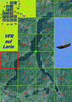
This is the third scenery of the "VFR of Lario" project, with photorealistic terrain and some 3D GMax realistic objects.
Information: this third scenery covers approximately an area of 7.5x6 kmt, from Pellio Intelvi/Ramponio (NW) to Colonno (NE), and from Almanno/Vesbio (SW) to Cavagnola locality (SE) and includes some details (GMax) of Argegno town, as NLC pier, some Holtel and Restaurants, the SS. Trinity church, some bridges and walls on Telo torrent and the cableway Argegno-Pigra (animated); it is also enclosed the unique small museum of financial police and smuggling, on Erbonne.
Contents: GMax objects as above and other buidings, minor piers and boats together with autogen buildings and trees are fully spreaded on the scenery.
| Filename: | VFR_of_Lario_Area_C1__Como_lake_Italy.zip |
| License: | Freeware |
| Added: | 16th February 2012, 00:17:59 |
| Downloads: | 1,779 |
| Author: | Aldo Della Vedova, Daniele Lanfranchi, Gian Mario Verga e Diego Caligiuri |
| Size: | 12.98 MB |
| Category: Flight Simulator 2004 - Scenery | |
| Ko Samui, Thailand (VTSM) v4.0 |
|
File Description:
Samui is a small, but busy airport on the island of Ko Samui. It is located in Southern Thailand, and is an exotic resort destination. In 1989 Bangkok Airways opened their own airport on the island, which decreased the travel time from Bangkok considerably. The airport is currently served by Bangkok Airways, although an occasional private aircraft will land here. This scenery is a detailed and accurate representation of this airport as it looks today. I consulted with several visitors to the airport, as well as the AIP for Thailand. Landsat imagery was used to modify the shoreline, and a custom landclass is included. Taxiway and parking areas were modified by using AFCAD2. This scenery is compatible with 3rd-party mesh scenery for Thailand.
| Filename: | Ko_Samui_Thailand_VTSM_v40.zip |
| License: | Freeware, limited distribution |
| Added: | 25th April 2004, 21:10:31 |
| Downloads: | 11,751 |
| Author: | Martin Strong |
| Size: | 5.34 MB |


© 2001-2026 AVSIM Online
All Rights Reserved
Privacy Policy |