
Where Flight Simulation Enthusiasts Gather from Around the World!
AVSIM Library - Search Results

| Category: Flight Simulator X - Scenery | |
| Victoria, Canada including US Southern Gulf Islands and San Juan Islands - Part 1 of 2 |

|
Images related to this file:
File Description:
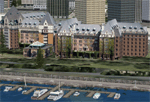
FSX-only version of Victoria, Canada area scenery including the Southern Gulf Islands and the San Juan Islands of the US. Includes automated installer and configurator by Scot Fraser.
Features:
-accurate shorelines, lakes and streams;
-landclass;
-FSX multi-LOD mesh with 10m maximum resolution;
-complete road network with moving traffic;
-railroads;
-utility corridors;
-marinas and ferry terminals;
-many static boats, including a custom model of the Canada Coast Guard ship Sir Wilfred Laurier;
-detailed models of major buildings and the Ogden Point Terminal;
-many bridges;
-nearly 300 marine lights; and corrected antennae locations.
Facilities include Don Grovestine's famous CYYJ (Victoria International Airport); 12 other Canadian land-based airports: Butler Field, Duncan (CAM3), Gaines, Hastings, Hudson Island, James Island, Thomas, Village Bay, Raven Field (CML2), Saltspring, Sidney Island, Whiskey Point; 20 US airports Blakely (38WA), Burden (61WA), Center Island (79WA), Clam Harbor (WA35), Crane Island, Decatur Shores (WN07), Decatur-Jones (WA18), Waldronaire (90WA), Orcas Island (KORS), Friday Harbour (KFHR), Lopez Island (S31), Pile Point, Roche Harbor (WA09), Shaw Island, Stuart Island Airpark (7WA5), Stuart Island West (2WA3), Wilding (6WA5), Windsock (4WA4); 12 floatplane facilities: Bedwell (CAB3), Fisherman's Bay (WA81), Friday Harbor (W33), Ganges (CAX6), Maple Bay, Mayne (CAW7), Port Washington (CAP8), Roche Harbor (W39), Rosario (W49), Shawnigan Lake (CAV8), Victoria Harbour (CYWH), Victoria International (CAP5) and Westsound, Orcas (WA83) - many with AI traffic; 9 heliports: Ganges (CAL7), Mayne (CBF5), Camel Point (CBF7), Jubilee (CBK8), Victoria General (CBW7) Madrona Bay (CBW9), Shoal Point (CBZ7), Mount Belcher (CMBH).
AI models include the DHC-2 floatplane in local liveries, a cruise ship model (by Mitsuya Hamaguchi) and two repaints, pilot boat, and small boats (by Larry Silsbee).
Ultimate Terrain X compatible (not required). Users of Vancouver+ for FSX will also get additional cruise ship traffic and additional floatplane and helicopter traffic. Full documentation. By Don Grovestine, Jon Patch and Holger Sandmann. Many other contributors: see documentation. Part 1 of 2 - you also need file vicenh7b.zip
| Filename: | Victoria_Canada_including_US_Southern_Gulf_Islands.zip |
| License: | Check within download |
| Added: | 29th January 2010, 21:23:17 |
| Downloads: | 23,162 |
| Author: | Don Grovestine, Jon Patch and Holger Sandmann |
| Size: | 56.8 MB |
| Category: Flight Simulator X - Scenery | |
| Victoria, Canada including US Southern Gulf Islands and San Juan Islands - Part 2 of 2 |
|
Images related to this file:
File Description:
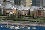
FSX-only version of Victoria, Canada area scenery including the Southern Gulf Islands and the San Juan Islands of the US. Includes automated installer and configurator by Scot Fraser.
Features:
-accurate shorelines, lakes and streams;
-landclass;
-FSX multi-LOD mesh with 10m maximum resolution;
-complete road network with moving traffic;
-railroads;
-utility corridors;
-marinas and ferry terminals;
-many static boats, including a custom model of the Canada Coast Guard ship Sir Wilfred Laurier;
-detailed models of major buildings and the Ogden Point Terminal;
-many bridges;
-nearly 300 marine lights; and corrected antennae locations.
Facilities include Don Grovestine's famous CYYJ (Victoria International Airport); 12 other Canadian land-based airports: Butler Field, Duncan (CAM3), Gaines, Hastings, Hudson Island, James Island, Thomas, Village Bay, Raven Field (CML2), Saltspring, Sidney Island, Whiskey Point; 20 US airports Blakely (38WA), Burden (61WA), Center Island (79WA), Clam Harbor (WA35), Crane Island, Decatur Shores (WN07), Decatur-Jones (WA18), Waldronaire (90WA), Orcas Island (KORS), Friday Harbour (KFHR), Lopez Island (S31), Pile Point, Roche Harbor (WA09), Shaw Island, Stuart Island Airpark (7WA5), Stuart Island West (2WA3), Wilding (6WA5), Windsock (4WA4); 12 floatplane facilities: Bedwell (CAB3), Fisherman's Bay (WA81), Friday Harbor (W33), Ganges (CAX6), Maple Bay, Mayne (CAW7), Port Washington (CAP8), Roche Harbor (W39), Rosario (W49), Shawnigan Lake (CAV8), Victoria Harbour (CYWH), Victoria International (CAP5) and Westsound, Orcas (WA83) - many with AI traffic; 9 heliports: Ganges (CAL7), Mayne (CBF5), Camel Point (CBF7), Jubilee (CBK8), Victoria General (CBW7) Madrona Bay (CBW9), Shoal Point (CBZ7), Mount Belcher (CMBH).
AI models include the DHC-2 floatplane in local liveries, a cruise ship model (by Mitsuya Hamaguchi) and two repaints, pilot boat, and small boats (by Larry Silsbee).
Ultimate Terrain X compatible (not required). Users of Vancouver+ for FSX will also get additional cruise ship traffic and additional floatplane and helicopter traffic. Full documentation. By Don Grovestine, Jon Patch and Holger Sandmann. Many other contributors: see documentation. Part 2 of 2 - you also need file vicenh7a.zip
| Filename: | Victoria_Canada_including_US_Southern_Gulf_Islands.zip |
| License: | Check within download |
| Added: | 29th January 2010, 21:21:49 |
| Downloads: | 23,166 |
| Author: | Don Grovestine, Jon Patch and Holger Sandmann |
| Size: | 59.08 MB |
| Category: Flight Simulator 2004 - Scenery | |
| Masbate Airport, Masbate, Philippines |
|
File Description:
This is a totally new Masbate Scenery Addon for Flight Simulator 2004. This features Multi-Level of Detail (MLOD) which makes a scenery framerate-friendly. At a distance, the objects are on its LOW POLYGON STATE. And while you get closer and closer, the objects become more and more complex, making you landing sequence unaffected by heavy framerate hit due to the High number of Polygons of the Library Objects.
In this scenery, you will see a total transformation from the default Masbate City area in FS2004 to a new realistic and alive Masbate City as seen in the included screenshots.
Masbate Airport Scenery (RPVJ) features photorealistic textures. This includes the Main Terminal Building, the Rancho Cuervo Verde Hangar, the Masbate Airport cargo warehouse, the Administration Building, the Crash and Fire Rescue Station, and the Control Tower. This scenery has full night lighting textures and has night lighting beams that illuminate the ramp from the firestation building. Other library objects included are: Animated Baggage Carts, Airport and Ramp personnel, ferry boats, ships, yachts, sailboats, cargo vessels, lighthouse, jeeps, cows and horses. But these objects do not interfere with the framerate so much because this is defined in the MLOD feature.This scenery has not been tested with FS2002 but is more likely to work without problem in that version except that AFCAD for FS2002 should be separately designed.
Currently, Asian Spirit serves this destination daily from Manila arriving at 7:15 a.m. and departing for Manila at 7:35 a.m.
| Filename: | Masbate_Airport_Masbate_Philippines.zip |
| License: | Freeware |
| Added: | 29th June 2004, 02:55:36 |
| Downloads: | 4,247 |
| Author: | Ver Walter Gulfan, Philippine Flightsimmers Group |
| Size: | 4.09 MB |
| Category: Flight Simulator X - Scenery | |
| FSX-DTTJ-Djerba |
|
File Description:
Well it starts like always, I can't find a usable freeware airport in this
case for the DTTJ Djerba-Zarzis so I'll build it myself again.........
well what can I say here it is built as real as possible with many details
with the standard scenery after a lot of work ..........
So fly to Tunisia to the island of Djerba, of course with an Airbus A321 or
a Boeing 737. There you change to a helicopter or a smaller plane and
look around the area...Tip: Zarzis is near the port a helipad......
Installation:
copy the folder DTTJ Djerba Scenery into the addon folder of the FSX,
start the FSX go to settings, scenery library, add area, press OK, then
you can already start.............
Extras: to be able to see people, I deliver the file 3DPeoble_Lib, copy it
into the Addon Scenery folder and activate it in FSX as described during
the installation and you can already see people......
the same applies to all files that are supplied to see more details in the
FSX folder Addon Scenery copy individually and activate in FSX you
should have already activated one of these files! You don't need to install
it again! EZ-Scenery-Object Files ( for extra buildings and accessories )
...... RCJ-Neoplan............( Buses ). airport_restaurants_ss_fsx..........
( extra building ) Parking lots_large_ss_Fsx.Bgl........( vehicles and
parking lots) Lightobj.bgl......lights and light poles......... more about it on
my youtube channel https://www.youtube.com
/channel/UC7vHXQMa3hhU2iGtODXlkHw/videos
Support:Questions and help on my YouTube channel or by email to
[email protected] And now have fun In Djerba Jamaica
| Filename: | FSXDTTJDjerba.zip |
| License: | Freeware |
| Added: | 18th September 2023, 14:53:38 |
| Downloads: | 396 |
| Author: | Wagner Ewald alias Jamaika |
| Size: | 84.97 MB |
| Category: Flight Simulator 2004 - Scenery | |
| Warsaw Airport (EPWA) 2010, Poland (v1.1) |
|
Images related to this file:
File Description:

Warsaw Frederic Chopin Airport (Polish: Port Lotniczy im. Fryderyka Chopina) (IATA: WAW, ICAO: EPWA) is an international airport located in the Okecie district of Warsaw, Poland. Formerly Okecie International Airport, it is named after the famous Polish composer and former Warsaw resident, Frederic Chopin. It is Poland's busiest airport, handling just under 50% of the country's air passenger traffic. High detailed airport scenery by MK-Studios.com.pl
Updated version 1.1 of Warsaw scenery
| Filename: | Warsaw_Airport_EPWA_2010_Poland_v11.zip |
| License: | Freeware, limited distribution |
| Added: | 5th May 2010, 21:35:20 |
| Downloads: | 10,088 |
| Author: | Mateusz Stabryla, MK Studios |
| Size: | 33.16 MB |
| Category: Flight Simulator 2004 - Scenery | |
| Cape Girardeau Regional |
|
File Description:
FS2004 Scenery - Cape Girardeau Regional Airport (IATA: CGI, ICAO: KCGI) is a public airport located five miles (8 km) southwest of the central business district (CBD) of Cape Girardeau, a city in Cape Girardeau County, Missouri, USA. The airport covers 557 acres (225 ha) and has two runways. It is used for general aviation. Created using Instant Scenery. Libraries listed. Created With assistance from David "Opa" Marshall, by John B. Loney, Jr.
| Filename: | Cape_Girardeau_Regional.zip |
| License: | Freeware, limited distribution |
| Added: | 3rd August 2008, 17:02:06 |
| Downloads: | 783 |
| Author: | John B. Loney, Jr. |
| Size: | 1.18 MB |
| Category: Flight Simulator 2004 - Scenery Design | |
| Ellsworth AFB Runway Fix |
|
File Description:
After the release of my Ellsworth AFB scenery (KRCA_JS2.zip), it was pointed out to me that I had forgotten to check the runway lighting and sure enough there is none. Thanks to a thoughtful user who helped verify the proper lighting information. This is a replacement ADE file that will correct the issue. Will NOT work with the default airport - requires the scenery package found in KRCA_JS2.zip for proper operation.
| Filename: | Ellsworth_AFB_Runway_Fix.zip |
| License: | Freeware, limited distribution |
| Added: | 28th February 2014, 09:29:23 |
| Downloads: | 706 |
| Author: | John Stinstrom |
| Size: | 19.51 KB |
| Category: Flight Simulator 2004 - AFCAD Files | |
| LFBO v2 ( Toulouse Blagnac ) |
|
File Description:
It's an Afcad file for the LFBO sim-wings scenery without static plane. In this file, you'll find traffic AI and another one for the A380 and A300-600st (super - beluga) static sceneries. In the readme I show you how to suppress a part of the static scenery.
Excuse me because in my last upload (LFBO afcad) I haven't got see that it was the wrong afcad.
Suppress the last afcad and install this afcad
| Filename: | LFBO_v2__Toulouse_Blagnac_.zip |
| License: | Freeware |
| Added: | 4th December 2005, 17:00:22 |
| Downloads: | 711 |
| Author: | Dinot Mathieu |
| Size: | 366.31 KB |
| Category: Flight Simulator 2004 - Scenery Design | |
| Military Buildings #8 |
|
File Description:
FS2004/FS2002 API macro--Military Buildings
#8. All are Hospital Quonset Buildings
for scenery designers. All of the parts
that you need to build a Vietnam era MASH
hospital. Textures are from photos of the
27th Surgical hospital that was located at
Chu Lai, Vietnam during the Vietnam war.
This hospital was a duplicate of many others
located all over Vietnam. They will be
useable with most any modern warfare scenery.
By Al Simms
| Filename: | Military_Buildings_8.zip |
| License: | Freeware |
| Added: | 11th June 2006, 04:59:47 |
| Downloads: | 565 |
| Author: | Albert E Simms Jr |
| Size: | 210.65 KB |
| Category: Flight Simulator 2002 - Scenery | |
| Saguaro National Park East. |
|
File Description:
This is a scenery of Saguaro National Park East, located at the eastern edge of Tucson, Arizona, next to the Rincon Mountains. There are photoreal macros of the Visitor Center, Toll Booth, and Saguaro's created with EOD and digital photos from the park. I have provided a fictional helio pad, and also a fictional airstrip, Tanque Verde Airstrip TVA, with AFCAD file, to provide easy access to the scenery. All Textures included. By Robert Palmer
| Filename: | Saguaro_National_Park_East.zip |
| License: | Freeware, limited distribution |
| Added: | 11th April 2003, 23:49:38 |
| Downloads: | 909 |
| Author: | Robert Palmer |
| Size: | 2.57 MB |


© 2001-2026 AVSIM Online
All Rights Reserved
Privacy Policy |