
Where Flight Simulation Enthusiasts Gather from Around the World!
AVSIM Library - Search Results

| Category: Flight Simulator X - AFCAD Files | |
| Camden County Airport (19N), NJ |

|
File Description:
Located 01 miles SW of Berlin, New Jersey on 75 acres of land, Camden County Airport is a small general aviation airport privately owned by Albion Airport, Inc. The airport can handle small commuter planes (like the Cessna 208B) as well as small GA craft. Tiedowns are available on both the grass turf at the west end of the airport and the tarmac on the east end. Fuel is only available on the tarmac - park next to the fuel trucks. Trees are summer time ONLY.
Scenery constructed with use of Google Maps images/streetview, the author has not been there in person.
This scenery is meant to be used in conjunction with MegaScenery Earth New Jersey/Delaware 004. It is not required, but apron use is minimized to allow satellite scenery to show through as much as possible, and objects are placed based on the MSE textures - lack of it may make scenery look out of place.
| Filename: | Camden_County_Airport_19N_NJ.zip |
| License: | Freeware |
| Added: | 8th October 2010, 14:04:03 |
| Downloads: | 243 |
| Author: | Drew Sikora |
| Size: | 944.87 KB |
| Category: Flight Simulator X - AFCAD Files | |
| Air-List-Ads Airport (JY07), NJ |
|
File Description:
This is a small turf strip 1500x70 feet located near the border of NJ and PA in the northwestern part of the state. It's not officially listed so I don't have any more data than that. No services of any kind are available. Trees are summer ONLY. If you fly VFR around the area, this will at least prevent you from seeing a random-looking grass strip over some trees and half a neighborhood. Runway headings are 11/29
Scenery constructed with use of satellite images/streetview, the author has not been there in person.
This scenery is meant to be used in conjunction with MegaScenery Earth New York 007. It is not required, but apron use is minimized to allow satellite scenery to show through as much as possible, and objects are placed based on the MSE textures - lack of it may make scenery look out of place.
| Filename: | AirListAds_Airport_JY07_NJ.zip |
| License: | Freeware |
| Added: | 16th October 2010, 08:57:57 |
| Downloads: | 182 |
| Author: | Drew Sikora |
| Size: | 283.7 KB |
| Category: Flight Simulator X - AFCAD Files | |
| Old Bridge Airport (3N6), NJ |
|
File Description:
Located 05 miles S of Old Bridge, New Jersey on 120 acres of land, Old Bridge Airport is a public airstrip. Fuel is available by stopping next to the tank north of the parking area. This airport has hangars for transient aircraft - two hangars next to the parking area are open for parking. You can also start in them by selecting one of the DOCK parking options. Immediately adjacent to the airport is Raceway Park, which features a drag strip, road course, dirt bike course, and karting/motoX areas. Trees are summertime ONLY.
Scenery constructed with use of satellite images/streetview, the author has not been there in person.
This scenery is meant to be used in conjunction with MegaScenery Earth New Jersey/Delaware 001. It is not required, but apron use is minimized to allow satellite scenery to show through as much as possible, and objects are placed based on the MSE textures - lack of it may make scenery look out of place.
| Filename: | Old_Bridge_Airport_3N6_NJ.zip |
| License: | Freeware |
| Added: | 22nd November 2010, 18:40:52 |
| Downloads: | 211 |
| Author: | Drew Sikora |
| Size: | 1.61 MB |
| Category: Flight Simulator X - AFCAD Files | |
| Var-Sky Airport (JY08), NJ |
|
File Description:
Located 02 miles E of Woodstown, New Jersey on 38 acres of land, Var-Sky Airport is a private turf strip 1165' in length and a slightly challenging approach with trees closely bordering the sides of both runway ends. This airport has lighting on the runway however there is no beacon and the windsock (located atop the hangar) is not lit. There are no services offered for transient aircraft. There is no hard surfaced runway so having your terrain mesh settings as high as possible is recommended.
Scenery constructed with use of satellite images/streetview/aerial photos - the author has not been there in person.
This scenery is meant to be used in conjunction with MegaScenery Earth New Jersey/Delaware 004. It is not required, but apron use is minimized to allow satellite scenery to show through as much as possible, and objects are placed based on the MSE textures - lack of it may make scenery look out of place.
| Filename: | VarSky_Airport_JY08_NJ.zip |
| License: | Freeware |
| Added: | 19th April 2011, 06:21:50 |
| Downloads: | 195 |
| Author: | Drew Sikora |
| Size: | 361.96 KB |
| Category: Flight Simulator X - AFCAD Files | |
| Malone Airport (NJ61), NJ |
|
File Description:
Located 02 miles E of Frenchtown, New Jersey on 45 acres of land, Malone is a private airport with two turf strips, the longest of which is 2400' in length. There are no services offered, although there is room next to the existing planes to park if you wish - collisions are disabled with the aircraft. Both runways have their hard surfaces removed so turn your mesh settings as high as possible. Both runways slope down from the hangar/house area. Airport is unlit and daytime VFR operations only are recommended.
Scenery constructed with use of satellite images/streetview/aerial photos - the author has not been there in person.
This scenery is meant to be used in conjunction with MegaScenery Earth New York 007. It is not required, but apron use is minimized to allow satellite scenery to show through as much as possible, and objects are placed based on the MSE textures - lack of it may make scenery look out of place.
| Filename: | Malone_Airport_NJ61_NJ.zip |
| License: | Freeware |
| Added: | 20th September 2011, 13:57:18 |
| Downloads: | 284 |
| Author: | Drew Sikora |
| Size: | 958.34 KB |
| Category: Flight Simulator X - Scenery | |
| LFST - Strasbourg-Entzheim, France |
|
Images related to this file:
File Description:
A very detailed rendition of Strasbourg-Entzheim airport (France).
This scenery has been made for FSX SP2 or Acceleration and DirectX9.
However, it has been tested successfully with DX10 free shaders from Steve Parsons (not tested with DX10 Scenery Fixer SteveFSX)and with Prepar3D v.2.1.
Almost all the buildings have been built accurately, based on numerous pictures.
Runway, taxiways and aprons are covered with textured polygons so as to keep the look of the pavement regardless of extra add-ons installed. These textured polygons enable a smooth transition with the photorealistic ground (blend effect).
Aprons markings are up to date. This scenery is ready to accommodate your AI traffic : the stands are assigned to the main airlines serving the airport and their settings match with the real ones (nose-in, nose-out, drive through).
I have spent more than 2 years to make this photorealistic scenery.
I hope you enjoy discovering Strasbourg airport, have nice flights!
| Filename: | LFST__StrasbourgEntzheim_France.zip |
| License: | Freeware, limited distribution |
| Added: | 9th March 2014, 22:52:25 |
| Downloads: | 16,968 |
| Author: | Jacques-Paul Bollard |
| Size: | 66.87 MB |
| Category: Flight Simulator 2004 - Scenery | |
| UBBB - Heydar Aliyev Airport - Azerbaijan ** DEMO ** |
|
Images related to this file:
File Description:
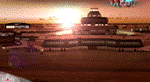
Baku 2017 DEMO is the scenery featuring a highly detailed representation of UBBB Heydar Aliyev airport in Azerbaijan. This product is fully compatible with FS2004.
It's a fully functional DEMO version of the commercial payware product. It features same airport layout as in the full version but with limited 3D objects and low resolution textures. Using this free demo ensures no problems with online (VATSIM, IVAO, multiplayer etc.) flying in case some users use the payware scenery and some don't.
Heydar Aliyev International Airport (IATA: GYD, ICAO: UBBB) (former Bina International Airport) is the main international airport in Azerbaijan, the home of Azerbaijan Airlines, the national flag carrier.
It's equipped with an automatic installer, which means that the scenery will be automatically added to the Flight Simulator Scenery Library.
Please uninstall all previous versions of this airport you may have installed before. Please make also sure that no duplicated AFCAD files are installed!
Enjoy your virtual flying with Drzewiecki Design!
| Filename: | UBBB__Heydar_Aliyev_Airport__Azerbaijan__DEMO_.zip |
| License: | Freeware, limited distribution |
| Added: | 30th May 2016, 10:48:12 |
| Downloads: | 1,414 |
| Author: | Drzewiecki Design |
| Size: | 12.01 MB |
| Category: Flight Simulator 2004 - Scenery | |
| Bumba Airport (FZFU/BMB) |
|
File Description:
Scenery for Bumba airport (FZFU/BMB), namely a small airport located in the North part of the Democratic Republic of Congo (DRC), Mondala Province, serving the small town of Bumba located near the Congo river. Bumba is an ideal reference point for VFR flights along the Congo river in that region, as well as around that part of the DRC forest. The scenery contains two parts: the landclass, that defines the terrain at and around the airport, and the airport scenery, which contains the runway, the aprons, and the 3D objects. In comparison with the default FS2004 scenery, this contains brand new runway and aprons, drawn using custom textures that should give a more realistic feeling of the airstrip, and the landclass has been modified in order to represent faithfully the real landscape around the airport. The Static Object Library of RWY12 is necessary in order to properly display the 3D objects: it can be found easily in the AVSIM library.
| Filename: | Bumba_Airport_FZFUBMB.zip |
| License: | Freeware |
| Added: | 30th April 2020, 18:31:15 |
| Downloads: | 161 |
| Author: | Marco Ruggieri |
| Size: | 7.52 MB |
| Category: Flight Simulator 2002 - Scenery | |
| Saipan Kagman Field |
|
File Description:
The sixth in DBWsim Design's series of historic WWII airfields in the Marianas Islands is Saipan's Kagman (East) Field, on the eastern side of Saipan. This pack follows up scenery packs for Marpi Point, Isley and Kobler Field on Saipan and West Field and North Field Tinian. This scenery is a stand alone package and does not require any other DBWsim scenery packages to be fully functional. (but it does need Gerrish Grey's trees_v3.zip)
Kagman Field has perhaps the least available information about it of all the WWII airfields on the Marianas Islands. However, it is understood to have still been operational into the early 1970's. Also it is alleged to have been used as a CIA training facility. DBWsim's scenery of this field includes the most comprehensive version of Kagman as it appears today as could be designed with the limited information available, as well as a (fictional) version of this CIA base at the field.
| Filename: | Saipan_Kagman_Field.zip |
| License: | Freeware |
| Added: | 28th August 2003, 16:27:27 |
| Downloads: | 317 |
| Author: | Derek and Brendan Webb |
| Size: | 929.73 KB |
| Category: Flight Simulator X - Scenery | |
| Deer Valley FC Resort & Roosevelt Lake |
|
File Description:
Deer Valley Resort at Roosevelt Lake Scenery. -
This is a fictious Resort at Roosevelt Lake by Grapevine AZ USA.
Its basically a fly-in resort for the Deer Valley Flying Club members to relax, do some fishing, go to the Amusement Park and have a general great time. But the resort is now open to the public. If you dont want to spend the big bucks, there is a small campground located nearby.
I suggest a float plane or helocopter for the trip out and back. If you're a competent bush pilot, you might be able to land on the grass runway, but its a very difficult strip. Fly a STOL plane or you wil not make it.
Acknowledments:
Microsoft: FS X Sdk Scenery function of the Mission builder.
Abacus: Scenery shortcut tool.
Lee Swordy: AFCAD Ver 2.21.
NOTE: This scenery is frame rate friendly, but I would highly suggest turning off ground shadows.
| Filename: | Deer_Valley_FC_Resort__Roosevelt_Lake.zip |
| License: | Freeware |
| Added: | 18th January 2007, 05:20:29 |
| Downloads: | 1,220 |
| Author: | Bob Caparoula |
| Size: | 4.16 MB |


© 2001-2026 AVSIM Online
All Rights Reserved
Privacy Policy |