
Where Flight Simulation Enthusiasts Gather from Around the World!
AVSIM Library - Search Results

| Category: Flight Simulator 2004 - Scenery | |
| HTMS Moshi |

|
File Description:
Googly scenery for Moshi (ICAO: HTMS), a small airport serving the town of the same name
located in the lower slopes of Africa's highest mountain - Mount Kilamanjaro.
The town boasts good quality education and medical facilities, and industry
includes production of fizzy drinks, beer, flour, animal feed and furniture,
but surprisingly little tourism activity has been developed here so much of
the traffic at this airport is unscheduled and charter work using smaller
aircraft.
Microsoft have only provided wrongly-positioned runways at this airport in
Flight Simulator 2004 and this scenery seeks to redress the situation
so that you and your "AI" traffic can use the airport.
The scenery does not purport to be ultra-accurate. Based on high quality
satellite imagery from Google Earth, the layout is proportionally correct but the
added airport features, such as buildings, are built from default Microsoft objects
and add-on libraries so will not look exactly like the real thing.
You are not obliged to download and install any additional scenery libraries,
but to enjoy this scenery in its entirety, you may wish to. It will work fine,
with or without.
| Filename: | HTMS_Moshi.zip |
| License: | Freeware |
| Added: | 12th October 2008, 10:22:59 |
| Downloads: | 1,079 |
| Author: | John Hinson |
| Size: | 61.84 KB |
| Category: Flight Simulator 2004 - Scenery | |
| VABP Bhopal/Bairagarh, India |
|
Images related to this file:
File Description:
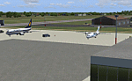
Googly scenery for VABP Bhopal/Bairagarh, India - an enhancement to the
airport provided in Flight Simulator 2004 which is incorrect in many respects.
These scenery files enlarge the apron to a realistic size to accept scheduled
traffic, remove spurious taxiways (they were actually perimeter tracks!), and
add buildings and other airport features so that you and your "AI" traffic
can land, taxi, park and take off in a realistic manner.
This small domestic airport is served by Boeing and Airbus jets of Indian
Airlines and Jet Airways together with local flights operated by ATRs of Air
Deccan.
The scenery does not purport to be ultra-accurate. Based on high-detail satellite
imagery from Google Earth, the layout is proportionally correct but the added
airport features, such as buildings, are built from default Microsoft objects
and add-on libraries so will not look like the real thing.
You are not obliged to download and install any additional scenery libraries,
but to enjoy this scenery in its entirety, you may wish to. It will work fine,
with or without.
[File re-uploaded at request of AVSIM]
| Filename: | VABP_BhopalBairagarh_India.zip |
| License: | Freeware |
| Added: | 7th May 2010, 22:34:06 |
| Downloads: | 1,625 |
| Author: | John Hinson |
| Size: | 64.37 KB |
| Category: Flight Simulator 2004 - Scenery | |
| Houn, Libyan (HLON/HUQ) |
|
File Description:
Googly scenery for HLON Hon, Libya, a small domestic airport serving the oasis town (which is correctly spelt Houn) about 250 miles south-east of Tripoli. It is the capital of the Al Jufrah region. Although the airport holds ICAO and IATA status, as far as I can establish there are
currently no scheduled services to this airport, so present-day traffic is limited to the occasional charter, cargo or private flight. Flight Simulator 2004 has made no provision for traffic with only a runway provided and this scenery seeks to redress the situation so that you and your "AI" traffic can use the airport. The scenery does not purport to be ultra-accurate. Based on high quality satellite imagery from Google Earth, the layout is proportionally correct but the
added airport features, such as buildings, are built from default Microsoft objects
and add-on libraries so will not look exactly like the real thing. You are not obliged to download and install any additional scenery libraries, but to enjoy this scenery in its entirety, you may wish to. It will work fine, with or without.
| Filename: | Houn_Libyan_HLONHUQ.zip |
| License: | Freeware |
| Added: | 18th April 2008, 09:51:02 |
| Downloads: | 842 |
| Author: | John Hinson |
| Size: | 65.71 KB |
| Category: Flight Simulator 2004 - Scenery | |
| DTTG Gabes, Tunisia |
|
File Description:
Googly scenery for Gabes (ICAO: DTTG), a somewhat nondescript airport
shoe-horned into one of Tunisia's largest industrial cities. Famed for
its beaches, the city hosts cement, chemical and brick factories and an
oil refinery, resulting in poor levels of air pollution. The airport is
a joint military and civilian operation although military traffic appears
to be mostly helicopter activity and the civilian traffic consists of an
ATR of Sevenair calling in once in a blue moon.
Microsoft have only provided a runway at this airport in Flight Simulator
2004 and this scenery seeks to redress the situation so that you and your
"AI" traffic can use the airport realistically.
The scenery does not purport to be ultra-accurate. Based on high quality
satellite imagery from Google Earth, the layout is proportionally correct but the
added airport features, such as buildings, are built from default Microsoft objects
and add-on libraries so will not look exactly like the real thing.
You are not obliged to download and install any additional scenery libraries,
but to enjoy this scenery in its entirety, you may wish to. It will work fine,
with or without.
| Filename: | DTTG_Gabes_Tunisia.zip |
| License: | Freeware |
| Added: | 14th October 2008, 13:18:33 |
| Downloads: | 757 |
| Author: | John Hinson |
| Size: | 83.15 KB |
| Category: Flight Simulator 2004 - Scenery | |
| HEMM Mersa Matruh, Egypt |
|
File Description:
Googly scenery for HEMM Mersa Matruh - a large Air Base near the north coast of
Egypt. Marsa Matruh, as the town should be spelt, is a seaport 150 miles west of
Alexandria but its main function today is that of a holiday resort for the
residents of Cairo. It does not have an airport of its own, but uses a small
corner of the Air Base for civilian flights. Microsoft Flight Simulator has
made no provision for any traffic at this airport and this scenery seeks to
redress the situation.
Scheduled flights are operated by Egyptair Express using Embraer 170 jets,
but other airlines call here from time to time, such as Air Sinai and Midwest
Airlines.
The scenery does not purport to be ultra-accurate. Based on high quality
satellite imagery from Google Earth, the layout is proportionally correct but the
added airport features, such as buildings, are built from default Microsoft objects
and add-on libraries so will not look exactly like the real thing.
You are not obliged to download and install any additional scenery libraries,
but to enjoy this scenery in its entirety, you may wish to. It will work fine,
with or without.
| Filename: | HEMM_Mersa_Matruh_Egypt.zip |
| License: | Freeware |
| Added: | 18th February 2008, 17:32:10 |
| Downloads: | 1,989 |
| Author: | John Hinson |
| Size: | 114.6 KB |
| Category: Flight Simulator 2004 - Scenery | |
| FNGI N'giva/Ondjiva Pereira, Angola |
|
File Description:
Googly scenery for N'giva - Ondjiva Pereira (ICAO: FNGI, IATA: NGV), an airport
serving Ondjiva, one of Angola's larger cities. Until relatively recently it
possessed little more than a dirt runway but recent expansion has seen the
commissioning of a longer asphalt runway and a terminal area. Today, the airport
sees passenger and cargo flights from airlines such as Air Gemini, Angola
Airlines, Savanair and Sonair utilising a variety of aircraft from the little
Let 410 turboprop through to Boeing 737 jets.
Microsoft have only provided the dirt runway at this airport in Flight Simulator
2004 and this scenery seeks to redress the situation so that you and your
"AI" traffic can use the airport realistically.
The scenery does not purport to be ultra-accurate. Based on high quality
satellite imagery from Google Earth, the layout is proportionally correct but the
added airport features, such as buildings, are built from default Microsoft objects
and add-on libraries so will not look exactly like the real thing.
You are not obliged to download and install any additional scenery libraries,
but to enjoy this scenery in its entirety, you may wish to. It will work fine,
with or without.
| Filename: | FNGI_NgivaOndjiva_Pereira_Angola.zip |
| License: | Freeware |
| Added: | 15th October 2008, 12:40:17 |
| Downloads: | 1,608 |
| Author: | John Hinson |
| Size: | 73.94 KB |
| Category: Flight Simulator 2004 - Scenery | |
| Sproat Lake CAA9 V2 on Vancouver Island in British Columbia, Canada |
|
Images related to this file:
File Description:
This presumes you have already installed Sproat Lake CAA9; it is not a stand-alone scenery. In the original post I omitted the traffic bgl. This is now included, as are the two AI Beavers that FSAddon gave permission for inclusion and use as AI with Sproat Lake. So if you already have installed the pay scenery they came with they will show up anyway, but if you don't then install these two and they will; just drop the Sproat Lake AI Beavers folder into your aircraft folder, and the traffic bgl into the FS9'Scenery/World/Scenery folder as usual. I have now also included a Grumman Goose amphibian as this was the plane that the Fire Boss would be operating in while fire fighting. The textures are what were available and that I could (limited skills here) revise to at least have a Canadian registration. If I find a more accurate version I will include it at a later date. Drop the bgl's and textures into the already installed Sproat Lake scenery and texture folders and say yes to overwrite or replace.
| Filename: | Sproat_Lake_CAA9_V2_on_Vancouver_Island_in_British.zip |
| License: | Freeware, limited distribution |
| Added: | 11th December 2016, 06:45:32 |
| Downloads: | 223 |
| Author: | Roger Wensley |
| Size: | 3.89 MB |
| Category: X-Plane - Scenery | |
| ENNM - Namsos Airport - Namsos, Norway |
|
Images related to this file:
File Description:
This Namsos scenery corresponds to the current Airport Layout of ENNM. The near surroundings are designed based on a satellite photo so that VFR flights and VFR orientation should be very easy. The second bridge a bit far west of the airport is included, also the City of Namsos, a cruise ship dock and the marina south of the Namsos Bridge.
I used some parts of freeware libraries, which are already included in this package.
The airport buildings are converted from the famous FS2004 scenery from Kjell Arild Bersaas & Arne Sundsboe.
I did some small changes which were absolutely necessary to fit the new airport layout. Finally I only deleted a fence which blocked the new apron.
This scenery is converted from my ENNM-FSX scenery and the reworked with WED and OverlayEditor. The library "OpenSceneryX" must be installed first:
http://www.opensceneryx.com/
| Filename: | ENNM__Namsos_Airport__Namsos_Norway.zip |
| License: | Freeware |
| Added: | 17th May 2015, 08:59:30 |
| Downloads: | 140 |
| Author: | Wolfgang Allers |
| Size: | 16.75 MB |
| Category: Flight Simulator X - Scenery | |
| Concord NC X - Textures 1 ONLY |
|
File Description:
Requirements: -Microsoft Flight Simulator X (not tested with FS2004)
Optional Requirements: -Ultimate Terrain X (tested with the latest version out as of June 2015)
-Orbx Global FTX
Install: Simply place the "Concord NC X" folder inside your FSX Addon Scenery folder, go inside FSX, activate the scenery and enjoy!
FOR TEXTURES!!!: Create A Textures Folder Inside The ConcordNCX Folder , restart FSX and enjoy!
Concord NC X includes:
- Up to date KJQF (Concord Regional Airport) (June 2015)
- Photoreal scenery in and around the Concord Regional Airport
- Custom night lighting!!
- Charlotte Motor Speedway (with Autogen)
- New parking at KJQF
- Longer runway to current 7000+ ft length at KJQF
- Autogen on photoscenery (not just textures but also autogen!)
Kaleem Beats Sceneries is a local Charlotte, NC scenery maker.
This is our first project and a V2 will be in the making soon.
Questions, Comments, Concerns: [email protected]
| Filename: | Concord_NC_X__Textures_1_ONLY.zip |
| License: | Freeware |
| Added: | 25th June 2015, 08:02:39 |
| Downloads: | 405 |
| Author: | William Campbell |
| Size: | 66.54 MB |
| Category: Flight Simulator X - Scenery | |
| Concord NC X - Textures 2 ONLY |
|
File Description:
Requirements: -Microsoft Flight Simulator X (not tested with FS2004) Optional Requirements: -Ultimate Terrain X (tested with the latest version out as of June 2015) -Orbx Global FTX Install: Simply place the "Concord NC X" folder inside your FSX Addon Scenery folder, go inside FSX, activate the scenery and enjoy! FOR TEXTURES!!!: Create A Textures Folder Inside The Concord NC X Folder , restart FSX and enjoy! Concord NC X includes: - Up to date KJQF (Concord Regional Airport) (June 2015) - Photoreal scenery in and around the Concord Regional Airport - Custom night lighting!! - Charlotte Motor Speedway (with Autogen) - New parking at KJQF - Longer runway to current 7000+ ft length at KJQF - Autogen on photoscenery (not just textures but also autogen!) Kaleem Beats Sceneries is a local Charlotte, NC scenery maker. This is our first project and a V2 will be in the making soon. Questions, Comments, Concerns: [email protected]
| Filename: | Concord_NC_X__Textures_2_ONLY.zip |
| License: | Freeware |
| Added: | 25th June 2015, 08:02:50 |
| Downloads: | 314 |
| Author: | William Campbell |
| Size: | 74.97 MB |


© 2001-2026 AVSIM Online
All Rights Reserved
Privacy Policy |