
Where Flight Simulation Enthusiasts Gather from Around the World!
AVSIM Library - Search Results

| Category: Flight Simulator 2004 - Miscellaneous Files | |
| The ultimate guide to the best approaches ! |

|
File Description:
If you find ILS approaches boring and you're looking for something more fun and exciting ... look no further! 'The ultimate guide to the best approaches' present you five of the most popular, beautiful and difficult approaches to airports from all over the world. All the five approaches presented have the approach chart and detialed information included, for you to fly them with the maximum possible realism! - Visit www.fsstation.com to read many other reviews and tutorials and get support for this one.
| Filename: | The_ultimate_guide_to_the_best_approaches_.zip |
| License: | Freeware |
| Added: | 15th October 2005, 22:34:10 |
| Downloads: | 9,633 |
| Author: | Bernardo Srulzon |
| Size: | 2.65 MB |
| Category: Flight Simulator X - Scenery | |
| SVMI Simon Bolivar International Airport of Maiquetia |
|
File Description:
Simon Bolivar International Airport of Maiquetia (IATA: CCS, ICAO: SVMI) (Spanish: Aeropuerto Internacional de Maiquetia Simon Bolivar) is located in Maiquetia, about 13 miles (21 kilometers) from downtown Caracas, Venezuela.Simply called 'Maiquetia' by the local population, it is the top international air passenger gateway to Venezuela among the twelve international airports in the country.
This file has the right coordinates, with the apron and characteristics of the airport. The runways and runways were resized the gates placed on correct location.
| Filename: | SVMI_Simon_Bolivar_International_Airport_of_Maique.zip |
| License: | Freeware |
| Added: | 3rd April 2011, 00:02:43 |
| Downloads: | 5,003 |
| Author: | Anwar Gonzalez |
| Size: | 41.32 KB |
| Category: Microsoft Flight Simulator (2020) - Utilities | |
| Flightplan Visualizer 1.18 |
|
Images related to this file:
File Description:
Flightplan Visualizer (FV) version 1.18.0. Copyright 2018-2020 by Pelle F. S. Liljendal ([email protected]), all rights reserved.
FV comes with 787 pre-imported Commercial AI flightplans (+380 BizJet flightplans are available as a separate download). However you are able to import additional (AI) flightplans yourself. Once imported these (AI) flightplans can be visualized on a map-view, and the user will be able to search accross all these. Hence you can use the program as inspiration as to which routes to fly. E.g. you can search across all imported flightplans to find all flights in an A321 flying into/out from LDDU, or simply to look for all flights in a Boeing 747-8F.
Simply run the included installer to install the software. The program will be installed into "C:\Program Files (x86)\Flightplan Visualizer" and all datafiles will be installed into: "C:\Users\[UserName]\AppData\Roaming\FlightplanVisualizer". The program comes with a full manual explaining everything, and a 3 page quick manual to get you started. The first 3 times you run the program the quick manual will automatically open. The forum is hosted here: https://forum.aerosoft.com/index.php?/forum/919-flightplan-visualizer/
Version 1.18 Contains the following changes:
- GREATLY improved the search-legs feature (by a factor of +50).
- In the past the application was forced to 32 bit. This is no longer the case, hence if needed its able to allocate more memory than before. I have never heard of anyone getting an "out of memory" exception, buy anyway.
- In the settings form, the field for entering the path to where to look for the Make Runways -files, have been replaced with a (MRU) combo-box, remembering the last 5 paths entered. So now you don't need to remember these paths each time you want to change it (e.g. if you switch between a set of files generated for P3D and another generated for MSFS). Remark that when this path is changed, FV will automatically restart when saving the settings, as the MkRwy-data are only loaded at startup.
- Added new command-line argument /MkRwy="G:\FS\MakeRunways". If this argument is set, FV will try to locate the files generated by Pete Dowson's MakeRunway in the specified folder, no matter the value of the MkRwy-path set in the settings-form.
- Added new command-line argument /FilePrefix=XXX. If this prefix is set (in the short-cut starting FV) it will look for files in the UserData-folder using this prefix and an underscore (e.g. open "XXX_UserAirportInfo.xml" in stead of "UserAirportInfo.xml"). If FV is started with this argument it will be displayed in the caption of the main-form to notify the user "which prefix is in use".
- Added new command-line argument /ForceReprocessFlightplans which forces all flightplans to be reprocessed on startup (e.g. process all airport redirections according to loaded redirection file).
- Added new command-line argument /? or /help. Using either of these, or having specified a wrong command-line argument will show a small example of the correct way to use these arguments.
- Added a new "Auto-activation prefixes" entry field to the "Edit owned aircraft" form where you can now enter a comma separated list of prefixes for which each aircraft should set to active. If entered, the aircraft will automatically be set active when FV have been started with the /FilePrefix argument set to the entered value (e.g. P3D). If one or more prefixes have been entered into this field, and FV have been started with another prefix, those aircraft will be set to not-active.
- Added new setting to reprocess all loaded flightplans on startup if FV was started with another /FilePrefix argument than used the previous time FV was started (e.g. if you switch between two different simulators).
- Improved how pseudo-airports tries to look-up airport data from the bundled airport-database. So there is now a higher chance that: name, country/state, and time-zone will be populated with useful data for the pseudo airports.
- In previous versions when opening the airport-info form, the checkbox "Exclude small/grass/dirt" (runways) was always checked, meaning you had to uncheck this checkbox before being able to see any runway-information for small airports. In this version a new setting have been added where you can chose if this checkbox should default to being: Checked, Unchecked or (default) Automatic. if choosing "Automatic", this checkbox will default to un-checked for airports only having few/small runways.
- Redesigned the settings-form so things are less "cluttered", and it will be more easy for me to add additional items in the future.
- The Search Airport form now contains fields that lets you specify min/max criteria for rwy-length and airport elevation, and min/max distance to a specified airport (e.g. find all airports within 20-50 Nm of XXXX). Also you can specify required rwy-type (e.g. "All Hard", "Have Soft" ...).
- Added an "Edit" menu-item to the context menu in the Search Airport form, which opens the Airport Info form, and returns back to the Search Airport form (e.g. see details for a few found airports before chooing one of them).
- If Transition Altitude (TA) is not known for a particular airport, the program will now try to estimate TA based on nearby airports in the same country, where those nearby are weighted more than those further away (its not perfect, but "better" than 0). An estimated TA will be postfixed by a asterisk to mark that it is estimated.
- Minor (internal) changes to the automatic version-check.
- Fixed: Issue importing some AigFP flightplans where airports were being redirected (e.g. "AIG_AviaTrafficCompany_Winter_2019-2020v2").
- Fixed: Using the context menu in the list-view showing all owned aircraft, the changes were sometimes not saved.
- Fixed: In the conversion-form when converting weight/volume into US-Gal, the calcuation was wrong (converting from US-Gal was not an issue).
- Fixed: In the leg-info report the value of Transition Altitude was in some cases used in stead of the length of the longest runway.
- Fixed: Leg-info report only contained taxi-out time for all airports. Now it only contains the taxi-out time for the departure airport, but both departure- and destination airports contains a taxi-in time.
- Fixed: In some cases an airport that was currently being edited, could be edited in another window at the same time (opening multiple Airport Info forms).
- Data: The bundled airport-database had a MAJOR face-lift. Various data were corrected, and it have more than doubled in number of airports/helipads contained within the database.
- Data: Improved detection of aircraft-type "IAI 1126 Galaxy" (as "Gulfstream G200"). Thanks to Bruce Nicholson for notifying me of the issue when importing a particular AIG flight-plan.
- Flightplans: All new/updated flightplans have been added to the installer, and all obsolete/defunct have been marked/removed. A total of 787 active flightplans are bundled with the installer.
Pelle
| Filename: | Flightplan_Visualizer_118.zip |
| License: | Freeware, limited distribution |
| Added: | 9th November 2020, 20:09:24 |
| Downloads: | 479 |
| Author: | Pelle Liljendal |
| Size: | 34.48 MB |
| Category: Flight Simulator 2004 - Scenery | |
| WIOO Pontianak/Supadio, Kalimantan, Indonesia |
|
Images related to this file:
File Description:
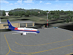
Googly scenery for WIOO Pontianak/Supadio, Kalimantan, Indonesia. In Flight Simulator
2004 only a general aviation parking is provided at this important Indonesian domestic
airport, but in the real world it is served over fifteen times
a day by jets and smaller aircraft of Adam Air, Airfast Service, Batavia Air, Deraya
Air Taxi, Indonesia Air Transport, Sriwijaya Air and Tri-MG Intra Asia Airlines. These
scenery files add aprons, taxiways, buildings and other airport features to Flight
Simulator's limited representation and allow "AI" traffic to land, taxi, park and
take off in a realistic manner.
The scenery does not purport to be ultra-accurate. Based on high-detail satellite
imagery from Google Earth, the layout is proportionally correct but the added
airport features, such as buildings, are built from default Microsoft objects
and add-on libraries so will not look like the real thing.
You are not obliged to download and install any additional scenery libraries,
but to enjoy this scenery in its entirety, you may wish to. It will work fine,
with or without.
[File re-uploaded at request of AVSIM]
| Filename: | WIOO_PontianakSupadio_Kalimantan_Indonesia.zip |
| License: | Freeware |
| Added: | 15th May 2010, 01:10:01 |
| Downloads: | 1,962 |
| Author: | John Hinson |
| Size: | 64.96 KB |
| Category: Flight Simulator 2004 - Scenery | |
| VEPT Patna, India |
|
Images related to this file:
File Description:
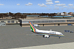
Googly scenery for VEPT Patna, India. In Flight Simulator 2004, the airport is
depicted at a pretty waterside location but only a small ramp for general aviation
aircraft is provided. In the real world it is served around six times a day by
Boeing jets on domestic flights by Alliance Air, Indian Airlines, Jet Airways, and
Sahara Airlines. These scenery files add aprons, taxiways, buildings and other
airport features to Flight Simulator's bland representation and allow "AI" traffic,
to land, taxi, park and take off in a realistic manner.
The scenery does not purport to be ultra-accurate. Based on high-detail satellite
imagery from Google Earth, the layout is proportionally correct but the added
airport features, such as buildings, are built from default Microsoft objects
and add-on libraries so will not look like the real thing.
You are not obliged to download and install any additional scenery libraries,
but to enjoy this scenery in its entirety, you may wish to. It will work fine,
with or without.
[File re-uploaded at request of AVSIM]
| Filename: | VEPT_Patna_India.zip |
| License: | Freeware |
| Added: | 7th May 2010, 11:02:44 |
| Downloads: | 1,704 |
| Author: | John Hinson |
| Size: | 65.91 KB |
| Category: Flight Simulator 2004 - Scenery | |
| WAML Palu/Mutiara, Indonesia |
|
Images related to this file:
File Description:
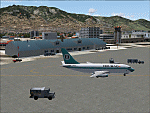
Googly scenery for WAML Palu/Mutiara, Indonesia. In Flight Simulator 2004 little
is provided other than a runway at this small domestic airport, although in the
real world it sees regular jet flights from airlines such as Batavia Air, Bouraq
Indonesia Airlines, Garuda Citylink, Lion Airlines and Merpati Nusentara and
smaller aircraft from operators like Airfast Service and Indonesia Air Transport.
These scenery files add aprons, taxiways, buildings and other airport features
to Flight Simulator's limited representation and allow "AI" traffic to land,
taxi, park and take off in a realistic manner.
The scenery does not purport to be ultra-accurate. Based on high-detail satellite
imagery from Google Earth, the layout is proportionally correct but the added
airport features, such as buildings, are built from default Microsoft objects
and add-on libraries so will not look exactly like the real thing.
You are not obliged to download and install any additional scenery libraries,
but to enjoy this scenery in its entirety, you may wish to. It will work fine,
with or without.
| Filename: | WAML_PaluMutiara_Indonesia.zip |
| License: | Freeware |
| Added: | 15th May 2010, 01:11:30 |
| Downloads: | 1,770 |
| Author: | John Hinson |
| Size: | 140.88 KB |
| Category: Flight Simulator 2002 - Scenery | |
| EGGP Liverpool John Lennon Airport V3.1 |
|
File Description:
This new version has come about as a result of over a month sitting in front of Paint Shop Pro! All the textures have been redone including the night textures (If anyone knows how to light up AI aircraft then I'd love to hear from them!).
Many new macros have been created and hence the airport now has a lot more buildings! The railway bridge has been finished and I've also created my own version of the road bridge.
I've switched tree creation to GroundMaker as this was less frame rate hugging and allowed what I consider to be a more realistic representation of the wooded areas around the airport.
The scenery is aligned to the Visual Flight / Getmapping VFR Scenery published by Just Flight and has been specifically designed to complement the add-on. You do not however need the VFR scenery to use these files!
This scenery forms part of the "UK2002 Scenery Project" co-ordinated by John Woodside - http://fsaviation.net/. Thanks also go to John and to Peter Leadbeater for the information they have supplied to me regarding the airport
| Filename: | EGGP_Liverpool_John_Lennon_Airport_V31.zip |
| License: | Freeware |
| Added: | 22nd March 2003, 02:36:29 |
| Downloads: | 2,824 |
| Author: | Paul Derbyshire |
| Size: | 3.67 MB |
| Category: Flight Simulator 2004 - Scenery | |
| MRE Mara Serena, Kenya |
|
File Description:
Googly scenery for Mara Serena, Kenya, a small airfield serving the Mara Serena
Safari Lodge in the Masai Mara National park. The original metalled runway has
fallen into disuse and these days a rough dirt runway alongside it is used by
the twice daily flights of Air Kenya Express to and from Nairobi and the
occasional light aircraft.
Flight Simulator 2004 has made no provision for traffic with only a runway
provided and this scenery seeks to redress the situation. The airport has no
ICAO code (MRE is the IATA code) but Microsoft Flight Simulator has created an
unofficial ICAO of HK0A.
The scenery does not purport to be ultra-accurate. Based on high quality
satellite imagery from Google Earth, the layout is proportionally correct but the
added airport features, such as buildings, are built from default Microsoft objects
and add-on libraries so will not look exactly like the real thing.
You are not obliged to download and install any additional scenery libraries,
but to enjoy this scenery in its entirety, you may wish to. It will work fine,
with or without.
| Filename: | MRE_Mara_Serena_Kenya.zip |
| License: | Freeware |
| Added: | 16th April 2008, 19:19:33 |
| Downloads: | 988 |
| Author: | John Hinson |
| Size: | 68.01 KB |
| Category: Flight Simulator 2004 - Scenery | |
| YEVD Evans Head Memorial, Australia |
|
File Description:
Googly scenery for YEVD Evans Head Memorial, a former RAAF Training base in
New South Wales, Australia, now reduced to a single runway and small apron.
In its heyday it was home to the RAAF No 1 Bombing and Gunnery and the RAAF No 1
Air Observers Schools and it was said to be the largest training base in the
southern hemisphere - at that time it had four runways.
Flight Simulator 2004 has made no provision for traffic with only a runway
provided and this scenery seeks to redress the situation so that you and your
"AI" traffic can use the airport.
The scenery does not purport to be ultra-accurate. Based on high quality
satellite imagery from Google Earth, the layout is proportionally correct but the
added airport features, such as buildings, are built from default Microsoft objects
and add-on libraries so will not look exactly like the real thing.
You are not obliged to download and install any additional scenery libraries,
but to enjoy this scenery in its entirety, you may wish to. It will work fine,
with or without.
| Filename: | YEVD_Evans_Head_Memorial_Australia.zip |
| License: | Freeware |
| Added: | 19th April 2008, 10:23:02 |
| Downloads: | 544 |
| Author: | John Hinson |
| Size: | 71.78 KB |
| Category: Flight Simulator 2004 - Scenery | |
| OPDB Dalbandin, Pakistan |
|
Images related to this file:
File Description:

Googly scenery for OPDB Dalbandin, Pakistan - a quiet domestic airport for
which no operational facilities are provided in Flight Simulator 2004. These
scenery files add/correct the runways, apron, taxiways, buildings and other
airport features so that you and your "AI" traffic can land, taxi, park
and take off in a realistic manner.
The airport appears to be served all of once per week by ATRs of Pakistan
International Airways so will hardly buzz with activity, but you will be
assured of a friendly welcome when you arrive.
The scenery does not purport to be ultra-accurate. Based on high-detail satellite
imagery from Google Earth, the layout is proportionally correct but the added
airport features, such as buildings, are built from default Microsoft objects
and add-on libraries so will not look like the real thing.
You are not obliged to download and install any additional scenery libraries,
but to enjoy this scenery in its entirety, you may wish to. It will work fine,
with or without.
[File re-uploaded at the request of AVSIM]
| Filename: | OPDB_Dalbandin_Pakistan.zip |
| License: | Freeware |
| Added: | 5th May 2010, 22:32:37 |
| Downloads: | 1,017 |
| Author: | John Hinson |
| Size: | 65.99 KB |


© 2001-2026 AVSIM Online
All Rights Reserved
Privacy Policy |