
Where Flight Simulation Enthusiasts Gather from Around the World!
AVSIM Library - Search Results

| Category: Flight Simulator 2004 - Scenery | |
| Glacier Park International Airport |

|
Images related to this file:
File Description:
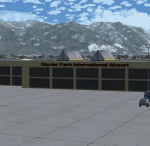
Glacier Park International Airport in Kalispell, MT. The scenery is based on actual photos of the airport, and includes the runway and taxiway changes since FS9 was released. This scenery will have a negligible effect, if any, on frame rates. Although created for FS9, it will work in FSX, but not in earlier versions.
| Filename: | Glacier_Park_International_Airport.zip |
| License: | Freeware, limited distribution |
| Added: | 21st November 2009, 23:25:28 |
| Downloads: | 1,814 |
| Author: | Gary Widup |
| Size: | 1.37 MB |
| Category: Flight Simulator 2004 - Scenery | |
| Malta Intl. Airport V1.0 |
|
File Description:
Freeware scenery of Malta Intl. Airport for Fs2004 only.
Certain people who have previously used this scenery, have experienced a problem where a few buildings were sinking into the ground. This has been solved and has been included in this new self-install package.
Afcad file included.
Contains also a tree library by Gerrish Grey.
| Filename: | Malta_Intl_Airport_V10.zip |
| License: | Freeware |
| Added: | 5th September 2005, 16:55:19 |
| Downloads: | 39,160 |
| Author: | Daniel Chircop |
| Size: | 26.87 MB |
| Category: Flight Simulator X - Scenery Design | |
| Duplicate Object Finder for FS9 and FSX |
|
Images related to this file:
File Description:
Duplicate Object Finder (DOF) is a simple tool designed to find multiple copies of FS9 or FSX scenery
objects. It does this by searching through your FS installation using the Scenery List and collecting
information about objects. The results are displayed in a list for information. It is also possible to
print this list.
| Filename: | Duplicate_Object_Finder_for_FS9_and_FSX.zip |
| License: | Freeware, limited distribution |
| Added: | 20th March 2011, 20:44:56 |
| Downloads: | 2,374 |
| Author: | Jon Masterson - ScruffyDuck Software |
| Size: | 2.9 MB |
| Category: Flight Simulator 2004 - Scenery | |
| Orlando Executive Airport (KORL) |
|
File Description:
Scenery for Orlando Executive Airport, Orlando, Florida, USA. This airport is a busy general aviation and corporate aviation airfield which provides an important link to the central Florida region. This scenery was developed in GMAX and includes a new static aircraft and GA hangar library to give it a 'feel' of a busy GA airfield.
| Filename: | Orlando_Executive_Airport_KORL.zip |
| License: | Freeware, limited distribution |
| Added: | 22nd October 2005, 20:21:08 |
| Downloads: | 6,503 |
| Author: | Shehryar Ansari |
| Size: | 5.22 MB |
| Category: Flight Simulator X - Scenery | |
| Trabzon Airport |
|
Images related to this file:
File Description:
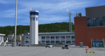
Detailed and realistically depicted scenery of Trabzon (LTCG) Airport in the eastern Black Sea region of Turkey, for FSX (SP2). Created mainly by FSDS 3.5.1, the scenery includes many accurate and detailed airport buildings including the new domestic terminal, afd file, various objects, detailed surroundings and some photo real terrain textures. By Sunay KILIC.
| Filename: | Trabzon_Airport.zip |
| License: | Freeware |
| Added: | 19th September 2010, 18:12:57 |
| Downloads: | 10,994 |
| Author: | Sunay KILIC |
| Size: | 45.63 MB |
| Category: Flight Simulator 2004 - Scenery | |
| RAAF Base Butterworth |
|
File Description:
This scenery is a complete remake of my FS2002 version and is now fully compatible with FS2004 and now covers RAAF Base Butterworth, Penang Town (Georgetown) and Butterworth Port. Includes Full Textures, AFCAD2 Files as well as Landclass Scenery.
Airport Layout was made using Airport for Windows and AFCAD2 and is not compatible with FS2002 .
| Filename: | RAAF_Base_Butterworth.zip |
| License: | Freeware, limited distribution |
| Added: | 13th March 2004, 16:54:05 |
| Downloads: | 2,478 |
| Author: | Bill Holker |
| Size: | 2.73 MB |
| Category: Flight Simulator 2004 - AFCAD Files | |
| LEMD - Madrid Barajas |
|
File Description:
This afcad is designed for Fernando de la Portilla's scenery default upgrade (lemdgb1.zip) and the update for this scenery made by Joaquin and Miguel Zafra (lemdgb1mod.zip). This afcad file fixes the problem with ILS in runways 33R and 18L. It also updates the taxiway names and the parking position numbers to AIRAC 09/06.
| Filename: | LEMD__Madrid_Barajas.zip |
| License: | Freeware |
| Added: | 25th October 2006, 12:44:44 |
| Downloads: | 3,730 |
| Author: | Alfredo Cabezas |
| Size: | 31.16 KB |
| Category: Flight Simulator 2004 - Miscellaneous Files | |
| Some Curved or Angled Approaches, Beirut, Washington Reagan, Lugano and Swiss valleys |
|
File Description:
This little project started from my Air Glaciers package when I noticed how indifferent the AI pilots were to terrain. Intrigued by the work of Jim Vile on his "active approach" series I have experimented with interesting approaches that FS9 has not implemented. Using XML files I created curved approaches for Beirut Runway 21 ILS (inbound flights arc across the city), the visual turn to final for Washington Reagan's Runway 19, the circling approach for runway 19 at Lugano in Switzerland (just an arc in this case) and valley approaches for airports in Switzerland at Sion, Samedan and Locarno. Due to AI limitations in FS9 these have all needed to be created as ILS approaches, even at airports without an ILS. Note that your AFCAD layouts do not need to have ILS added to airports that don't have it. In some cases the approach will be called an ILS by the controller, if you can live with that, you might like these. Note that I've included the source XML for each of the approaches so that you can improve upon them if you wish. Note also that they have been tested with the default Microsoft mesh and an addon mesh might alter the proximity of terrain to aircraft. AI aircraft FDEs will, in some cases, be stretched to (and beyond?) their limits. In the case of Beirut I have included two approaches (BOB NDB and "Wide Arc"), the latter less demanding than the former, in case your AI can't fly the BOD NDB approach.
Note that although the approaches are designed for AI, I have built full procedures for Lugano and Sion for the user to fly.
| Filename: | Some_Curved_or_Angled_Approaches_Beirut_Washington.zip |
| License: | Freeware, limited distribution |
| Added: | 8th April 2005, 03:19:33 |
| Downloads: | 2,763 |
| Author: | Matthew Ministry |
| Size: | 478.08 KB |
| Category: Flight Simulator 2004 - Gauges | |
| FS2004 GPS Map View Gauge v3.0 |
|
File Description:
The ultimate gauge. The Map will show: Airports details (Runways ID's, length & ILS), VOR's and NDB's frequencies,
Intersections and waypoints, Airspaces, Approaches and flight routes. You can toggle the view
you require for your flight. Also you can zoom in/out to see the nearest airports, vor's and
ndb's. The map will indicate A/C heading flightplan title and waypoints ID's.
Version 3 includes more enhancements such as the ability to input the ICAO code or name of any airport and the map will
show all the frequencies of that airport including ATIS, ILS, AND COM. In addition, the map will show the active
runway designations, length and width.
You can also input ICAO code of any VOR/NDB and the map will show their frequencies.
There was a bug in v2.0, in which if you enter ( click on ENT )the ICAO code of an airport, you will lose the flight
plan loaded. Now you can go back to the flight plan and with the NEXT/PREV buttons you have the choice of where to start
your FP.
The gauge will show Flight Plan Title, originating and destination airports, active waypoint, waypoint index and FP
crusing altitude.
I addition, the gauge will show various useful information, such as, Runway IDs, lenght, width and approach magnetic heading,
Airport name, city, and type. NAV1/2 names, codes, distances and ETA's, ADF1/2 names and codes.
Finally, the gaugee will show other information, such as, magvar, indicated airspeed, mach, ground velocity, ambient
wind velocity and direction, bank angle , and a/c altitude ( radio height ).
All the information above and much more on a single gauge window.
| Filename: | FS2004_GPS_Map_View_Gauge_v30.zip |
| License: | Freeware, limited distribution |
| Added: | 14th September 2005, 14:19:46 |
| Downloads: | 10,848 |
| Author: | Talal Alhaj |
| Size: | 710.05 KB |
| Category: Flight Simulator X - Scenery | |
| 52F North West Regional Airport (DFW TX) |
|
Images related to this file:
File Description:
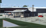
This airport scenery does not require any other software other than Microsoft Flight Sim X SP1 (minimum) - SP2 required for mission and display of some of the scenery items. However, it could help with performance on your PC if you install any accurate photo scenery for DFW. One such scenery is MEGASCENERY DFW photo scenery from http://www.megascenery.com/.
This is a custom developed scenery for airport, 52F - Northwest Regional, Roanoke, TX. 52F is next to Fort Worth Alliance in the Dallas Fort Worth Metroplex. It's a nice little airport.
This scenery package also includes a Mission called "52Foxtrot - Approach to Rwy 35 - Thermals". It is more of a free flight than the traditional FSX missions. The ones who fly for real at 52F-Northwest regional knows the quirks when coming into land at runway 35 on a hot day. The thermals at the cleared land and the sinking feeling when flying over the wooded area nearing the approach to 35. These thermal lifts and sinks have been modeled here. However, the only way to experience these thermals in FSX is via Missions. Once you select the mission "52Foxtrot - Approach to Rwy 35 - Thermals" and by selecting option "Enable changes in selected Mission", you could fly around like you would under "free flight". Except this time, you would have these thermal effects around 52F and get to experience what it's really like to fly and land at 52F.
| Filename: | 52F_North_West_Regional_Airport_DFW_TX.zip |
| License: | Freeware, limited distribution |
| Added: | 24th March 2010, 01:23:59 |
| Downloads: | 3,335 |
| Author: | Manny Mahadevan |
| Size: | 19.06 MB |


© 2001-2026 AVSIM Online
All Rights Reserved
Privacy Policy |