
Where Flight Simulation Enthusiasts Gather from Around the World!
AVSIM Library - Search Results

| Category: Flight Simulator X - Scenery | |
| FSX (only) SCENERY and AI for KCLT Charlotte Douglas International, NC USA |

|
Images related to this file:
File Description:

FSX (only) SCENERY and AI for KCLT Charlotte Douglas International, NC USA
Custom made terminal, hangars, buildings, ramp and street lighting, for KCLT Charlotte, NC, USA
Douglas International Airport. Includes current runway and taxiway configurations, interiors
for terminals and buildings, and a rail intermodal terminal with trains.
Textures and traffic file provided to make the new NCANG C-17s. This is a large, extensive project.
by Dan French
| Filename: | FSX_only_SCENERY_and_AI_for_KCLT_Charlotte_Douglas.zip |
| License: | Freeware, limited distribution |
| Added: | 30th December 2022, 22:28:41 |
| Downloads: | 596 |
| Author: | Dan French |
| Size: | 66.24 MB |
| Category: Flight Simulator 2004 - Scenery | |
| FS2004 Scenery-EIDW-Dublin Intl AFCAD with new Runway 10L-28R, v1.1 |
|
File Description:
FS2004 Scenery-EIDW-Dublin Intl AFCAD with new Runway 10L-28R, v 1.1 with Parking Positions.
Based on open photos available and Dublin from Eiresim 2009 and Ultimate Terrain Europe.
Please see Install notes for necessary object files and enjoy.
| Filename: | FS2004_SceneryEIDWDublin_Intl_AFCAD_with_new_Runwa.zip |
| License: | Freeware |
| Added: | 10th October 2022, 14:02:55 |
| Downloads: | 575 |
| Author: | Bernd Barsch |
| Size: | 7.41 MB |
| Category: Flight Simulator 2004 - Miscellaneous Files | |
| Some Curved or Angled Approaches, Beirut, Washington Reagan, Lugano and Swiss valleys |
|
File Description:
This little project started from my Air Glaciers package when I noticed how indifferent the AI pilots were to terrain. Intrigued by the work of Jim Vile on his "active approach" series I have experimented with interesting approaches that FS9 has not implemented. Using XML files I created curved approaches for Beirut Runway 21 ILS (inbound flights arc across the city), the visual turn to final for Washington Reagan's Runway 19, the circling approach for runway 19 at Lugano in Switzerland (just an arc in this case) and valley approaches for airports in Switzerland at Sion, Samedan and Locarno. Due to AI limitations in FS9 these have all needed to be created as ILS approaches, even at airports without an ILS. Note that your AFCAD layouts do not need to have ILS added to airports that don't have it. In some cases the approach will be called an ILS by the controller, if you can live with that, you might like these. Note that I've included the source XML for each of the approaches so that you can improve upon them if you wish. Note also that they have been tested with the default Microsoft mesh and an addon mesh might alter the proximity of terrain to aircraft. AI aircraft FDEs will, in some cases, be stretched to (and beyond?) their limits. In the case of Beirut I have included two approaches (BOB NDB and "Wide Arc"), the latter less demanding than the former, in case your AI can't fly the BOD NDB approach.
Note that although the approaches are designed for AI, I have built full procedures for Lugano and Sion for the user to fly.
| Filename: | Some_Curved_or_Angled_Approaches_Beirut_Washington.zip |
| License: | Freeware, limited distribution |
| Added: | 8th April 2005, 03:19:33 |
| Downloads: | 2,761 |
| Author: | Matthew Ministry |
| Size: | 478.08 KB |
| Category: Flight Simulator 2004 - Gauges | |
| FS2004 GPS Map View Gauge v3.0 |
|
File Description:
The ultimate gauge. The Map will show: Airports details (Runways ID's, length & ILS), VOR's and NDB's frequencies,
Intersections and waypoints, Airspaces, Approaches and flight routes. You can toggle the view
you require for your flight. Also you can zoom in/out to see the nearest airports, vor's and
ndb's. The map will indicate A/C heading flightplan title and waypoints ID's.
Version 3 includes more enhancements such as the ability to input the ICAO code or name of any airport and the map will
show all the frequencies of that airport including ATIS, ILS, AND COM. In addition, the map will show the active
runway designations, length and width.
You can also input ICAO code of any VOR/NDB and the map will show their frequencies.
There was a bug in v2.0, in which if you enter ( click on ENT )the ICAO code of an airport, you will lose the flight
plan loaded. Now you can go back to the flight plan and with the NEXT/PREV buttons you have the choice of where to start
your FP.
The gauge will show Flight Plan Title, originating and destination airports, active waypoint, waypoint index and FP
crusing altitude.
I addition, the gauge will show various useful information, such as, Runway IDs, lenght, width and approach magnetic heading,
Airport name, city, and type. NAV1/2 names, codes, distances and ETA's, ADF1/2 names and codes.
Finally, the gaugee will show other information, such as, magvar, indicated airspeed, mach, ground velocity, ambient
wind velocity and direction, bank angle , and a/c altitude ( radio height ).
All the information above and much more on a single gauge window.
| Filename: | FS2004_GPS_Map_View_Gauge_v30.zip |
| License: | Freeware, limited distribution |
| Added: | 14th September 2005, 14:19:46 |
| Downloads: | 10,840 |
| Author: | Talal Alhaj |
| Size: | 710.05 KB |
| Category: Flight Simulator X - Missions | |
| IrelandVFRTour1.zip |
|
File Description:
Ireland VFR Tour 1. This is the first of ten helicopter tours based on the work of Daniel Florentin. You will need to download and install BOTH of Daniel's VFR scenery packs from here:
http://library.avsim.net/search.php?SearchTerm=daniel+florentin&CatID=fsxscen&Go=Search
In addition, you will need to have Orbx EU Ireland installed. (The mission will work with only DF's scenery but you will miss several sites included in the Orbx add on.)
You only need to install Mr. Florentin's packs once as the remaining 9 tours are based on the same scenery.
| Filename: | IrelandVFRTour1zip.zip |
| License: | Freeware |
| Added: | 3rd February 2019, 18:29:19 |
| Downloads: | 155 |
| Author: | HeloMissionMan |
| Size: | 5.98 MB |
| Category: Flight Simulator 2004 - Scenery | |
| CYZF Yellowknife, Northwest Territories |
|
File Description:
Created using EZ-Scenery by Abacus. I could find only a few photos of Yellowknife, so there was a certain amount of guesswork involved in making this scenery. The general layout should be reasonably accurate and it's hopefully an improvement over the default scenery. The terminal and tower at the real Yellowknife are really cool. I'm sorry I couldn't do a better job at representing them. Also includes a file to add some additional GA traffic. Have fun flying in the beautiful Northwest Territories. (Previous version had 616 downloads)
| Filename: | CYZF_Yellowknife_Northwest_Territories.zip |
| License: | Freeware |
| Added: | 12th March 2006, 04:03:36 |
| Downloads: | 3,243 |
| Author: | Sidney Schwartz |
| Size: | 2.91 MB |
| Category: Flight Simulator X - Scenery | |
| Avalon Catalina - California (CA), USA |
|
Images related to this file:
File Description:
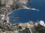
The city of Avalon on Catalina Island with many custom built objects including the Turret House, Wrigley Memorial, Pier, working Bell Tower (sounds), and several businesses and hotels. This scenery was designed around the freeware Catalina Island by Aerosoft and is required for this scenery to display correctly. FS2002 version of this scenery has over 5500 downloads. Tested on FSX Gold Edition (FSX Deluxe and Acceleration Expansion Pack), FSGenesis 9.6 terrain mesh, and Win7 operating system. Requires RWEOBJv5.zip & RWEOBJc5.zip (or later) Object Libraries. By Ron Ezra
| Filename: | Avalon_Catalina__California_CA_USA.zip |
| License: | Freeware |
| Added: | 14th January 2016, 19:29:50 |
| Downloads: | 903 |
| Author: | Ron Ezra |
| Size: | 1.53 MB |
| Category: Flight Simulator X - Scenery | |
| Okanagan Lake, British Columbia, Canada Upgrades |
|
Images related to this file:
File Description:
A scenery upgrade to Okanagan Lake, BC, Canada. This scenery continues the upgrades to the Kelowna area near CYLW. South of the airport the lake received marinas and docks and a marina entrance station located near the bridge. As per Google Earth both sides of the lake at the bridge have several marinas, docks and small piers, lot's of boats and some added fictitious objects including a landable water helipad. This scenery is stand-alone. Nothing else is required. Read the text file for instructions and please enjoy. By Savageale.
| Filename: | Okanagan_Lake_British_Columbia_Canada_Upgrades.zip |
| License: | Freeware |
| Added: | 4th December 2011, 08:08:34 |
| Downloads: | 992 |
| Author: | Tim Durham |
| Size: | 1.58 MB |
| Category: Flight Simulator X - Scenery | |
| Avalon Airport |
|
File Description:
Avalon airport is an airport in Victoria Australia it is only about a 15 minute flight from Melbourne International airport it is one of the hubs for Low cost airline Jetstar. In FSX its scenery is very sparse considering it is the location of the Australian international Air show. I have created this scenery with Abacus Scenery editor and it adds an environment which represents an Air Show it also adds a terminal (not exact to the real one) and a few other enhancements to the Airport environment.
Note, uses default AFCAD
| Filename: | Avalon_Airport.zip |
| License: | Freeware, limited distribution |
| Added: | 27th February 2007, 02:43:58 |
| Downloads: | 2,046 |
| Author: | Scott Hickey |
| Size: | 444.98 KB |
| Category: Flight Simulator 2004 - Scenery | |
| KCRW - Kanawha River Valley - West Virginia, USA |
|
Images related to this file:
File Description:

This scenery is made to blend with autogen scenery and the defaults of FS9. Transits crossing the southern Allegheny Mountains will follow this valley seeing some of the landmark bridges and dams of the central WV area. The New river bridge scenery is not included in this package because (not only my own version which works default mesh), but another fellow has made one. It also fits with this package and looks real good. This package blends well with default or compliments my Land Class Central Appalachia package.
| Filename: | KCRW__Kanawha_River_Valley__West_Virginia_USA.zip |
| License: | Freeware |
| Added: | 9th July 2015, 17:26:13 |
| Downloads: | 228 |
| Author: | Rick Connolly |
| Size: | 2.33 MB |


© 2001-2026 AVSIM Online
All Rights Reserved
Privacy Policy |