
Where Flight Simulation Enthusiasts Gather from Around the World!
AVSIM Library - Search Results

| Category: Flight Simulator X - Scenery | |
| Plovdiv Airport LBPD Updated AFCAD 2020 FSX |

|
File Description:
This is an update of the default Plovdiv scenery for FSX.
Plovdiv is a city in Bulgaria near the Rhodopi mountain range with a few flights from Stansted in the UK every week operated by Ryanair.
I have added new taxiways, roads and the new terminal which Ryanair and other charter airlines operate out of, the main two gates are gates 10 and 11.
For installation copy the LBPD_ADEX_AM.bgl file and LBPD_ADEX_AM_CVX.bgl and copy C:\Program Files (x86)\Steam\steamapps\common\FSX\Addon Scenery\scenery and restart the sim.
For uninstalling simply just delete the BGL files from your scenery folder.
Any problems contact [email protected]
Thanks for downloading :)
| Filename: | Plovdiv_Airport_LBPD_Updated_AFCAD_2020_FSX.zip |
| License: | Freeware |
| Added: | 4th May 2020, 17:56:08 |
| Downloads: | 519 |
| Author: | Alex Miles |
| Size: | 6.42 KB |
| Category: Flight Simulator 2004 - Scenery | |
| Montego Bay (Sangster) International Airport |
|
File Description:
This scenery corrects the problems encountered in FS2004 of my recently released scenery of Montego Bay (Sangster) International airport. It seems as if the airport location in FS2004 was moved slightly causing my scenery to end up back near the hills. Everything has been moved to the new location, and some improvements have been made such as a second story on the entire terminal building, more plants and roadways, and guidance lights which now go right into the Air Jamaica hangars. The parking lot is also deeper since there is now additional space behind the main terminal. This scenery will not work with FS2002.
| Filename: | Montego_Bay_Sangster_International_Airport.zip |
| License: | Freeware |
| Added: | 17th August 2003, 16:40:12 |
| Downloads: | 9,247 |
| Author: | Bill Melichar |
| Size: | 4.25 MB |
| Category: Flight Simulator 2004 - Scenery | |
| Dallas, Texas Love Field (KDAL) - AI Greyhound Bus Shuttle amd Scenery |
|
File Description:
Dallas, Texas - Love Field (KDAL) Shuttle Bus Service. This package adds a fictional Shuttle Bus service (using an AI Greyhound Bus) from the GA side of the airport to the Main terminal. It is designed to compliment the Sikorsky S-76C Helijet Shuttle service - dallashj.zip and s76_dhj.zip - available from this site. At the Bus Shuttle starting location, and along the bus route, there are a few scenery enhancements created with the EZ Scenery Object Placer program. All necessary files - other than the AI Greyhound Bus - are included. This scenery is presented not only as an interesting addition to the KDAL airport, but also as a “case study” to help you add the same type of service in other suitable locations. By studying the Afcad I have created, you will quickly see how it is possible to include AI Bus service in your sceneries using the "invisible” airport technique. Please unzip this package (using folders option) to a temporary folder and carefully follow the simple installation instructions.
| Filename: | Dallas_Texas_Love_Field_KDAL___AI_Greyhound__Bus_S.zip |
| License: | Freeware |
| Added: | 24th July 2006, 20:54:37 |
| Downloads: | 1,572 |
| Author: | David "Opa" Marshall |
| Size: | 2.64 MB |
| Category: Flight Simulator 2004 - Scenery | |
| Tucson, Arizona, High-Resolution Scenery - Part 1: Tucson Intl. Airport (KTUS) |
|
File Description:
This is the first part of high resolution ground scenery for Tucson AZ, containing Tucson Intl. airport (KTUS) and 90 sq km around it. The resolution of the airport area itself is 0.3m/pix! The area around is in 1m/pix resolution. Realistic real-world runway textures are provided as well. This scenery is best, when combined with my standard resolution Tucson scenery (TUS2008_LR.zip), which covers a much larger area and matches perfectly in color and everything. YourDonation@Work: Dedicated to Robert, George and Jeff. Thanks!
| Filename: | Tucson_Arizona_HighResolution_Scenery__Part_1_Tucs.zip |
| License: | Freeware, limited distribution |
| Added: | 10th September 2008, 23:58:16 |
| Downloads: | 4,265 |
| Author: | Gottfried Razek - www.blueskyscenery.com |
| Size: | 97.19 MB |
| Category: Flight Simulator 2004 - Scenery | |
| Canyonlands National Park South, Monticello (U43), Utah, Photo-Scenery (FSX too) |
|
Images related to this file:
File Description:
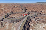
This scenery covers the southern part of Canyonlands National Park (Needles District) in Utah. The colorful layers of sand- and limestone that you can see today built over hundreds of millions years by advancing and retreating oceans as well as rivers that deposited huge amounts of sediment. About 15 million years ago these layers began to rise due to a colliding movement of plates in the earth's crust, forming what is today called the Colorado Plateau. As the land rose higher, erosion accelerated, resulting in countless canyons, mesas and buttes. The uplifting land caused the rivers to carve in even faster, resulting in the deep canyons of the Colorado and Green Rivers. The needles and fins in the Needles District have yet another story: First uplifts and later slides created a system of perpendicular cracks. Then he resulting crosshatched pattern of "joints" widened by erosion until only thin fins and needles of rock remained. The scenery extends my Arches National Park scenery to the south and brings you another 3.500 sq km in 4.7m/pix quality. To explore the scenery depart from Monticello (U43) and head north. YourDonation@Work: Dedicated to Nels, David and Michael. Thanks!
| Filename: | Canyonlands_National_Park_South_Monticello_U43_Uta.zip |
| License: | Freeware, limited distribution |
| Added: | 30th December 2009, 21:44:56 |
| Downloads: | 1,528 |
| Author: | Gottfried Razek - blueskyscenery.com |
| Size: | 95.76 MB |
| Category: Flight Simulator 2004 - Scenery | |
| Canyonlands National Park, The Maze-North, Utah, Photo-Scenery (FSX too) |
|
Images related to this file:
File Description:
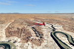
This is a re-upload of a package that was corrupted during the crash of the AVSIM library. The Maze is the wildest and least accessible district of Canyonlands National Park. It is a perplexing jumble of canyons that has been described as a '30 sq miles puzzle in sandstone'. The Maze covers the area west of the Green River and north of the Colorado River. Getting to most locations requires multiple hours of 4WD road driving. Hiking trails usually require multi day backpack trips.
Too strenous? Let's go flying! Checking out the area from an eagles perspective is certainly a stunning experience. The colors are awesome and the landforms are of breathtaking beauty. The scenery extends my Arches National Park scenery to the west and brings you another 3.500 sq km in 4.7m/pix quality. YourDonation@Work: Dedicated to Frans, Francois and James. Thanks!
| Filename: | Canyonlands_National_Park_The_MazeNorth_Utah_Photo.zip |
| License: | Freeware, limited distribution |
| Added: | 31st December 2009, 11:01:39 |
| Downloads: | 2,373 |
| Author: | Gottfried Razek - blueskyscenery.com |
| Size: | 92.88 MB |
| Category: Flight Simulator 2004 - Scenery | |
| Canyonlands National Park, The Maze-South, Utah, Photo-Scenery (FSX too) |
|
Images related to this file:
File Description:
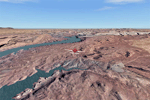
This is a re-upload of a package that was corrupted during the crash of the AVSIM library. This is the fourth package of the Arches/Canyonlands area. It covers the area southwest and including the confluence of the Colorado and Green Rivers. From there you can fly down Cataract Canyon which is famed for its premium whitewater rafting oportunities. Or explore the Maze (the area west of the Green and north of the Colorado River) with it's labyrinth of canyons and colorful sandstone formations. The scenery extends west to Hite (UT03) on Lake Powell. Brings the total Southern Utah coverage to 14.000 sq km in 4.7m/pix quality. YourDonation@Work: Dedicated to Patrick, Hideyuki and Art. Thanks!
| Filename: | Canyonlands_National_Park_The_MazeSouth_Utah_Photo.zip |
| License: | Freeware, limited distribution |
| Added: | 31st December 2009, 22:33:46 |
| Downloads: | 2,085 |
| Author: | Gottfried Razek - blueskyscenery.com |
| Size: | 95.67 MB |
| Category: Flight Simulator 2004 - Scenery | |
| Lake Powell, Navajo Mountain (04UT), Utah/Arizona, Photo-Scenery (FS9 & FSX) |
|
Images related to this file:
File Description:
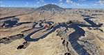
This package contains the center of Lake Powell and the Navajo Nation around Navajo Mountain. It contains remote areas of stunning beauty. Wonderful sandstone formations in bright shades of red and pink. Contains landmarks like the Rainbow Bridge National Monument and the confluence of the Colorado and San Juan Rivers. Extends my Monument Valley scenery to the west and brings you another 3.500 sq km in 4.7m/pix quality. To explore the scenery depart from Navajo Mountain dirt strip (04UT). High resolution versions of this scenery for FS9 and FSX (much sharper, but larger and multiple downloads) are available at www.blueskyscenery.com/CNY_South3West2.html . The screenies are taken from the high-res versions, so expect this version to be slightly more blurry. YourDonation@Work: Joaquin, Donald and Scott.
| Filename: | Lake_Powell_Navajo_Mountain_04UT_UtahArizona_Photo.zip |
| License: | Freeware, limited distribution |
| Added: | 23rd January 2010, 23:06:49 |
| Downloads: | 1,790 |
| Author: | Gottfried Razek - blueskyscenery.com |
| Size: | 91.43 MB |
| Category: Flight Simulator 2004 - Scenery | |
| Eagle County (KEGE), Glenwood Springs (KGWS), Colorado, Photo-Scenery (FS9 & FSX) |
|
Images related to this file:
File Description:
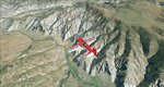
To explore this region depart from Eagle County Regional Airport (KEGE) which is a popular regional airport used in winter to transport skiers to nearby Vail. Northwest of the airport you can see the pit gypsum mine of American Gypsum which produces a variety of wallboard products. When you fly to the west and along the Eagle River, you soon pass its confluence with the Colorado River. Further west you can fly along Glennwood Canyon and finally reach Glennwood Springs where the Colorado meets the Roaring Fork River. Here you can turn south and fly direct Glenwood Springs Airport (KGWS) which lies south of the city. This scenery brings you another 3.500 sq km of beautiful Colorado in 4.7m/pix quality.
High resolution versions of this scenery for FS9 and FSX (much sharper, but larger and multiple downloads) are available at www.blueskyscenery.com/GNB_SouthWest2.html . The screenies are taken from the high-res versions, so expect this version to be slightly more blurry. YourDonation@Work: Dedicated to Alain and James.
| Filename: | Eagle_County_KEGE_Glenwood_Springs_KGWS_Colorado_P.zip |
| License: | Freeware, limited distribution |
| Added: | 30th January 2010, 17:01:49 |
| Downloads: | 2,710 |
| Author: | Gottfried Razek - blueskyscenery.com |
| Size: | 93.8 MB |
| Category: Flight Simulator 2004 - Scenery | |
| Page (KPGA), Lake Powell West, Utah/Arizona, Photo-Scenery (FS9 & FSX) |
|
Images related to this file:
File Description:
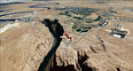
This scenery covers the western part of Lake Powell, the city of Page (KPGA), the Vermillion Cliffs, Glenn Canyon just south of Glenn Canyon Dam, the northern part of Marble Canyon, Paria Canyon, Cockscomb, etc, etc. Spectacular! To explore the scenery depart from Page Municipal Airport (KPGA). High resolution versions of this scenery for FS9 and FSX (much sharper, but larger and multiple downloads) are available at www.blueskyscenery.com/CNY_South3West3.html . The screenies are taken from the high-res versions, so expect this version to be slightly more blurry. YourDonation@Work: Dedicated to William, Veit and Michele.
| Filename: | Page_KPGA_Lake_Powell_West_UtahArizona_PhotoScener.zip |
| License: | Freeware, limited distribution |
| Added: | 3rd March 2010, 21:26:32 |
| Downloads: | 1,821 |
| Author: | Gottfried Razek - blueskyscenery.com |
| Size: | 92.41 MB |


© 2001-2026 AVSIM Online
All Rights Reserved
Privacy Policy |