
Where Flight Simulation Enthusiasts Gather from Around the World!
AVSIM Library - Search Results

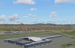
| Category: Flight Simulator X - Scenery | |
| KUTS - Huntsville Airport - Texas, USA |

|
Images related to this file:
File Description:
FSX Scenery - Bruce Brothers Huntsville Regional Airport, also known as Huntsville Municipal Airport, (IATA: HTV, ICAO: KUTS, FAA LID: UTS), is a city owned, public use airport located two nautical miles (4 km) northwest of the central business district of Huntsville, a city in Walker County, Texas, United States. It is included in the National Plan of Integrated Airport Systems for 2011-2015, which categorized it as a general aviation facility. Although most U.S. airports use the same three-letter location identifier for the Federal Aviation Administration (FAA) and International Air Transport Association (IATA), this airport is assigned UTS by the FAA and HTV by the IATA. For your flying pleasure by John B. Loney, Jr.
| Filename: | KUTS__Huntsville_Airport__Texas_USA.zip |
| License: | Freeware, limited distribution |
| Added: | 7th September 2015, 22:30:00 |
| Downloads: | 459 |
| Author: | John B. Loney, Jr. |
| Size: | 8.64 MB |
| Category: Flight Simulator 2004 - Scenery | |
| Catalonia version II |
|
Images related to this file:
File Description:
Catalonia is my small country located among Spain northeast and France southeast. Its surface it is 32000 km2 in its south area and of about 2000 kn2
In its area north. Your coastal fringe in the Mediterranean is about 630 kms. This is the whole Catalonia.
Their capital is Barcelona where the olympic games was played in recent years.
It is headquarters of the cathedral of Gaudi.It contains 7 big airports 7 airclubs and two seaports. The port of Barcelona is the first tourist port of the mediterranean of the they leave the big tourist cruises.
Airport LEBL is reconstructed with new great terminal
This scenery contents the new airport LEDA in Lleida city
| Filename: | Catalonia_version_II.zip |
| License: | Freeware |
| Added: | 17th March 2010, 23:29:15 |
| Downloads: | 7,102 |
| Author: | Toni Agramont |
| Size: | 74.05 MB |
| Category: Flight Simulator X - AFCAD Files | |
| KCLE - Cleveland Hopkins International Airport, U.S.A. (Default) |
|
Images related to this file:
File Description:

This is part of the sixth round of Afcads issued by Alpha India Group. AIG Ground aims to create high quality Afcads for both FS2004 and for FSX default and Add On Scenery airports. Our Afcads are created drawing on a number of resources and aim to simulate the real world airport as closely as possible but also to take account of FS constraints and to ensure good levels of traffic and realistic traffic parking and flow around the airport.
This file includes an entirely newly modelled Concourse 'C'
Please read and follow installation instructions in the Readme file carefully, as these do vary.
Visit us at www.alpha-india.net for more information.
| Filename: | KCLE__Cleveland_Hopkins_International_Airport_USA_.zip |
| License: | Freeware |
| Added: | 2nd November 2009, 04:12:30 |
| Downloads: | 1,559 |
| Author: | Patrick Finch & Alpha India Group |
| Size: | 6.45 MB |
| Category: Flight Simulator 2004 - Scenery | |
| KPVG - Hampton Roads Executive Airport - Virginia, USA |
|
Images related to this file:
File Description:
FS2004 Scenery - Hampton Roads Executive Airport (ICAO: KPVG, FAA LID: PVG) is a public-use airport
located seven miles (11 km) southwest of the central business district of Norfolk and northwest of Chesapeake, both independent cities in the U.S. state of Virginia. It is privately owned by Virginia Aviation Associates, L.L.C. Although most U.S. airports use the same three-letter location identifier for the FAA and IATA, Hampton Roads Executive Airport is assigned PVG by the FAA but has no designation from the IATA (which assigned PVG to Pudong International Airport in Shanghai, China). All buildings are custom made. AI traffic contains default aircraft. Created for your flight simming pleasure by John B. Loney, Jr.
| Filename: | KPVG__Hampton_Roads_Executive_Airport__Virginia_US.zip |
| License: | Freeware, limited distribution |
| Added: | 7th September 2014, 23:06:07 |
| Downloads: | 527 |
| Author: | John B. Loney, Jr. |
| Size: | 18.79 MB |
| Category: Flight Simulator X - Scenery | |
| KPVG - Hampton Roads Executive Airport - Virginia, USA |
|
Images related to this file:
File Description:
FSX Scenery - Hampton Roads Executive Airport (ICAO: KPVG, FAA LID: PVG) is a public-use airport located seven miles (11 km) southwest of the central business district of Norfolk and northwest of Chesapeake, both independent cities in the U.S. state of Virginia. It is privately owned by Virginia Aviation Associates, L.L.C. Although most U.S. airports use the same three-letter location identifier for the FAA and IATA, Hampton Roads Executive Airport is assigned PVG by the FAA but has no designation from the IATA (which assigned PVG to Pudong International Airport in Shanghai, China). All buildings are custom made. AI traffic contains default aircraft. Created for your flight simming pleasure by John B. Loney, Jr.
| Filename: | KPVG__Hampton_Roads_Executive_Airport__Virginia_US.zip |
| License: | Freeware, limited distribution |
| Added: | 7th September 2014, 23:05:56 |
| Downloads: | 846 |
| Author: | John B. Loney, Jr. |
| Size: | 18.89 MB |
| Category: Flight Simulator 2004 - Scenery | |
| Mail Run 2 |
|
File Description:
This scenery is located in,British Columbia, Canada. See map(included)
Airport name's,
1.Leo Creek.CAH5. Default enhanced. 3900' dirt field
2.Takla Narrows.CBD5. Default enhanced. 2000' gravel. Look out for fires in the area!
3.Ogden Field.CC5A. Addon. 2800' gravel. Ndb on field. OGDEN(OGD)402Khz
Overview: Take the mail to the different airports as instructed. You'll find the instruction signs close to the buildings at each air strip. Not hard to find. Just nose around a bit. This theme takes advantage of the weight and fuel loading area of the sim for each aircraft. Your looking at hauling up to 1500 lbs at any one time so just be aware.
| Filename: | Mail_Run_2.zip |
| License: | Freeware |
| Added: | 17th October 2003, 16:53:46 |
| Downloads: | 1,584 |
| Author: | Frank Betts |
| Size: | 1.99 MB |
| Category: Prepar3D V1-4 - Scenery | |
| Grise Fiord Airport (CYGZ) N76.25.34 W82.54.36 |
|
File Description:
Grise Fiord Airport (CYGZ) N76.25.34 W82.54.36 is located in the Qikiqtaaluk Region of the territory of Nunavut, and is one of the northernmost inhabited settlements of Canada and the whole world. The scenario shows the airport infrastructure and the small town not far from the airport. This scenario goes to fill the absence of scenarios towards the North Pole. The airport is open only in the mei that go from August to October where it is practically possible to land considering also the proximity of mountains remains one of the most difficult and dangerous airports.
Within the downloaded package you will find readme files for scenery installation. Good fly VFR. Pasquale Marrulli.
| Filename: | Grise_Fiord_Airport_CYGZ_N762534_W825436.zip |
| License: | Freeware |
| Added: | 30th December 2017, 19:14:28 |
| Downloads: | 149 |
| Author: | Pasquale Marrulli |
| Size: | 2.97 KB |
| Category: Flight Simulator 2004 - Scenery | |
| City Airport - Belfast |
|
File Description:
Ok, my previous EGAC with FS Enhancer was fine until I installed Just Flight Roads and Rivers Europe. As users are aware, although it is accurate, it leaves some buildings and AFCAD in the water at coastal locations. Well this is a remake of pervious FSE scenery for RR Europe users. You will need FS Enhancer from Lago for this to work along with your Just Flight RR Europe. I have added lots of new gates and buildings. Changed the runway texture and something exclusive to Irish FS Airports, new helicopter AI. This is a trail version of the helicopter AI, it works fine but you need the MRAI installer for the flight plans. Enjoy.
| Filename: | City_Airport__Belfast.zip |
| License: | Freeware |
| Added: | 9th October 2005, 15:05:48 |
| Downloads: | 2,947 |
| Author: | René Bruun & LAGO FSE |
| Size: | 1.58 MB |
| Category: Flight Simulator 2004 - Scenery | |
| LFPB 1960 Paris Le Bourget Version 2 |
|
Images related to this file:
File Description:
Le Bourget airport north of Paris is one of the world's oldest airports.
It dates back to the early days of World War One,
when land was seized for a military airfield.
The airport opened for commercial operations in 1919.
Possibly the most significant historical event was
Charles Lindbergh's landing there after his historic
solo transatlantic flight on Mai 21st, 1927.
We have produced this scenery to provide taxiways and details
as they were around 1960 in Paris le Bourget
We've also included new parking to allow the AI aircraft to taxi
correctly at the new (old!) airport.
New in version 2 : Upgraded terminal textures by Rui Cristina
and new custom made hangars.
| Filename: | LFPB_1960_Paris_Le_Bourget_Version_2.zip |
| License: | Freeware |
| Added: | 16th January 2011, 23:13:13 |
| Downloads: | 3,559 |
| Author: | Wolfgang Gersch, Volker Boehme and Rui Cristina |
| Size: | 1.06 MB |
| Category: Flight Simulator X - AFCAD Files | |
| LYBR - Dolac airport - Berane, Montenegro |
|
File Description:
Dolac Airport (Serbian: Aerodrom Dolac) (IATA: IVG, ICAO: LYBR) is an airport located near Berane, Montenegro. Berane was known as Ivangrad from July 1949 to March 1992, hence the IATA code IVG.
It is one of the four Montenegrin airports to feature paved runway and one of three Montenegrin airports to have terminal building. Berane Airport was used for regular airline traffic during the SFRY era, but has since fell into disuse. Today is used mostly by general aviation.
You can select this airport in FSX as Serbia and Montenegro, then Berane, as this was one country when FSX was released.
VFR Charts included
| Filename: | LYBR__Dolac_airport__Berane_Montenegro.zip |
| License: | Freeware |
| Added: | 15th November 2016, 14:54:58 |
| Downloads: | 515 |
| Author: | Danilo Jankovic |
| Size: | 2.47 MB |
© 2001-2026 AVSIM Online
All Rights Reserved
Privacy Policy |