
Where Flight Simulation Enthusiasts Gather from Around the World!
AVSIM Library - Search Results

| Category: Flight Simulator X - Scenery | |
| Whole Ghana,Togo and Benin ,Soaring Scenery |

|
File Description:
FSX/2004/FS2002 Whole Ghana,Togo and Benin ,Soaring Scenery
This file adds thermals lifts to glider´s flights over Whole Ghana,Togo and Benin Regions,Africa
It is freeware.Good Flights and better Landings
Volta Redonda,Brazil,05/01/2008
It is freeware
Design:Francisco Vargas. E-mail:[email protected]
| Filename: | Whole_GhanaTogo_and_Benin_Soaring_Scenery.zip |
| License: | Freeware |
| Added: | 2nd May 2008, 02:28:52 |
| Downloads: | 316 |
| Author: | Francisco Augusto Vargas Carneiro |
| Size: | 1.28 MB |
| Category: Flight Simulator X - Scenery | |
| EKKL-Kalundborg Airport X VFR Photo Scenery |
|
File Description:
Kalundborg Airport – named Kaldred is a small regional field in a comfortable distance from my other FOTOREAL airport EKRK-Copenhagen Airport Roskilde. In the period 1964-76, airfield operations was yearly 15.000-20.000, and in 1976 the heavier aircrafts with retractable gear made it necessary to change the Runway surface from grass to asphalt. In 1981, the closure of Skovlunde Airfield in the Greater Copenhagen Area moved traffic to other locations like EKRK-Roskilde, and investments was made to improve service and facilities at EKKL to attract new customers, being a the perfect hub for aircraft operations to many of the small Danish islands. For many years post and News papers were daily transported by road from print in Copenhagen to Kaldred and flown to EKSS-Samsø (my last released airport).
Today six Air companies reside in Kaldred, together with Kalundborg Flyveklub. Visit Kaldred, and be sure you will get a warm welcome, and as they say in Kalundborg Flying Club, there are always coffee in the clubhouse. Included in the zip file is a version for Ultimate Terrain Europe and Dan-Vfr plus the Default scenery. Enjoy.
| Filename: | EKKLKalundborg_Airport__X__VFR_Photo_Scenery.zip |
| License: | Freeware |
| Added: | 22nd May 2008, 09:17:33 |
| Downloads: | 2,060 |
| Author: | Jens Peter Bruun-Hansen |
| Size: | 22.54 MB |
| Category: X-Plane - Scenery | |
| Hannover, Lower Saxony, Germany (EDDV/HAJ) Scenery |
|
File Description:
EDDV-Scenery by Alexander Schön, originally made for FS9. Converted with his kind permission to X-Plane 9 using Marginals great FS2XPlane and the v8s_scenery-tools.
| Filename: | Hannover_Lower_Saxony_Germany_EDDVHAJ_Scenery.zip |
| License: | Freeware |
| Added: | 26th May 2008, 19:11:51 |
| Downloads: | 427 |
| Author: | Alexander Schön, conversion done by Marc Reinhold |
| Size: | 1.93 MB |
| Category: Flight Simulator 2004 - Scenery | |
| Tehran Scenery 2003 Update 2.07 - Full Package |
|
File Description:
This update (for fs2004 ONLY) will fix issues and bugs, reported since the release of “Tehran scenery 2003 - FS2004 compatibility patch” in the July 2007. It also adds some more new features to the scenery and improves its performance. This is probably the last update for Tehran scenery 2003 and is a full package containing all files you need to run the scenery.Thanks to beta testers for their work and also all those who reported the bugs and deficiencies.
| Filename: | Tehran_Scenery_2003_Update_207__Full_Package.zip |
| License: | Freeware |
| Added: | 1st October 2008, 21:59:58 |
| Downloads: | 7,605 |
| Author: | Touradg Morassaei |
| Size: | 4.46 MB |
| Category: Flight Simulator 2004 - Scenery | |
| Toronto, Ontario, Canada Area Power Stations Scenery |
|
File Description:
Toronto area power stations FS2004
The Pickering power station 20 miles E of Toronto
is one of the largest in the world with 8 units.
The Darlington station 43 miles east of Toronto
will be 4 units when completed. When used
with UT they are correctly located on the shore
line. Rwy 12 library will be required.
Works with Toronto2 scenery. Cooling towers are
reduced scale to reflect differences of CANDU
reactors
by David "Datatrain" Eastbury
| Filename: | Toronto_Ontario_Canada__Area_Power_Stations_Scener.zip |
| License: | Freeware |
| Added: | 1st February 2009, 22:50:19 |
| Downloads: | 1,290 |
| Author: | David Eastbury |
| Size: | 849.67 KB |
| Category: Flight Simulator X - Scenery | |
| Quebec Scenery - Lakes and Rivers (3/5) |
|
File Description:
Lakes, shorelines and rivers of the province of Quebec, Canada. (range : N45�°-N52�°, W55�°-W80�°).
| Filename: | Quebec_Scenery__Lakes_and_Rivers_35.zip |
| License: | Freeware, limited distribution |
| Added: | 17th December 2009, 23:13:20 |
| Downloads: | 7,288 |
| Author: | Gilles Gauthier |
| Size: | 23.76 MB |
| Category: Flight Simulator X - Scenery | |
| Quebec Scenery - Lakes and Rivers (5/5) |
|
File Description:
Lakes, shorelines and rivers of the province of Quebec, Canada. (range : N45�°-N52�°, W55�°-W80�°).
| Filename: | Quebec_Scenery__Lakes_and_Rivers_55.zip |
| License: | Freeware, limited distribution |
| Added: | 17th December 2009, 23:14:54 |
| Downloads: | 7,916 |
| Author: | Gilles Gauthier |
| Size: | 28.5 MB |
| Category: Flight Simulator 2004 - Scenery | |
| Park County, Colorado, Photo-Scenery (FS9 & FSX) |
|
Images related to this file:
File Description:
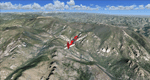
Covers the gap between my Leadville and Colorado Springs North sceneries and provides you with continuous coverage for longer cross country flights. High resolution versions of this scenery for FS9 and FSX (much sharper, but larger and multiple downloads) are available at www.blueskyscenery.com/GNB_South2.html . The screenies are taken from the high-res versions, so expect this version to be slightly more blurry. YourDonation@Work: Dedicated to Arthur and Pierre-Alain.
| Filename: | Park_County_Colorado_PhotoScenery_FS9__FSX.zip |
| License: | Freeware, limited distribution |
| Added: | 3rd February 2010, 22:19:58 |
| Downloads: | 1,423 |
| Author: | Gottfried Razek - blueskyscenery.com |
| Size: | 89.49 MB |
| Category: Flight Simulator 2004 - Scenery | |
| Colorado Springs South (KCOS), Colorado, Photo-Scenery |
|
Images related to this file:
File Description:
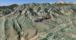
Colorado Springs South (KCOS), Colorado, Photo-Scenery (FS9 & FSX)
This region covers the area of Colorado Springs. Just west of the city you can fly around Pikes Peak. At 14.115ft it is the easternmost of Colorado's 54 fourteeners. Northwest of the city lies the Garden Of Gods with its many vertical rock formations. They are made of sedimentary beds red and white sandstones, conclomerates and limestone that were deposited horizontally but have been tilted vertically and faulted by the immense mountain building forces caused by the uplift of the Pikes Peak massiv. Deep within Chayenne Mountain is the North American Aerospace Defense Command's (NORAD) main technical facility which collects and evaluates data from a worldwide system of satellites, radars and other sensors.
High resolution versions of this scenery for FS9 and FSX (much sharper, but larger and multiple downloads) are available at www.blueskyscenery.com/GNB_South3East.html . The screenies are taken from the high-res versions, so expect this version to be slightly more blurry. YourDonation@Work: Dedicated to Veit and Hector.
| Filename: | Colorado_Springs_South_KCOS_Colorado_PhotoScenery.zip |
| License: | Freeware, limited distribution |
| Added: | 5th February 2010, 16:30:42 |
| Downloads: | 1,983 |
| Author: | Gottfried Razek, blueskyscenery.com |
| Size: | 95.63 MB |
| Category: Flight Simulator 2004 - Scenery | |
| Kremmling, Mc Elroy (20V), Colorado, Photo-Scenery |
|
Images related to this file:
File Description:
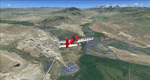
Kremmling, Mc Elroy (20V), Colorado, Photo-Scenery (FS9 & FSX)
Ever wanted to know how the scenery looks like around Kremmling VOR? Now you got the chance! This region covers the area around Kremmling and the northern part of the Gore Range. At Kremmling the Colorado River meets both the Blue River and the Muddy Creek. West of Kremmling you can see Gore Canyon. This rugged and steep canyon is almost 1000ft deep and was carved by the Colorado River on its way thru the Gore Range.
To explore the scenery depart from Mc Elroy Airfield (20V) in Kremmling and head north. High resolution versions of this scenery for FS9 and FSX (much sharper, but larger and multiple downloads) are available at www.blueskyscenery.com/GNB_West.html . The screenies are taken from the high-res versions, so expect this version to be slightly more blurry. Thanks to Joop Mak for providing custom AFCADs that correct airport layouts so that they align with the photo-textures! They are available at www.blueskyscenery.com/AFCADs.html . YourDonation@Work: Dedicated to Michael.
| Filename: | Kremmling_Mc_Elroy_20V_Colorado_PhotoScenery.zip |
| License: | Freeware, limited distribution |
| Added: | 21st April 2010, 17:39:09 |
| Downloads: | 1,141 |
| Author: | Gottfried Razek, blueskyscenery.com |
| Size: | 91.2 MB |


© 2001-2026 AVSIM Online
All Rights Reserved
Privacy Policy |