
Where Flight Simulation Enthusiasts Gather from Around the World!
AVSIM Library - Search Results

| Category: Fly! II - Scenery | |
| Los Angeles International Airport (KLAX) - v2.0 |

|
File Description:
TerraModels Scenery Development System by Allen Kriesman was used to create the scenery for Los Angeles International Airport (KLAX), California - version 2. Biber Salsa models were also used to create this scenery. No custom models were created for this scenery. There are dynamic vehicles moving in this scenery.
| Filename: | Los_Angeles_International_Airport_KLAX__v20.zip |
| License: | Freeware |
| Added: | 13th March 2003, 02:48:24 |
| Downloads: | 619 |
| Author: | Wayne Roberts |
| Size: | 650.31 KB |
| Category: Flight Simulator 2004 - Scenery | |
| Cleveland Hopkins International Airport (KCLE) |
|
Images related to this file:
File Description:
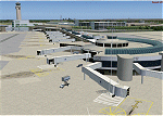
Scenery upgrade for the Cleveland Hopkins International Airport scenery (CLE2004). This upgrade extends the runway 6L/24R to its full length, and also builds in some small fixes. (Requires installation of scenery CLE2003 and CLE2004u. See readme for details) [NOTE: Reupload of previous scenery - not a new scenery]
| Filename: | Cleveland_Hopkins_International_Airport_KCLE.zip |
| License: | Freeware, limited distribution |
| Added: | 8th January 2010, 21:02:19 |
| Downloads: | 8,342 |
| Author: | Shehryar Ansari |
| Size: | 177.13 KB |
| Category: Flight Simulator 2004 - AFCAD Files | |
| Sunnyside Municipal Airport, Sunnyside, Washington (1S5) |
|
File Description:
1S5 Sunnyside just east of KYKM Yakima by about 23 miles, thought i'd work on surrounding airports in the Lower Valley, I changed and corrected the Runway length, lighting and taxi and apron. Enjoy thanks Lee for the Afcad program.
| Filename: | Sunnyside_Municipal_Airport_Sunnyside_Washington_1.zip |
| License: | Freeware |
| Added: | 16th August 2006, 03:57:58 |
| Downloads: | 312 |
| Author: | Nigel Carter |
| Size: | 2.49 KB |
| Category: Navigation and ATC - Navigation | |
| Orthodromic Calculator / version Ortho-Cities |
|
File Description:
Version Ortho-Cities is an upgrade of Ortho-2. Ortho-Cities calculates orthodromic distance and orthodromic angle between two points on the Earth. Easy input of coordinates from the list of selected airports,useful for inercial navigation systems, fuel calculations ...
| Filename: | Orthodromic_Calculator__version_OrthoCities.zip |
| License: | Freeware |
| Added: | 8th January 2008, 21:39:32 |
| Downloads: | 442 |
| Author: | Bohumil Stadnik |
| Size: | 275.42 KB |
| Category: Flight Simulator 2004 - AI Flight Plans | |
| Blue Wings Jan'09 |
|
File Description:
Flightplans for German Airline: BLUE WINGS 'Januar 2009' Flightplans are taken from Öger Tours Website and the Websites of the German Airports from Frankfurt, Düsseldorf, Stuttgart, Dortmund, Münster-Osnabrück, Berlin-Tegel, Hamburg, Hannover, Bremen, Nürnberg and München. See Readme-File.
| Filename: | Blue_Wings_Jan09.zip |
| License: | Freeware |
| Added: | 6th January 2009, 09:04:35 |
| Downloads: | 702 |
| Author: | Stefan Schmidt |
| Size: | 5.38 KB |
| Category: Flight Simulator 2004 - AI Flight Plans | |
| IrAero Russia Summer 2009 |
|
File Description:
IrAero is an Irkutsk, Russia based commuter airline that serves the Siberian Far East with passenger services, charter and cargo flights. Data taken from the airline's web site. Unfortunately some airports are missing in FS9. Tested with TTools, bgl-included.
| Filename: | IrAero_Russia_Summer_2009.zip |
| License: | Freeware |
| Added: | 26th April 2009, 08:14:36 |
| Downloads: | 488 |
| Author: | Uwe Hoffmann |
| Size: | 8.11 KB |
| Category: Flight Simulator 2004 - Utilities | |
| Italian Airport Charts and Procedures Series 1 |
|
File Description:
These files are to use with THE NEW CHARTMAP program.
Please before, download THE NEW CHARTMAP program (the_new_chartmap.zip) and after this zip file. After download this zip file (SERIES 1), unzip all inside the AIRPORTS FOLDER of the NEW CHARTMAP PROGRAM.
| Filename: | Italian_Airport_Charts_and_Procedures_Series_1.zip |
| License: | Freeware |
| Added: | 30th January 2010, 09:43:12 |
| Downloads: | 1,799 |
| Author: | Carlo Chiappisi |
| Size: | 92.94 MB |
| Category: Flight Simulator 2004 - Utilities | |
| Italian Airport Charts and Procedures Series 2 |
|
File Description:
These files are to use with THE NEW CHARTMAP program. Please before, download THE NEW CHARTMAP program (the_new_chartmap.zip) and after this zip file. After download this zip file (SERIES 2), unzip all inside the AIRPORTS FOLDER of the NEW CHARTMAP PROGRAM.
| Filename: | Italian__Airport_Charts_and_Procedures_Series_2.zip |
| License: | Freeware |
| Added: | 30th January 2010, 09:44:50 |
| Downloads: | 1,222 |
| Author: | Carlo Chiappisi |
| Size: | 89.11 MB |
| Category: Flight Simulator 2004 - AI Flight Plans | |
| Airpac Airlines Winter 12-13 |
|
Images related to this file:
File Description:

Airpac Airlines is a small contract cargo carrier based at KBFI (Boeing Field). They serve destinations in the Pacific Northwest with flights to CYVR, KGEG, KPDX and smaller surrounding airports. Data obtained from Flightaware for the week of January 20-26,2013.
| Filename: | Airpac_Airlines_Winter_1213.zip |
| License: | Freeware |
| Added: | 27th January 2013, 18:08:34 |
| Downloads: | 606 |
| Author: | Brian Summers |
| Size: | 2.28 KB |
| Category: Flight Simulator 2004 - AFCAD Files | |
| Antalya, Turkey (LTAI) |
|
File Description:
One of the main airports of Turkey. Antalya has a new runway (36R-18L), which is used heavily during the tourist season. This scanaey adds the new runway and corrects all gates and parking areas, taxi ways, and navigational aids.
| Filename: | Antalya_Turkey_LTAI.zip |
| License: | Freeware |
| Added: | 6th May 2004, 20:00:47 |
| Downloads: | 4,884 |
| Author: | Salim Unuver |
| Size: | 473.34 KB |


© 2001-2026 AVSIM Online
All Rights Reserved
Privacy Policy |