
Where Flight Simulation Enthusiasts Gather from Around the World!
AVSIM Library - Search Results

| Category: Prepar3D V1-4 - Scenery | |
| Broadford Airfield, Scotland : EGEI |

|
Images related to this file:
File Description:

Isle of Skye (Broadford) Airfield (also known as Ashaig Airstrip or Broadford Aerodrome) is a small airfield on the Isle of Skye, Scotland, with a single runway. It is next to the hamlet of Ashaig, near the village of Broadford. The airport was constructed by the Corps of Royal Engineers and opened in 1972 to serve as a gateway to the Isle of Skye. Loganair operated a scheduled service from the airfield to Glasgow from 1972. However this service was discontinued in 1988. No commercial services have existed since then, and the airfield is usually deserted although the airport is occasionally used by NHS Highland and the Scottish Ambulance Service for transferring patients to hospitals in Inverness or Glasgow. Discussions were started in 2012 regarding the reinstatement of the airfield for commercial use but, as yet, this has not happened.
| Filename: | Broadford_Airfield_Scotland__EGEI.zip |
| License: | Freeware |
| Added: | 3rd November 2019, 18:31:13 |
| Downloads: | 675 |
| Author: | Andy Kewley |
| Size: | 178.5 MB |
| Category: Flight Simulator 2004 - Scenery | |
| VCRI - Mattala Rajapaksa International Airport - Hambantota, Sri Lanka |
|
File Description:
Mattala Rajapaksa International Airport (MRIA) (also known as the Hambantota International Airport) (IATA: HRI, ICAO: VCRI) is an international airport serving the city of Hambantota in southeast Sri Lanka.Mattala Rajapaksa International Airport is Sri Lanka's third international airport, after Bandaranaike International Airport and Colombo City Airport. It serves as the secondary hubs for Sri Lankan Airlines and Mihin Lanka. It is named after the Rajapaksa family. It is the newest and most developing airport in Sri Lanka. It is also the first greenfield airport in the country.
| Filename: | VCRI__Mattala_Rajapaksa_International_Airport__Ham.zip |
| License: | Freeware |
| Added: | 27th October 2013, 00:10:56 |
| Downloads: | 586 |
| Author: | Billy Guo |
| Size: | 682 KB |
| Category: Fly! II - Miscellaneous Files | |
| KDTW-3 Flight Plan |
|
File Description:
This flight plan starts at the Detroit Metro Wayne Airport (KDTW), Michigan and ends at that airport. There are stops at the Cleveland Hopkins International Airport (KCLE) and the Northern Kentucky International Airport (KCVG).
| Filename: | KDTW3_Flight_Plan.zip |
| License: | Freeware |
| Added: | 22nd October 2005, 01:44:17 |
| Downloads: | 46 |
| Author: | Wayne Roberts |
| Size: | 17.63 KB |
| Category: Flight Simulator 2004 - Scenery | |
| PACD - Cold Bay - Aleutian Islands, Alaska, USA |
|
Images related to this file:
File Description:
Cold Bay is in the eastern third of the Aleutian chain of islands in Alaska, around 175 miles east of Dutch Harbor. The small town has a population of just over 100 and is in existance solely because of the airport with its long runways, one just over 6,000 feet and the other over 10,000 feet and with an ILS. Goods are flown here for local redistribution. The airport was originally built to this size for use in WW2 and there are still quonset huts from this time visible in the area, though the majority of the rough-and-ready housing has now been cleared away. There are scheduled flights by Grant Aviation to neighbouring local airfields and flights to and from Anchorage by Peninsula Air (included in the AI posted with Adak) and Grant Aviation have space attached to their hangar that serves as a terminal. The Coastguard also make use of Cold Bay.
| Filename: | PACD__Cold_Bay___Aleutian_Islands_Alaska_USA.zip |
| License: | Freeware, limited distribution |
| Added: | 21st January 2015, 10:01:50 |
| Downloads: | 425 |
| Author: | Roger Wensley |
| Size: | 4.88 MB |
| Category: Flight Simulator 2004 - AFCAD Files | |
| Eagle NDB and Taxiways at Goodyear and Mobile |
|
File Description:
These AFCAD 2 files for Microsoft Flightsimulator 2004 add the Eagle NDB Taxiways at Mobile Airport and some Taxiways at Goodyear airport to the default Flightsim scenery. It may help students of the Luftwaffe, ATCA and OATC to practise the NDB/ILS approach at Mobile.
| Filename: | Eagle_NDB_and_Taxiways_at_Goodyear_and_Mobile.zip |
| License: | Freeware |
| Added: | 13th August 2007, 15:09:08 |
| Downloads: | 245 |
| Author: | Tom Pranker |
| Size: | 3.82 KB |
| Category: Flight Simulator X - Miscellaneous Files | |
| Compact Flows and Checklists for FS2CREW and PMDG777 |
|
Images related to this file:
File Description:
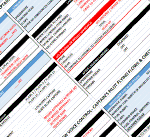
All of the Captains Flows and Checklists items provided in 3 formats (Excel, PDF & epub). Compact to allow for use on a second screen along with other items such as charts, online networks, weather etc. FO flows excluded to save space and allow you to focus on flying!!!
For use only with FS2Crew and PMDG 777.
| Filename: | Compact_Flows_and_Checklists_for_FS2CREW_and_PMDG7.zip |
| License: | Freeware |
| Added: | 6th December 2014, 00:20:02 |
| Downloads: | 2,726 |
| Author: | Mark Wolpert |
| Size: | 322.58 KB |
| Category: Flight Simulator 2004 - Miscellaneous Files | |
| Airbus A32X, A330, and A340 SOP's and checklists |
|
File Description:
Complete checklists for the POSKY A330 and A340 and iFDG A320 family of aircraft with the Ken Mitchell Panels.
Includes complete checklists, links at the bottom to the panel site and model makers sites, emergency proceedures (Rejected take-offs), refrence materials, refrence speeds, refrence weights, altitudes, runway lengths, flap setting speeds, and general aircraft informations. This is a complete package, includes speeds and info for the A318, 319, 320, 321, 330-200, 330-300, 340-200, and 340-300. Enjoy!
| Filename: | Airbus_A32X_A330_and_A340_SOPs_and_checklists.zip |
| License: | Freeware |
| Added: | 7th August 2005, 23:40:30 |
| Downloads: | 5,925 |
| Author: | Kevin Gomes |
| Size: | 11.27 KB |
| Category: Prepar3D V1-4 - Scenery | |
| Hot Air Balloons and Paragliders P3D and FSX |
|
File Description:
This pack contains 16 animated Hot air Balloons and 13 groups of animated paragliders at various places in South England and Wales(paragliders in Jersey also). S.O.D.E at least 1.63 and preferably 1.65 is required.
The objects are influenced by, weather, time of day, month of year and days of the year or week.
Balloons at -GOWER, PWLHELLI, TAUNTON, BATH etc. Paragliders at - IOW, STROUD, BURTON BRADSTOCK etc.
| Filename: | Hot_Air_Balloons_and_Paragliders_P3D_and_FSX.zip |
| License: | Freeware, limited distribution |
| Added: | 18th November 2019, 16:41:22 |
| Downloads: | 138 |
| Author: | john watts |
| Size: | 502.92 KB |
| Category: Flight Simulator 2004 - Utilities | |
| Fuel and Payload Calculator B737NG and B757 ** Update ** |
|
Images related to this file:
File Description:
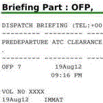
This file contains a spreadsheet template in OpenDocument format to prepare your flight ! Prepare your route, then, using planning tables and filling the fuel and weight form, prepare your payload estimation in this document. A copy of some tables (weights and limitations) for the B737 NG are embedded. A fuel calculator is also embbeded. It will provide automatic fuel load suggestion for each flight once you have completed your flight level and time of flight (based on linear interpolation of a real world flight planning table). Of course you can erase any suggestion with your own value. When it is done, go to the dispatcher briefing tab. Sign it to complete it automatically with some captain notes. In the end, export the dispatcher briefing as a selection in PDF if you wish. Fully reliable when used with your aircraft tables, this document uses the fuel planning methodology described in a PMDG manual and has been validated against a real B737-800 dispatcher briefing. The file contains two templates with automatic fuel load calculation (one for the 737NG, the other for the 757) and two templates without the linear interpolation module (for the Avro RJ and for the B727).
| Filename: | Fuel_and_Payload_Calculator_B737NG_and_B757__Updat.zip |
| License: | Freeware |
| Added: | 11th February 2013, 20:29:55 |
| Downloads: | 595 |
| Author: | Geoffrey Fernandez |
| Size: | 3.46 MB |
| Category: Flight Simulator 2004 - Scenery | |
| Collings and Mansfield |
|
File Description:
FS2004 Scenery - In 1979 the Collings Foundation was founded to support "living history" events involving transportation. Originally founded with the focus of automobiles, the foundation moved to aircraft as the need for quality aviation history exhibits grew. Mansfield Municipal Airport (1B9) serves Mansfield and Bristol County, MA and is owned by the Town Of Mansfield. The airport has more than one runway. The longest is a paved runway extending 3498 feet. The facility is at an elevation of 122 feet. Created using Instant Scenery by John B. Loney, Jr.
| Filename: | Collings_and_Mansfield.zip |
| License: | Freeware, limited distribution |
| Added: | 3rd February 2010, 02:07:34 |
| Downloads: | 247 |
| Author: | John B. Loney, Jr. |
| Size: | 1.78 MB |


© 2001-2026 AVSIM Online
All Rights Reserved
Privacy Policy |