
Where Flight Simulation Enthusiasts Gather from Around the World!
AVSIM Library - Search Results

| Category: Flight Simulator 2004 - Scenery | |
| VABP Bhopal/Bairagarh, India |

|
Images related to this file:
File Description:
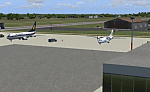
Googly scenery for VABP Bhopal/Bairagarh, India - an enhancement to the
airport provided in Flight Simulator 2004 which is incorrect in many respects.
These scenery files enlarge the apron to a realistic size to accept scheduled
traffic, remove spurious taxiways (they were actually perimeter tracks!), and
add buildings and other airport features so that you and your "AI" traffic
can land, taxi, park and take off in a realistic manner.
This small domestic airport is served by Boeing and Airbus jets of Indian
Airlines and Jet Airways together with local flights operated by ATRs of Air
Deccan.
The scenery does not purport to be ultra-accurate. Based on high-detail satellite
imagery from Google Earth, the layout is proportionally correct but the added
airport features, such as buildings, are built from default Microsoft objects
and add-on libraries so will not look like the real thing.
You are not obliged to download and install any additional scenery libraries,
but to enjoy this scenery in its entirety, you may wish to. It will work fine,
with or without.
[File re-uploaded at request of AVSIM]
| Filename: | VABP_BhopalBairagarh_India.zip |
| License: | Freeware |
| Added: | 7th May 2010, 22:34:06 |
| Downloads: | 1,625 |
| Author: | John Hinson |
| Size: | 64.37 KB |
| Category: Flight Simulator 2004 - Miscellaneous Files | |
| Sorted POI global cities and airports pack for FSDiscover! |
|
File Description:
README:
FSDiscover! Global Point of Interest pack.
Here is a poi pack of roughly 147 000 cities, 40 000 small airports,
1 177 seaplane bases, 4695 medium airports and 475 of the largest
airports.
Airports are split up in categories, small, medium, big, seaplane base.
Cities are split up into files of 10 000 cities each by size.
There are 15 files for cities.
The smallest cities are in xaa, xab, xac, xad, and so on.
The biggest cities are in xam, xan, until xao.
You should open the files in notepad to see for yourself which city
files to activate in FSDiscover! to balance clutter and detail.
This has been my main problem with the default populated places list;
there is no way to sort by population size
Compared to the default FSDiscover! populated places here are some
notes:
I have noticed that in the default FSDiscover! set for europe and many
other places, the coordinates are placed like on a "honeycomb" grid
which obviously is not very precise. In general, in terms of city map
precision, this pack should be better.
In the default pack, in an area I am familiar with, a city was placed on the other side of
a river compared to reality. In many other areas, you can clearly see
that the cities are not well-aligned with Ultimate Terrain europe or
even some places in UT USA. My theory is that either data was not super
precise for europe to begin with or that the dataset has been arranged
in the honeycomb grid fashion perhaps to reduce clutter or something.
Mostly though, the default populated places FSDiscover! file is very
useful for really small villages since these tend to be forgotten in
other datasets. The problems come when you want to filter out smaller
villages or airports. This is where this pack comes in handy.
Since no data is perfect, you can use this pack alone or in
combination with the FSDiscover! defaults. Personally, I put the same
files in both "Documents/FSDiscover Files" and
"Program Files/FSDiscover" so I can pick and choose a useful combo
from relevant sets inside the options.
Personally, I prefer the cities from this pack and the rest
(mountains, rivers etc.) from the default FSDiscover! pack.
INSTALLATION:
Just unzip the archived files into "C:\Users\YOURUSERNAME\Documents\FSDiscover Files"
or "C:\Program Files (x86)\FSDiscover!\geodata" or both!
I do not know if the geodata folder is completely overwritten some
times or not so keep that in mind. (probably safe, though)
AUTHOR:
fs9_2003 thanks to data made available by opendatasoft.com and ourairports.com
The source for cities:
https://public.opendatasoft.com/explore/dataset/geonames-all-cities-with-a-population-1000
The source for airports:
https://ourairports.com/data
| Filename: | Sorted_POI_global_cities_and_airports_pack_for_FSD.zip |
| License: | Freeware |
| Added: | 6th May 2024, 14:13:54 |
| Downloads: | 53 |
| Author: | Kim Husainov |
| Size: | 3.18 MB |
| Category: Flight Simulator X - Scenery | |
| X2AM - RAF Aldermaston - Berkshire, England |
|
File Description:
RAF Aldermaston (ICAO X2AM) is a former Royal Air Force station located 8 miles (13 km) east of Newbury, Berkshire and 9.8 miles (15.8 km) southwest of Reading, Berkshire, England.
Originally built as an RAF Bomber Command airfield during 1941-1942, Aldermaston was transferred to the United States Army Air Forces in August 1942.
Placed under the jurisdiction of Eighth Air Force, it was home to several Douglas C-47 Skytrain Troop Carrier Groups. It was transferred to Ninth Air Force in 1943 primarily as a Troop Carrier Command base. Returned to RAF Control at the end of 1945, it was used by Technical Training Command before being placed on Care and Maintenance. In 1946, it was transferred to the Ministry of Civil Aviation and used by BOAC aircraft for training.
Also used by the Ministry of Aircraft Production for Supermarine Spitfire assembly and flight testing, the airfield closed in 1950 and the site became home of the Atomic Weapons Research Establishment (later the Atomic Weapons Establishment) from 1950.
| Filename: | X2AM__RAF_Aldermaston__Berkshire_England.zip |
| License: | Freeware |
| Added: | 25th March 2016, 15:29:24 |
| Downloads: | 286 |
| Author: | Terry Boissel |
| Size: | 1.37 MB |
| Category: Flight Simulator 2004 - Miscellaneous Files | |
| Dauair Vcpmod |
|
File Description:
Vcpmod file for the small german regional airline Dauair. This file is for use with EditVoicepack only.
| Filename: | Dauair_Vcpmod.zip |
| License: | Freeware |
| Added: | 23rd January 2006, 17:57:45 |
| Downloads: | 432 |
| Author: | Martin Landmann |
| Size: | 1.35 KB |
| Category: Flight Simulator 2004 - Scenery | |
| Centre Bush Aerodrome - NZCB |
|
Images related to this file:
File Description:
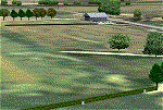
Small New Zealand aerodrome, 22nm north of Invercargill, Southland. Made to fit Christian Stock's NZ 20m mesh.
| Filename: | Centre_Bush_Aerodrome__NZCB.zip |
| License: | Freeware |
| Added: | 17th April 2012, 22:13:32 |
| Downloads: | 162 |
| Author: | Godfrey Tier |
| Size: | 476.1 KB |
| Category: Flight Simulator X - AI Flight Plans | |
| Air KBZ Winter 2013 / 2014 - Version 2 |
|
File Description:
Flightplans for Air KBZ (Myanmar) Winter 2013-2014. Version 2 corrects a small bug with one Aircraft.
| Filename: | Air_KBZ_Winter_2013__2014__Version_2.zip |
| License: | Freeware |
| Added: | 14th December 2013, 19:28:25 |
| Downloads: | 160 |
| Author: | Oliver Kerl |
| Size: | 3.7 KB |
| Category: Flight Simulator X - Aircraft Repaints, Textures and Modifications | |
| Kalitta Air 767-300ER - N765CK |
|
Images related to this file:
File Description:

Repaint of the LevelD 767-300ER. Kalitta Air's N765CK in the Kalitta White/Small Red Logo Paint
| Filename: | Kalitta_Air_767300ER__N765CK.zip |
| License: | Freeware |
| Added: | 8th June 2020, 17:05:48 |
| Downloads: | 130 |
| Author: | Michael Mainiero |
| Size: | 6.98 MB |
| Category: Flight Simulator 2004 - Gauges | |
| Flight Information Display Version 1.0a |
|
File Description:
Last version hat a small bug in the readme about implementing the gauge into the panel - sorry!
| Filename: | Flight_Information_Display__Version_10a.zip |
| License: | Freeware |
| Added: | 9th March 2005, 13:52:53 |
| Downloads: | 2,568 |
| Author: | Georg Aubele |
| Size: | 85.95 KB |
| Category: Flight Simulator 2004 - Gauges | |
| Flight Information Display Version 2a |
|
File Description:
Version 2a of the Flight Information Display - last version had a small bug in BOD/TOC calculation.
| Filename: | Flight_Information_Display__Version_2a.zip |
| License: | Freeware |
| Added: | 29th March 2005, 14:53:32 |
| Downloads: | 1,924 |
| Author: | Georg Aubele |
| Size: | 106.13 KB |
| Category: Flight Simulator 2002 - Scenery | |
| Grenchen/Granges (LSZG) for Suisse 2002 (update) |
|
File Description:
Small update to correct a texture error in the bgl file. You need previous file (CH03-ZG.zip).
| Filename: | GrenchenGranges__LSZG_for_Suisse_2002_update.zip |
| License: | Freeware, limited distribution |
| Added: | 28th July 2003, 15:36:06 |
| Downloads: | 1,285 |
| Author: | Daniel Gauthier |
| Size: | 126.66 KB |


© 2001-2026 AVSIM Online
All Rights Reserved
Privacy Policy |