
Where Flight Simulation Enthusiasts Gather from Around the World!
AVSIM Library - Search Results

| Category: Flight Simulator 2002 - Scenery | |
| Selcuk-Efes (Ephesus) Airport LTFB (Turkey) |

|
File Description:
South of Izmir on the south Aegean, Selcuk has been transformed since the 1990s into a major tourist destination, mainly as a base to visit the famous ruins of Ephesus a few kilometres away. The ancient classical city is one of the best preserved in the eastern Mediterranean and is a great example of Roman architecture. This scenery represents the tiny little airport near the ancient site, for small light aircrafts. Only on AVSIM. By Hakan Unal.
| Filename: | SelcukEfes_Ephesus__Airport_LTFB_Turkey.zip |
| License: | Freeware, limited distribution |
| Added: | 6th February 2003, 16:09:57 |
| Downloads: | 2,870 |
| Author: | Hakan Unal |
| Size: | 1.17 MB |
| Category: Flight Simulator X - Scenery | |
| UGAM Ambrolauri Airport, Georgia [FSX] |
|
Images related to this file:
File Description:
DISCLAIMER: The FSX Version is a straight port from the P3D version and might have issues or missing features compared to the P3Dv5 version. The screenshots are taken in P3D.
Ambrolauri
Ambrolauri (Georgian: áƒáƒ›áƒ‘რáƒáƒšáƒáƒ£áƒ ი) is a city in Georgia, located in the western part of the country, on both banks of the Rioni river, at the elevation of 550 m above sea level. It is a self-governing city. At the same time, the city serves as the seat of the Racha-Lechkhumi and Kvemo Svaneti regional administration and the Ambrolauri Municipality. According to the 2014 census, the city had a population of 2,047. Its area is 1.6 km². Ambrolauri is first recorded in the 17th century as a place, where one of the palaces of the kings of Imereti was located. It acquired the city status in 1966 and became a self-governing city with its own municipal government in 2014.
The Airport
The airport is nestled into the Caucasus mountains right at the bank of the river Rioni. It has a single runway of 1100 m length and caters small propeller aeroplanes. The apron has space for two planes at a time and caters up to 50 passengers at one time.
In the Simulator
The virtual airport is very close to its real-world counterpart. All the buildings at and near the airport are modelled and the terminal even has an interior that can be seen from outside. The look and feel from a trip to the Racha region is definitely there. In real life, only small planes fly to the airport but that shouldn't stop you to bring planes from the size of the Dash 8.
| Filename: | UGAM_Ambrolauri_Airport_Georgia_FSX.zip |
| License: | Freeware, limited distribution |
| Added: | 5th July 2020, 22:50:18 |
| Downloads: | 447 |
| Author: | David Hilker |
| Size: | 309.42 MB |
| Category: Flight Simulator X - AFCAD Files | |
| SAWH-Ushuaia International Airport-Argentina |
|
File Description:
Ushuaia International Airport (Spanish: Aeropuerto Internacional de Ushuaia) (IATA: USH, ICAO: SAWH) is located 4 km (2.5 mi) south[1] of the center of Ushuaia, a city on the island of Tierra del Fuego in the Tierra del Fuego
Province of Argentina.Ushuaia International Airport is fit to receive airplanes as large as the Boeing 747. Tower Air used to operate such types into the airport, and AeroliÂneas Argentinas operated 747-400s into the airport
during events of high passenger numbers (such as entire cruise-ship passenger payloads) until retiring this aircraft type in February, 2012. Two chartered Air France Concordes also visited in the past: F-BTSD arriving from
Buenos Aires and continuing to Santiago, Chile, in early 1999; the second arriving from Easter Island, Chile and continuing to Buenos Aires prior to the cessation of most Concorde charter flights on July 25, 2000. Condor and
LTU also offered charter flights from Germany and First Choice Airways from the United Kingdom. It also offers charter flights to Maputo, Mozambique.
This work is dedicate to Tiziano Fiori who lives in Trelew.
| Filename: | SAWHUshuaia_International_AirportArgentina.zip |
| License: | Freeware |
| Added: | 27th September 2012, 23:55:23 |
| Downloads: | 794 |
| Author: | Anwar Gonzalez |
| Size: | 58.72 KB |
| Category: Flight Simulator 2004 - Aircraft Repaints, Textures and Modifications | |
| Pacific Southwest Airlines Douglas DC-6B Textures |
|
File Description:
Pacific Southwest Airlines (PSA) Douglas DC-6B textures. Download the aircraft separately (United DC-6B Base Pack). Painted by Greg Pepper and Tom Gibson. From CalClassic Propliners. For use in FS2002, FS2004 and FSX.
| Filename: | Pacific_Southwest_Airlines_Douglas_DC6B_Textures.zip |
| License: | Freeware, limited distribution |
| Added: | 31st January 2013, 01:15:11 |
| Downloads: | 235 |
| Author: | Tom Gibson and Greg Pepper |
| Size: | 3.07 MB |
| Category: Flight Simulator 2004 - AI Aircraft | |
| United Express opb SkyWest Airlines Embraer 120 |
|
Images related to this file:
File Description:

Repaint of the Embraer 120 Aircraft by AI
Aardvark in the United Express Livery operated
by SkyWest Airlines. FS9 and FSX textures
included in archive. Model by AI Aardvark and
repaint by Jim Martin.
| Filename: | United_Express_opb_SkyWest_Airlines_Embraer_120.zip |
| License: | Freeware |
| Added: | 25th June 2014, 08:00:11 |
| Downloads: | 698 |
| Author: | Jim Martin, AI Aardvark |
| Size: | 577.67 KB |
| Category: Flight Simulator 2004 - Scenery | |
| DTTR El Borma, Tunisia |
|
File Description:
Googly scenery for El Borma (ICAO: DTTR, IATA: EBM), a small airport with a
long runway deep in the Tunisian desert near the Algerian border. El Borma,
also known as Al Borma or Al Burmah is one of Tunisia's top onshore oil and
natural gas sources and it is this that probably justifies the twice-weekly
flights operated by ATR turboprops of Sevenair.
Microsoft have only provided runways at this airport in Flight Simulator
2004 and this scenery seeks to redress the situation so that you and your
"AI" traffic can use the airport realistically.
The scenery does not purport to be ultra-accurate. Based on high quality
satellite imagery from Google Earth, the layout is proportionally correct but the
added airport features, such as buildings, are built from default Microsoft objects
and add-on libraries so will not look exactly like the real thing.
You are not obliged to download and install any additional scenery libraries,
but to enjoy this scenery in its entirety, you may wish to. It will work fine,
with or without.
| Filename: | DTTR_El_Borma_Tunisia.zip |
| License: | Freeware |
| Added: | 17th December 2008, 16:49:15 |
| Downloads: | 1,028 |
| Author: | John Hinson |
| Size: | 58.32 KB |
| Category: Flight Simulator X - AFCAD Files | |
| Princeton Airport (39N), NJ |
|
File Description:
Located 03 miles N of Princeton/Rocky Hill, New Jersey on 100 acres of land, Princeton Airport is a public airstrip. Fuel is available by parking next to the fuel tank - make sure you leave yourself enough room to get back out! (The block of static aircraft parked near the fuel area have collision disabled). This airport offers hangar space for transient aircraft, and as such 5 hangars are open that you can park in - the large hanger and the 4 surrounding it, 2 to the north and 2 to the south. The large hangar has operating doors - the frequency to open them is posted on the hangar doors. You can also choose to start in one of the hangars by selecting a DOCK parking space when positioning yourself at the airport. Docks 16 & 17 are the two small north hangars, Dock 20 is the large central hangar and Docks 18 & 19 are the two small south hangars.
Scenery constructed with use of satellite images/streetview, the author has not been there in person.
This scenery is meant to be used in conjunction with MegaScenery Earth New Jersey/Delaware 001. It is not required, but apron use is minimized to allow satellite scenery to show through as much as possible, and objects are placed based on the MSE textures - lack of it may make scenery look out of place.
| Filename: | Princeton_Airport_39N_NJ.zip |
| License: | Freeware |
| Added: | 21st November 2010, 09:01:50 |
| Downloads: | 311 |
| Author: | Drew Sikora |
| Size: | 1.26 MB |
| Category: Fly! II - Scenery | |
| Pocatello Regional Airport, Pocatello, Idaho (KPIH) and Sea Plane Base |
|
File Description:
TerraModels Scenery Development System by Allen Kriesman was used to create the scenery for Pocatello Regional Airport (KPIH) and Sea Plane Base, Idaho. Biber Salsa and Steves models were also used to create this scenery. The taxiways were added using the program by Peter Jacobson.
| Filename: | Pocatello_Regional_Airport_Pocatello_Idaho_KPIH_an.zip |
| License: | Freeware |
| Added: | 28th August 2006, 03:51:15 |
| Downloads: | 71 |
| Author: | Wayne Roberts |
| Size: | 229.61 KB |
| Category: Flight Simulator X - AFCAD Files | |
| TKPK - Robert L. Bradshaw International Airport / Saint Kitts and Nevis |
|
Images related to this file:
File Description:
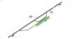
This airport update was made with the latest version of ADE (Airport Design Editor) and made for FSX as a replacement for the stock (default) airport. I've made several changes to the airport which are listed below. All these enchancements are as close to the real airport as I can get with stock library objects. I've used satellite images, terminal photos and maps throughout the whole process so building locations are as accurate as possible. Happy landings in sunny Saint Kitts and Nevis!
Features:
*Expanded parking apron
*Main terminal building with parking area for commercial traffic (Gates 1-9)
*St. Kitts airport sign
*Seperate parking area for GA traffic
*Parking stand for cargo (Gate 9)
*Misc airport buildings added
*Airport vehicles and objects throughout the airport
*Fuel tanks and station
*Airport fire station
*Windsocks added
*Birds flying near runway (beware)
*Palm trees/vegitation added near terminal
*Taxiway signs
*Taxiways Bravo and Charlie properly assigned
*New taxiway Alpha added
(For more information about Endeavourai please visit our site at endeavourai.com)
| Filename: | TKPK__Robert_L_Bradshaw_International_Airport__Sai.zip |
| License: | Freeware |
| Added: | 1st September 2012, 21:23:20 |
| Downloads: | 819 |
| Author: | Jaison Diaz / Endeavour ai |
| Size: | 87.92 KB |
| Category: Flight Simulator X - Scenery | |
| Uyuni - Bolivia - Joya Andina Airport (SLUY) and Uyuni City Photoreal |
|
File Description:
Uyuni Airport (IATA: UYU, ICAO: SLUY), aka Joya Andina Airport, is a public use airport located slightly northwest of Uyuni, in the southwestern Potosi Department of Bolivia. It is close to the Salar de Uyuni, the world's largest salt flat. It was opened by the Bolivian president Evo Morales on July 11, 2011.
Currently the airport is served by two airlines: Amaszonas and TAM Transporte Aereo Militar, which offer regular flights to and from Sucre, La Paz and Rurrenabaque.
Uyuni Airport features a 4,000 meters (13,000 ft) long and 45 meters (148 ft) wide paved runway, making it the airport with Bolivia's second longest runway.
Compatible with both FSX and P3D.
| Filename: | Uyuni__Bolivia__Joya_Andina_Airport_SLUY_and_Uyuni.zip |
| License: | Freeware |
| Added: | 10th July 2015, 12:13:26 |
| Downloads: | 870 |
| Author: | Marcos A. Rivas Torrez |
| Size: | 39.81 MB |


© 2001-2026 AVSIM Online
All Rights Reserved
Privacy Policy |