
Where Flight Simulation Enthusiasts Gather from Around the World!
AVSIM Library - Search Results

| Category: Flight Simulator 2002 - AFCAD Files | |
| Gibraltar Airport AFCAD and AI FlightPlans V2.0 |

|
File Description:
FS2002 Gibraltar sim-wings AFCAD and AI FlightPlans V2.0 for use with sim-wings Gibraltar 2004 payware scenery.
The AFCAD-File adds gates and parking postitions to the Airport. The AI Traffic connects the Airport with EGKK, LEPA, LEMG and GMTT. Additionally there are some circuit flights. Version 2.0 corrects the problem with the flying "progressive taxi"-line. Discover and enjoy the Rock of Gibraltar and the Strait of Gibraltar. (Previous Version had 159 downloads).
| Filename: | Gibraltar_Airport_AFCAD_and_AI_FlightPlans_V20.zip |
| License: | Check within download |
| Added: | 7th November 2003, 16:59:07 |
| Downloads: | 573 |
| Author: | Roland Flommer |
| Size: | 13.41 KB |
| Category: Fly! II - Scenery | |
| Kodiak Airport (PADQ) and Sea Plane Base |
|
File Description:
TerraModels Scenery Development System by Allen Kriesman was used to create the scenery for Kodiak Airport (PADQ), Alaska. The FlyII designator for this airport is CDB. The taxiways were added by Pieter Miller. No custom models were created for this scenery.
| Filename: | Kodiak_Airport_PADQ_and_Sea_Plane_Base.zip |
| License: | Freeware |
| Added: | 9th November 2003, 02:58:00 |
| Downloads: | 145 |
| Author: | Wayne Roberts |
| Size: | 62.49 KB |
| Category: Civil Flight Simulators - Looking Glass Flight Unlimited 3 | |
| Flat and dry Heathrow Airport classification file |
|
File Description:
Robert Driscoll makes a wonderful Heathrow package.
My automatic classification generator expected the UK weather as very rainy and
so Heathrow is not only not flat enough for runways but also very wet.
This file and description will modify the classification and elevation of Heathrow airport to 78ft.
| Filename: | Flat_and_dry_Heathrow_Airport_classification_file.zip |
| License: | Freeware |
| Added: | 18th December 2002, 02:46:16 |
| Downloads: | 122 |
| Author: | André Meystre |
| Size: | 13.01 KB |
| Category: Flight Simulator X - AFCAD Files | |
| VA1P - Diu Airport - Daman and Diu, India |
|
Images related to this file:
File Description:

AFCAD file (V1.0) for Diu Airport - Daman and Diu, India (VA1P) for FSX. This file gives the near realistic layout of the taxiways with taxiway signs, and parking stands/gates. This contribution is part of "Project FSX India" initiative 2013-2015.
| Filename: | VA1P__Diu_Airport__Daman_and_Diu_India.zip |
| License: | Freeware |
| Added: | 16th June 2015, 13:30:59 |
| Downloads: | 205 |
| Author: | Arjun Bala |
| Size: | 11.07 KB |
| Category: Flight Simulator 2004 - Scenery | |
| 1962 and 1965 Tokyo Haneda Airport Scenery |
|
File Description:
This scenery represents the international airport of Tokyo in the 1960's, Haneda. This package also removes the modern airport of Narita. There are two versions of the airport in this package, 1962 and 1965. Today, Tokyo International Airport (known to locals as Haneda) is consistently among the five busiest airports in the world. In the early 1960s, it was the only international airport serving the economic recovery of the Japanese capital. The entire airport was upgraded extensively between 1961 and 1964 in preparation for the Tokyo Olympics in October of '64. By 1965, a longer runway 15/33, expanded terminal, and improved ground transportation links were all in use at Haneda (these changes are reflected in the '62 and '65 versions). Terminal and ground details by Aaron Seymour, JAMCO/JAL hangars and AFCAD files by Tom Gibson. Thanks to Wolfgang Gersch for the parking area.
| Filename: | 1962_and_1965_Tokyo_Haneda_Airport_Scenery.zip |
| License: | Freeware, limited distribution |
| Added: | 5th October 2008, 20:43:08 |
| Downloads: | 3,850 |
| Author: | Aaron Seymour and Tom Gibson |
| Size: | 1.04 MB |
| Category: Flight Simulator 2004 - Scenery | |
| Sheikh Zayed Road and Dubai Airport Surroundings |
|
File Description:
Based upon the Martin Brunken/FlyTampa open source "Dubai City" add on, this is an expanded Sheikh Zayed Road, with added skyscrapers and a few MS default buildings to fill in the gaps. There is also a BGL of default buildings to populate Dubai Marina and the Palms. If you installed our landclass add on for the palms, this will put hotels on them. This also moves Sheikh Zayed Road inland to its correct position (Martin put it on the coast). You do not need Martins open source file, this is installable "as is". If you own FT Dubai you put the files into that scenery, if not, you can still install SZ Road to get the city skyline.
After a couple of requests, we have added in a second city BGL file that omits the Burj.
| Filename: | Sheikh_Zayed_Road_and_Dubai_Airport_Surroundings.zip |
| License: | Freeware, limited distribution |
| Added: | 23rd January 2010, 23:00:40 |
| Downloads: | 7,757 |
| Author: | Richard Faith/Matthew Ministry/FT Dubai |
| Size: | 2.21 MB |
| Category: Flight Simulator 2004 - Scenery | |
| Cromwell Aerodrome - NZCW |
|
Images related to this file:
File Description:
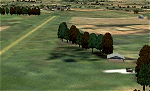
Central Otago, New Zealand. Fertilizer bin and small hangar for your Fletcher.
| Filename: | Cromwell_Aerodrome__NZCW.zip |
| License: | Freeware |
| Added: | 5th December 2010, 08:43:00 |
| Downloads: | 308 |
| Author: | Godfrey Tier |
| Size: | 239.66 KB |
| Category: Flight Simulator 2002 - Scenery | |
| Kiev City |
|
File Description:
Small Kiev-city Scenery. Includes autogen, TV towers and some smoking pipes.
| Filename: | Kiev_City.zip |
| License: | Freeware, limited distribution |
| Added: | 25th June 2003, 21:13:58 |
| Downloads: | 825 |
| Author: | Andrew Parubets |
| Size: | 110.54 KB |
| Category: Flight Simulator 2004 - Scenery | |
| Union Island TVSU in the Grenadines |
|
Images related to this file:
File Description:
Union Island is in the southern tail of the chain of islands known as St Vincent and the Grenadines, between Canouan and Carriacou. Union is another small island, 3.5 miles long and at its widest 1.5 miles wide; the resident population is around 3,000, mostly in the two towns Clifton and Ashton.
The airport is at the eastern end of the island, and has been extended into the sea on landfill. The runway is now around 2,480 feet long, aligned 08 (and with the southeast trade winds it is unlikely that you will find yourself using 26) and with a displaced threshold of 530 feet due to the hill to the west. The terminal is adjacent to a rather small apron; there is parking on the grass north of the taxiway. There are connecting flights by SVG to Barbados and the other islands and these are reflected in the AI. The airport has no lighting, and flights are obliged to land and depart in daylight hours only, outside of which the airport is closed.
| Filename: | Union_Island_TVSU_in_the_Grenadines.zip |
| License: | Freeware, limited distribution |
| Added: | 11th June 2013, 23:26:50 |
| Downloads: | 436 |
| Author: | Roger Wensley |
| Size: | 2.02 MB |
| Category: Prepar3D V1-4 - Scenery | |
| Grise Fiord Airport (CYGZ) N76.25.34 W82.54.36 |
|
File Description:
Grise Fiord Airport (CYGZ) N76.25.34 W82.54.36 is located in the Qikiqtaaluk Region of the territory of Nunavut, and is one of the northernmost inhabited settlements of Canada and the whole world. The scenario shows the airport infrastructure and the small town not far from the airport. This scenario goes to fill the absence of scenarios towards the North Pole. The airport is open only in the mei that go from August to October where it is practically possible to land considering also the proximity of mountains remains one of the most difficult and dangerous airports.
Within the downloaded package you will find readme files for scenery installation. Good fly VFR. Pasquale Marrulli.
| Filename: | Grise_Fiord_Airport_CYGZ_N762534_W825436.zip |
| License: | Freeware |
| Added: | 30th December 2017, 19:14:28 |
| Downloads: | 149 |
| Author: | Pasquale Marrulli |
| Size: | 2.97 KB |


© 2001-2026 AVSIM Online
All Rights Reserved
Privacy Policy |