
Where Flight Simulation Enthusiasts Gather from Around the World!
AVSIM Library - Search Results

| Category: Flight Simulator 2004 - Scenery | |
| Excursion Inlet Cannery for the "Glacier Bay" scenery |

|
File Description:
Excursion Inlet is in Alaska and in the area covered by Holger Sandmann's scenery called "Glacier Bay" which you will need to have already installed. It might work with just Ultimate Terrain, but then there will be no float base in the same inlet (nicely modelled by Holger and the team) which from the air is pushed off to one side (as a significant landmark, not literally!) by a large cannery which has been there since 1908. And rebuilt several times, I hasten to add, so don't think you're getting a museum piece here. And the only thing nearby that looms larger than the cannery is nature; lots of water, mountains, and trees. For me to start this Holger's scenery had to be there, so without it you won't get the same result.
| Filename: | Excursion_Inlet_Cannery_for_the_Glacier_Bay_scener.zip |
| License: | Freeware |
| Added: | 17th June 2008, 07:37:59 |
| Downloads: | 1,473 |
| Author: | Roger Wensley & Jim Turner |
| Size: | 1.43 MB |
| Category: Flight Simulator 2004 - Scenery | |
| Paugan & Mercier Dams on the Gatineau River in Quebec Canada |
|
Images related to this file:
File Description:
This will not work without Ultimate Terrain, as the rivers and lakes just won't be there. The Paugan and Mercier Dams are on the Gatineau River in Quebec, north of Ottawa. Both of them are for power generation, rather than water conservation; the Paugan power generation building sits at the bottom of the sluiceway below the dam and appears far larger than the dam itself; there is a separate overflow sluice system nearby. The Paugan Dam is around 30 miles north up the river from Ottawa and the Mercier a further 70 miles. The Mercier holds back a huge and irregularly shaped volume of water known as the Reservoir Baskatong, with numerous branching arms and islands, and you will recognise where the dam must be long before you see it.
| Filename: | Paugan__Mercier_Dams_on_the_Gatineau_River_in_Queb.zip |
| License: | Freeware, limited distribution |
| Added: | 3rd May 2010, 00:11:21 |
| Downloads: | 273 |
| Author: | Roger Wensley |
| Size: | 421.81 KB |
| Category: Flight Simulator 2004 - Scenery | |
| Calgary Alberta and Local Area Scenery |
|
File Description:
Calgary, Alberta, Canada
Version 1.1
This version contains the same 58 downtown buildings including the Calgary Tower and over 40 of the largest buildings, as of September, 2006. There are no new buildings in this version but several scenery (terrain) files have been added which replace Microsoft's default scenery for the Calgary area. This allows all the downtown buildings to be moved to their proper location rather than sitting in the default Bow River which looked more like a long lake. This version should work with Ultimate Terrain and other add on scenery files such as Holger Sandmann's bcmesh9e. Other enhancements include some VFR scenery based on the VFR Terminal Area Chart for Calgary, a more realistic Bow River, Elbow River, Glenmore Reservoir, Chestermere Lake and Ghost Lake.
| Filename: | Calgary_Alberta_and_Local_Area_Scenery.zip |
| License: | Freeware |
| Added: | 18th May 2010, 02:18:28 |
| Downloads: | 1,565 |
| Author: | Rick Engler |
| Size: | 713.92 KB |
| Category: Flight Simulator 2004 - Scenery | |
| Bettles PABT in Alaska |
|
Images related to this file:
File Description:
Bettles is around 175 miles north of Fairbanks in ALaska, and 25 miles north of the Arctic Circle. It is also where James "Andy" Andersen started flying for Wien Airlines and where he spent the 20 years between 1947 and 1967. Read "Arctic Bush Pilot" by Andy and Jim Rearden for his story of those 20 years flying the bush. Bettles PABT is the gravel strip and due to the limitations of FS9 AI the float base on the adjacent river has to be separately named PABX. Bettles village (old Bettles) used to be 2 miles southwest of the field, but has now slowly relocated close to the strip. In this download there is an AFCAD folder, landclass folders, a scenery folder, and a traffic folder. You will need Ultimate Terrain Alaska Canada.
| Filename: | Bettles_PABT_in_Alaska.zip |
| License: | Freeware, limited distribution |
| Added: | 22nd August 2010, 16:21:12 |
| Downloads: | 755 |
| Author: | Roger Wensley |
| Size: | 2.66 MB |
| Category: Flight Simulator 2004 - Scenery | |
| Perrine Bridge, Twin Falls Idaho Updated |
|
Images related to this file:
File Description:
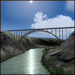
A prominent VFR landmark near Twin Falls Idaho, the Perrine Bridge spans over 1600' and stands 486 feet above the river below. At one time it was the tallest bridge in the world. Perrine Bridge is the only man-made structure in the USA were "base jumping" is allowed without a permit 365 days out of the year. Download includes gmax bridge object, a small photoscenery for the surrounding area, and two saved flight scenarios for exploring the scenery in the default J3 Cub. Bridge surface is landable and crash box has been removed allowing flight beneath the bridge. Scenery is compatible with, and nicely compliments John B. Loney's "Joslin-Magic Valley Regl" airport scenery (ktwf_v1.zip). Requires Ultimate Terrain and freeware mesh product, links provided in the readme.
| Filename: | Perrine_Bridge_Twin_Falls_Idaho_Updated.zip |
| License: | Freeware, limited distribution |
| Added: | 5th July 2011, 04:28:11 |
| Downloads: | 411 |
| Author: | Jim Robinson |
| Size: | 1.52 MB |
| Category: Flight Simulator 2004 - AFCAD Files | |
| Fiji Airstrips |
|
File Description:
Afcads and exclude files for 11 airstrips in Fiji that Microsoft omitted from FS9. Made primarily with Ultimate Traffic users in mind, to give full traffic in the Fiji Islands (aircraft assigments permitting!).
The Afcads add runways, aprons and parking spots; the exclude files get rid of the autogen trees. Airstrips built using current data from Australian Defense Force En Route Supplements, so runway locations, dimensions, alignments and elevations are fairly accurate. But aprons and parking spots are entirely fictional! And no airport buildings included!
Tested only with default scenery plus fijifix.zip by Jim Keir (available at avsim) to correct elevation errors in default mesh at Moala.
Includes NFNB Levuka/Bureta, NFCI Cicia, NFKD Kandavu/Namalata, NFNO Koro Is, NFNK Lakeba, NFNH Laucala, NFFO Malololailai, NFMA Mana Is, NFMO Moala, NFNS Savusavu and NFVB Vanuabalavu.
| Filename: | Fiji_Airstrips.zip |
| License: | Freeware |
| Added: | 4th December 2004, 05:17:19 |
| Downloads: | 1,613 |
| Author: | Adrian Wright |
| Size: | 14.82 KB |
| Category: Flight Simulator 2004 - Scenery | |
| Fort Resolution CYFR in the Northwest Territories, Canada |
|
Images related to this file:
File Description:
Fort Resolution is on the south side of Great Slave Lake, 75 miles east of Hay River and just west of where the Slave River flows into the lake from Fort Smith. Fort Resolution, the oldest community in the Territories and once a vital link in the fur trade business, is a small town with a population of around 500. It was not included in the original FS9 or Ultimate Terrain so I have added it here.
The airfield is next to the town on the lakeshore. The runway is 4,000 feet of gravel with a displaced threshold at the southern (town) end; it is lit and there is PAPI. There are no scheduled flights to Fort Resolution, just occasional charters; the AI includes a stock FS9 Cessna and a Wasaya Airways PC12.
| Filename: | Fort_Resolution_CYFR_in_the_Northwest_Territories_.zip |
| License: | Freeware, limited distribution |
| Added: | 4th October 2013, 22:11:26 |
| Downloads: | 294 |
| Author: | Roger Wensley |
| Size: | 2.31 MB |
| Category: Flight Simulator 2004 - Aircraft Repaints, Textures and Modifications | |
| Thomson Airways Boeing 757-28A WL (G-OOBE) |
|
Images related to this file:
File Description:

This (FS9 Version) repaint is part of my Very High Accuracy re-releases which are repaints I've spent over 2 months painting and feature very accurate details such as re-painted door labels & realistic colours. It is one of the most accurate repaints you'll find for the Thomson 757! The colours are very accurate.
This in particular is a VERY high accuracy non-fictional repaint of Thomson Airways' 757-200 aircraft: G-OOBE. This repaint is compatible with the QualityWings Ultimate 757 Collection (Which can be found here: http://qwsim.com/ ). This repaint should ONLY be used in FS2004 - Please refer to my other Repaint which is the original HD repaint this is converted from! Instructions on how to install the repaint are located within the zip file.
Compatibility: FS2004 ONLY.
| Filename: | Thomson_Airways_Boeing_75728A_WL_GOOBE.zip |
| License: | Freeware, limited distribution |
| Added: | 19th September 2014, 00:12:34 |
| Downloads: | 586 |
| Author: | Christopher Evans |
| Size: | 20.59 MB |
| Category: Flight Simulator X - Scenery | |
| Bahamas Airfield Package (BAP) |
|
Images related to this file:
File Description:

Get the "full Bahamas"... The "Bahamas Airfield Package" contains ALL 64 airfields and airports in the Bahamas - a complete country especially (re-) designed for VFR pilots!
All required objects libraries are included in the download. Nassau Intl (MYNN) comes as a "free loan" of Menno C. Robert. Big thank you for that, Menno :-)
Look forward to an improved version of ALL Bahamian airfields with a lot of atmosphere, many details and some landclass enhancements.
Since the original FSX didn't contain all existing airfields in the Bahamas, I've added the missing 5 airports. Two of them comes along with a complete new designed island as well. A comprehensive manual is also provided. Requirements: FSX with Acceleration pack and Ultimate Terrain X - The Tropical Americas & Caribbean (= UTX-TAC)!
| Filename: | Bahamas_Airfield_Package_BAP.zip |
| License: | Freeware |
| Added: | 21st June 2013, 07:25:51 |
| Downloads: | 4,933 |
| Author: | Dirk Cremer |
| Size: | 129.09 MB |
| Category: Flight Simulator X - AFCAD Files | |
| Harris Hill Emergency Field |
|
Images related to this file:
File Description:
Harris Hill Emergency Field
This is a simple add on for those who want the ultimate realism for their Harris Hill scenery. See my Harris hill scenery on AVSIM. This is the Emergency landing strip for gliders that can't make the main field due mostly to congestion at the end of a busy competition day, but also serves for those who find themselves to low to make the field. There is no ICAO code for this field so it is simply designated HHEM for FSX. I changed the land class for the valley in which it resides so as to reflect more accurately what is actually there. If your using another land class product you may see some difference from the screen shots. I tested with ORBX World and UTX.
| Filename: | Harris_Hill_Emergency_Field.zip |
| License: | Freeware |
| Added: | 9th June 2014, 14:15:38 |
| Downloads: | 320 |
| Author: | Jon Davidson |
| Size: | 3.09 KB |


© 2001-2026 AVSIM Online
All Rights Reserved
Privacy Policy |