
Where Flight Simulation Enthusiasts Gather from Around the World!
AVSIM Library - Search Results

| Category: Flight Simulator X - Scenery | |
| LamiaNew |

|
Images related to this file:
File Description:
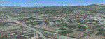
Lamia New
This is an update of the old Lamia-Chalkida upload because the previous
upload it seems to be missing the scenery
files down the Corinthian Gulf.
AS REAL AS IT GETS.
This is a detailed photorealistic scenery
of Lamia, Chalkida and the area
from Almyros in the North, to the
Corinthian Gulf in the South WITH NIGHT
TEXTURES.
This scenery abuts with my Attiki and
Agrinio photoscenery.
| Filename: | LamiaNew.zip |
| License: | Freeware |
| Added: | 9th June 2016, 22:42:43 |
| Downloads: | 1,051 |
| Author: | Angelo Tassoglou |
| Size: | 224.83 MB |
| Category: Flight Simulator X - Scenery | |
| Inagua - The Bahamas (MYIG) |
|
Images related to this file:
File Description:
MYIG is the southernmost airport in the Bahamas. At nearby Matthew Town is the Morton Salt Company's main facility - Inagua's main industry. The scenery includes custom scenery objects; placement of library objects and landclass changes. The airport is also moved to it's proper location. Scenery is based on Google Earth and Microsoft Bing imagery and photos taken locally, and it is optimized for use with or without UTX-TAC.
| Filename: | Inagua__The_Bahamas_MYIG.zip |
| License: | Freeware |
| Added: | 21st December 2012, 18:12:48 |
| Downloads: | 1,258 |
| Author: | Art Poole |
| Size: | 365.77 KB |
| Category: Flight Simulator X - Scenery | |
| MYGF - Freeport, Bahamas |
|
Images related to this file:
File Description:
MYGF includes separate international and domestic terminals as well as a terminal for general aviation. The old terminal shown in FSX has been removed and the control tower and fire station relocated as in real life. The scenery includes custom scenery objects; placement of library objects and landclass changes. Scenery is based on Google Earth imagery and photos taken locally, and it is optimized for use with UTX-TAC.
| Filename: | MYGF__Freeport_Bahamas.zip |
| License: | Freeware |
| Added: | 27th March 2013, 05:34:42 |
| Downloads: | 2,582 |
| Author: | Art Poole |
| Size: | 1.98 MB |
| Category: Flight Simulator 2004 - Scenery | |
| Italy, Toscana 6, Firenze, Photo Real |
|
Images related to this file:
File Description:
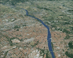
Toscana, Italy, Photoreal Scenery Part 6 (Firenze).
The photoreal scenery covers a great area of Toscana (Tuscany) around the city of Firenze (Florence). The airport of Firenze Peretola (LIRQ) are found inside the scenery (see map). For the best results, use it in association with other parts of Toscana photoreal: Toscana 1 Grosseto, Toscana 2 Piombino, Toscana 3 Siena, Toscana 4 Poggibonsi, Toscana 5 Livorno_Lucca_Pisa_Pistoia, Toscana 7 Massa_Carrara, italy_islands_vfr_part2_nw.zip
| Filename: | Italy_Toscana_6_Firenze_Photo_Real.zip |
| License: | Freeware |
| Added: | 28th April 2010, 13:46:09 |
| Downloads: | 7,058 |
| Author: | Fulvio Mazzokan |
| Size: | 89.82 MB |
| Category: Flight Simulator 2004 - Scenery | |
| Italy, Toscana 1, Grosseto, Photo Real |
|
Images related to this file:
File Description:
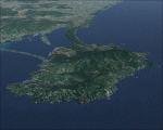
Toscana, Italy, Photoreal Scenery Part 1 (Grosseto).
The photoreal scenery covers a great area of Toscana (Tuscany) around the city of Grosseto. The airport of Grosseto(ICAO code LIRS) are found inside the scenery (see map). For the best results, use it in association with other parts of Toscana photoreal: Toscana 2 Piombino, Toscana 3 Siena, Toscana 4 Poggibonsi, Toscana 5 Livorno_Lucca_Pisa_Pistoia,Toscana 6 Firenze, Toscana 7 Massa_Carrara, italy_islands_vfr_part2_nw.zip
| Filename: | Italy_Toscana_1_Grosseto_Photo_Real.zip |
| License: | Freeware |
| Added: | 27th May 2010, 20:42:50 |
| Downloads: | 6,661 |
| Author: | Fulvio Mazzokan |
| Size: | 69.17 MB |
| Category: Flight Simulator 2004 - Scenery | |
| Italy, Campania 4, Benevento, Photo Real |
|
Images related to this file:
File Description:
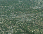
Campania, Italy, Photoreal Scenery Part 4 Benevento.
The photoreal scenery covers a great area of Campania around the city of Benevento (see map). The airports of Napoli (ICAO code LINR) and Grazzanise (LIRM) are founds near the scenery (see map). For the best results, use it in association with other parts of Campania photoreal: Campania 1 Caserta, Campania 2 Napoli, Campania 3 San Severo, Campania 5 Melfi, Campania 6 Palinuro.
| Filename: | Italy_Campania_4_Benevento_Photo_Real.zip |
| License: | Freeware |
| Added: | 31st May 2010, 13:52:07 |
| Downloads: | 6,502 |
| Author: | Fulvio Mazzokan |
| Size: | 75.32 MB |
| Category: Flight Simulator 2004 - Scenery | |
| Italy, Lazio 2, Roma, Photo Real |
|
Images related to this file:
File Description:
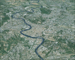
Lazio, Italy, Photoreal Scenery Part 2 (Roma).
The photoreal scenery covers a great area of Lazio around the city of Roma (Rome). The airports of Roma Urbe (ICAO code LIRU), Roma Fiumicino (LIRF) and Roma Ciampino (LIRA) are founds inside the scenery (see map). For the best results, use it in association with other parts of Lazio photoreal: Lazio 1 Viterbo, Lazio 3 Rieti, Lazio 4 Latina, Lazio 5 Gaeta.
| Filename: | Italy_Lazio_2_Roma_Photo_Real.zip |
| License: | Freeware |
| Added: | 1st June 2010, 20:38:25 |
| Downloads: | 15,712 |
| Author: | Fulvio Mazzokan |
| Size: | 78.89 MB |
| Category: Flight Simulator 2004 - Scenery | |
| Italy, Campania 2, Naples (Napoli), Photo Real |
|
Images related to this file:
File Description:
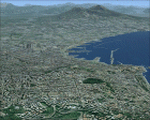
Campania, Italy, Photoreal Scenery Part 2 Naples (Napoli).
The photoreal scenery covers a great area of Campania around the city of Naples (Napoli). The airports of Napoli (ICAO code LINR) and Pontecagnano (LIRI) are founds inside the scenery (see map). For the best results, use it in association with other parts of Campania photoreal: Campania 1 Caserta, Campania 3 San Severo, Campania 4 Benevento, Campania 5 Melfi, Campania 6 Palinuro.
| Filename: | Italy_Campania_2_Naples_Napoli_Photo_Real.zip |
| License: | Freeware |
| Added: | 31st May 2010, 17:41:08 |
| Downloads: | 9,689 |
| Author: | Fulvio Mazzokan |
| Size: | 75.74 MB |
| Category: Flight Simulator X - AFCAD Files | |
| Hartung Airport (2NJ5), NJ |
|
File Description:
Located 02 miles S of Phillipsburg, New Jersey on 8 acres of land, Hartung Airport is a private turf strip. No transient services are offered. Trees are summertime ONLY.
Scenery constructed with use of satellite images/streetview, the author has not been there in person.
This scenery is meant to be used in conjunction with MegaScenery Earth New York 007. It is not required, but apron use is minimized to allow satellite scenery to show through as much as possible, and objects are placed based on the MSE textures - lack of it may make scenery look out of place.
| Filename: | Hartung_Airport_2NJ5_NJ.zip |
| License: | Freeware |
| Added: | 29th October 2010, 16:10:12 |
| Downloads: | 178 |
| Author: | Drew Sikora |
| Size: | 247.8 KB |
| Category: Flight Simulator X - AFCAD Files | |
| Perl Acres Airport (46NJ), NJ |
|
File Description:
Located 02 miles S of Clarksburg, New Jersey on 5 acres of land, Perl Acres Airport is a private turf strip. No transient services are offered. Trees are summertime ONLY.
Scenery constructed with use of satellite images/streetview, the author has not been there in person.
This scenery is meant to be used in conjunction with MegaScenery Earth New Jersey/Delaware 002. It is not required, but apron use is minimized to allow satellite scenery to show through as much as possible, and objects are placed based on the MSE textures - lack of it may make scenery look out of place.
| Filename: | Perl_Acres_Airport_46NJ_NJ.zip |
| License: | Freeware |
| Added: | 25th November 2010, 14:15:41 |
| Downloads: | 183 |
| Author: | Drew Sikora |
| Size: | 759.75 KB |


© 2001-2026 AVSIM Online
All Rights Reserved
Privacy Policy |