
Where Flight Simulation Enthusiasts Gather from Around the World!
AVSIM Library - Search Results

| Category: Flight Simulator 2004 - Scenery | |
| Lake Powell East / Natural Bridges National Monument, Utah, Photo-Scenery |

|
Images related to this file:
File Description:
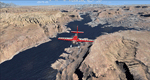
Lake Powell East / Natural Bridges National Monument, Utah, Photo-Scenery (FS9 & FSX)
This scenery covers the eastern part of Lake Powell from just south of Hite (UT03) and goes down south along White Canyon, Natural Bridges National Monument and the Grand Gulch Primitive Area all the way to the San Juan River. It extends my Canyonlands sceneries to the south and brings you another 3.500 sq km of wonderful southern Utah in 4.7m/pix quality. To explore the scenery depart from Cal Black Memorial Apt. (U96) and head east. High resolution versions of this scenery for FS9 and FSX (much sharper, but larger and multiple downloads) are available at www.blueskyscenery.com/CNY_South2West.html. The screenies are taken from the high-res versions, so expect this version to be slightly more blurry. YourDonation@Work: Dedicated to Guy, Ruben and EDB.
| Filename: | Lake_Powell_East__Natural_Bridges_National_Monumen.zip |
| License: | Freeware, limited distribution |
| Added: | 4th January 2010, 19:19:43 |
| Downloads: | 1,873 |
| Author: | Gottfried Razek, blueskyscenery.com |
| Size: | 95.26 MB |
| Category: Flight Simulator 2004 - Scenery | |
| Capitol Reef National Park/North - Hanksville (KHVE), Utah, Photo-Scenery |
|
Images related to this file:
File Description:
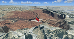
Capitol Reef National Park/North - Hanksville (KHVE), Utah, Photo-Scenery (for FS9 & FSX)
This scenery covers the northern part of Capitol Reef National Park, Hanksville (KHVE), the Goblin Valley and extends north to I70 and the San Rafael Swell. It extends my Canyonlands sceneries to the west and brings you another 3.500 sq km in 4.7m/pix quality. To explore the scenery depart from Hanksville (KHVE) and head northwest. High resolution versions of this scenery for FS9 and FSX (much sharper, but larger and multiple downloads) are available at www.blueskyscenery.com/CNY_West2.html . The screenies are taken from the high-res versions, so expect this version to be slightly more blurry. YourDonation@Work: Dedicated to Andy and Robert.
| Filename: | Capitol_Reef_National_ParkNorth__Hanksville_KHVE_U.zip |
| License: | Freeware, limited distribution |
| Added: | 13th January 2010, 19:32:33 |
| Downloads: | 1,694 |
| Author: | Gottfried Razek, blueskyscenery.com |
| Size: | 94.77 MB |
| Category: Flight Simulator 2004 - Scenery | |
| Capitol Reef National Park/South - Waterpocket Fold, Utah, Photo-Scenery |
|
Images related to this file:
File Description:
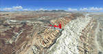
Capitol Reef National Park/South - Waterpocket Fold, Utah, Photo-Scenery (for FS9 & FSX)
This scenery covers the area from the southern part of Capitol Reef National Park down along the Waterpocket Fold and the Henry Mountains. It extends my Canyonlands sceneries to the west and brings you another 3.500 sq km in 4.7m/pix quality. To explore the scenery depart from Hanksville (KHVE) and head northwest. High resolution versions of this scenery for FS9 and FSX (much sharper, but larger and multiple downloads)
are available at www.blueskyscenery.com/CNY_SouthWest2.html . The screenies are taken from the high-res versions, so expect this version to be slightly more blurry. YourDonation@Work: Eric and Andy.
| Filename: | Capitol_Reef_National_ParkSouth__Waterpocket_Fold_.zip |
| License: | Freeware, limited distribution |
| Added: | 13th January 2010, 20:46:53 |
| Downloads: | 1,733 |
| Author: | Gottfried Razek - blueskyscenery.com |
| Size: | 95.92 MB |
| Category: Flight Simulator 2004 - Scenery | |
| Lake Powell - Bullfrog Basin (U07), Utah, Photo-Scenery (FS9 & FSX) |
|
Images related to this file:
File Description:
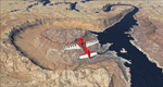
This scenery covers the area from the southern end of the Waterpocket Fold down to the Bullfrog Basin and the eastern end of the Kiaparowits Plateau. It extends my Canyonlands sceneries to the southwest and brings you another 3.500 sq km in 4.7m/pix quality. To explore the scenery depart from Bullfrog Basin Airport (U07) and west. High resolution versions of this scenery for FS9 and FSX (much sharper, but larger and multiple downloads)
are available at www.blueskyscenery.com/CNY_South2West2.html . The screenies are taken from the high-res versions, so expect this version to be slightly more blurry. YourDonation@Work: Dedicated to Jean-Marc, Jim and Cay.
| Filename: | Lake_Powell__Bullfrog_Basin_U07_Utah_PhotoScenery_.zip |
| License: | Freeware, limited distribution |
| Added: | 18th January 2010, 19:27:52 |
| Downloads: | 1,602 |
| Author: | Gottfried Razek - blueskyscenery.com |
| Size: | 92.83 MB |
| Category: Flight Simulator 2004 - Scenery | |
| Steamboat Springs (KSBS), Flat Tops Wilderness Area, Colorado - Photo-Scenery |
|
Images related to this file:
File Description:
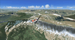
Steamboat Springs (KSBS), Flat Tops Wilderness Area, Colorado, Photo-Scenery (FS9 & FSX)
The Flat Tops Wilderness Area, which is the second largest wilderness area in Colorado, is named for its many flat topped mountains that are clearly visible from the sky. Trappers Lake, located in the north of the area inspired Arthur Carhart, a US Forest Service official, to initiate a plea for Wilderness preservation as early as 1919. Finally in 1975, three years before his death in 1978, the Flat Tops were designated a wilderness area. No wonder he found the area so entrancing: Behind Trappers Lake loom majestic volcanic cliffs, and beyond them a vast subalpine terrain reluctantly yields to alpine tundra with an average elevation of about 10.000 feet. More than 100 lakes dot the country above and below numerous flat-topped cliffs. Steamboat Springs is an internationally known winter resort destination.
To explore the scenery depart from Steamboat Springs Airport (KSBS) or Yampa Valley Airport (KHDN) and head south. High resolution versions of this scenery for FS9 and FSX (much sharper, but larger and multiple downloads) are available at www.blueskyscenery.com/GNB_West2.html . The screenies are taken from the high-res versions, so expect this version to be slightly more blurry. Thanks to Joop Mak for providing custom AFCADs that correct airport layouts so that they align with the photo-textures! They are available at www.blueskyscenery.com/AFCADs.html . YourDonation@Work: Dedicated to James.
| Filename: | Steamboat_Springs_KSBS_Flat_Tops_Wilderness_Area_C.zip |
| License: | Freeware, limited distribution |
| Added: | 26th April 2010, 17:53:25 |
| Downloads: | 1,307 |
| Author: | Gottfried Razek - blueskyscenery.com |
| Size: | 91.57 MB |
| Category: Flight Simulator X - Scenery | |
| Quebec Scenery - Lakes and River - Baie James Hydroelectric Complex Territory |
|
File Description:
Re-uploaded file. Lakes, shorelines and rivers of the province of Quebec, Baie James hydroelectric complex territory, Canada (for FSX only)(range : N52-N55, W66-W80). For best rendering, use terrain mesh for the same territory of the province of Quebec (Canada) in LOD10 (Qc38mBJ_FSX_*de2.zip - 2 files - AVSIM library).
| Filename: | Quebec_Scenery__Lakes_and_River__Baie_James_Hydroe.zip |
| License: | Freeware, limited distribution |
| Added: | 28th May 2010, 04:17:20 |
| Downloads: | 3,865 |
| Author: | Gilles Gauthier |
| Size: | 62.77 MB |
| Category: Flight Simulator 2004 - AFCAD Files | |
| AFCAD2 for Oslo Gardemoen in Norway 2004 Package 3 scenery |
|
Images related to this file:
File Description:

AFCAD2 for Oslo Gardemoen in Norway 2004 Package 3 scenery
----------------------------------------------------------
Reworked on:
1 - Gate radius
2 - Airport related chart
3 - Airport web-site for airline assignments
| Filename: | AFCAD2_for_Oslo_Gardemoen_in_Norway_2004_Package_3.zip |
| License: | Freeware |
| Added: | 26th February 2011, 22:26:44 |
| Downloads: | 327 |
| Author: | Vincenzo Mercolino |
| Size: | 15.02 KB |
| Category: Flight Simulator 2004 - AFCAD Files | |
| AFCAD2 for EKCH Scenery for Freeware SwedflightPro v.2.0, UPDATE |
|
Images related to this file:
File Description:

AFCAD2 for EKCH Scenery for Freeware SwedflightPro v.2.0, update.
Reworked using, in the order:
1 - Airport related chart
2 - Airport web-site for terminal assignments
3 - Google Earth(r) Airport visualization and airport related internet site(s), where applicable on FS2004 scenery airport areas with changes to parking assignments.
| Filename: | AFCAD2_for_EKCH_Scenery_for_Freeware_SwedflightPro.zip |
| License: | Freeware |
| Added: | 26th February 2011, 22:27:39 |
| Downloads: | 666 |
| Author: | Vincenzo Mercolino |
| Size: | 8.54 KB |
| Category: Flight Simulator 2004 - Scenery | |
| OMAA - Abu Dhabi, UAE - Three files for Matthew Ministry's scenery |
|
File Description:
Some fixes/tweaks for the Abu Dhabi scenery by Matthew Ministry (OMAA - auh-omaa-abudhabi-fs9.zip in the AVSIM library).
| Filename: | OMAA__Abu_Dhabi_UAE__Three_files_for_Matthew_Minis.zip |
| License: | Freeware |
| Added: | 18th April 2016, 20:09:20 |
| Downloads: | 888 |
| Author: | Martin Stebbing |
| Size: | 84.34 KB |
| Category: Flight Simulator X - Scenery | |
| Locher/Sarentino Airfield scenery for MS FSX and LM Prepar3D |
|
Images related to this file:
File Description:
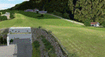
This scenery package is a representation of "Locher" airfield, a private grass field in the Trentino (or South Tyrol) area, close to the town of Sarentino (or Sarnthein, or Sarntal) in northern Italy. The town is very close to the border with Austria (hence the many versions of the town name). The field belongs to Locher Gebhard and shares the premises with Mr. Gebhard's factory, apparently producing metallic fire rated doors.
Features of the Locher airfield scenery include:
- Photoreal area with seasonal variations and watermask
- Custom mesh for a large area around the field
- Custom buildings and rock formations around the hangar, as well as sloped taxiway
- Custom landmarks on approach from the south, including power cables over the valley
| Filename: | LocherSarentino_Airfield_scenery_for_MS_FSX_and_LM.zip |
| License: | Freeware |
| Added: | 25th September 2017, 03:37:52 |
| Downloads: | 6,947 |
| Author: | Vassilios Dimoulas |
| Size: | 316.11 MB |


© 2001-2026 AVSIM Online
All Rights Reserved
Privacy Policy |