
Where Flight Simulation Enthusiasts Gather from Around the World!
AVSIM Library - Search Results

| Category: Flight Simulator 2004 - Scenery | |
| Mexicali Airport (MMML) |

|
File Description:
This is a scenery for Mexicali airport (ICAO code: MMML; IATA code: MXL). It is an improvement of the default FS2004 scenery (the latter being a strip into the nothing). It has been created for the Airbrixia Mexico Tour 2008, and it is also a small tribute to all of my Mexican simpilots friends and controllers I met on the IVAO net during my Mexican journeys. I have used the default library objects as well as the library created by Sidney Schwartz (fs9 custom buildings vol.1) and Bill Leaming (ramp light); therefore I explicitly thank both of them for their great work, and for making it freeware for all the AVSIM community.
| Filename: | Mexicali_Airport_MMML.zip |
| License: | Freeware |
| Added: | 2nd November 2008, 23:02:21 |
| Downloads: | 929 |
| Author: | Marco Ruggieri |
| Size: | 6.05 MB |
| Category: Flight Simulator X - Scenery | |
| Land's End SeaPlanes; West Coast Travels |
|
File Description:
Part III in the four part scenery series of Land's End SeaPlanes. Part III, West Coast Travel covers the United States West Coast from Seattle Washington to San Diago, California. This scenery pack requaires Lands End SeaPlanes Part I and Part II. Part III includes, KAST - Astoria Regional Airport, KONP - Newport Municipal Airport, Newport, Oregon; KOTH - North Bend Airport, North Bend Oregon; KBOK - Brookings State Airport, Brookings Oregon; KACV - Arcata-Eureka Airport, Arcata, California; OQ5 - Shelter Cove Airport, Shelter Cove, Ca; CA51 - The Sea Ranch, Ca; KHAF - Half Moon Bay, Ca; O62 - Carmel Valley Vintage; L52 - Oceano County; and more. Package includes hundreds of custom models, effects, textures. Includes both day and night textures.
| Filename: | Lands_End_SeaPlanes_West_Coast_Travels.zip |
| License: | Freeware, limited distribution |
| Added: | 21st November 2008, 19:06:05 |
| Downloads: | 2,618 |
| Author: | Chris Carel |
| Size: | 42.47 MB |
| Category: Flight Simulator X - Scenery | |
| Crete Island, Version 2 |
|
Images related to this file:
File Description:
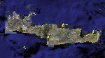
Crete is the bigger than the islands of the Greek archipelago and it is the south rampant of the Aegean sea. This scenery contains the following airports: LGIR, LGSA, LGOB, LGTL and 78 cities.
In this 2nd version I have used the mesh terrain of Yiannis Dermitzakis that offers a bigger realism to the costs. This has put under an obligation to reconstruct the entirety of the populations of the since costs they were located inside the sea. At the same time I have been able to redraw them populations with houses and real facilities that. I believe that I can offer a quite realistic scenery especially in the group of populations of the coast.
| Filename: | Crete_Island_Version_2.zip |
| License: | Freeware |
| Added: | 7th November 2009, 21:08:05 |
| Downloads: | 6,014 |
| Author: | Toni Agramont |
| Size: | 31.14 MB |
| Category: Flight Simulator X - Scenery | |
| Aurora Muni - Greater Kankakee |
|
File Description:
FSX Scenery - Aurora Municipal Airport serves Chicago/Aurora and Kane County and is owned by the City Of Aurora. The airport has more than one runway. The longest is a paved runway extending 6500 feet. The facility is at an elevation of 706 feet at a distance of about 38 miles from Chicago. Greater Kankakee Airport serves Kankakee and Kankakee County and is owned by Kankakee Valley Arpt Auth. The airport has more than one runway. The longest is a paved runway extending 5979 feet. The facility is at an elevation of 629 feet at a distance of about 3 miles from Kankakee. Created with Instant Scenery. By John B. Loney, Jr.
| Filename: | Aurora_Muni__Greater_Kankakee.zip |
| License: | Freeware, limited distribution |
| Added: | 2nd November 2009, 20:05:32 |
| Downloads: | 500 |
| Author: | John B. Loney, Jr. |
| Size: | 1.11 MB |
| Category: Flight Simulator 2004 - Scenery | |
| Weaver MT54 Montana USA |
|
Images related to this file:
File Description:
I made this because I downloaded and tried the Glacier Park scenery by Blue Sky Scenery and then discovered that the airfield runways are not always correctly positioned or aligned. So I moved the Weaver runway over and added a couple of buildings. That's it, almost the same as I did for Whitefish. If I find some more airfields in this area with similar problems then I'll do more of the same. Weaver is a private field 4 miles south of Glacier Park International at 2,929 feet ASL and around 45 miles south of the Canadian border. There are no large towns close by; the nearest would be Missoula, which is some 90 miles further south.
| Filename: | Weaver_MT54__Montana_USA.zip |
| License: | Freeware, limited distribution |
| Added: | 26th May 2010, 03:18:46 |
| Downloads: | 203 |
| Author: | Roger Wensley |
| Size: | 14.23 MB |
| Category: Flight Simulator 2004 - AI Flight Plans | |
| MAIW USN/USMC Special Use Mentors V2 Complete AI Package |
|
Images related to this file:
File Description:

Military AI Works is proud to present version 2 of the USN/USMC Special Use Mentors Complete AI Package for FS2004. This package features Nick Black's T-34C Mentor AI model featuring a highly realistic FDE by Mike MacIntyre. This package depicts the various USN and USMC organizations that use the Mentor in duties other than primary flight training. This package also features custom scenery for NAS Lemoore. Credits: Model by Nick Black, Repaints by Graham King, FDE by Mike MacIntyre, Flightplans by Desmond Burrell, AFCADs by Duncan Mackellar, John Stinstrom, Desmond Burrell and Mark Cambell, callsigns by Stewart Pearson, Dan Bourque and Desmond and Custom Scenery by John Stinstrom and Marcel Ritzema.
| Filename: | MAIW_USNUSMC_Special_Use_Mentors_V2_Complete_AI_Pa.zip |
| License: | Freeware |
| Added: | 7th May 2010, 05:38:44 |
| Downloads: | 1,010 |
| Author: | Desmond Burrell (Military AI Works) |
| Size: | 14.52 MB |
| Category: Flight Simulator X - AFCAD Files | |
| Haverstraw Heliport (H43), NY |
|
File Description:
This is a public helipad that services the town of Haverstraw, New York. It provides both air freight and charter services for the area. Scenery has been designed based on Google Maps aerial photos, the author has not been to this heliport in person. Trees ringing the heliport are basic Oak models, they are not seasonal objects. This heliport gives you a great excuse to travel far north along the beautiful Hudson River valley from NYC.
Comms are not activated for this heliport, because really what use would you have for them anyways?
This scenery is meant to be used in conjunction with MegaScenery Earth New York 004. It is not required.
| Filename: | Haverstraw_Heliport_H43_NY.zip |
| License: | Freeware |
| Added: | 3rd October 2010, 23:47:07 |
| Downloads: | 237 |
| Author: | Drew Sikora |
| Size: | 1.9 MB |
| Category: Flight Simulator 2004 - AI Flight Plans | |
| NAF Atsugi Complete AI Package |
|
Images related to this file:
File Description:

Military AI Works is proud to bring you the NAF Atsugi Complete AI Package for FS2004. This package depicts Hornet/Super Hornet units assigned to Carrier Air Wing 5 which is permanently forward deployed in Japan. Also depicted are the Beechcraft UC-12M aircraft assigned to NAF Atsugi Air Operations Division. This package also comes with custom scenery of NAF Atsugi. Credits: Models by Nick Black and Henry Tomkiewicz, Repaints by Graham King, FDE/Effects by Mike MacIntyre, Nick Needham, Steve Holland and Graham King, Custom Scenery by John Stinstrom and Tony Dalton, Flightplans and VCPs by Mark Campbell, AFCADs by Paul Stevens, John Stinstrom, Stephen Phillips, Ray Parker, Mark Campbell and Tony Dalton
| Filename: | NAF_Atsugi_Complete_AI_Package.zip |
| License: | Freeware, limited distribution |
| Added: | 25th July 2010, 21:31:32 |
| Downloads: | 1,754 |
| Author: | Mark Campbell, Military AI Works (MAIW) |
| Size: | 17.91 MB |
| Category: Flight Simulator X - Scenery | |
| Northeast New Jersey 5 Meter Mesh Terrain |
|
Images related to this file:
File Description:
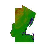
High Resolution Northeast New Jersey 5 Meter Mesh Terrain by Wally-Bob represents a significant improvement over FSX default 38 meter mesh terrain. The results are also dramatic compared to 10 meter compressed payware mesh as lossless compression compilation (read no data loss) is used. Lossless compiling produces renderings that have the Crispness of the Real World Terrain. Fly the Hudson River and view the Palisades as they are in real life, see the screen shots enclosed. High Quality 5 meter mesh terrain is a must have for mountainous areas especially where photo scenery is also used to render the virtual world. Manual includes FSX configuration and scenery installation tips. USGS LiDAR 1/9 Arc-Second source data.
| Filename: | Northeast_New_Jersey_5_Meter_Mesh_Terrain.zip |
| License: | Freeware, limited distribution |
| Added: | 26th February 2011, 21:35:52 |
| Downloads: | 1,100 |
| Author: | Walter Roberts |
| Size: | 135.89 MB |
| Category: Flight Simulator 2004 - Scenery | |
| Quinta do Alqueidao ULM Airfield v1 |
|
Images related to this file:
File Description:

This very old farm was reworked in order to became an ULM airfield, very crowded during weekends; it's also a rural tourism farm with a small but very nice restaurant (I suggest you visit Pelicano site and see the pictures). This scenery is ONLY compatible with Portugal Terrain from PTSIM (http://www.ptsim.com) and is based on digital pictures taken at the place, accurate real measures by Aerodromos de Portugal (http://www.pelicano.com.pt/zmapa.html). Although certified for ULM, this airfield have no ICAO so I gave it the fake LPQA.
This scenery is still under construction, so a second version will be published with several improvements and reworked objects. Freeware. For Microsoft FS2004. NOT tested for FSX
| Filename: | Quinta_do_Alqueidao_ULM_Airfield_v1.zip |
| License: | Freeware |
| Added: | 20th September 2011, 23:38:52 |
| Downloads: | 372 |
| Author: | Joao A. Graca Ferreira |
| Size: | 4.01 MB |


© 2001-2026 AVSIM Online
All Rights Reserved
Privacy Policy |