
Where Flight Simulation Enthusiasts Gather from Around the World!
AVSIM Library - Search Results

| Category: Flight Simulator 2004 - Scenery | |
| Denver (KDEN), Colorado, Photo-Scenery |

|
Images related to this file:
File Description:

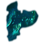
Denver (KDEN), Colorado, Photo-Scenery for FS9 & FSX.
This package covers Denver, the capital of Colorado which is also nicknamed Mile-High City because its elevation is one mile (5.280 ft). The sixth RW (16R/34L) of Denver Int'l. Airport (KDEN) is the longest commercial RW in the US with a length of 16.000ft. This allows fully loaded B747's to take off in Denvers mile-high altitude during hot summer days, when density altitudes can approach 9.000(!) ft.
KDEN is a major hub for United Airlines and the headquarters for Frontier Airlines. The airports distinctive white tent-like fabric roof is designed to be reminiscent of the snow-covered peaks of the Rocky Mountains which you can see on approach or departure.
Other important airports covered by this region are Centennial Airport (KAPA), Buckley AFB (KBKF) and Rocky Mountain Metropolitan Airport (KBJC). Extends my Mt.Evans/Georgetown package to the east and provides another 3.500 sq km in 4.7m/pix quality.
High resolution versions for FS9 and FSX (much sharper, but larger and multiple downloads) are available at www.blueskyscenery.com/GNB_SouthEast.html
. The screenies are taken from the high-res versions, so expect this version to be slightly more blurry. YourDonation@Work: Dedicated to Mark and Charles. Thanks!
| Filename: | Denver_KDEN_Colorado_PhotoScenery.zip |
| License: | Freeware, limited distribution |
| Added: | 31st October 2009, 11:24:39 |
| Downloads: | 7,274 |
| Author: | Gottfried Razek, blueskyscenery.com |
| Size: | 95.21 MB |
| Category: Flight Simulator 2004 - Scenery | |
| FS9 Scenery - Freeflow Bahamas CJCR07b |
|
Images related to this file:
File Description:
FS9 Scenery - Freeflow Bahamas CJCR07b
FRAMERATE improvement over 20%. Replaced buildings which were
slowing down FR's by adding highly detailed macros.
Plus total improvement of Cape Eleutehria Yacht Club & Rock Sound.
With FS Freeflow you will have total landclass of all the Bahamas in accurate detail!
Requires FREEFLOW Bahamas http://fs-freeflow.com.
jimmy R martin
| Filename: | FS9_Scenery__Freeflow_Bahamas_CJCR07b.zip |
| License: | Freeware |
| Added: | 5th May 2010, 21:39:01 |
| Downloads: | 1,058 |
| Author: | jimmy R martin |
| Size: | 11.02 MB |
| Category: Flight Simulator 2004 - Scenery | |
| FS2004 Scenery--LIMG ALBENGA AIRPORT |
|
Images related to this file:
File Description:

FS2004 Scenery--LIMG ALBENGA AIRPORT (AIRAC 1811).
Only use with IVAO or VATSIM; no AI possible.
This scenery was built from the official maps for the runway and taxiways with Google Maps as a background image as support.
The different signs were positioned without any documentation or references.
By Serge Libon.
| Filename: | FS2004_SceneryLIMG_ALBENGA_AIRPORT.zip |
| License: | Freeware |
| Added: | 22nd October 2018, 16:42:03 |
| Downloads: | 508 |
| Author: | Libon Serge |
| Size: | 36.57 MB |
| Category: Flight Simulator 2004 - Scenery | |
| Scenery Amboise-Dierre (LFEF) France |
|
File Description:
A very detailed and accurate airport located 100 Nm southwest from Paris, in the
region central loire valley. With a concrete and grass runway area with the newest textured airport buildings all made by digital photographs. Static aircrafts, gliders, cars, windsails and visual approach charts are available. Works very well in FS2004 and FS2002.
| Filename: | Scenery_AmboiseDierre_LFEF_France.zip |
| License: | Freeware, limited distribution |
| Added: | 31st August 2003, 00:36:17 |
| Downloads: | 7,310 |
| Author: | Bruno Zurmuehle |
| Size: | 3.1 MB |
| Category: Flight Simulator 2004 - Scenery | |
| Canaima National Park Mesh Scenery |
|
File Description:
Covers over 3 million hectares in south-eastern
Venezuela. Roughly 65% of the park is covered
by table mountain (tepui) formations. Include
Angel Falls, the world's tallest waterfall
(1000 m). Made from GOTOPO30 DEM using Microsoft
Terrain SDK Tools, with a resolution of 3,75
arc sec using graphical interpolation techniques.
Also works great in FS2002.
By David Maldonado - September, 2003
| Filename: | Canaima_National_Park_Mesh_Scenery.zip |
| License: | Freeware |
| Added: | 21st September 2003, 19:02:25 |
| Downloads: | 4,183 |
| Author: | David Maldonado |
| Size: | 922.91 KB |
| Category: Flight Simulator 2004 - Scenery | |
| Faroes Islands mesh and scenery |
|
File Description:
This is, as far as we know, the first non-default mesh of the Faroe Islands and a vast improvement over the default. It is based on the free data made available by Jonathan de Ferranti. The default is not placed correctly so the package includes also new coastlines, land class, streams and other basic elements plus some of the towns and objects on the islands. It will be supplemented later with more towns and other scenery elements.
| Filename: | Faroes_Islands_mesh_and_scenery.zip |
| License: | Freeware |
| Added: | 3rd April 2006, 21:44:59 |
| Downloads: | 2,013 |
| Author: | Jonathan de Ferranti, Ryan Andersen and Peter H. Poulsen |
| Size: | 514.32 KB |
| Category: Flight Simulator X - Scenery | |
| The Dry Tortugas Photo Scenery |
|
Images related to this file:
File Description:
Where are the Dry Tortugas? Should you be wondering, at the western end of the Florida Keys. Located 68 miles west of Key West, they are accessible only by boat and of course via your favorite seaplane.
Source Data: National Agriculture Imagery Program (NAIP) Orthoimagery, 1 meter per pixel resolution. The scenery package also corrects the MS-FSX Island and Lighthouse position errors overlooked by UTX-USA and UTX-TAC.
For your finest virtual experience it is highly recommended you download, install and use with: South Florida and The Bahamas Water Class scenery. (S-FL_Bahamas_WC.zip)
Enjoy your flight and don't forget your Scuba Gear or the sunscreen! - Wally-Bob
| Filename: | The_Dry_Tortugas_Photo_Scenery.zip |
| License: | Freeware, limited distribution |
| Added: | 23rd August 2014, 11:08:17 |
| Downloads: | 917 |
| Author: | Walter Roberts |
| Size: | 50.9 MB |
| Category: Flight Simulator 2004 - Scenery | |
| Solis-Piriapolis Photo-Real Scenery |
|
Images related to this file:
File Description:
Photo-real scenery of the Solis-Piriapolis-Laguna del Sauce region in the department of Maldonado, Uruguay. This package covers an area of about 150 km2 west of Punta del Este with photo-real textures. Also included are custom 3D objects in Solis and Piriapolis, autogen and two real grass strip airports at Cuchilla Alta and Punta Colorada.
Scenery also works in FSX.
| Filename: | SolisPiriapolis_PhotoReal_Scenery.zip |
| License: | Freeware, limited distribution |
| Added: | 20th February 2010, 14:54:16 |
| Downloads: | 1,085 |
| Author: | "As the Bird Flies / A Vuelo de Pajaro" group members: Diego Altgenug, Alan Pereira-Pierce and Juan Pablo Simonet |
| Size: | 18.3 MB |
| Category: Flight Simulator 2004 - Scenery | |
| Australia Rockhampton New Scenery 2003 |
|
File Description:
New scenery about Rockhampton Australia with AFCAD file
| Filename: | Australia_Rockhampton_New_Scenery_2003.zip |
| License: | Freeware |
| Added: | 21st May 2010, 03:10:40 |
| Downloads: | 625 |
| Author: | Claude Schmidt |
| Size: | 2.15 MB |
| Category: Flight Simulator X - Scenery | |
| Faroe Islands mesh and scenery |
|
File Description:
Welcome to the Faroe Islands. Our complete mesh and scenery will let you enjoy these beautiful North Atlantic islands. The only airport of the islands is modelled together with all helipads, towns, ports, road traffic and much more. A FSX-style flight plan for Atlantic Airways (2007, week 36) is included.
Please read the manual for further information.
| Filename: | Faroe_Islands_mesh_and_scenery.zip |
| License: | Freeware, limited distribution |
| Added: | 28th August 2007, 15:48:07 |
| Downloads: | 7,267 |
| Author: | Ryan Andersen and Peter H. Poulsen |
| Size: | 18.18 MB |
© 2001-2026 AVSIM Online
All Rights Reserved
Privacy Policy |