
Where Flight Simulation Enthusiasts Gather from Around the World!
AVSIM Library - Search Results

| Category: Flight Simulator X - Scenery | |
| Mayon Volcano V2 |

|
File Description:
This scenery will bring to life Mayon volcano in the Philippines. Includes updated airports for RPLP Legazpi and Pili RPUN, default airports had no parking. See readme for full instructions.
| Filename: | Mayon_Volcano_V2.zip |
| License: | Freeware |
| Added: | 18th July 2011, 09:46:31 |
| Downloads: | 1,511 |
| Author: | Kym Burton |
| Size: | 7.2 KB |
| Category: Flight Simulator X - Scenery | |
| Mihail Kogainiceanu International Airport LRCK |
|
Images related to this file:
File Description:
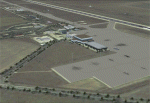
Mihail Kogainiceanu International Airport ,Constanta, Romania LRCK . Complete remake of the airport adding photoreal terrain buildings and so on . This scenery will work in FSX only . Lights by Jim Dhaenens
| Filename: | Mihail_Kogainiceanu_International_Airport_LRCK.zip |
| License: | Freeware |
| Added: | 2nd May 2011, 14:47:47 |
| Downloads: | 4,086 |
| Author: | Lee Marrow |
| Size: | 4.98 MB |
| Category: Flight Simulator X - AFCAD Files | |
| Blairstown Airport (1N7), NJ |
|
File Description:
Located 02 miles SW of Blairstown, New Jersey on 151 acres of land, Blairstown Airport is privately owned by J.D. Air Inc. and is home to a moderate number of small GA planes and gliders. This scenery is not completely up to date, as the MegaScenery Earth textures themselves are outdated. Missing are the added taxiway/parking lot north of the existing north taxiway as well as the second hangar area to the north that it leads to. Parking is available on the south tarmac but if that's all taken there is room just to the west in the taxiway offshoot. Also room on the grass, although stay south of the windsock to avoid interfering with glider operations. Glider pilots that wish to start on the grass, select either Runway East or Runway West. Fuel is available by stopping near the gas tank on the south tarmac.
Scenery constructed with use of satellite images/streetview, the author has not been there in person.
This scenery is meant to be used in conjunction with MegaScenery Earth New York 007. It is not required, but apron use is minimized to allow satellite scenery to show through as much as possible, and objects are placed based on the MSE textures - lack of it may make scenery look out of place.
| Filename: | Blairstown_Airport_1N7_NJ.zip |
| License: | Freeware |
| Added: | 8th October 2010, 20:22:59 |
| Downloads: | 247 |
| Author: | Drew Sikora |
| Size: | 576.39 KB |
| Category: X-Plane - Scenery | |
| WPDL Dili International Airport v1.0.0 |
|
Images related to this file:
File Description:

This is an X-Plane 11 scenery for Presidente Nicolau Lobato International Airport (WPDL/DIL) in Dili, East Timor (Timor Leste). This airport may serve as a stopover for flights between Java and Papua, for the Susi Air scenery package. Susi Air is pictured in the 2014 TV mini-series "Worst Place to be a Pilot", that follows the highs and lows in the lives of the young British pilots who work for Susi Air, as they fly and land their planes in some of the most breath-taking, remote and dangerous locations on earth. For more info, search for "Worst Place to be a Pilot" in YouTube. This scenery was tested and is operational (as of January 16, 2017) in "X-Plane 11 Public Beta #6 64 bit", Windows 10 Home. It was also tested and is operational (as of January 16, 2017) in "X-Plane 10.51 Public Beta #3 64 bit", Windows 10 Home. In XP10, you may have a scenery error message saying the sceney may not look correct. This is due to one file used from XP11 native library. If you see this message, just ignore it, bypassing it by clicking "understood". The scenery will load and will be operational in XP10 users (as a courtesy), despite being created natively for XP11 users.
| Filename: | WPDL_Dili_International_Airport_v100.zip |
| License: | Freeware |
| Added: | 17th January 2017, 02:52:15 |
| Downloads: | 110 |
| Author: | Rui Mesquita |
| Size: | 4.38 MB |
| Category: Flight Simulator 2004 - Scenery Design | |
| WBGT/WBTM Long Banga, Tanjung Manis, Malaysia |
|
Images related to this file:
File Description:
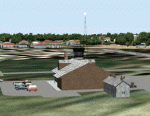
Googly scenery for WBGT Long Banga, Tanjung Manis (sometimes also referred to
under the ICAO code WBTM) - a small domestic airport in Malaysia that it seems
Microsoft forgot to provide in in Flight Simulator 2004. These scenery
files create the airport and add taxiways, aprons, buildings and other airport
features, so that you and your "AI" traffic can land, taxi, park and take off in
a realistic manner. Also added is the missing TMS non-directional beacon at
this airport (on frequency 264.0).
The airport serves the township of Sarikei, capital of the Sarekei district in
the Sarekei Division (are you following this?) of Sarawak in Eastern Malaysia.
Flights are provided by MASwings, a subsidiary of Malaysian Airlines, with De
Havilland Twin Otter aircraft calling here a few times per week.
The scenery does not purport to be ultra-accurate. Based on high-detail satellite
imagery from Google Earth, the layout is proportionally correct but the added
airport features, such as buildings, are built from default Microsoft objects
and add-on libraries so will not look exactly like the real thing.
You are not obliged to download and install any additional scenery libraries,
but to enjoy this scenery in its entirety, you may wish to. It will work fine,
with or without.
[File re-uploaded at request of AVSIM]
| Filename: | WBGTWBTM_Long_Banga_Tanjung_Manis_Malaysia.zip |
| License: | Freeware |
| Added: | 23rd May 2010, 01:23:38 |
| Downloads: | 964 |
| Author: | John Hinson |
| Size: | 51.04 KB |
| Category: Flight Simulator 2004 - Scenery | |
| HLLQ El Beida/Labraq |
|
Images related to this file:
File Description:
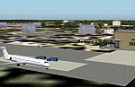
Googly scenery for HLLQ El Beida/Labraq - a joint civilian and military airport
near the north coast of Libya that is poorly provided for in Flight Simulator
2004. These scenery files add taxiways, aprons, buildings and other airport
features, so that you and your "AI" traffic can land, taxi, park and take off
in a realistic manner.
The city of Al Beida, or Al Bayda' or El Beda or Al Baidhah (depending on who
you are) has achieved its own airport status by using the end of a dead runway
at Labraq Air Base. In turn the airbase has contracted to use the opposite end
of the runway as its base of activity. The city is served by jets of Libyan
Airways and turboprop craft of Air One Nine and Ghadames Air Transport.
The scenery does not purport to be ultra-accurate. Based on high-detail satellite
imagery from Google Earth, the layout is proportionally correct but the added
airport features, such as buildings, are built from default Microsoft objects
and add-on libraries so will not look like the real thing.
You are not obliged to download and install any additional scenery libraries,
but to enjoy this scenery in its entirety, you may wish to. It will work fine,
with or without. [File re-uploaded at request of AVSIM]
| Filename: | HLLQ_El_BeidaLabraq.zip |
| License: | Freeware |
| Added: | 28th May 2010, 20:42:26 |
| Downloads: | 1,286 |
| Author: | John Hinson |
| Size: | 73.79 KB |
| Category: Flight Simulator 2004 - Scenery | |
| FTTN Am-Timan, Chad |
|
File Description:
Googly scenery for Am-Timan (ICAO: FTTN, ICAO: ANC), also known as Am
Timan, Am Timane, Am Timmane, Umm Timman - take your pick! It is a small
airport serving a small city of the same name in South-Eastern Chad,
almost exactly centred in the continent of Africa.
The airport was upgraded in 1971 by the French Foreign Legion to allow
military transport craft to land, but it still retains a sand/dirt
strip. The airport is served today by a couple of flights a week using
Fokker Fellowship jets of Toumai Air Tchad.
The entire area is very dry and sandy but for some reason it is depicted
in Flight Simulator as green and lush. Microsoft have only provided a runway
at this airport and this scenery seeks to redress the situation so that you
and your "AI" traffic can use the airport realistically.
The scenery does not purport to be ultra-accurate. Based on high quality
satellite imagery from Google Earth, the layout is proportionally correct but the
added airport features, such as buildings, are built from default Microsoft objects
and add-on libraries so will not look exactly like the real thing.
You are not obliged to download and install any additional scenery libraries,
but to enjoy this scenery in its entirety, you may wish to. It will work fine,
with or without.
| Filename: | FTTN_AmTiman_Chad.zip |
| License: | Freeware |
| Added: | 24th December 2008, 13:31:36 |
| Downloads: | 883 |
| Author: | John Hinson |
| Size: | 83.66 KB |
| Category: Flight Simulator 2004 - Scenery | |
| MRAO Turtuguero, Costa Rica |
|
Images related to this file:
File Description:
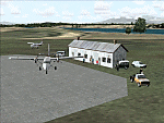
Googly scenery for MRAO Turtuguero, Costa Rica - another one that Microsoft
forgot in FS2004. It is a small domestic airport located on a long spit of
land that almost seems like an island. Turtuguero is just a village but the
airport also serves the lush Tortuguero National Park (rain falls all the
year round here) which draws thousands of visitors each year. The airport
is served daily by DHC-6 Twin Otters of Nature Air.
These scenery files create the airport and add taxiways, aprons, buildings and other airport features, so that you and your "AI" traffic can land, taxi, park and take
off in a realistic manner.The scenery does not purport to be ultra-accurate. Based on less-than-perfect satellite imagery from Google Earth, the layout is as good as I can get it, but some imagination has been used as I cannot tell what buildings exist. The
buildings and other features I have provided are built from default Microsoft
objects and add-on libraries so will not look exactly like the real thing.
You are not obliged to download and install any additional scenery libraries,
but to enjoy this scenery in its entirety, you may wish to. It will work fine,
with or without. [File re-uploaded at request of AVSIM]
| Filename: | MRAO_Turtuguero_Costa_Rica.zip |
| License: | Freeware |
| Added: | 28th May 2010, 20:40:00 |
| Downloads: | 1,174 |
| Author: | John Hinson |
| Size: | 65.12 KB |
| Category: Flight Simulator 2004 - Scenery | |
| SKMD Medellin/Enrique Olaya Herrera, Colombia |
|
File Description:
Googly scenery for Medellin/Enrique Olaya Herrera (ICAO: SKMD, IATA: EOH). This
centrally located airport, named after the 1930 president of Colombia, was once
the only airport for the city of Medellin but most international flights are now
concentrated on the new international airport inconveniently situated 24 miles
away. Nevertheless the airport is very busy with domestic, charter and private
traffic and is regularly served by scheduled services of Aerolínea de Antioquia,
AIRES, Easyfly and SATENA. There are many charter operators based or serving
serving this airport, including Aexpa, Heliandes, Sarpa, Helicol and TAC; these
are mostly smaller aircraft or helicopter operations.
Remarkably for such an important airport, Microsoft have only provided a runway
at this airport in Flight Simulator 2004 and this scenery seeks to redress the
situation so that you and your "AI" traffic can use the airport realistically.
The scenery does not purport to be ultra-accurate. Based on high quality
satellite imagery from Google Earth, the layout is proportionally correct but the
added airport features, such as buildings, are built from default Microsoft objects
and add-on libraries so will not look exactly like the real thing.
You are not obliged to download and install any additional scenery libraries,
but to enjoy this scenery in its entirety, you may wish to. It will work fine,
with or without.
| Filename: | SKMD_MedellinEnrique_Olaya_Herrera_Colombia.zip |
| License: | Freeware |
| Added: | 6th December 2008, 10:22:40 |
| Downloads: | 2,564 |
| Author: | John Hinson |
| Size: | 388 KB |
| Category: X-Plane - Scenery | |
| San Diego, Ca. 2004 - v6.70thru v7.30 |
|
File Description:
San Diego Scenery Package
for X-Plane v6.51+v7.XX
by Bill Moore
January 3, 2004
Here is a new San Diego scenery package that I designed for my personal use. I have had numerous requests to do more cities and airports so this is my first free scenery for 2004. Being the lazy person I am, no research was done and no claim to real life designs are implied.
I have added many objects to the airports and cities including terminals, hangers, buildings, stadiums, balloons, city scapes and other fun and interesting things. All of which were begged, borrowed or stolen from all the wonderful designers in the X-Plane Community such as Ken Spiker, Christian Franz, Ted Davis, Robert Bunce, Tom Curtis, B. Brooks and all the others who have inspired me. Many thanks to each of you for your contributions to the X-Plane community.
Like all my scenery packages, the additions to the citys and airports are purely fictional. The airports themselves are unaltered. I have enhanced "San Diego Intl.-Lindburg Fld. (KSAN), "North Island NAS. (KNZY), Miramar MCAS (KNKX), Imperial Beach NOLF (KNRS), General Abelardo L. Rodriquez Intl. (MMTJ) and a few other near by airports. A special thanks to Ted Davis for creating the orignal San Diego scenery that led me to adding to his great work. Also, Ken Spikers new KWIKCITYS package contributed to the completion of my version of San Diego and surrounding areas. His cities really added the crowning touch. Thanks Ken. If I inadvertently left out other object designers, it was purely unintentional and I offer my apologies.
Installation: Place the extracted "San Diego" folders in your "Custom Scenery" folder.
Please send any comments or suggestions to [email protected]. If you choose to rate my Scenery Packs and give less than a "9" rating, I would appreciate knowing what I can do to improve them. I can only do that with your feedback.
Have fun and FLY SAFE!
| Filename: | San_Diego_Ca_2004__v670thru_v730.zip |
| License: | Freeware |
| Added: | 4th January 2004, 05:18:56 |
| Downloads: | 814 |
| Author: | Bill Moore |
| Size: | 7.96 MB |


© 2001-2026 AVSIM Online
All Rights Reserved
Privacy Policy |