
Where Flight Simulation Enthusiasts Gather from Around the World!
AVSIM Library - Search Results

| Category: Flight Simulator 2004 - Aircraft Repaints, Textures and Modifications | |
| Italian Air Force, Lockeed F-104G "Starfighter" |

|
Images related to this file:
File Description:
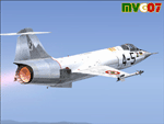
Lockheed's F-104 "Starfighter" was sleek, sexy, and difficult to fly. Essentially a J-79 turbojet with tiny wings and a place for the pilot to sit, it had a poor turning radius and very unpredictable behavior at high angles of attack along with very high takeoff and landing speeds. Its strength was never in its agility, but rather in its speed. The type was the only aircraft in existence at the time that could sustain speeds of over Mach 2.0, and it had a stellar rate of climb.
The "Starfighter" was an icon among jet interceptors throughout the 1970s. It was built also in Italy (G version), under licence. The first Italian F-104G flown during the end of 1962 and the last one (S version) was retired from active service in 2004 (42 Years !!!).
Textures only for two "Starfighters" of the 9 Gruppo of 4 Aerobrigata of the Aeronautica Militare Italiana (Italian Air Force), the first unit to receive the "Starfighter", based on Grosseto Airport, Italy, 1963/64. These textures require a legal copy of the payware Alphasim F-104G. The paints were done with the paintkit provided by Alphasim/Frank Safranek and the metal base textures provided by Henry William. Repaint by Manuele Villa.
| Filename: | Italian_Air_Force_Lockeed_F104G_Starfighter.zip |
| License: | Freeware |
| Added: | 4th June 2010, 11:28:46 |
| Downloads: | 599 |
| Author: | Manuele Villa |
| Size: | 6.05 MB |
| Category: Flight Simulator 2004 - Scenery | |
| Cape Dyer CWFD in Nunavut, Canada |
|
Images related to this file:
File Description:
Cape Dyer is on the southeast corner of Baffin Island, around 120 miles east of Pangnirtung at approximately N66 45 W61 30. There is a fine view north up the Davis Strait between Baffin Island and Greenland, and this is the whole reason for the airfield's existance as it was built to support the construction and operation of a DEW line radar station, which has now been updated to a North Warning System site. There are two camps; the upper camp is on the east side of the Cape and is where the radars are located, linked by a gravel road to the lower camp, which is on the west and more sheltered side of the Cape on the clifs above Sunneshine Fjord. The runway is 5,000' of 150' wide gravel, and it is lighted and at 1,320' feet ASL. Cape Dyer is now listed as abandoned in the Canada Flight Supplement. It is, however, still there and presumably is still used for access to the North Warning System equipment, which is automated and generally unmanned. The buildings were modeled for this scenery and include a hanagar large enough to accommodate a C-130. Ultimate Terrain is not required as it does not cover northern Canada.
| Filename: | Cape_Dyer_CWFD_in_Nunavut_Canada.zip |
| License: | Freeware, limited distribution |
| Added: | 21st June 2011, 19:30:07 |
| Downloads: | 488 |
| Author: | Roger Wensley |
| Size: | 1.9 MB |
| Category: Flight Simulator 2004 - Original Aircraft | |
| Lockheed EP-3E Aries II |
|
Images related to this file:
File Description:
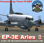
FS2004 Lockheed EP-3E Aries II, a turboprop-based signals reconnaissance aircraft, operated by the United States Navy. It is based on a Lockheed P-3 Orion airframe, which is in turn based on the Lockheed L-188 Electra passenger airliner. There are eleven EP-3Es in the Navy's inventory, the last of which was delivered in 1997. A total of twelve P-3C aircraft were converted to replace older versions of the aircraft, which had been converted in the late 1960s and early 1970s.
On April 1, 2001, an EP-3E (PR-32) was intercepted by Chinese F-8 fighter jets about 70 miles off the Chinese island of Hainan. One of the Chinese jets bumped the wing of the EP-3E, which was forced to make an emergency landing in China. VQ-1 provides electronic reconnaissance from the east coast of Africa to the west coast of the United States. The squadron maintains a permanent detachment in Misawa Japan and has maintained a continuous presence in the Arabian Gulf since July 1992.
The model is the seventh P3 series aircraft by Team FS KBT. This model was made with Gmax. By Team FS KBT
| Filename: | Lockheed_EP3E_Aries_II.zip |
| License: | Freeware |
| Added: | 10th April 2010, 08:39:01 |
| Downloads: | 6,973 |
| Author: | Team FS KBT |
| Size: | 31.24 MB |
| Category: Flight Simulator X - Scenery | |
| LATI - Tirana Intlnational Airport Nene Tereza - Tirana, Albania |
|
File Description:
Tirana International Airport Nene Tereza (IATA: TIA, ICAO: LATI) is Albania's only international airport. It is commonly known as Rinas International Airport, as it is located 6 NM (11 km; 6.9 mi) northwest of Tirana, in the village of
Rinas. In 2001, the airport was named after Mother Teresa. Tirana International Airport Nene Tereza was constructed in a period of two years, from 1955 to 1957.
After the fall of communism political and social changes caused an increase in the number of airlines operating in the airport. Notably its reconstruction, started in 2005 and terminated in 2008, made possible a relevant increase in
the processing capacity of the airport, which saw its number of passengers per year doubling from 2005 to 2010, when it reached 1.5M. The airport currently has a capacity to process 1.8M passengers per year and it is thought that such
capacity will suffice to handle the expected increase given the visa liberalization for the citizens of Albania in the Schengen Area, which started at the end of 2010.
This file has the right coordenates, with the apron and characteristics of the airport and buildings, also it is set to the correct altitud of 126 feet or 38 meters.
| Filename: | LATI__Tirana_Intlnational_Airport_Nene_Tereza__Tir.zip |
| License: | Freeware |
| Added: | 24th October 2012, 22:31:54 |
| Downloads: | 6,424 |
| Author: | Anwar Gonzalez |
| Size: | 5.62 MB |
| Category: Flight Simulator 2004 - Scenery | |
| Alaska South Slope 5; Ambler PAFM |
|
Images related to this file:
File Description:
There are four main northwestern Alaska towns which are serviced by Alaska Airlines, and from which local flights spread out. The northernmost is Barrow. Southwest of Barrow is Kotzebue, then Nome, and the furthest south is Bethel (not yet made). This is a continuation of the series for the flights from Kotzebue, 130 miles to the east to Ambler on the bank of the Kobuk River. The next additions will be a few miles further east, Shungnak and Kobuk, and a small strip just to the north of Kobuk. Ambler is a small village (population now around 260) beside the Kobuk River, the river being the reason for the existance of the village as it served (and still does) as both a source of food and a transport route. The airfield is just north of the village, with two runways, each around 3,500 feet of lit gravel and aligned 36-18 and 09-27, with PAPI on 36. There are scheduled flights by Era (now renamed Ravn) and by Bering Air, both of them originating in Kotzebue and routing east to Ambler, Shungnak, Kobuk, and then back again. The AI includes these flights along with Everts Air and GA. There are revisions to Kotzbue to provide more parking.
| Filename: | Alaska_South_Slope_5_Ambler_PAFM.zip |
| License: | Freeware, limited distribution |
| Added: | 11th October 2016, 23:26:52 |
| Downloads: | 207 |
| Author: | Roger Wensley |
| Size: | 4.21 MB |
| Category: Flight Simulator 2004 - Scenery | |
| PAAT (ATU) - Attu - Alaska, USA |
|
Images related to this file:
File Description:
Attu is AT the western end of the Aleutian chain of islands in Alaska, around 40 miles west of Shemya. There was small village on Attu before the Japanese invasion in mid 1942, but the island is now uninhabited. The Coast Guard Loran navigation station remains in place, though it is no longer in operation and visitors to the island are now either tourists or wildlife experts conducting surveys of numbers of nesting birds, etc. The runway still usable is aligned 02-20 and 5,800 feet long; right hand circuits on 02 to stay away from rising ground to the west. The "terminal" building has lost its sign regarding the Horny Bird, removed in 2010 by one of the last of the station operators, but the building is still there, as are some sheds and shacks that lately were used for the uncomfortable accommodation of bird counters. FS9 has used an incorrect icao identification for Attu but correcting it now would make life complicated so ATU it is and shall remain. I have removed the default FS9 roads that came complete with streetlights and telephone poles and replaced and amended the layout with gravel roads to better resemble real life, though the island shape is at best approximate, as is usual in FS9.
| Filename: | PAAT_ATU__Attu__Alaska_USA.zip |
| License: | Freeware, limited distribution |
| Added: | 2nd March 2015, 20:58:09 |
| Downloads: | 280 |
| Author: | Roger Wensley |
| Size: | 3.27 MB |
| Category: Flight Simulator X - Aircraft Repaints, Textures and Modifications | |
| Fairchild 24 (2/96) Swedish Air Force |
|
Images related to this file:
File Description:
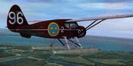
This folder contains a repaint for the Lionheart Fairchild 24, in the colors of 2/96, a civilian Fairchild 24 that was impressed into the Swedish Air Force. At the outbreak of war, many civilian aircraft were mobilized. Most of them was larger aircraft, but lighter aircraft for liaison work were also used. The Naval Aviation Wing of F 2 at Hägernäs needed smaller aircraft for transport of personnel and liaison in their co-operation with the Navy.
For this reason, one Fairchild 24-C8CS-De Luxe was mobilized between May of 1940 and February of 1943. Its earlier civil registration was SE-AIR (in the USA ex NC15926). It was powered with a Warner Super Scarab S50 air-cooled radial engine delivering 145 hk. The aircraft was designated Tp 6 and got the Air Force number 912. At the delivery of the Tp 6 in May of 1940 to the Air Force, it crashed. But it was repaired and in service again in October the same year. After its time in the Air Force, the Fairchild went back to the civil register, where it was written off in 1951 after another crash.
Repaint by Jan Kees Blom, based on the paintkit by Lionheart Creations.
| Filename: | Fairchild_24_296_Swedish_Air_Force.zip |
| License: | Freeware |
| Added: | 21st July 2018, 14:10:02 |
| Downloads: | 55 |
| Author: | Jan Kees Blom |
| Size: | 17.6 MB |
| Category: Flight Simulator 2004 - Scenery | |
| Port McNeill CAT5 in British Columbia, Canada |
|
Images related to this file:
File Description:
Port McNeill is at the northern end of Vancouver Island, on the coast and around 20 miles east of Port Hardy. The town population is just over 2,000 and the main industry is logging, followed by sand and gravel quarrying and exporting for the construction industry. Tourism rates third.
The airport, a mile or so east of the town, provides a swift connection for nearby islands and the surrounding area to the rest of the west coast, and serves as the HQ main base for West Coast Helicopters. Their newly built large hangar and office accommodation is next to their older hangar to one side of the central public parking area, opposite the club house cum terminal and hangars. There are two runways: 06-24 which is asphalt, 2,400 feet long, and lit; and 11-29 of gravel, 3,650 feet long and also lit. There is some taxiway lighting, but not, for instance, for the connection between runways, which is in real life a ramp up to the gravel runway which is 15 feet higher. There are no regularly scheduled flights and traffic consists mainly of the West Coast helicopters, plus GA and irregular charters, the latter being mostly from Port Hardy.
| Filename: | Port_McNeill_CAT5_in_British_Columbia_Canada.zip |
| License: | Freeware, limited distribution |
| Added: | 18th November 2018, 05:49:13 |
| Downloads: | 137 |
| Author: | Roger Wensley |
| Size: | 13.29 MB |
| Category: Flight Simulator 2002 - Aircraft Repaints, Textures and Modifications | |
| World Trade Memorial B747-400 textures |
|
File Description:
FS2002 World Trade Memorial replacement texture for the default B747-400.
New feature: At night, the Twin Towers on the tail are illuminated.
Keep the memory alive!God bless you all
Best wishes from Stefan.
| Filename: | World_Trade_Memorial_B747400_textures.zip |
| License: | Freeware |
| Added: | 11th September 2002, 00:33:44 |
| Downloads: | 507 |
| Author: | Stefan Reich |
| Size: | 1.09 MB |
| Category: Flight Simulator 2002 - Flight Plans | |
| Oceania Plans Package |
|
File Description:
The 3rd in my collection. Flights that include the Los Angeles to Wellington flight. Also included are the ACFAD files for Leigh Creek and Forrest, both in Southern Austrailia and are featured in the plans.
| Filename: | Oceania_Plans_Package.zip |
| License: | Freeware |
| Added: | 12th September 2002, 11:50:01 |
| Downloads: | 441 |
| Author: | Jacob Little |
| Size: | 46.97 KB |


© 2001-2026 AVSIM Online
All Rights Reserved
Privacy Policy |