
Where Flight Simulation Enthusiasts Gather from Around the World!
AVSIM Library - Search Results

| Category: Flight Simulator X - Aircraft Repaints, Textures and Modifications | |
| FSX Grumman F9F RNLN VSQ860 LATE |

|
Images related to this file:
File Description:
This livery represents a fictional "What if" repaint of the magnificent payware Grumman F9F-5 by VertigoStudios in a Royal Netherlands Navy Livery.
The aircraft resembles what it would look like if the Dutch government chose the Grumman F9F Panther over the Hawker Seahawk as their primary
attack fighter operating from the sole Dutch Navy aircraft carrier from the late 40-ies till the early 60-ies; the HRMS Karel Doorman (CV, R81,
Colossus Class). The Dutch navy operated two other aircraft carriers prior to this one (small MAC escort carriers, which were basically modified tankers),
but the R81 was the first and only real aircraft carrier ever operational within the Royal Netherlands Navy, and to operate jet-fighters from.
This particular livery of the F9F is in a typical grey & duck-egg green pattern resembling all Dutch naval aircraft of that era, carrier- and land based.
This livery with the "D" marking denotes the aircraft has the CV R81 "Karel Doorman" as home base.
Aircraft similar in operation and colour at that time (actually the Hawker Seahawk-era) were: Sikorsky S55, Grumman TBM 3S2/3W2 Avenger later
added/replaced with the Grumman S-2A Tracker and the Sikorsky S58. In the final stages of Dutch aircraft-carrier operations the role of the
HRMS Karel Doorman was reduced to an "Anti-Submarine Warfare" carrier. You need the payware VertigoStudios F9F for FSX in order to use this repaint.
| Filename: | FSX_Grumman_F9F_RNLN_VSQ860_LATE.zip |
| License: | Freeware |
| Added: | 11th January 2011, 08:31:58 |
| Downloads: | 161 |
| Author: | Rene Spaan |
| Size: | 7.51 MB |
| Category: Flight Simulator 2004 - Scenery | |
| Repulse Bay CYUT in Nunavut Canada |
|
Images related to this file:
File Description:
This is a scenery that I started in 2013, temporarily abandoned when I found there was a fault in the coastline that reduced it all to straight lines, and then totally forgot about. Until now, when I discovered that while I had made the Repulse Bay terminal building I had mysteriously not made the scenery. Investigation revealed the reason why and here it is with a coastline that has been repaired to the extent that the fault allowed. Repulse Bay has a population of around 1,100 and since 2015 has been officially named Naujaat, the traditional Inuit name. It is located exactly on the arctic circle on the northern extension of the western side of Hudson Bay, in a large bay off the northern tip of Southampton Island. Coral Harbour is on the far side of the island, 180 miles to the south. The airfield is alongside the town and the coast, with the runway 3,400 feet of gravel with PAPI at both ends, aligned 161T-341T with "T" standing for true as opposed to the unreliable magnetic bearing this far north. The regular scheduled flights are by Air Baffin (an Air Nunavut subsiduary), connecting to Iqaluit some 550 miles to the east. The helicopters are there in the summer with their own fuel in drums around their own parking apron. They land directly on the apron, which cannot be replicated in AI, so they are present only as parked choppers and not flying ones.
| Filename: | Repulse_Bay_CYUT_in_Nunavut_Canada.zip |
| License: | Freeware, limited distribution |
| Added: | 6th September 2018, 00:34:38 |
| Downloads: | 179 |
| Author: | Roger Wensley |
| Size: | 7.87 MB |
| Category: Flight Simulator 2004 - Scenery | |
| Chisasibi CSU2 in northern Quebec, Canada |
|
Images related to this file:
File Description:
Chisasibi is in northern Quebec on the east shore of James Bay, 60 miles from the corner of James Bay and Hudson Bay. Originally called Fort George and founded at the mouth of La Grande Riviere around the Hudson Bay trading post that was established in 1803, the town had to move 5 miles upstream in 1981 when the Quebec hydro project increased the flow rate of the river. The name was changed to Chisasibi at the time of the move (Chisasibi = Great River in Cree) and the population (750 as early as 1940) has now grown to around 2,000. There is a paved road east to Radisson that connects to the north-south James Bay road, which was built at the time of the hydro project work. The original Fort George airport runway is still visible but not usable, just south of the original town site. Chisasibi airport is to the west of the new town, and the gravel runway is 3,792 feet long and aligned 14/32, which is approximately parallel to the river. There is officially no fuel available, but there is JetA on site for Air Creebec in a tank protected by used fuel drums (filled with sand?). The terminal and the garage building are both relatively new; the terminal dates from 2002 and has unusual touches. There are two AI flights by Air Creebec each day plus other private planes.
| Filename: | Chisasibi_CSU2_in_northern_Quebec_Canada.zip |
| License: | Freeware, limited distribution |
| Added: | 27th February 2013, 21:24:47 |
| Downloads: | 287 |
| Author: | Roger Wensley |
| Size: | 2.79 MB |
| Category: Flight Simulator 2004 - Scenery | |
| Sachs Harbour CYSY in Northwest Territories, Canada |
|
Images related to this file:
File Description:
Sachs Harbour is on the southwest coast of Banks Island on the north side of Amundsen Gulf, around 240 miles northeast of Tuktoyaktuk and 180 miles northwest of Ulukhaktok. The village is the only permanent settlement on the island, and is located where it is to benefit from the harbour shelter provided by offshore land. The population is only 130 or so folks, who live on hunting and fishing with some tourism. One claim to fame is that the island is home to threequarters of the world's population of muskoxen and the second is the largest goose colony in North America. The airfield is on the plateau just above the village at 282 feet ASL. The gravel runway 084T/264T (true bearings in Northern Domestic Airspace) is 4,000' long and 100' wide and lit. The apron is on the south side at the centre of the runway and there is a new terminal building; there is JetA fuel available and perhaps 100LL in drums. To the west of the airfield are the deserted buildings of what was once a Department Of Transport weather station. Aklak Airlines flights (operated by Kenn Borek) fly to Sachs Harbour from Inuvik three times a week in summer and twice a week at other times; the AI will be included in the post of a revised Aklavik, and Inuvik revised and Tuktoyaktuk should be fully installed BEFORE Sachs Harbour.
| Filename: | Sachs_Harbour_CYSY_in_Northwest_Territories_Canada.zip |
| License: | Freeware, limited distribution |
| Added: | 14th May 2012, 17:20:09 |
| Downloads: | 394 |
| Author: | Roger Wensley |
| Size: | 6.16 MB |
| Category: Flight Simulator X - Original Aircraft | |
| Heinkel P-1079A Jet Nightfighter |
|
Images related to this file:
File Description:
Heinkel P-1079, a new twin-jet fighter project of the Heinkel Aircraft Construction Corp. was designed in five variations, all under the same designation.
The first of these advanced designs, the Heinkel P-1078A was basically developed as a two-seated nightfighter. The pilot and the gunner/navigator were sitting in tandem position. The wings were swept back 35 degrees, mounted to mid-fuselage. The tail had a V-shaped rudder. The armament were three Rheinmetall-Borsig MK 108 30mm cannons in the nose and 24 R4-M 'Orkan' high explosive rockets on two racks mounted under the wings. Another feature of armament was the so-called 'schraege musik' with four upward-firing 20 mm Mauser MG 151/20 autocannons, mounted in the back of the aircraft. Therefore, the nightfighter had to approach and attack bombers from below, guided into position by commands from the navigator.
The aircraft should be equipped with the new FUG 228 radar unit. This sophisticated radar would have empowered the aircraft with an almost all-weather ability.
The engines were located in the wing roots. This version should be fitted with two Junkers Jumo 004D turbojet engines with two-stage fuel injector, each with 8.8 kN of power.
The Max. speed was about Mach 0.89 = 950kph, the range about 1079.22nm = 1241.9 sm = 2000 km and the max. Service Ceiling up to 51,000 ft = 15,545m
Flyable in FS2004 and FSX
| Filename: | Heinkel_P1079A_Jet_Nightfighter.zip |
| License: | Freeware |
| Added: | 3rd June 2012, 19:56:05 |
| Downloads: | 997 |
| Author: | Andreas Becker |
| Size: | 21.43 MB |
| Category: Flight Simulator 2004 - Scenery | |
| Carrier Division Two off Cape Cod |
|
File Description:
This scenery places the two Yorktown-class aircraft carriers of the pre-WW2 U.S. Navy with a screen of four cruisers at sea 100 miles due east of Provincetown, Massachusetts, on the tip of Cape Cod. The ships are the Virtual Navy's Task Force 16 relocated and with the Hornet posing as the Yorktown. This package contains the carriers, cruisers, ship wakes, AFCAD files for all six ships and Arrestor Cables catch zones for the carriers. It provides start points on both carriers, on the catapults of all four cruisers, and in the water between the carriers for seaplanes. Also included are flight starts for Paul Clawson's Curtiss SOC Seagull on the catapults of the cruisers and for the plane of your choice on the carriers, and authentic repaints of the SOC for aircraft assigned to the cruisers plus one for the personal aircraft of the Admiral commanding CarDiv2. There is also a selection of Golden Wings splash screens featuring the ships and planes of CarDiv2. Carrier Division 2 is being released in celebration of Golden Wings 3, but works just as well in a standard FS9 installation. Catapult floatplane operations require the Carrier Operations Gauge Package and Paul Clawson's Curtiss SOC Seagull or another catapult floatplane. Ships and wake effects by The Virtual Navy, modified AFCAD files, SOC repaints, flights and ship placement by Mick Morrissey. A big Thank you to the Virtual Navy for allowing this use of their ships!
| Filename: | Carrier_Division_Two_off_Cape_Cod.zip |
| License: | Freeware, limited distribution |
| Added: | 17th September 2005, 12:50:26 |
| Downloads: | 3,289 |
| Author: | Mick Morrissey |
| Size: | 5.19 MB |
| Category: Flight Simulator 2004 - Scenery | |
| RAF Upper Heyford EGUA 1955-1962 |
|
File Description:
EGUA RAF Upper Heyford 1955-1962
The airfield was originally built in 1918 by the Royal Air Force on land owned by New College Oxford, closed briefly after the end of the First World War and then re-opened in the 1920s. During the Second World War it was used by units of RAF Bomber Command but these were training rather than operational forces, even if aircraft of the 16th OTU (Operational Training Unit) may sometimes have taken part in bombing operations against the Third Reich. New runways were laid in 1942. During the Cold War Upper Heyford was chosen as one of the airfields used to operate bomber aircraft belonging to the US Strategic Air Command, and in 1950 the main runway was extended while new hardstandings were constructed for the bombers concerned. However, units were not stationed there permanently, but did Temporary Duty Assignments from their bases in the US. They included the 93rd Bomb Wing, 97th Air Refueling Squadron, 509th Air Refueling Squadron, 301st Bomb Wing, 8th Air Sea Rescue Squadron, 2nd Bomb Wing, 5th Bomb Wing Detachment, and the 22nd Bomb Wing. Aircraft included the B-50 Superfortress, (briefly) the B-36 Peacemaker, the B-47 and from 1960 the B-52. There were further significant developments after 1962 which fall outside the remit of this scenery, Upper Heyford being finally returned to the British Ministry of Defence in 1994 after the end of the Cold War.
| Filename: | RAF_Upper_Heyford_EGUA_19551962.zip |
| License: | Freeware |
| Added: | 7th October 2022, 03:40:20 |
| Downloads: | 153 |
| Author: | Al Von Pingel, Ken Lawson |
| Size: | 42.75 MB |
| Category: Prepar3D V1-4 - Aircraft Repaints, Textures and Modifications | |
| Douglas TA-4 US Navy VA-127 - NJ 712 - Chameleon |
|
Images related to this file:
File Description:
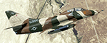
Texture for P3Dv4.4+ payware IndiaFoxEcho Visual Simulations TA-4J Skyhawk.
It depicting "Chameleon" a TA-4F (BuNo 154334) of the US Navy VA-127 Cyclons in the 80s.
The crews gave her the nickname "Chameleon" following the impressive number of different camouflages she received within the squadron.
| Filename: | Douglas_TA4_US_Navy_VA127__NJ_712__Chameleon.zip |
| License: | Freeware |
| Added: | 24th February 2020, 17:38:41 |
| Downloads: | 105 |
| Author: | Richard LUYCX |
| Size: | 9.6 MB |
| Category: Prepar3D V1-4 - Scenery | |
| Pisticci |
|
File Description:
Pisticci in the province of Matera Basilicata region coordinates N40.23.24 E16.3932 important VFR point for approaching the Jonian coast and in particular the disused Enrico Mattei airport in the municipal area of Pisticci (Matera). In the zipped file you will find instructions for installing the scenario.
| Filename: | Pisticci.zip |
| License: | Freeware |
| Added: | 2nd May 2020, 23:17:15 |
| Downloads: | 99 |
| Author: | Pasquale Marrulli |
| Size: | 2.62 KB |
| Category: Prepar3D V1-4 - Aircraft Repaints, Textures and Modifications | |
| Olympic Airways Boeing 747-8F |
|
Images related to this file:
File Description:

This is a fictional repaint of the PMDG B747-8F in the colors of Olympic Airways. Olympic Airways was the flag carrier of Greece up to 2009.
They never operated the B747-8F series although the did operate the B707-300C series as a pure cargo aircraft.
| Filename: | Olympic_Airways_Boeing_7478F.zip |
| License: | Freeware, limited distribution |
| Added: | 4th July 2019, 17:13:17 |
| Downloads: | 103 |
| Author: | Evangelos Kagklis / PMDG |
| Size: | 13.74 MB |


© 2001-2026 AVSIM Online
All Rights Reserved
Privacy Policy |